|
Whitsundays
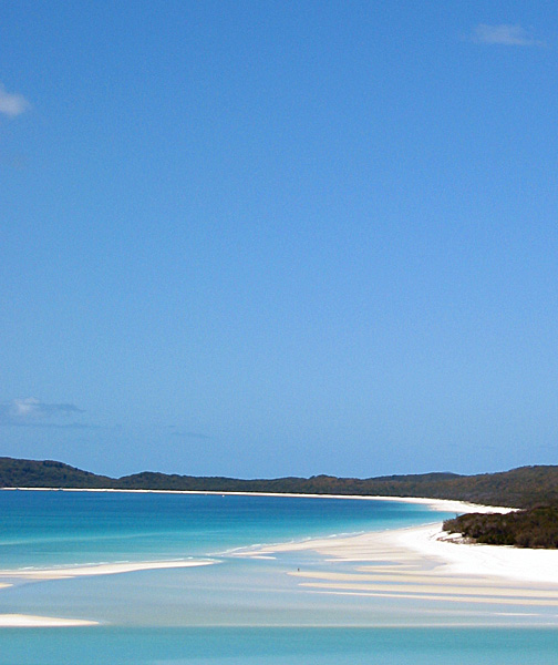
The Whitsunday Islands are 74 continental islands of various sizes off the central coast of Queensland, Australia, north of Brisbane. The northernmost of the islands are off the coast by the town of Bowen, while the southernmost islands are off the coast by Proserpine. The island group is centred on Whitsunday Island, while the commercial centre is Hamilton Island. The traditional owners of the area are the Ngaro people and the Gia people, whose Juru people has the only legally recognised native title in the Whitsunday Region. The islands are within the locality of Whitsundays and the local government Whitsunday Region. In 2009, as part of the Q150 celebrations, the Whitsunday Islands became one of the Q150 Icons of Queensland for their role as a natural attraction. Naming On Sunday 3 June 1770, (the day Whitsun—Pentecost was celebrated on the Christian calendar) Captain James Cook sailed his ship H.M.B. Endeavour, through a broad expanse of islands which provide ... [...More Info...] [...Related Items...] OR: [Wikipedia] [Google] [Baidu] |
Whitsundays, Queensland
Whitsundays is an island group locality that consists of the Whitsunday Group of islands. It is in the Whitsunday Region, Queensland, Australia. It is off the Queensland east coast in the Coral Sea, which is a mix of inhabited and uninhabited islands. In the , Whitsundays had a population of 2,281 people. Geography The larger islands in the locality include, from north to south: * Camp Island * Hayman Island * Hook Island * Whitsunday Island * North Molle Island * Cid Island * South Molle Island * Haslewood Island * Long Island Long Island is a densely populated continental island in southeastern New York (state), New York state, extending into the Atlantic Ocean. It constitutes a significant share of the New York metropolitan area in both population and land are ... * Hamilton Island * Dent Island The most populous island is Hamilton Island which recorded 1,867 people in the (82% of the locality's population. In addition to the island, the locality in ... [...More Info...] [...Related Items...] OR: [Wikipedia] [Google] [Baidu] |
Hamilton Island (Queensland)
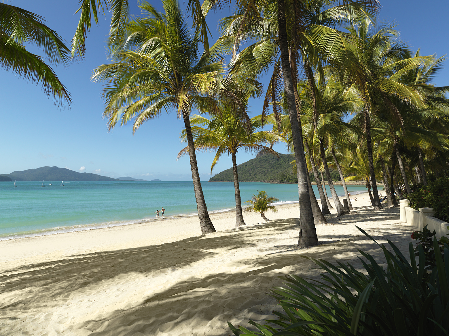
Hamilton Island is an island of the Whitsunday Islands in Queensland, Australia. It is approximately north of Brisbane and south of Cairns. It is the largest inhabited island of the Whitsunday Islands and a popular year-round tourist destination. Hamilton Island is one of the only islands in the Great Barrier Reef with a commercial airport, offering direct flights from Sydney, Melbourne and Brisbane. In the , Hamilton Island had a population of 1,759 people. Geography Like most in the Whitsunday group, Hamilton Island was formed as sea levels rose, creating numerous drowned mountains that are situated close to the east coast of Queensland. It is one of the larger islands in the Whitsundays. The central north-facing Catseye Beach is man-made. It is open to the public as well as the island's guests. Climate Hamilton Island has a tropical savanna climate (Köppen: ''Aw'') with a hot, rainy season during the summer and a warm, relatively dry season during the winter months. ... [...More Info...] [...Related Items...] OR: [Wikipedia] [Google] [Baidu] |
Great Barrier Reef
The Great Barrier Reef is the world's largest coral reef system, composed of over 2,900 individual reefs and 900 islands stretching for over over an area of approximately . The reef is located in the Coral Sea, off the coast of Queensland, Australia, separated from the coast by a channel wide in places and over deep. The Great Barrier Reef can be seen from outer space and is the world's biggest single structure made by living organisms. This reef structure is composed of and built by billions of tiny organisms, known as coral polyp (zoology), polyps. It supports a wide diversity of life and was selected as a World Heritage Site in 1981. CNN labelled it one of the Seven Wonders of the World#Seven Natural Wonders of the World, Seven Natural Wonders of the World in 1997. Australian World Heritage places included it in its list in 2007. The Queensland National Trust named it a state icon of Queensland in 2006. A large part of the reef is protected by the Great Barrier Reef Mar ... [...More Info...] [...Related Items...] OR: [Wikipedia] [Google] [Baidu] |
Whitsunday Island
Whitsunday Island is the largest island in the Whitsunday Islands, Whitsunday group of islands located off the coast of Central Queensland, Australia. History Whitsunday Island was inhabited by the sea-faring Ngaro people for around 8,000 years prior to British colonisation. Captain Cook Whitsun, named the island while sailing through the area in June 1770. The first of the logging camps on the island was set up by Eugene Fitzalan in 1861 to exploit the large hoop pine for construction of buildings at the new colonial outpost of Bowen, Queensland, Bowen on the mainland. Local Ngaro people laid siege to this camp, preventing work there for two weeks. A Native Police detachment was soon afterwards stationed on the island to protect the loggers. By the mid-1860s leisure trips to Whitsunday Island from the port of Bowen were being organised by colonists. In 1878, Captain McIvor of the vessel ''Louisa Maria'' was careening his boat on a beach on the western side of the island wi ... [...More Info...] [...Related Items...] OR: [Wikipedia] [Google] [Baidu] |
Hook Island
Hook Island is one of the Whitsunday Islands off the coast of the Australian state of Queensland. The island is almost uninhabited, quite rugged and almost completely contained within a section of the Whitsunday Islands National Park. The island has two prominent geographical features on the southern side of Hook Island; the Nara and Macona inlets, two fjord-like recesses that are used as anchorages for the Whitsunday tourist fleet. The island's northern coast is noted for its colourful underwater coral growths, to which snorkelling and diving enthusiasts are attracted. In 1964, photos were taken at the islands which circulated globally after what was believed to be some kind of sea monster was visible. The best known of the Hook Island Sea Monster photos is familiar to many (the two or three others are less familiar). It features a gigantic, tadpole-like monster, supposedly encountered in Stonehaven Bay, Hook Island, Queensland, by Robert Le Serrec and his family and a friend ... [...More Info...] [...Related Items...] OR: [Wikipedia] [Google] [Baidu] |
Whitsunday Regional Council
The Whitsunday Region is a local government area located in North Queensland, Australia. Established in 2008, it was preceded by two previous local government areas with a history extending back to the establishment of regional local government in Queensland in 1879. It has an estimated operating budget of A$48.8m. In the , the Whitsunday Region had a population of 37,152 people. History Prior to 2008, the new Whitsunday Region was an entire area of two previous and distinct local government areas: * the Shire of Bowen; * and the Shire of Whitsunday. The Bowen Municipality was constituted on 7 August 1863 under the ''Municipalities Act 1858'' (a piece of New South Wales legislation inherited by Queensland at its separation four years earlier). On 11 November 1879, the Wangaratta Division was created as one of 74 divisions around Queensland under the ''Divisional Boards Act 1879''. With the passage of the ''Local Authorities Act 1902'', Wangaratta became a shire and Bowen b ... [...More Info...] [...Related Items...] OR: [Wikipedia] [Google] [Baidu] |
Whitsunday Region
The Whitsunday Region is a Local government areas of Queensland, local government area located in North Queensland, North Queensland, Australia. Established in 2008, it was preceded by two previous local government areas with a history extending back to the establishment of regional local government in Queensland in 1879. It has an estimated operating budget of A$48.8m. In the , the Whitsunday Region had a population of 37,152 people. History Prior to 2008, the new Whitsunday Region was an entire area of two previous and distinct local government areas: * the Shire of Bowen; * and the Shire of Whitsunday. The Bowen Municipality was constituted on 7 August 1863 under the ''Municipalities Act 1858'' (a piece of New South Wales legislation inherited by Queensland at its separation four years earlier). On 11 November 1879, the Wangaratta Division was created as one of 74 divisions around Queensland under the ''Divisional Boards Act 1879''. With the passage of the ''Local Author ... [...More Info...] [...Related Items...] OR: [Wikipedia] [Google] [Baidu] |
Q150 Icons
The Queensland's Q150 Icons list of cultural icons was compiled as part of Q150 celebrations in 2009 by the Government of Queensland, Australia. It represented the people, places and events that were significant to Queensland Queensland ( , commonly abbreviated as Qld) is a States and territories of Australia, state in northeastern Australia, and is the second-largest and third-most populous state in Australia. It is bordered by the Northern Territory, South Austr ...'s first 150 years. History A list of 300 nominations for Queensland cultural icons was compiled by the Queensland Government, organised into 10 categories, and then the Queensland public were invited to vote to produce a final list of 150 icons. The final list was announced on 10 June 2009 by the Queensland Premier Anna Bligh, as part of the Q150 celebration of Queensland's foundation. State shapers This list is for people and organisations that are significant to Queensland. Influential artists ... [...More Info...] [...Related Items...] OR: [Wikipedia] [Google] [Baidu] |
Cumberland Islands
The Cumberland Islands form a group of 70 islands at on the Great Barrier Reef, off the coast of Mackay in Queensland, Australia. They were discovered by Captain James Cook in 1770. In 1770 James Cook (then a lieutenant in the Royal Navy) in HMS Endeavour sailed past the coast off what is now the city of Mackay. After travelling north for a further two days, in his journal for Monday 4 June he recorded that he named the body of water through which he sailed Whitsunday's Passage "''… as it was discovered on the day the Church commemorates that Festival''" and called the islands in the area "''Cumberland Isles in honour of His Royal Highness the Duke of Cumberland''" ( Henry Frederick, the brother of His Majesty King George III of Great Britain). In giving the name, Cook gave no firm indication which islands in the area were encompassed, but his chart showed the name covering islands as far south as St Bees Island and Keswick Island, and Hayman Island to the north. More deta ... [...More Info...] [...Related Items...] OR: [Wikipedia] [Google] [Baidu] |
Ngaro People
The Ngaro are an Australian Aboriginal group of people who traditionally inhabited the Whitsunday Islands and coastal regions of Queensland, employing a seafaring lifestyle in an area that archaeologically shows evidence of human habitation since 9000 BP. Ngaro society was destroyed by warfare with traders, colonists, and the Australian Native Police. The Native Police Corps forcibly relocated the remaining Ngaro people in 1870 to a penal colony on Palm Island or to the lumber mills of Brampton Island as forced labourers. Language There is some doubt about the status of the language, now extinct, of the Ngaro people. It may have been the same as the Wiri language or Giya language (both dialects of Biri), or a separate dialect. Country According to Norman Tindale, Ngaro territory amounted to some , from Whitsunday and Cumberland islands, ranging over Cumberland Islands and including the coastal mainland areas around Cape Conway. Their inland extension reached as far as the ... [...More Info...] [...Related Items...] OR: [Wikipedia] [Google] [Baidu] |
Proserpine, Queensland
Proserpine () is a rural town and Suburbs and localities (Australia), locality in the Whitsunday Region, Queensland, Australia. In the 2021 Australian census, 2021 census, the locality of Proserpine had a population of 3,614 people. Geography Proserpine is situated on the Bruce Highway. Proserpine is located on the North Coast railway line, Queensland, North Coast line with Proserpine railway station located in Hinschen Street in the town centre. The town is located along the banks of the Proserpine River and is immediately surrounded by floodplains used for sugarcane and cattle farming. Clarke Range is located to the west, Dryander National Park is to the north, and to the east is Conway National Park. The Clarke Range to the west of the town contains the small former gold mining town of Dittmer, Queensland, Dittmer. Proserpine is locally governed by Whitsunday Regional Council, a product of amalgamation of the former Shire of Whitsunday with the former Shire of Bowen. Pro ... [...More Info...] [...Related Items...] OR: [Wikipedia] [Google] [Baidu] |
Bareboating
{{more refs, date=April 2025 Bareboating is the act of chartering a sailboat that one occupies, navigates, and operates for a vacation from an owner or a charter company. Common bareboating locations are the Caribbean, the Mediterranean and the Whitsundays. To charter a sailboat, one must usually be able to demonstrate boat handling skills especially in operating the boat under power, docking, and anchoring. Typical sizes for bareboats come in the range of 30 ft to usually about 60 ft at the upper end. Most charter operators require a sailing resume listing sailing experience, boats that one has sailed and operated, and navigation and racing experience. If the charter operator is not satisfied that one has the appropriate experience, they will often require that the chartering party hire a captain from the charter company to sail with them for a few days. In most traditional charter destinations such as Greece or Croatia the chartering company would ask to see a skip ... [...More Info...] [...Related Items...] OR: [Wikipedia] [Google] [Baidu] |


