|
Wentwood
Wentwood (), in Monmouthshire (historic), Monmouthshire, South Wales, is a forested area of hills, rising to above sea level. It is located to the northeast of, and partly within the boundaries of, the city of Newport, Wales, Newport. Geology Wentwood is underlain by sandstones which are assigned to the Old Red Sandstone#The Anglo-Welsh Basin, Brownstones Formation of the Old Red Sandstone, a suite of sedimentary rocks laid down during the Devonian period. The strata (geology), beds dip gently to moderately in a south-easterly direction. It is the southernmost part of a range of hills formed by the relatively hard-wearing Brownstones sandstones which stretch in a rough arc northwards through eastern Monmouthshire, the broadly west-facing escarpment, scarps of which are generally well wooded. Wentwood hamlet There is a small number of houses in Wentwood, known as Wentwood hamlet. Gilgal Chapel is a restored church in Wentwood. Ancient woodland It is the largest ancient woo ... [...More Info...] [...Related Items...] OR: [Wikipedia] [Google] [Baidu] |
Nathan Rogers (writer)
Nathan Rogers (30 May 1638 – after 1708) was a landowner, lawyer, politician and writer in Monmouthshire (historic), Monmouthshire, Wales. He is notable for his radical polemic ''Memoirs of Monmouth-Shire...'', published in 1708 and later known as ''The Secret Memoirs of Monmouthshire''. Early years He was the son of Wroth Rogers of Llanvaches, who had been a colonel in the Roundhead, Parliamentarian New Model Army under Oliver Cromwell, and who claimed descent from the Vaughan (surname), Vaughan family of Tretower Court. Nathan Rogers matriculated from St John's College, Oxford in July 1655, and in 1659 was briefly a member of the Third Protectorate Parliament, representing Hereford. He became the lord of two manors in Monmouthshire, with his seat on the south side of Mynydd Alltir Fach (or "Money Turvey") near Llanvaches. He also qualified as a lawyer, and became steward of the manor of Caldicot (hundred), Caldicot in the 1670s. The Wentwood Forest case In 1678, the Marquis of ... [...More Info...] [...Related Items...] OR: [Wikipedia] [Google] [Baidu] |
Gray Hill, Monmouthshire
Gray Hill () is a hill approximately 2 miles north of the village of Llanvair Discoed, Monmouthshire Monmouthshire ( ; ) is a Principal areas of Wales, county in the South East Wales, south east of Wales. It borders Powys to the north; the English counties of Herefordshire and Gloucestershire to the north and east; the Severn Estuary to the s ..., South Wales, rising to above sea level. Location Gray Hill is on the eastern side of Wentwood Reservoir opposite Mynydd Alltir Fach which sits on the western side of the reservoir. Wentwood rises behind these two hills. The nearest large village or town is Caerwent. The summit of the hill has views over the Caldicot and Wentloog Levels, Caldicot Levels and Severn estuary, as well as inland. Geology Geologically the hill forms a detached part of a longer north and west-facing sandstone escarpment, scarp which runs roughly northeast through Monmouthshire from Llandevaud to the Wye valley south of Monmouth. Gray Hill is formed fr ... [...More Info...] [...Related Items...] OR: [Wikipedia] [Google] [Baidu] |
Newport, Wales
Newport ( ) is a city and Principal areas of Wales, county borough in Wales, situated on the River Usk close to its confluence with the Severn Estuary, northeast of Cardiff. The population grew considerably between the 2011 and the 2021 United Kingdom census, 2021 census, rising from 145,700 to 159,587, the largest growth of any unitary authority in Wales. Newport is the third-largest principal authority with City status in the United Kingdom, city status in Wales, and List of Welsh principal areas, sixth most populous overall. Newport became a unitary authority in 1996 and forms part of the Cardiff-Newport metropolitan area, and the Cardiff Capital Region. Newport has been a port since medieval times when the first Newport Castle was built by the Normans. The town outgrew the earlier Roman Britain, Roman town of Caerleon, immediately upstream and now part of the city. Newport gained its first Municipal charter, charter in 1314. It grew significantly in the 19th century when ... [...More Info...] [...Related Items...] OR: [Wikipedia] [Google] [Baidu] |
Marilyn (hill)
This is a list of Marilyn hills and mountains in the United Kingdom, Republic of Ireland, Ireland and surrounding islands and Stack (geology), sea stacks. Lists of mountains and hills in the British Isles#Marilyns, Marilyns are defined as peaks with a topographic prominence, prominence of or more, regardless of height or any other merit (e.g. topographic isolation, as used in Lists of mountains and hills in the British Isles#Munros, Munros). Thus, Marilyns can be mountains, with a height above , or relatively small hills. there were 2,010 recorded Marilyns. Definition The Marilyn classification was created by Alan Dawson in his 1992 book ''The Relative Hills of Britain''. The name Marilyn was coined by Dawson as a punning contrast to the ''Munro'' classification of Scottish mountains above , but which has no explicit prominence threshold, being homophone, homophonous with (Marilyn) ''Marilyn Monroe, Monroe''. The list of Marilyns was extended to Ireland by Clem Clements. Ma ... [...More Info...] [...Related Items...] OR: [Wikipedia] [Google] [Baidu] |
Monmouthshire
Monmouthshire ( ; ) is a Principal areas of Wales, county in the South East Wales, south east of Wales. It borders Powys to the north; the English counties of Herefordshire and Gloucestershire to the north and east; the Severn Estuary to the south, and Torfaen, Newport, Wales, Newport and Blaenau Gwent to the west. The largest town is Abergavenny, and the administrative centre is Usk. The county is administered by Monmouthshire County Council. It sends two directly-elected members to the Senedd at Cardiff and one elected member to the Parliament of the United Kingdom, UK parliament at Westminster. The county name is identical to that of the Monmouthshire (historic), historic county, of which the current local authority covers the eastern three-fifths. Between 1974 and 1996, the county was known as Gwent (county), Gwent, recalling Kingdom of Gwent, the medieval kingdom which covered a similar area. The present county was formed under the Local Government (Wales) Act 1994, which ... [...More Info...] [...Related Items...] OR: [Wikipedia] [Google] [Baidu] |
List Of Welsh Principal Areas By Highest Point
This is a list of the Subdivisions of Wales, principal areas of Wales, ordered by their highest points. Notes The highest points in the principal areas of both Torfaen and Rhondda Cynon Taf are not summits but locations high on hills, the summits of which are just west of the boundary in neighbouring principal areas. The highest points of the principal areas of Merthyr Tydfil and Caerphilly are not summits either but two locations near to each other on the southern slopes of a higher hill, Cefn yr Ystrad whose summit lies in the adjacent area of Powys. References *Ordnance Survey 1:25,000 scale map dataHill-bagging website - database of British and Irish hills {{Wales subdivisions Principal areas of Wales, *Highest point Lists of mountains and hills of Wales, Principal areas Lists of highest points in the United Kingdom, Welsh principal areas ... [...More Info...] [...Related Items...] OR: [Wikipedia] [Google] [Baidu] |
Ancient Woodland
In the United Kingdom, ancient woodland is that which has existed continuously since 1600 in England, Wales and Northern Ireland (or 1750 in Scotland). The practice of planting woodland was uncommon before those dates, so a wood present in 1600 is likely to have developed naturally. In most ancient woods, the trees and shrubs have been felled periodically as part of the management cycle. Providing that the area has remained as woodland, the stand is still considered ancient. Since it may have been cut over many times in the past, ancient woodland does not necessarily contain trees that are particularly old. For many animal and plant species, ancient woodland sites provide the sole habitat. Furthermore, for many others, the conditions prevailing on these sites are much more suitable than those on other sites. Ancient woodland in the UK, like rainforest in the tropics, serves as a refuge for rare and endangered species. Consequently, ancient woodlands are frequently described as an ... [...More Info...] [...Related Items...] OR: [Wikipedia] [Google] [Baidu] |
Kingdom Of Gwent
Gwent () was a medieval Welsh kingdom, lying between the Rivers Wye and Usk. It existed from the end of Roman rule in Britain in about the 5th century until the Norman invasion of Wales in the 11th century. Along with its neighbour Glywysing, it seems to have had a great deal of cultural continuity with the earlier Silures, Miranda Aldhouse-Green &al. ''Gwent In Prehistory and Early History: The Gwent County History'', Vol.1. 2004. . keeping their own courts and diocese separate from the rest of Wales until their conquest by Gruffydd ap Llywelyn. Although it recovered its independence after his death in 1063, Gwent was the first of the Welsh kingdoms to be overrun following the Norman conquest. History Establishment The area has been occupied since the Paleolithic, with Mesolithic finds at Goldcliff and evidence of growing activity throughout the Bronze and Iron Age. Gwent came into being after the Romans had left Britain, and was a successor state drawing on the cultur ... [...More Info...] [...Related Items...] OR: [Wikipedia] [Google] [Baidu] |
Stone Circle
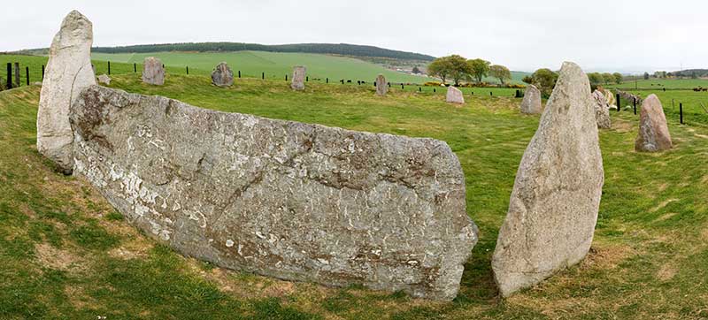
A stone circle is a ring of megalithic standing stones. Most are found in Northwestern Europe – especially Stone circles in the British Isles and Brittany – and typically date from the Late Neolithic and Early Bronze Age, with most being built between 3300 and 2500 BC. The best known examples include those at the henge monument at Avebury, the Rollright Stones, Castlerigg, and elements within the ring of standing stones at Stonehenge. Scattered examples exist from other parts of Europe. Later, during the Iron Age, stone circles were built in southern Scandinavia. The archetypical stone circle is an uncluttered enclosure, large enough to congregate inside, and composed of megalithic stones. Often similar structures are named 'stone circle', but these names are either historic, or incorrect. Examples of commonly misinterpreted stone circles are ring cairns, burial mounds, and kerb cairns. Although it is often assumed there are thousands of stone circles across the Br ... [...More Info...] [...Related Items...] OR: [Wikipedia] [Google] [Baidu] |
Megalithic
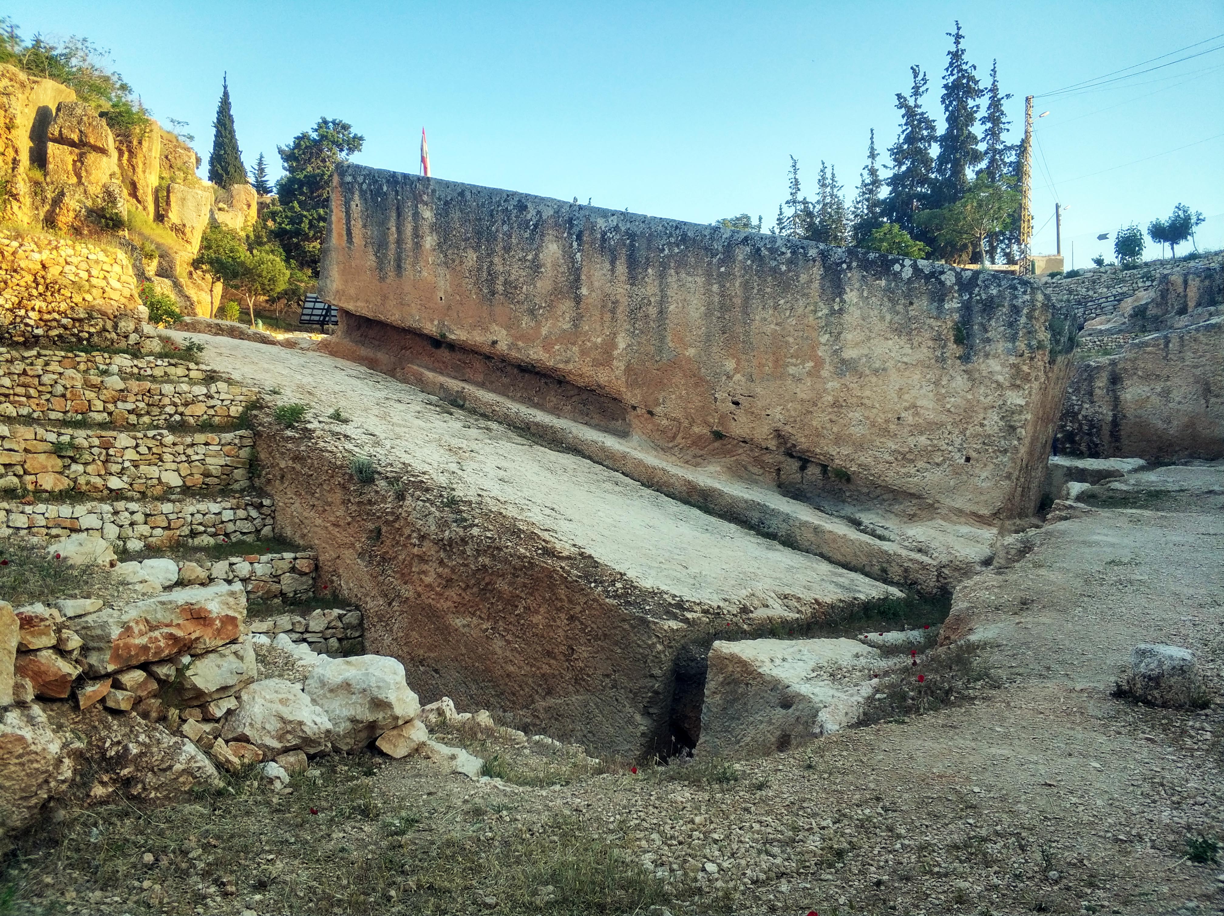
A megalith is a large Rock (geology), stone that has been used to construct a prehistoric structure or monument, either alone or together with other stones. More than 35,000 megalithic structures have been identified across Europe, ranging geographically from Sweden in the north to the Mediterranean Sea in the south. The word was first used in 1849 by the British antiquarian Algernon Herbert in reference to Stonehenge and derives from the Ancient Greek words "wikt:μέγας, mega" for great and "wikt:λίθος, lithos" for stone. Most extant megaliths were erected between the Neolithic period (although earlier Mesolithic examples are known) through the Chalcolithic, Chalcolithic period and into the Bronze Age. Types and definitions While "megalith" is often used to describe a single piece of stone, it also can be used to denote one or more rocks hewn in definite shapes for special purposes. It has been used to describe structures built by people from many parts of the wo ... [...More Info...] [...Related Items...] OR: [Wikipedia] [Google] [Baidu] |
Manorialism
Manorialism, also known as seigneurialism, the manor system or manorial system, was the method of land ownership (or "Land tenure, tenure") in parts of Europe, notably France and later England, during the Middle Ages. Its defining features included a large, sometimes fortified manor house in which the lord of the manor and his dependants lived and administered a rural estate, and a population of labourers or Serfdom, serfs who worked the surrounding land to support themselves and the lord. These labourers fulfilled their obligations with labour time or in-kind produce at first, and later by cash payment as commercial activity increased. Manorialism was part of the Feudalism, feudal system. Manorialism originated in the Roman villa system of the Late Roman Empire, and was widely practised in Middle Ages, medieval western Europe and parts of central Europe. An essential element of feudal society, manorialism was slowly replaced by the advent of a money-based market economy and new ... [...More Info...] [...Related Items...] OR: [Wikipedia] [Google] [Baidu] |
Middle Ages
In the history of Europe, the Middle Ages or medieval period lasted approximately from the 5th to the late 15th centuries, similarly to the post-classical period of global history. It began with the fall of the Western Roman Empire and transitioned into the Renaissance and the Age of Discovery. The Middle Ages is the middle period of the three traditional divisions of Western history: classical antiquity, the medieval period, and the modern period. The medieval period is itself subdivided into the Early, High, and Late Middle Ages. Population decline, counterurbanisation, the collapse of centralised authority, invasions, and mass migrations of tribes, which had begun in late antiquity, continued into the Early Middle Ages. The large-scale movements of the Migration Period, including various Germanic peoples, formed new kingdoms in what remained of the Western Roman Empire. In the 7th century, North Africa and the Middle East—once part of the Byzantine Empire� ... [...More Info...] [...Related Items...] OR: [Wikipedia] [Google] [Baidu] |


