|
Welbungin
Welbungin is a small town located just off the Koorda–Southern Cross road from Perth in the Wheatbelt region of Western Australia. Land was reserved in the area for a town hall as early as 1915 but it was not until the extension of the railway line from Mount Mashall to Lake Brown was planned to pass close by and that a station would be established in 1921 that the local primary producers association began to campaign for a town to be gazetted. The area was also known locally as Polkinghome's Corner but was gazetted in 1923 as Welbunging. The spelling was later changed to its current spelling in 1944. The name of the town is Aboriginal in origin and was first recorded in 1889 by early surveyors after the name of a nearby hill. In 1932 the Wheat Pool of Western Australia announced that the town would have two grain elevators, each fitted with an engine, installed at the railway siding. The surrounding areas produce wheat and other cereal crops. The town is a receival sit ... [...More Info...] [...Related Items...] OR: [Wikipedia] [Google] [Baidu] |
Shire Of Mount Marshall
The Shire of Mount Marshall is a local government area in the Wheatbelt region of Western Australia, about north-northwest of Merredin and about northeast of the state capital, Perth. The Shire covers an area of , and its seat of government is the town of Bencubbin. History The first European explorer in the area was Surveyor General John Septimus Roe; Mount Marshall and Lake McDermott were named after early Swan River Colony settler Marshall McDermott, cashier of the Bank of Western Australia, magistrate, and a director of the Agricultural Society of Western Australia. The area was first settled by sandalwood collectors and graziers in 1868. Sandalwood was removed from this area from the 1880s until the 1920s. Permanent settlement and the development and clearing of the land for farms commenced around 1910. The Mount Marshall Road District was established on 6 July 1923 from areas formerly falling within the Ninghan Road District and Nungarin Road District. On 1 July ... [...More Info...] [...Related Items...] OR: [Wikipedia] [Google] [Baidu] |
Aboriginal Australians
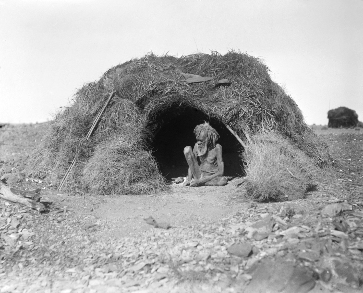
Aboriginal Australians are the various indigenous peoples of the Mainland Australia, Australian mainland and many of its islands, excluding the ethnically distinct people of the Torres Strait Islands. Humans first migrated to Australia (continent), Australia 50,000 to 65,000 years ago, and over time formed as many as 500 List of Aboriginal Australian group names, language-based groups. In the past, Aboriginal people lived over large sections of the continental shelf. They were isolated on many of the smaller offshore islands and Tasmania when the land was inundated at the start of the Holocene Interglacial, inter-glacial period, about 11,700 years ago. Despite this, Aboriginal people maintained extensive networks within the continent and certain groups maintained relationships with Torres Strait Islanders and the Makassar people, Makassar people of modern-day Indonesia. Over the millennia, Aboriginal people developed complex trade networks, inter-cultural relationships, law ... [...More Info...] [...Related Items...] OR: [Wikipedia] [Google] [Baidu] |
CBH Grain Receival Points
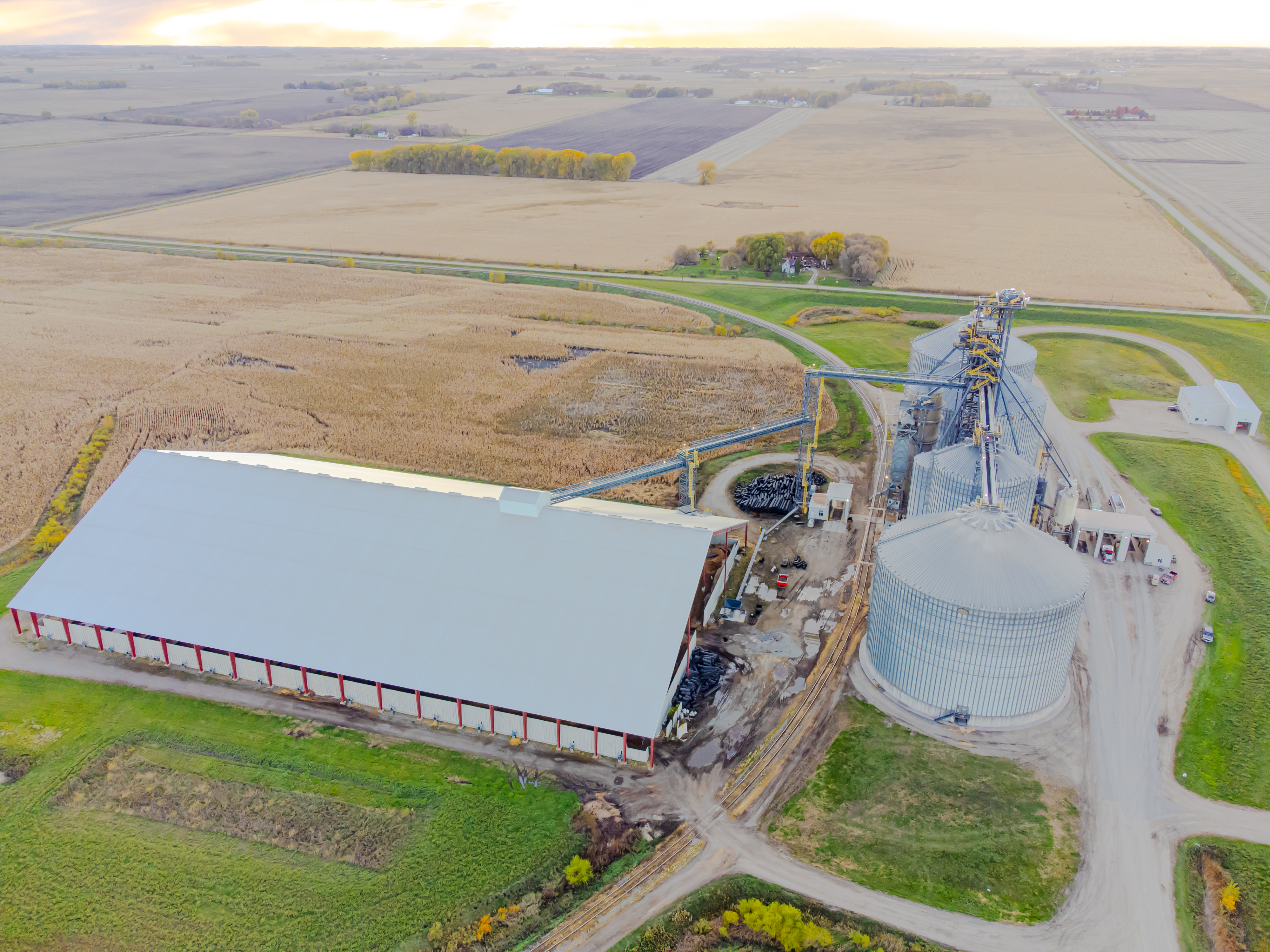
CBH grain receival points (also known as ''the bins'' or ''wheat bins'' in local popular usage) are grain silos spread around Western Australia, primarily in the wheatbelt region. Historically they have been linked with the wheatbelt railway lines, and the transport of grain to ports for export. Public art The range of available bins or grain silos have taken on identity as large public art works in the 2010s in the Public Silo Trail, with three sections to the trail identified: : The Northern Trail :: Northam :: Merredin : The "Central Heart" Trail – involving :: Katanning :: Pingrup :: Newdegate : The "Wave to wave" Trail – involving :: Ravensthorpe :: Albany Beginnings The earlier bins were made at the time of the change from wheat transport in bags, to bulk operations – and at the time of the creation of the CBH Group in 1933. The first five bins or grain receival points were located at Western Australian Government Railways sidings at: * Benjaberring * Korre ... [...More Info...] [...Related Items...] OR: [Wikipedia] [Google] [Baidu] |
Cereal
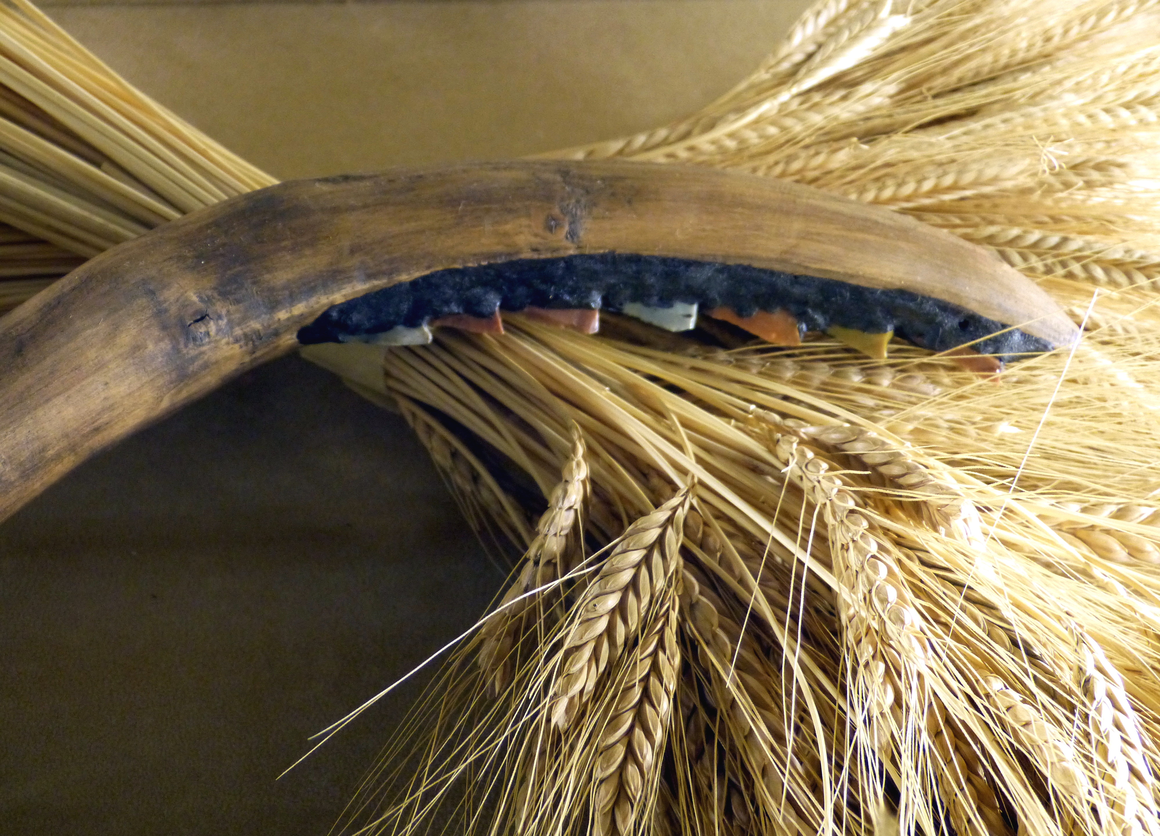
A cereal is a grass cultivated for its edible grain. Cereals are the world's largest crops, and are therefore staple foods. They include rice, wheat, rye, oats, barley, millet, and maize ( Corn). Edible grains from other plant families, such as amaranth, buckwheat and quinoa, are pseudocereals. Most cereals are annuals, producing one crop from each planting, though rice is sometimes grown as a perennial. Winter varieties are hardy enough to be planted in the autumn, becoming dormant in the winter, and harvested in spring or early summer; spring varieties are planted in spring and harvested in late summer. The term cereal is derived from the name of the Roman goddess of grain crops and fertility, Ceres. Cereals were domesticated in the Neolithic around 8,000 years ago. Wheat and barley were domesticated in the Fertile Crescent; rice and some millets were domesticated in East Asia, while sorghum and other millets were domesticated in West Africa. Maize was domesticat ... [...More Info...] [...Related Items...] OR: [Wikipedia] [Google] [Baidu] |
Wheat
Wheat is a group of wild and crop domestication, domesticated Poaceae, grasses of the genus ''Triticum'' (). They are Agriculture, cultivated for their cereal grains, which are staple foods around the world. Well-known Taxonomy of wheat, wheat species and hybrids include the most widely grown common wheat (''T. aestivum''), spelt, durum, emmer, einkorn, and Khorasan wheat, Khorasan or Kamut. The archaeological record suggests that wheat was first cultivated in the regions of the Fertile Crescent around 9600 BC. Wheat is grown on a larger area of land than any other food crop ( in 2021). World trade in wheat is greater than that of all other crops combined. In 2021, world wheat production was , making it the second most-produced cereal after maize (known as corn in North America and Australia; wheat is often called corn in countries including Britain). Since 1960, world production of wheat and other grain crops has tripled and is expected to grow further through the middle of ... [...More Info...] [...Related Items...] OR: [Wikipedia] [Google] [Baidu] |
The West Australian
''The West Australian'' is the only locally edited daily newspaper published in Perth, Western Australia. It is owned by Seven West Media (SWM), as is the state's other major newspaper, ''The Sunday Times''. It is the second-oldest continuously produced newspaper in Australia, having been published since 1833. It tends to have conservative leanings, and has mostly supported the Liberal–National Party Coalition. It has Australia's largest share of market penetration (84% of WA) of any newspaper in the country. Content ''The West Australian'' publishes international, national and local news. , newsgathering was integrated with the TV news and current-affairs operations of '' Seven News'', Perth, which moved its news staff to the paper's Osborne Park premises. SWM also publishes two websites from Osborne Park—thewest.com.au and PerthNow. The daily newspaper includes lift-outs including Play Magazine, The Guide, West Weekend, and Body and Soul. Thewest.com.au is the online ... [...More Info...] [...Related Items...] OR: [Wikipedia] [Google] [Baidu] |
Grain Elevators
A grain elevator or grain terminal is a facility designed to stockpile or store grain. In the grain trade, the term "grain elevator" also describes a tower containing a bucket elevator or a pneumatic conveyor, which scoops up grain from a lower level and deposits it in a silo or other storage facility. In most cases, the term "grain elevator" also describes the entire elevator complex, including receiving and testing offices, weighbridges, and storage facilities. It may also mean organizations that operate or control several individual elevators, in different locations. In Australia, the term describes only the lifting mechanism. Before the advent of the grain elevator, grain was usually handled in bags rather than in bulk (large quantities of loose grain). The Dart elevator was a major innovation—it was invented by Joseph Dart, a merchant, and Robert Dunbar, an engineer, in 1842, in Buffalo, New York. Using the steam-powered flour mills of Oliver Evans as their model, t ... [...More Info...] [...Related Items...] OR: [Wikipedia] [Google] [Baidu] |
CBH Group
The CBH Group (commonly known as CBH, an acronym for Co-operative Bulk Handling) is a grain growers' cooperative that handles, markets and processes grain from the wheatbelt of Western Australia. History CBH was formed on 5 April 1933, at a time when a royal commission on bulk handling of grain was in progress, and after over 20 years of failed proposals for bulk handling of grain in Western Australia. The trustees of the Wheat Board of Western Australia and Wesfarmers registered the company together with capital of £100,000 divided evenly into 100,000 shares. The cooperative was formed under the principle of one person, one vote, regardless of the amount of grain supplied. CBH merged with the Grain Pool in November 2002, after the Parliament of Western Australia passed legislation allowing the merger to go ahead. In 2016, the Australian Taxation Office revealed that despite generating more than $3.4 billion in revenue in 2013/14, the company paid no tax. This made it Aus ... [...More Info...] [...Related Items...] OR: [Wikipedia] [Google] [Baidu] |
Wyalkatchem To Southern Cross Railway Line
The Wyalkatchem to Southern Cross railway line is a partially operational railway line, operated by Arc Infrastructure, in the Wheatbelt region of Western Australia, once connecting Wyalkatchem with Southern Cross. Of the former long railway, only the western part, the long section from Wyalkatchem to Mukinbudin is still operational as the Wyalkatchem to Mukinbudin railway line. At Wyalkatchem, the railway line connects to the Goomalling to West Merredin railway line, with only the Goomalling to Wyalkatchem section of this line still being operational. At Mukinbudin, the line now terminates while, in the past, it extended all the way to Southern Cross, where it connected to the Eastern Goldfields Railway. History At the eastern end of the Wyalkatchem to Southern Cross railway line, the Eastern Goldfields Railway to Southern Cross had been completed in 1894. At the western end, the Goomalling to West Merredin railway line, passing through Wyalkatchem, was constructed in ... [...More Info...] [...Related Items...] OR: [Wikipedia] [Google] [Baidu] |
Electoral District Of Central Wheatbelt
Central Wheatbelt is an electoral district of the Legislative Assembly in the Australian state of Western Australia. The district is centrally located in the Wheatbelt region of Western Australia. Politically, Central Wheatbelt is a safe National Party seat. History Central Wheatbelt was first created for the 2008 state election. It was essentially an amalgamation of the abolished National-held districts of Avon and Merredin, although parts of each ended up in neighbouring districts. Roughly half the new district's voters came from each of the two former districts. The original proposal had the newly created district persisting with the name Merredin. However, this was the focus of several objections, as Merredin is but one town in the eastern part of this sizeable electorate. Instead, the more generic name of Central Wheatbelt was adopted. Geography Central Wheatbelt incorporates a number of rural inland shires to the east of Perth. Its population centres include Ball ... [...More Info...] [...Related Items...] OR: [Wikipedia] [Google] [Baidu] |
Western Australia
Western Australia (WA) is the westernmost state of Australia. It is bounded by the Indian Ocean to the north and west, the Southern Ocean to the south, the Northern Territory to the north-east, and South Australia to the south-east. Western Australia is Australia's largest state, with a land area of , and is also the List of country subdivisions by area, second-largest subdivision of any country on Earth. Western Australia has a diverse range of climates, including tropical conditions in the Kimberley (Western Australia), Kimberley, deserts in the interior (including the Great Sandy Desert, Little Sandy Desert, Gibson Desert, and Great Victoria Desert) and a Mediterranean climate on the south-west and southern coastal areas. the state has 2.965 million inhabitants—10.9 percent of the national total. Over 90 percent of the state's population live in the South-West Land Division, south-west corner and around 80 percent live in the state capital Perth, leaving the remainder ... [...More Info...] [...Related Items...] OR: [Wikipedia] [Google] [Baidu] |
Wheatbelt (Western Australia)
The Wheatbelt is one of nine regions of Western Australia defined as administrative areas for the state's regional development, and a vernacular term for the area converted to agriculture during colonisation. It partially surrounds the Perth metropolitan area, extending north from Perth to the Mid West region, and east to the Goldfields–Esperance region. It is bordered to the south by the South West and Great Southern regions, and to the west by the Indian Ocean, the Perth metropolitan area, and the Peel region. Altogether, it has an area of (including islands). The region has 42 local government authorities, with an estimated population of 75,000 residents. The Wheatbelt accounts for approximately three per cent of Western Australia's population. Ecosystems The area, once a diverse ecosystem, reduced when clearing began in the 1890s with the removal of plant species such as eucalypt woodlands and mallee, is now home to around 11% of Australia's critically end ... [...More Info...] [...Related Items...] OR: [Wikipedia] [Google] [Baidu] |


