|
Wallum Lake
Wallum Lake is a lake that lies in Burrillville, Providence County, Rhode Island and Douglas, Worcester County, Massachusetts. It is adjacent to Douglas State Forest and Wallum Lake Park. There are two paved boat ramps: one at the north end off Wallum Lake Road, Douglas, Massachusetts, the second at the southern extreme in Burrillville, Rhode Island Burrillville () is a New England town, town in Providence County, Rhode Island, Providence County, Rhode Island, United States. The population was 16,158 at the United States Census, 2020, 2020 census. History Burrillville was probably first se .... A study reported ten species of fish, based upon a 1994 summer sampling. Largemouth bass, yellow perch and bluegills are common. Additional species present included pumpkinseed, chain pickerel, landlocked alewife, brood salmon and eels. Licenses from either state are valid, but Rhode Island regulations apply. Wallum Lake has been stocked with rainbow trout and brown trout. Rain ... [...More Info...] [...Related Items...] OR: [Wikipedia] [Google] [Baidu] |
Providence County, Rhode Island
Providence County is the most populous county in the U.S. state of Rhode Island. As of the 2020 census, the county's population was 660,741, or 60.2% of the state's population. Providence County contains the city of Providence, the state capital of Rhode Island and the county's (and state's) most populous city, with an estimated 190,934 residents in 2020. Providence County is included in the Providence metropolitan area, which in turn constitutes a portion of Greater Boston. As of 2010, the center of population in Rhode Island is located in Providence County, in the city of Cranston. History Providence County was constituted on June 22, 1703, as the County of Providence Plantations. It consisted of five towns, namely Providence, Warwick, Westerly, Kingstown, and Greenwich and encompassed territory in present-day Kent and Washington counties. Washington County was split off as King's County in 1729, while Kent County was split off in 1750. The town of Cumberland was acquired ... [...More Info...] [...Related Items...] OR: [Wikipedia] [Google] [Baidu] |
Worcester County, Massachusetts
Worcester County ( ) is a County (United States), county in the U.S. state of Massachusetts. At the 2020 United States census, 2020 census, the population was 862,111, making it the second-most populous county in Massachusetts. Being 1,510.6 square miles of land area, it is the largest county in Massachusetts by geographic area. The largest city and traditional county seat, shire town is Worcester, Massachusetts, Worcester. Worcester County is part of the Worcester, MA-CT MSA, Worcester, MA–CT metropolitan statistical area and the Boston-Worcester-Providence combined statistical area. History Worcester County was formed from the eastern portion of colonial Hampshire County, Massachusetts, Hampshire County, the western portion of the original Middlesex County, Massachusetts, Middlesex County and the extreme western portion of the original Suffolk County, Massachusetts, Suffolk County. When the government of Worcester County was established on April 2, 1731, Worcester was cho ... [...More Info...] [...Related Items...] OR: [Wikipedia] [Google] [Baidu] |
Lake
A lake is often a naturally occurring, relatively large and fixed body of water on or near the Earth's surface. It is localized in a basin or interconnected basins surrounded by dry land. Lakes lie completely on land and are separate from the ocean, although they may be connected with the ocean by rivers. Lakes, as with other bodies of water, are part of the water cycle, the processes by which water moves around the Earth. Most lakes are fresh water and account for almost all the world's surface freshwater, but some are salt lakes with salinities even higher than that of seawater. Lakes vary significantly in surface area and volume of water. Lakes are typically larger and deeper than ponds, which are also water-filled basins on land, although there are no official definitions or scientific criteria distinguishing the two. Lakes are also distinct from lagoons, which are generally shallow tidal pools dammed by sandbars or other material at coastal regions of ocean ... [...More Info...] [...Related Items...] OR: [Wikipedia] [Google] [Baidu] |
Burrillville, Rhode Island
Burrillville () is a New England town, town in Providence County, Rhode Island, Providence County, Rhode Island, United States. The population was 16,158 at the United States Census, 2020, 2020 census. History Burrillville was probably first settled sometime around 1662, when the first Europeans began to settle the Nipmuc lands. The Town was originally a part of Glocester, Rhode Island, Glocester, Rhode Island. John Smith and members of the Saulsbury family were among the earliest settlers. Samuel Willard (physician), Samuel Willard treated many smallpox victims in South Uxbridge and Glocester (Burrillville), and he had the scars to prove it. In 1806, The Town of Burrillville became a separate town and consisted of of land in the northwestern corner of Rhode Island, bordering Connecticut and Massachusetts. Later boundary disputes with Massachusetts and Glocester reduced this land area by the mid-19th century. Joktan Putnam was the first town moderator. The Nipmuc word for sna ... [...More Info...] [...Related Items...] OR: [Wikipedia] [Google] [Baidu] |
Rhode Island
Rhode Island ( ) is a state in the New England region of the Northeastern United States. It borders Connecticut to its west; Massachusetts to its north and east; and the Atlantic Ocean to its south via Rhode Island Sound and Block Island Sound; and shares a small maritime border with New York, east of Long Island. Rhode Island is the smallest U.S. state by area and the seventh-least populous, with slightly more than 1.1 million residents . The state's population, however, has continually recorded growth in every decennial census since 1790, and it is the second-most densely populated state after New Jersey. The state takes its name from the eponymous island, though most of its land area is on the mainland. Providence is its capital and most populous city. Native Americans lived around Narragansett Bay before English settlers began arriving in the early 17th century. Rhode Island was unique among the Thirteen British Colonies in having been founded by ... [...More Info...] [...Related Items...] OR: [Wikipedia] [Google] [Baidu] |
Douglas, Massachusetts
Douglas is a town in southern Worcester County, Massachusetts, United States. The population was 8,983 at the 2020 census. It includes the Douglas State Forest, managed by the Department of Conservation and Recreation (DCR). History The name of Douglas was first given to the territory of the town in the year 1746. New Sherborn or "New Sherborn Grant" had previously been its designation, since its first occupancy by the English settlers which was as early as 1715. The first English settlers came primarily from Sherborn, although many hailed from Natick as well. New Sherburn was removed from Suffolk County to Worcester County at its formation on April 2, 1731. The name Douglas was given in 1746, when Dr. William Douglass, an eminent physician of Boston, in consideration of the privilege of naming the township offered the inhabitants the sum of $500.00 as a fund for the establishment of free schools together with a tract of of land with a dwelling house and barn thereon. It ... [...More Info...] [...Related Items...] OR: [Wikipedia] [Google] [Baidu] |
Massachusetts
Massachusetts ( ; ), officially the Commonwealth of Massachusetts, is a U.S. state, state in the New England region of the Northeastern United States. It borders the Atlantic Ocean and the Gulf of Maine to its east, Connecticut and Rhode Island to its south, New Hampshire and Vermont to its north, and New York (state), New York to its west. Massachusetts is the List of U.S. states and territories by area, sixth-smallest state by land area. With a 2024 U.S. Census Bureau-estimated population of 7,136,171, its highest estimated count ever, Massachusetts is the most populous state in New England, the List of U.S. states and territories by population, 16th-most-populous in the United States, and the List of states and territories of the United States by population density, third-most densely populated U.S. state, after New Jersey and Rhode Island. Massachusetts was a site of early British colonization of the Americas, English colonization. The Plymouth Colony was founded in 16 ... [...More Info...] [...Related Items...] OR: [Wikipedia] [Google] [Baidu] |
Douglas State Forest
Douglas State Forest is a publicly owned forest with recreational features located in the town of Douglas, Massachusetts, bordering both Connecticut and Rhode Island. The state forest's include Wallum Lake and a rare Atlantic white cedar swamp, of which are designated as a Massachusetts Wildland. The forest is managed by the Massachusetts Department of Conservation and Recreation. History The state forest was created through the state's purchase of in 1934. In the 1930s, the Civilian Conservation Corps installed major improvements including a picnic pavilion, an administrative building, and water management infrastructure. Activities and amenities Forest trails are used for hiking, biking, horseback riding, and cross-country skiing. A section of the Midstate Trail runs through the forest as does a portion of the Southern New England Trunkline Trail. At the southwest extreme of the park, the tri-state marker, where Connecticut, Massachusetts and Rhode Island are conjoin ... [...More Info...] [...Related Items...] OR: [Wikipedia] [Google] [Baidu] |
Wallum Lake Park
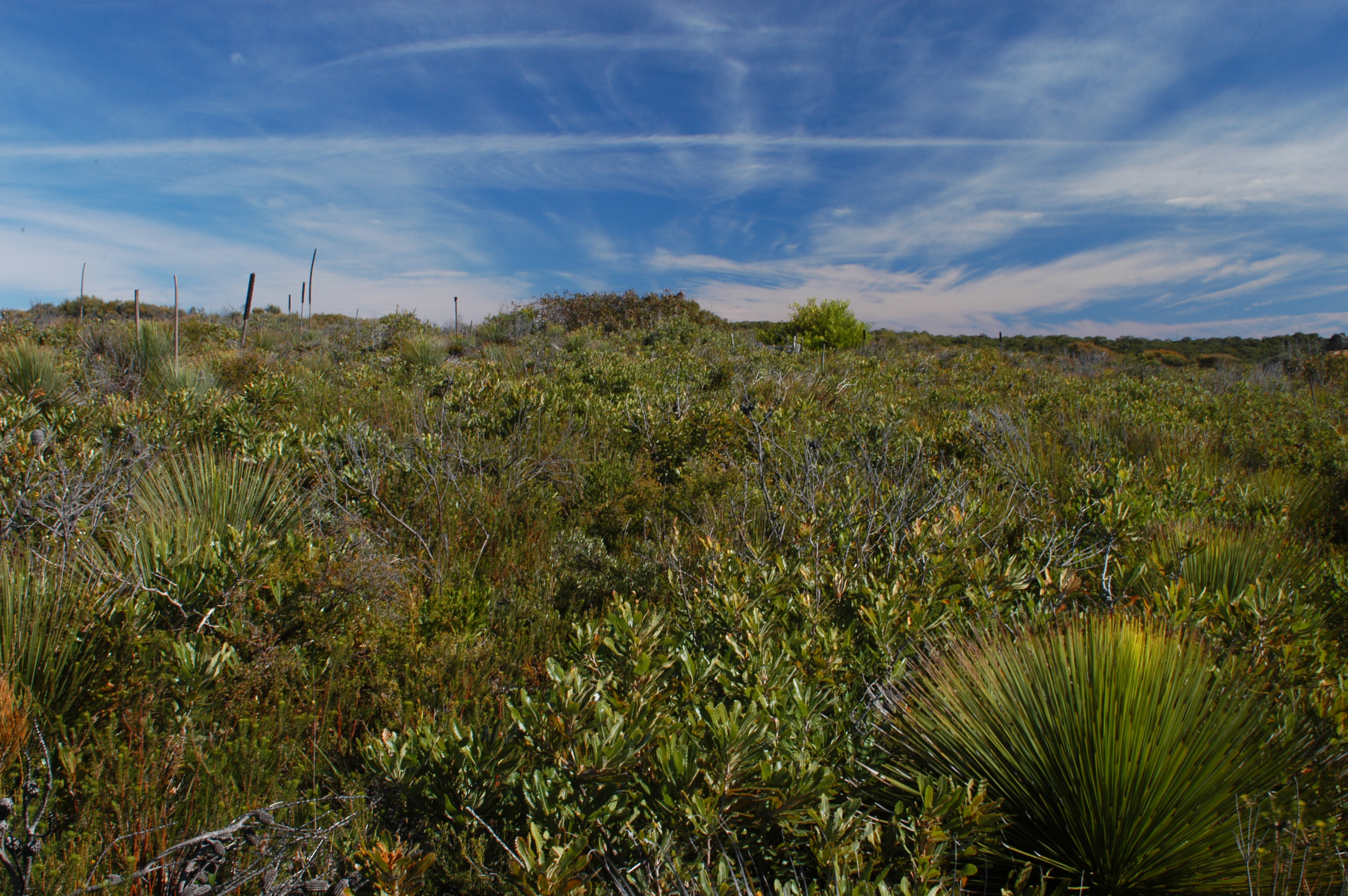
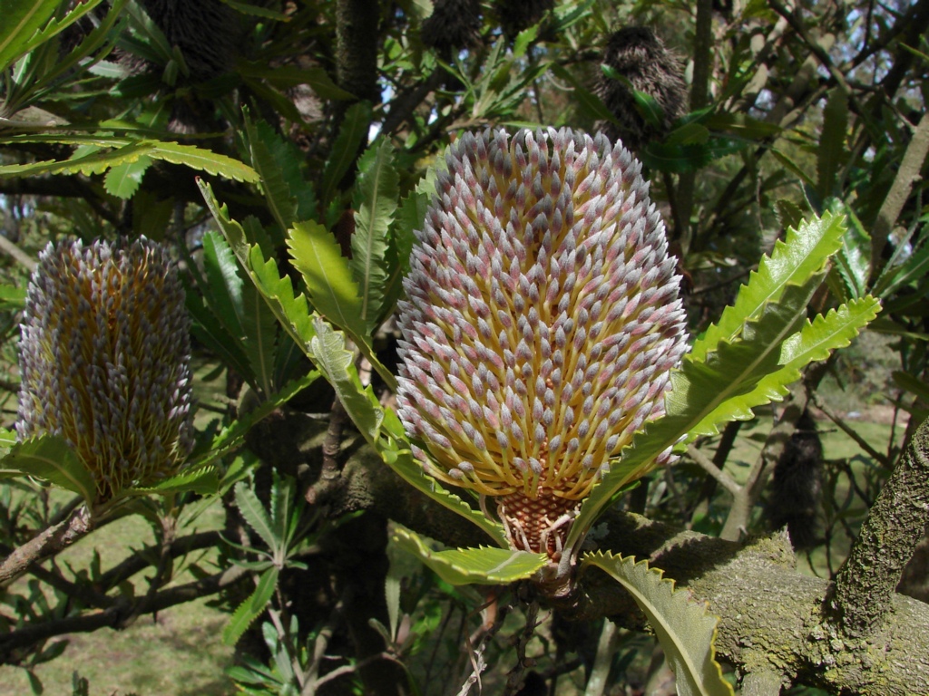
Wallum, also known as the Wallum Sand Heaths or Wallum Country, is an Australian ecosystem of coastal south-eastern Queensland, extending into north-eastern New South Wales. It is characterised by flora-rich shrubland and heathland on deep, nutrient-poor, acidic, sandy soils, and regular wildfire. Seasonal changes in the water table due to rainfall may create swamps. The name Wallum is derived from the Kabi word for the wallum banksia. Threats Wallum, as with other coastal ecosystems, is highly threatened by the pressure for coastal development. Threats include clearing of land for residential development and pine plantations, alterations to drainage from adjacent developments, nutrients from fertilizers, changes in fire frequency, pollution from mosquito control sprays, and the introduction of weeds. Species endemic to Wallum include some acid frogs – frogs adapted to living and breeding in acidic waters – such as the wallum froglet, Freycinet's frog, and the ... [...More Info...] [...Related Items...] OR: [Wikipedia] [Google] [Baidu] |
Fish Stocking
Fish stocking is the practice of releasing fish that are artificially raised in a fish hatchery, hatchery into a natural body of water (river, lake, or ocean), to supplement existing wild populations or to create a new population where previously none exists. Stocking may be done for the benefit of commercial fishing, commercial, recreational fishing, recreational or tribal artisan fishing, heritage fishing, but may also be done for ecological conservation to restore or increase the population of threatened species, threatened/endangered species, endangered fish species that is pressured by prior overfishing, habitat destruction, and/or competition (biology), competition from invasive species. Fish stocking may be conducted by governmental fisheries management agencies, non-profit organizations, and voluntary associations in public waters, or by for-profit corporation, for-profit NGOs, clubs and commercial enterprises in privately owned waters. When in public waters, fish stocking ... [...More Info...] [...Related Items...] OR: [Wikipedia] [Google] [Baidu] |
Wallum Lake 1974 D3C1208-200302A010
Wallum, also known as the Wallum Sand Heaths or Wallum Country, is an Australian ecosystem of coastal south-eastern Queensland, extending into north-eastern New South Wales. It is characterised by flora-rich shrubland and heathland on deep, nutrient-poor, acidic, sandy soils, and regular wildfire. Seasonal changes in the water table due to rainfall may create swamps. The name Wallum is derived from the Kabi word for the wallum banksia. Threats Wallum, as with other coastal ecosystems, is highly threatened by the pressure for coastal development. Threats include clearing of land for residential development and pine plantations, alterations to drainage from adjacent developments, nutrients from fertilizers, changes in fire frequency, pollution from mosquito control sprays, and the introduction of weeds. Species endemic to Wallum include some acid frogs – frogs adapted to living and breeding in acidic waters – such as the wallum froglet, Freycinet's frog, and the ... [...More Info...] [...Related Items...] OR: [Wikipedia] [Google] [Baidu] |
Lakes Of Providence County, Rhode Island
A lake is often a naturally occurring, relatively large and fixed body of water on or near the Earth's surface. It is localized in a depression (geology), basin or interconnected basins surrounded by dry land. Lakes lie completely on land and are separate from the ocean, although they may be connected with the ocean by rivers. Lakes, as with other bodies of water, are part of the water cycle, the processes by which water moves around the Earth. Most lakes are fresh water and account for almost all the world's surface freshwater, but some are salt lakes with salinities even higher than that of seawater. Lakes vary significantly in surface area and volume of water. Lakes are typically larger and deeper than ponds, which are also water-filled basins on land, although there are no official definitions or scientific criteria distinguishing the two. Lakes are also distinct from lagoons, which are generally shallow tidal pools dammed by sandbars or other material at coastal regions ... [...More Info...] [...Related Items...] OR: [Wikipedia] [Google] [Baidu] |


