|
Wadō (era)
was a after '' Keiun'' and before '' Reiki''. This period spanned the years from January 708 through September 715. The reigning monarch was Empress Genmei (元明天皇, Genmei-tennō). Change of era * 708 : The new era name ''Wadō'' (meaning "Japanese copper") was created because a high-quality copper mine was discovered in Chichibu in Musashi Province, what is now known as Wadō Archaeological Site. The previous era ended and the new one commenced in the spring of ''Keiun'' 5, on the 11th day of the 1st month of 708. The Japanese word for copper is ; and since this was indigenous copper, the ''"wa"'' (the ancient Chinese term for Japan) could be combined with the ''"dō"'' (copper) to create a new composite term -- "''wadō''"—meaning "Japanese copper". A mint was established in the province of Ōmi;Ponsonby-Fane, Richard Arthur Brabazon. (1959). ''The Imperial House of Japan'', p. 56. and the ''Wadō'' era is famous for the coin , which is recognized as the fi ... [...More Info...] [...Related Items...] OR: [Wikipedia] [Google] [Baidu] |
Shōsōin
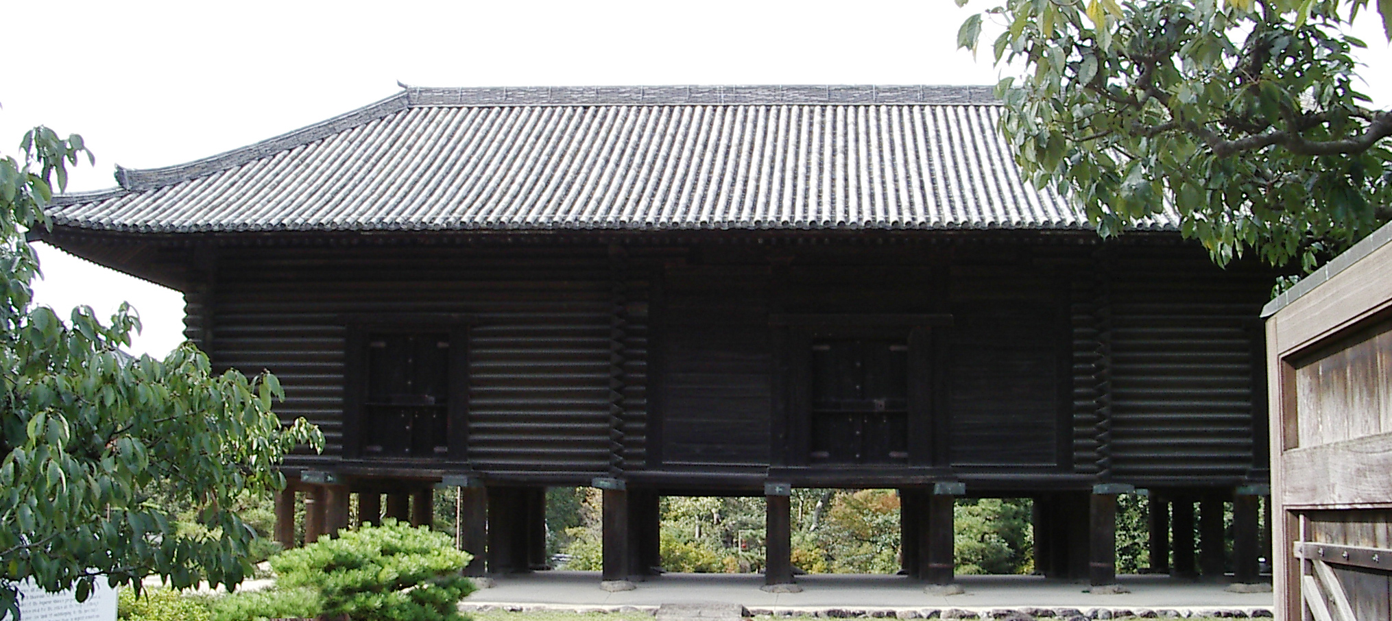
The is the wikt:treasure house, treasure house of Tōdai-ji Temple in Nara, Nara, Nara, Japan. The building is in the ''azekura'' (log-cabin) style with a raised floor. It lies to the northwest of the Great Buddha Hall. The Shōsō-in houses artifacts connected to Emperor Shōmu (聖武天皇)(701–756) and Empress Kōmyō (光明皇后)(701–760), as well as arts and crafts of the Tenpyō, Tempyō (天平) era of History of Japan, Japanese history. History The construction of the Tōdai-ji Buddhist temple complex was ordained by Emperor Shōmu as part of a national project of Buddhist temple construction. During the Tenpyō, Tempyō period, the years during which Emperor Shōmu reigned, multiple disasters struck Japan as well as political uproar and epidemics. Because of these reasons Emperor Shōmu launched a project of provincial temples. The Tōdai-ji was appointed as the head temple of these provincial temples. Emperor Shōmu was a strong supporter of Buddhism and he tho ... [...More Info...] [...Related Items...] OR: [Wikipedia] [Google] [Baidu] |
Heijō-kyō
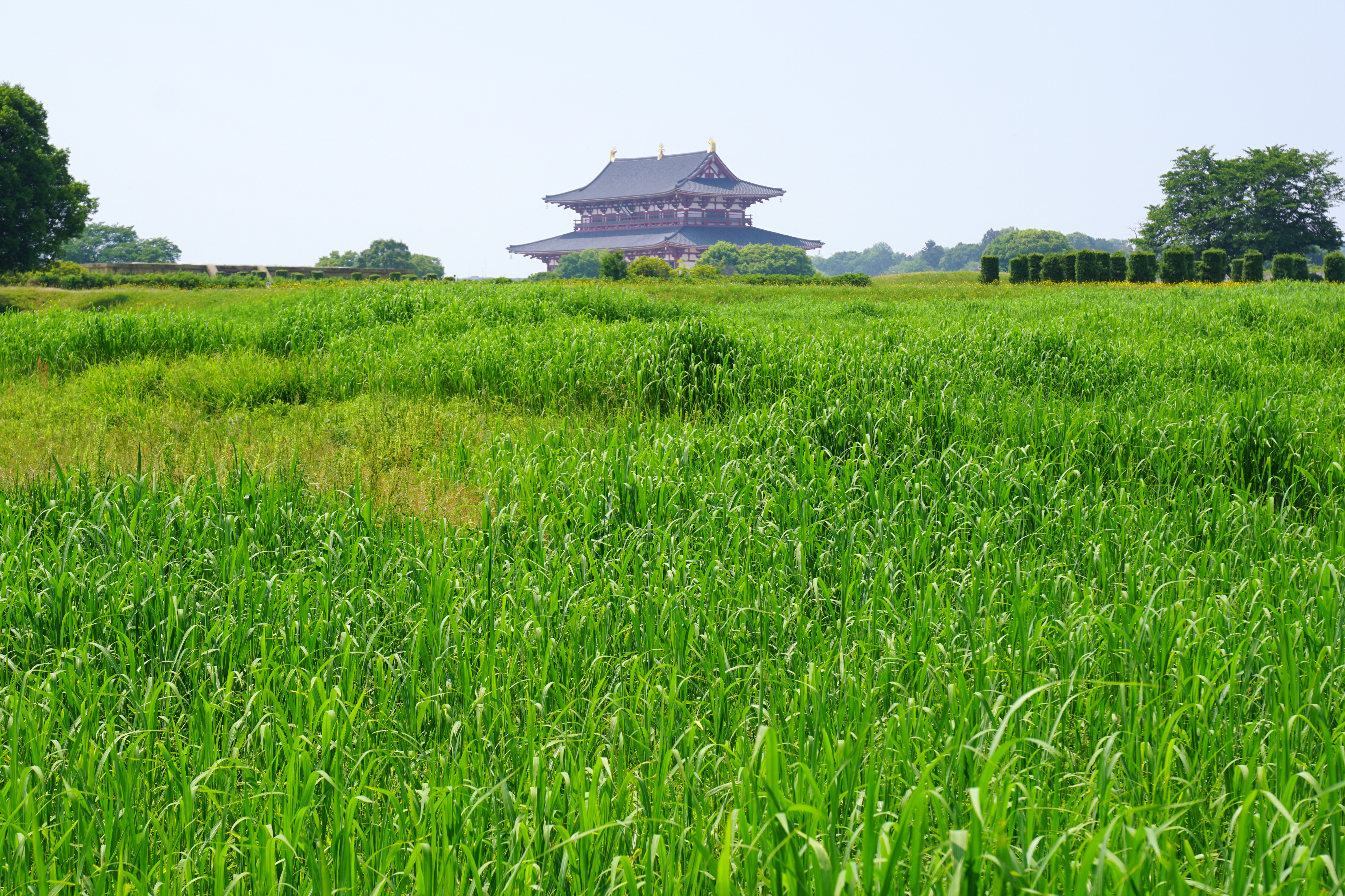
was the Capital of Japan during most of the Nara period, from 710 to 740 and again from 745 to 784. The imperial palace is a listed UNESCO World Heritage together with other places in the city of Nara (cf. Historic Monuments of Ancient Nara). Empress Genmei ordered the Imperial capital moved from Fujiwara-kyō to Heijō-kyō in 708, and the move to Heijō-kyō was complete in 710. Heijō-kyō was modeled after Chang'an, the capital of Tang-dynasty China, although Heijō-kyō lacked walls. In the city, merchants and traders from China, Korea and India introduced various foreign cultures to Heijō-kyō through the Silk Road. As a result, Heijō-kyō flourished as Japan's first international and political capital, with a peak population of between 50,000 and 100,000. The overall form of the city was an irregular rectangle, and the area of the city was more than 25 km2. Architecture In the area of Heijō-kyō, there are ancient Buddhist temples, and some temples are ... [...More Info...] [...Related Items...] OR: [Wikipedia] [Google] [Baidu] |
Ōsumi Province
was a province of Japan in the area of southeastern Kyūshū, corresponding to the eastern half of modern Kagoshima Prefecture, and including the Ōsumi Islands . Ōsumi bordered on Hyūga to the northeast, and Satsuma Province to the northwest. Its abbreviated form was . In terms of the Gokishichidō system, Ōsumi was one of the provinces of the Saikaidō circuit. Under the '' Engishiki'' classification system, Ōsumi was ranked as one of the "middle countries" (中国) in terms of importance, and one of the "far countries" (遠国) in terms of distance from the capital. The Ōsumi region has developed its own distinct local dialect. Although Ōsumi is part of Kagoshima Prefecture today, this dialect is different from that spoken in the city of Kagoshima. There is a notable cultural pride in traditional poetry written in Ōsumi and Kagoshima dialects. Japan's first satellite, '' Ōsumi'', was named after the province. History Early history Before the establishment ... [...More Info...] [...Related Items...] OR: [Wikipedia] [Google] [Baidu] |
Hyūga Province
was a province of Japan in the area of southeastern Kyūshū, corresponding to modern Miyazaki Prefecture Hyūga bordered on Ōsumi to the south, Higo to the west, and Bungo to the north. Its abbreviated form name was , although it was also called . In terms of the Gokishichidō system, Hyūga was one of the provinces of the Saikaidō circuit. Under the '' Engishiki'' classification system, Hyūga was ranked as one of the "middle countries" (中国) in terms of importance, and one of the "far countries" (遠国) in terms of distance from the capital. History Early history Ruins from the Japanese Paleolithic period have been discovered in the Hyūga area, and red-colored pottery made from cinnabar has been excavated from the Tsukahara ruins from the Jōmon period. The Hyūga region of the Yayoi period is characterized by the lack of bronze tools and the presence of gouged square stone knives, while imported ironware from the central Kyushu region have been unearthed. Ma ... [...More Info...] [...Related Items...] OR: [Wikipedia] [Google] [Baidu] |
Bizen Province
was a Provinces of Japan, province of Japan in the area that is eastern Okayama Prefecture in the Chūgoku region of western Japan.Louis-Frédéric, Nussbaum, Louis-Frédéric. (2005). "''Mimasaka no Kuni''" in . Bizen bordered Bitchū Province, Bitchū, Mimasaka Province, Mimasaka, and Harima Provinces. Its abbreviated form name was . In terms of the Gokishichidō system, Bizen was one of the provinces of the San'yō region, San'yō circuit. Under the ''Engishiki'' classification system, Bizen was ranked as one of the 35 "superior countries" (上国) in terms of importance, and one of the "near countries" (近国) in terms of distance from the capital. The provincial capital was located in what is now the city of Okayama. History After its conquest, the ancient Kingdom of Kibi became Kibi Province. It was divided into Bizen (備前), Bitchu Province, Bitchū (備中), and Bingo Province, Bingo (備後) Provinces in the ''Ritsuryō'' administrative reforms in the late 7th cent ... [...More Info...] [...Related Items...] OR: [Wikipedia] [Google] [Baidu] |
Mimasaka Province
was a Provinces of Japan, province of Japan in the area that is northern Okayama Prefecture in the Chūgoku region of western Japan. Mimasaka bordered Bitchū Province, Bitchū, Bizen Province, Bizen, Harima Province, Harima, Hōki Province, Hōki, and Inaba Province, Inaba Provinces. Its abbreviated form name was . In terms of the Gokishichidō system, Mimasaka was one of the provinces of the San'yōdō, San'yō circuit. Under the ''Engishiki'' classification system, Mimasaka was ranked as one of the 35 "superior countries" (上国) in terms of importance, and one of the "near countries" (近国) in terms of distance from the capital. The provincial capital was located in what is now the city of Tsuyama. Geography Mimasaka was a landlocked province on the southern side of the Chugoku Mountains. The area is very mountainous, and is divided into three major river basins. In the east is the Asahi River which flows through the Maniwa Basin. In the center is the Yoshii River, wh ... [...More Info...] [...Related Items...] OR: [Wikipedia] [Google] [Baidu] |
Tango Province
was a Provinces of Japan, province of Japan in the area of northern Kyoto Prefecture. Tango bordered on Tanba Province, Tanba to the south, Tajima Province, Tajima to the west, and Wakasa Province, Wakasa to the east. Its abbreviated form name was . It was also referred to as or . In terms of the Gokishichidō system, Tango was one of the provinces of the San'indō circuit. Under the ''Engishiki'' classification system, Tango was ranked as one of the "middle countries" (中国) in terms of importance, and one of the "near countries" (近国) in terms of distance from the capital. The provincial capital was located in what is now the city of Miyazu, Kyoto, Miyazu. The ''ichinomiya'' of the province is the Kono Shrine also located in Miyazu. The province had an area of . History Early history The Tango region prospered around the Takeno River basin (present-day Kyōtango city) during the Kofun period, during which time many keyhole-shaped kofun, burial mounds were constructed ... [...More Info...] [...Related Items...] OR: [Wikipedia] [Google] [Baidu] |
Tanba Province
was a province of Japan in the area of central Kyoto and east-central Hyōgo Prefectures. Tanba bordered on Harima, Ōmi, Settsu, Tajima. Tango, Wakasa, and Yamashiro provinces. Its abbreviated form name was . In terms of the Gokishichidō system, Tanba was one of the provinces of the San'indō circuit. Under the '' Engishiki'' classification system, Tanba was ranked as one of the "superior countries" (上国) in terms of importance, and one of the "near countries" (近国) in terms of distance from the capital. The provincial capital is believed to have been located in what is now the city of Kameoka, although the exact location remains uncertain. The ''ichinomiya'' of the province is the Izumo-daijingū also located in Kameoka. The province had an area of . History Before the establishment of the Ritsuryō system, the area was under control of the Tanba Kokuzō and included both the Tanba and Tango areas. The province of Tango was created in 713 during the reign o ... [...More Info...] [...Related Items...] OR: [Wikipedia] [Google] [Baidu] |
Dewa Province
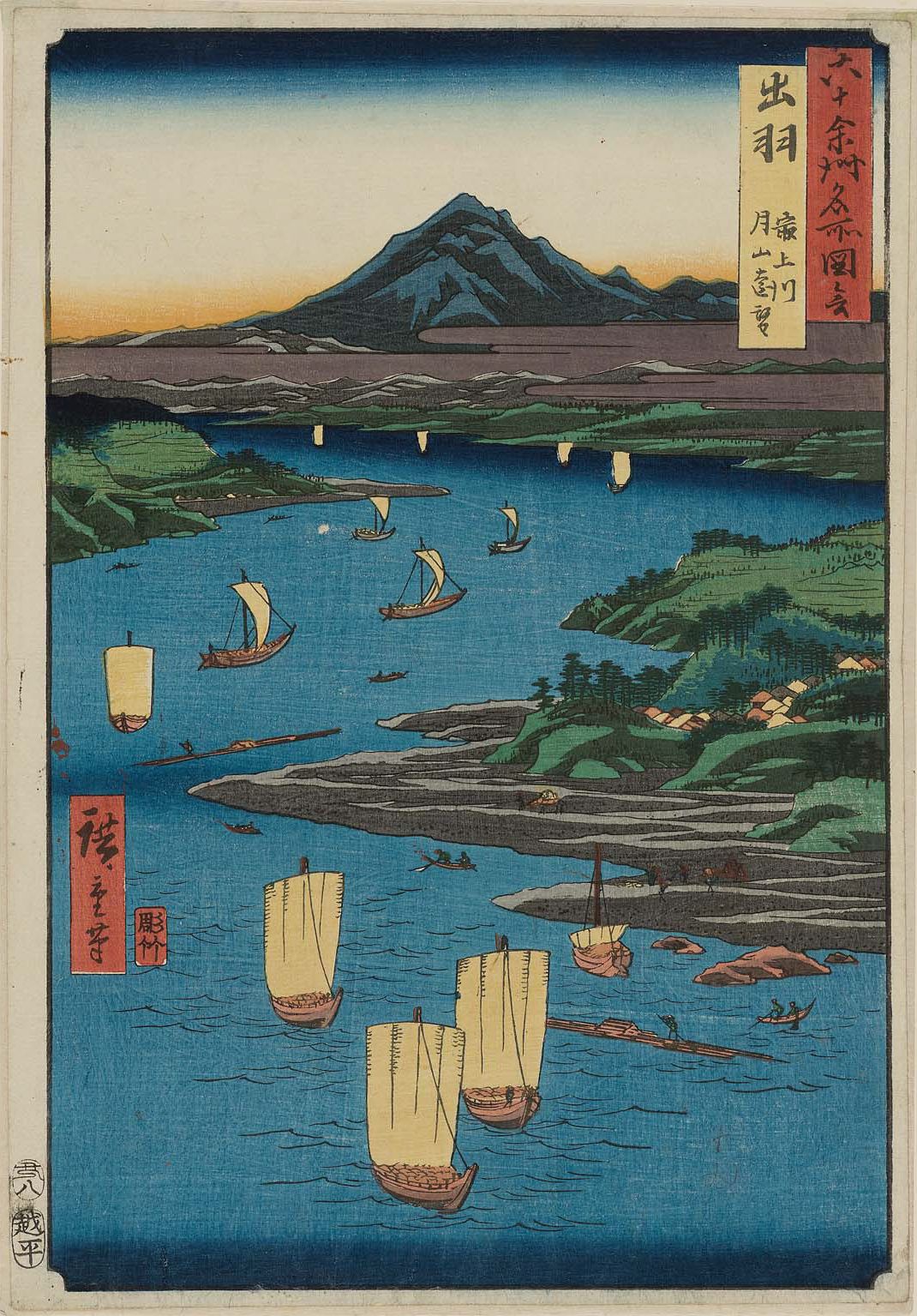
was a province of Japan comprising modern-day Yamagata Prefecture and Akita Prefecture, except for the city of Kazuno and the town of Kosaka. Dewa bordered on Mutsu and Echigō Provinces. Its abbreviated form name was . History Early period Prior to the Asuka period, Dewa was inhabited by Ainu or Emishi tribes, and was effectively outside of the control of the imperial dynasty. Abe no Hirafu conquered the native Emishi tribes at what are now the cities of Akita and Noshiro in 658 and established a fort on the Mogami River. In 708 AD was created within Echigō Province. The area of Dewa District was roughly that of the modern Shōnai area of Yamagata Prefecture, and was gradually extended to the north as the Japanese pushed back the indigenous people of northern Honshū. Dewa District was promoted to the status of a province () in 712 AD, and gained Okitama and Mogami Districts, formerly part of Mutsu Province. A number of military expeditions were sent to the area, ... [...More Info...] [...Related Items...] OR: [Wikipedia] [Google] [Baidu] |
Kojiki
The , also sometimes read as or , is an early Japanese chronicle of myths, legends, hymns, genealogies, oral traditions, and semi-historical accounts down to 641 concerning the origin of the Japanese archipelago, the , and the Japanese imperial line. It is claimed in its preface to have been composed by Ō no Yasumaro at the request of Empress Genmei in the early 8th century (711–712), and thus is usually considered to be the oldest extant literary work in Japan. The myths contained in the as well as the are part of the inspiration behind many practices and unified "Shinto orthodoxy". Later, they were incorporated into Shinto practices such as the purification ritual. Composition It is believed that the compilation of various genealogical and anecdotal histories of the imperial (Yamato) court and prominent clans began during the reigns of Emperors Keitai and Kinmei in the 6th century, with the first concerted effort at historical compilation of which we have record ... [...More Info...] [...Related Items...] OR: [Wikipedia] [Google] [Baidu] |
Ō No Yasumaro
was a Japanese nobleman, bureaucrat, and chronicler. He may have been the son of Ō no Honji, a participant in the Jinshin War of 672.Philippi (1968:546) He is most famous for compiling and editing, with the assistance of Hieda no Are, the ''Kojiki'', the oldest extant Japanese history. Empress Genmei (r. 707-721) charged Yasumaro with the duty of writing the ''Kojiki'' in 711 using the differing clan chronicles and native myths. It was finished the following year and presented to Empress Genmei in 3 volumes in 712.''Obunsha Japanese Encyclopedia 3rd Edition'' Career details In 704, Yasumaro was promoted from Shorokuinoge (Senior Sixth Rank, Lower Grade) to the rank of Jugoinoge (Junior Fifth Rank, Lower Grade). In 711, Yasumaro was promoted to Shogoinojo (Senior Fifth Rank, Upper Grade). In September of the same year, Emperor Genmei presumably ordered him to combine two pre-existing documents, the "Imperial Sun-lineage" and "Ancient Dicta of Former Ages", which was le ... [...More Info...] [...Related Items...] OR: [Wikipedia] [Google] [Baidu] |
Empress Jitō
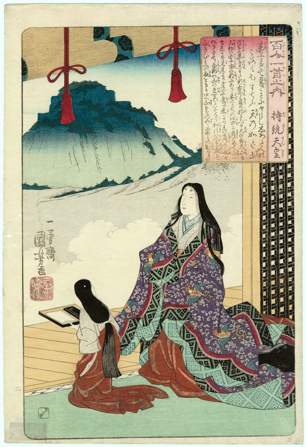
was the 41st emperor of Japan, monarch of Japan,Imperial Household Agency (''Kunaichō'') 持統天皇 (41)/ref> according to the traditional List of Emperors of Japan, order of succession. Jitō's reign spanned the years from Jitō period, 686 through 697.Titsingh, Isaac. (1834). In the history of Japan, Jitō was the third of eight women to take on the role of Josei Tennō, empress regnant. The two female monarchs before Jitō were Empress Suiko, Suiko and Empress Kōgyoku, Kōgyoku/Empress Saimei, Saimei. The five women sovereigns reigning after Jitō were Empress Genmei, Genmei, Empress Genshō, Genshō, Empress Kōken, Kōken/Empress Shōtoku, Shōtoku, Empress Meishō, Meishō, and Empress Go-Sakuramachi, Go-Sakuramachi. Traditional narrative Empress Jitō was the daughter of Emperor Tenji. Her mother was Ochi-no-Iratsume, the daughter of Minister Ō-omi Soga no Yamada-no Ishikawa Maro. She was the wife of Tenji's full brother Emperor Tenmu, whom she succeeded on the ... [...More Info...] [...Related Items...] OR: [Wikipedia] [Google] [Baidu] |


