|
Wadesmill
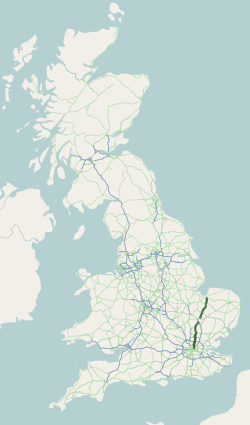
Wadesmill is a hamlet in Hertfordshire, England, located on the north side of the River Rib with an estimated population of 264. At the 2011 Census the population of the hamlet was included in the civil parish of Thundridge. Running through the centre of Wadesmill is the road formerly known as the A10 - the main London to King's Lynn (via Cambridge) road - but now that the A10 by-pass has been built, Wadesmill and surrounding villages have returned to the quiet of former times. The route that was formerly the A10 is an ancient one with portions of it following the line of the Roman Road Ermine Street. Ermine street also figures as the former main street in Wadesmill's adjacent village Thundridge. History Historically Wadesmill is particularly notable for two features - it is the location of the first turnpike in England (and therefore the world), and the presence of the Clarkson Memorial halfway up nearby High Cross hill, a memorial to Thomas Clarkson's rest point in his trav ... [...More Info...] [...Related Items...] OR: [Wikipedia] [Google] [Baidu] |
Thundridge
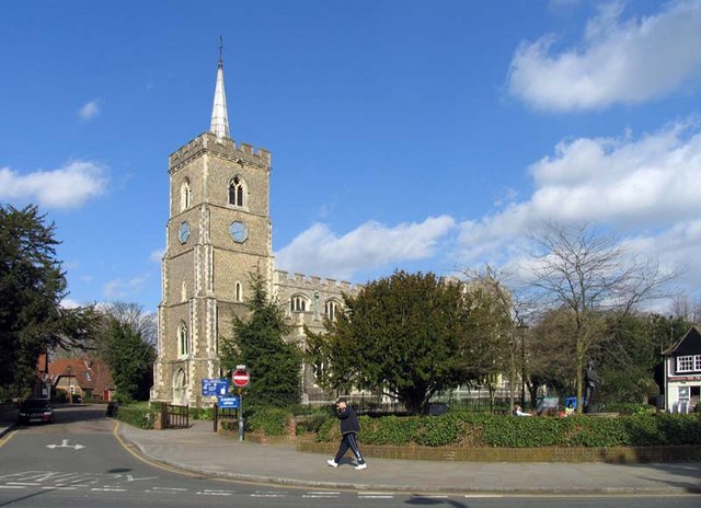
Thundridge is a village and civil parish in the East Hertfordshire district, in the county of Hertfordshire, England. It is about two miles away from the town of Ware and about seven miles away from the large town of Hertford, the county town of Hertfordshire. Nearby settlements Nearby villages include Wadesmill and Tonwell, and the hamlets of Cold Christmas and High Cross. Transport Road Thundridge is on Ermine Street, which is a Roman road, and it was on the A10 road until it was by-passed in 2005, restoring it to a quiet village. Rail Ware is the nearest railway station. There was formerly a line in the Rib valley, the Buntingford branch line Amenities Thundridge has a primary school, along with three pubs in the shape of The Anchor, The Maltons (previously The Sow & Pigs), and The Feathers. The village also has a cricket team, along with Thundridge United Football Club, who play in the Hertford and District League 2. History The village of Thundri ... [...More Info...] [...Related Items...] OR: [Wikipedia] [Google] [Baidu] |
A10 Road (Great Britain)
The A10 (in certain sections known as ''Great Cambridge Road'' or Old North Road) is a major road in England. Its southern end is at London Bridge in the London Borough of Southwark, and its northern end is the Norfolk port town of King's Lynn. From London to Royston it chiefly follows the line of Roman Ermine Street. The main route to Cambridge is now via the M11 motorway, however non-motorway traffic still uses the A10. Route Within the City of London, the route of the A10 comprises King William Street, Gracechurch Street, Bishopsgate and Norton Folgate. It then becomes Shoreditch High Street, Kingsland Road, Kingsland High Street and Stoke Newington Road. It runs through Stoke Newington as Stoke Newington High Street and then becomes Stamford Hill, through Stamford Hill until Tottenham. In July 2013, the Tottenham Hale gyratory was removed and the A10 now follows the route of Tottenham High Road in both directions. North of Tottenham, the A10 leaves its ... [...More Info...] [...Related Items...] OR: [Wikipedia] [Google] [Baidu] |
Turnpike Trusts
Turnpike trusts were bodies set up by individual acts of Parliament, with powers to collect road tolls for maintaining the principal roads in Britain from the 17th but especially during the 18th and 19th centuries. At the peak, in the 1830s, over 1,000 trusts administered around of turnpike road in England and Wales, taking tolls at almost 8,000 toll-gates and side-bars. During the early 19th century the concept of the turnpike trust was adopted and adapted to manage roads within the British Empire (Ireland, Canada, Australia, New Zealand, India, and South Africa) and in the United States. Turnpikes declined with the coming of the railways and then the Local Government Act 1888 gave responsibility for maintaining main roads to county councils and county borough councils. Etymology The term "turnpike" originates from the similarity of the gate used to control access to the road, to the barriers once used to defend against attack by cavalry (see Cheval de frise). The tu ... [...More Info...] [...Related Items...] OR: [Wikipedia] [Google] [Baidu] |
Thomas Clarkson
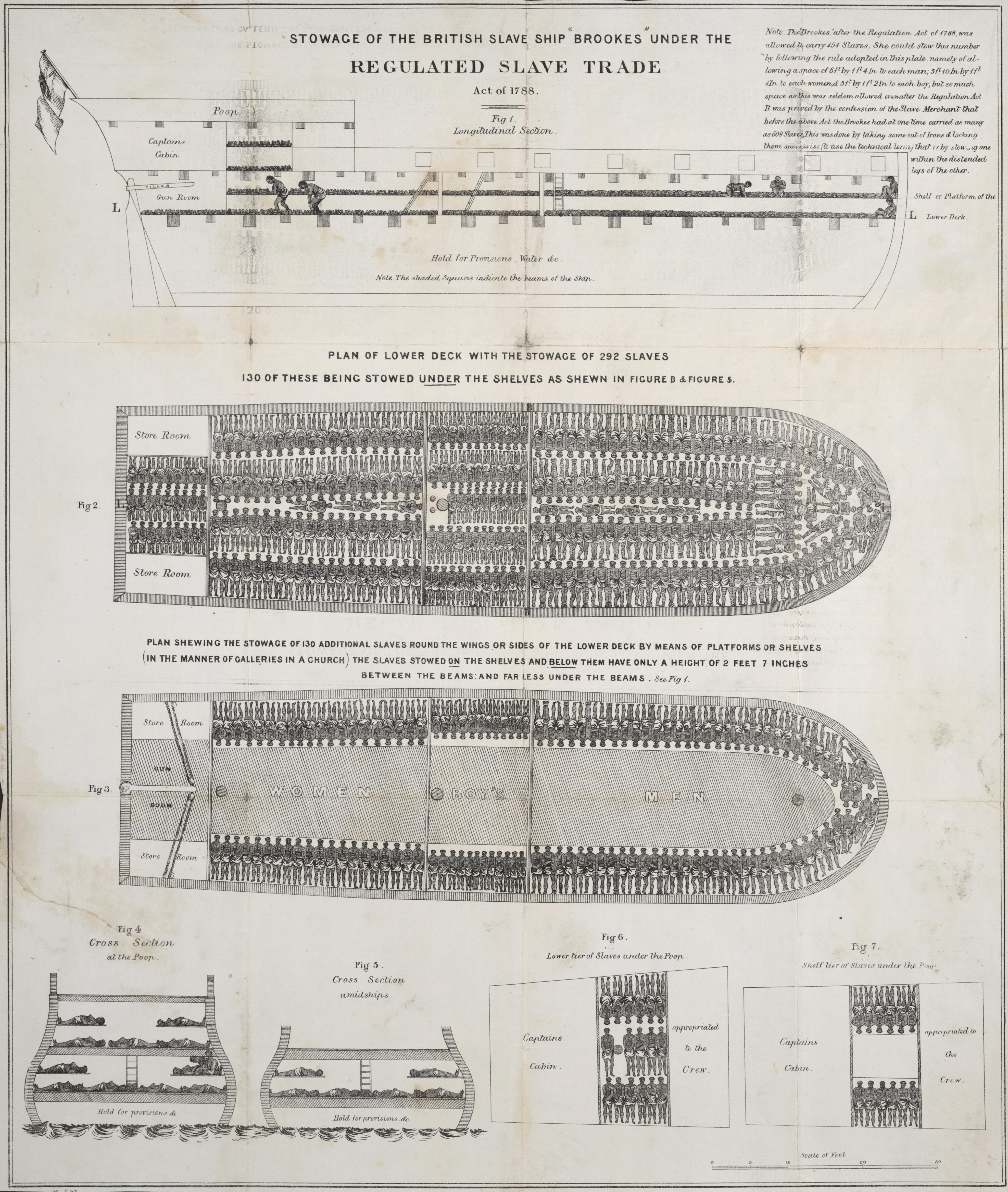
Thomas Clarkson (28 March 1760 – 26 September 1846) was an English abolitionist, and a leading campaigner against the slave trade in the British Empire. He helped found The Society for Effecting the Abolition of the Slave Trade (also known as the Society for the Abolition of the Slave Trade) and helped achieve passage of the Slave Trade Act 1807, which ended British trade in slaves. He became a pacifist in 1816 and, together with his brother John, was among the twelve founders of the Society for the Promotion of Permanent and Universal Peace. In his later years, Clarkson campaigned for the abolition of slavery worldwide. In 1840, he was the key speaker at the Anti-Slavery Society's (today known as Anti-Slavery International) first conference in London which campaigned to end slavery in other countries. Early life and education Clarkson was the eldest son of the Reverend John Clarkson (1710–1766), a Church of England priest and master of Wisbech Grammar School, and his ... [...More Info...] [...Related Items...] OR: [Wikipedia] [Google] [Baidu] |
Ware, Hertfordshire
Ware is a town in Hertfordshire, England close to the county town of Hertford. It is also a civil parish in East Hertfordshire district. Location The town lies on the north–south A10 road which is partly shared with the east–west A414 (for Hertford to the west and Harlow to the east). There is a large viaduct over the River Lea at Kings Meads. The £3.6m two-mile bypass opened on 17 January 1979. At the north end of the bypass is the Wodson Park Sports and Leisure Centre and Hanbury Manor, a hotel and country club. The former route of the A10 through the town is now the A1170. The railway station is on the Hertford East Branch Line and operated by Greater Anglia and is on a short single track section of the otherwise double track line. History Archaeology has shown that Ware has been occupied since at least the Mesolithic period (which ended about 4000 BC). The Romans had a sizeable settlement here and foundations of several buildings, including a temple, and two cemeter ... [...More Info...] [...Related Items...] OR: [Wikipedia] [Google] [Baidu] |
River Rib
The River Rib originates near the East Hertfordshire village of Therfield and runs parallel with the A10 through Chipping, Wyddial, Buntingford, Westmill, Braughing, Puckeridge and Standon, before dividing the villages of Thundridge and Wadesmill and continuing until it reaches its confluence with the River Lea near Hertford. History The River Rib was used to power an overshot watermill at Ware Park between Hertford and Ware. The River Rib used to have frequent floods due to heavy rain in the autumn, but this propensity was resolved by dredging and engineering work in the 1970s. It was used as the main water supply in Buntingford and the surrounding areas before a pump was installed. See also * Index: River Lea References External links * Rib, River Rib In vertebrate anatomy, ribs ( la, costae) are the long curved bones which form the rib cage, part of the axial skeleton. In most tetrapods, ribs surround the chest, enabling the lungs to expand ... [...More Info...] [...Related Items...] OR: [Wikipedia] [Google] [Baidu] |
Civil Parish
In England, a civil parish is a type of Parish (administrative division), administrative parish used for Local government in England, local government. It is a territorial designation which is the lowest tier of local government below districts of England, districts and metropolitan and non-metropolitan counties of England, counties, or their combined form, the Unitary authorities of England, unitary authority. Civil parishes can trace their origin to the ancient system of Parish (Church of England), ecclesiastical parishes, which historically played a role in both secular and religious administration. Civil and religious parishes were formally differentiated in the 19th century and are now entirely separate. Civil parishes in their modern form came into being through the Local Government Act 1894, which established elected Parish councils in England, parish councils to take on the secular functions of the vestry, parish vestry. A civil parish can range in size from a sparsely ... [...More Info...] [...Related Items...] OR: [Wikipedia] [Google] [Baidu] |
Ermine Street
Ermine Street is a major Roman road in England that ran from London (''Londinium'') to Lincoln ('' Lindum Colonia'') and York (''Eboracum''). The Old English name was ''Earninga Strǣt'' (1012), named after a tribe called the ''Earningas'', who inhabited a district later known as ''Armingford Hundred'', around Arrington, Cambridgeshire, and Royston, Hertfordshire. "Armingford", and "Arrington" share the same Old English origin. The original Celtic and Roman names for the route remain unknown. It is also known as the Old North Road from London to where it joins the A1 Great North Road near Godmanchester. Course Ermine Street begins at Bishopsgate, where one of the seven gates in the wall surrounding Roman London was located. From here it runs north up Norton Folgate, Shoreditch High Street and Kingsland Road through Stoke Newington (forming Stoke Newington Road and Stoke Newington High Street), Tottenham, Edmonton and eastern Enfield (Ponders End, Enfield Highw ... [...More Info...] [...Related Items...] OR: [Wikipedia] [Google] [Baidu] |
A10 Wadesmill Bypass - Geograph
A1, A-1, A01 or A.1. may refer to: Education * A1, the Basic Language Certificate of the Common European Framework of Reference for Languages * Language A1, the former name for "Language A: literature", one of the IB Group 1 subjects * A1, a secondary school subdivision in the Congolese education system * A1, a baccalauréat series in the education system of some parts of France * A1, a baccalaureate in the Gabonese education system, see Education in Gabon * A1, the highest category of Qualified Flying Instructor in the Central Flying School of the UK Royal Air Force Grades * A1, a grade for the Leaving Certificate, a qualification in the education system of Ireland * A1, the highest obtainable grade for the Sijil Pelajaran Malaysia examination in Malaysia * A1, a grade for the Senior Secondary Certificate Examination in Nigeria, see Education in Nigeria * A1, a grade for the Singaporean GCE 'O' Level, an examination in the education system of Singapore * A-1, an Academ ... [...More Info...] [...Related Items...] OR: [Wikipedia] [Google] [Baidu] |
Hertfordshire
Hertfordshire ( or ; often abbreviated Herts) is one of the home counties in southern England. It borders Bedfordshire and Cambridgeshire to the north, Essex to the east, Greater London to the south, and Buckinghamshire to the west. For government statistical purposes, it forms part of the East of England region. Hertfordshire covers . It derives its name – via the name of the county town of Hertford – from a Hart (deer), hart (stag) and a Ford (crossing), ford, as represented on the county's coat of arms and on the Flag of Hertfordshire, flag. Hertfordshire County Council is based in Hertford, once the main market town and the current county town. The largest settlement is Watford. Since 1903 Letchworth has served as the prototype Garden city movement, garden city; Stevenage became the first town to expand under post-war Britain's New Towns Act 1946, New Towns Act of 1946. In 2013 Hertfordshire had a population of about 1,140,700, with Hemel Hempstead, Stevenage, Watford ... [...More Info...] [...Related Items...] OR: [Wikipedia] [Google] [Baidu] |
High Cross, Hertfordshire
High may refer to: Science and technology * Height * High (atmospheric), a high-pressure area * High (computability), a quality of a Turing degree, in computability theory * High (tectonics), in geology an area where relative tectonic uplift took or takes place * Substance intoxication, also known by the slang description "being high" * Sugar high, a misconception about the supposed psychological effects of sucrose Music Performers * High (musical group), a 1974–1990 Indian rock group * The High, an English rock band formed in 1989 Albums * ''High'' (The Blue Nile album) or the title song, 2004 * ''High'' (Flotsam and Jetsam album), 1997 * ''High'' (New Model Army album) or the title song, 2007 * ''High'' (Royal Headache album) or the title song, 2015 * ''High'' (EP), by Jarryd James, or the title song, 2016 Songs * "High" (Alison Wonderland song), 2018 * "High" (The Chainsmokers song), 2022 * "High" (The Cure song), 1992 * "High" (David Hallyday song), 1988 * "Hig ... [...More Info...] [...Related Items...] OR: [Wikipedia] [Google] [Baidu] |
Hamlet (place)
A hamlet is a human settlement that is smaller than a town or village. Its size relative to a parish can depend on the administration and region. A hamlet may be considered to be a smaller settlement or subdivision or satellite entity to a larger settlement. The word and concept of a hamlet has roots in the Anglo-Norman settlement of England, where the old French ' came to apply to small human settlements. Etymology The word comes from Anglo-Norman ', corresponding to Old French ', the diminutive of Old French ' meaning a little village. This, in turn, is a diminutive of Old French ', possibly borrowed from ( West Germanic) Franconian languages. Compare with modern French ', Dutch ', Frisian ', German ', Old English ' and Modern English ''home''. By country Afghanistan In Afghanistan, the counterpart of the hamlet is the qala ( Dari: قلعه, Pashto: کلي) meaning "fort" or "hamlet". The Afghan ''qala'' is a fortified group of houses, generally with its ... [...More Info...] [...Related Items...] OR: [Wikipedia] [Google] [Baidu] |


