|
WCKZ
WLAB (88.3 MHz) is a non-commercial, listener-supported FM radio station in Fort Wayne, Indiana. It is owned by the Star Educational Media Network and broadcasts a Contemporary Christian radio format. It holds periodic on-air fundraisers to support the broadcasts. WLAB has an effective radiated power (ERP) of 7,500 watts. In addition to its main transmitter at 88.3, it has FM translators in Kendallville (89.7 MHz), Auburn (99.9 MHz) and Warsaw (90.9 MHz). The station also simulcasts its programming on 91.3 FM WCKZ in Orland, Indiana, which expands the station's coverage area to include Angola and LaGrange, Indiana, and in Michigan, into Coldwater and Sturgis. History WLAB began broadcasting on . It was owned by the Indiana District of the Lutheran Church–Missouri Synod for 23 years until 2009, when it was sold to Star Educational Media Network. The station is still located on the campus of Concordia Theological Seminary Concordia Theological Semin ... [...More Info...] [...Related Items...] OR: [Wikipedia] [Google] [Baidu] |
Fort Wayne, Indiana
Fort Wayne is a city in Allen County, Indiana, United States, and its county seat. Located in northeastern Indiana, the city is west of the Ohio border and south of the Michigan border. The city's population was 263,886 at the 2020 census, making it the second-most populous city in Indiana after Indianapolis, and the 83rd-most populous city in the U.S. The Fort Wayne metropolitan area, consisting of Allen and Whitley counties, has an estimated population of 463,000. Fort Wayne is the cultural and economic center of northeastern Indiana. Fort Wayne was built in 1794 by the United States Army under the direction of American Revolutionary War general Anthony Wayne, the last in a series of forts built near the Miami village of Kekionga. Named in Wayne's honor, the European-American settlement developed at the confluence of the St. Joseph, St. Marys, and Maumee rivers, known originally as Fort Miami, a trading post constructed by Jean Baptiste Bissot, Sieur de Vin ... [...More Info...] [...Related Items...] OR: [Wikipedia] [Google] [Baidu] |
Effective Radiated Power
Effective radiated power (ERP), synonymous with equivalent radiated power, is an IEEE standardized definition of directional radio frequency (RF) power, such as that emitted by a radio transmitter. It is the total power in watts that would have to be radiated by a half-wave dipole antenna to give the same radiation intensity (signal strength or power flux density in watts per square meter) as the actual source antenna at a distant receiver located in the direction of the antenna's strongest beam (main lobe). ERP measures the combination of the power emitted by the transmitter and the ability of the antenna to direct that power in a given direction. It is equal to the input power to the antenna multiplied by the gain of the antenna. It is used in electronics and telecommunications, particularly in broadcasting to quantify the apparent power of a broadcasting station experienced by listeners in its reception area. An alternate parameter that measures the same thing is eff ... [...More Info...] [...Related Items...] OR: [Wikipedia] [Google] [Baidu] |
Radio Stations Established In 1976
Radio is the technology of communicating using radio waves. Radio waves are electromagnetic waves of frequency between 3 hertz (Hz) and 300 gigahertz (GHz). They are generated by an electronic device called a transmitter connected to an antenna which radiates the waves. They can be received by other antennas connected to a radio receiver; this is the fundamental principle of radio communication. In addition to communication, radio is used for radar, radio navigation, remote control, remote sensing, and other applications. In radio communication, used in radio and television broadcasting, cell phones, two-way radios, wireless networking, and satellite communication, among numerous other uses, radio waves are used to carry information across space from a transmitter to a receiver, by modulating the radio signal (impressing an information signal on the radio wave by varying some aspect of the wave) in the transmitter. In radar, used to locate and track objects like air ... [...More Info...] [...Related Items...] OR: [Wikipedia] [Google] [Baidu] |
Lutheran Church – Missouri Synod
The Lutheran Church – Missouri Synod (LCMS), also known as the Missouri Synod, is an orthodox, traditional confessional Lutheran Christian denomination, denomination in the United States. With 1.7 million members as of 2022 it is the second-largest Lutheranism, Lutheran body in the United States, behind the Evangelical Lutheran Church in America (ELCA). In 2025, Pew Research Center estimated that 1 percent of US adults, approximately 2.6 million people, identified with the LCMS and evangelical Lutheranism in contrast with 2 percent, or approximately 5.2 million people, who identified with the ELCA and mainline Lutheranism. as The LCMS was organized in 1847 at a meeting in Chicago, Illinois, Chicago, as the German Evangelical Lutheran Synod of Missouri, Ohio, and Other States (), a name which partially reflected the geographic locations of the founding congregations. The LCMS has congregations in all 50 U.S. states and two Canadian provinces, but over half of its members are lo ... [...More Info...] [...Related Items...] OR: [Wikipedia] [Google] [Baidu] |
Radio Stations In Fort Wayne, Indiana
Radio is the technology of communicating using radio waves. Radio waves are electromagnetic waves of frequency between 3 hertz (Hz) and 300 gigahertz (GHz). They are generated by an electronic device called a transmitter connected to an antenna which radiates the waves. They can be received by other antennas connected to a radio receiver; this is the fundamental principle of radio communication. In addition to communication, radio is used for radar, radio navigation, remote control, remote sensing, and other applications. In radio communication, used in radio and television broadcasting, cell phones, two-way radios, wireless networking, and satellite communication, among numerous other uses, radio waves are used to carry information across space from a transmitter to a receiver, by modulating the radio signal (impressing an information signal on the radio wave by varying some aspect of the wave) in the transmitter. In radar, used to locate and track objects like air ... [...More Info...] [...Related Items...] OR: [Wikipedia] [Google] [Baidu] |
Concordia Theological Seminary
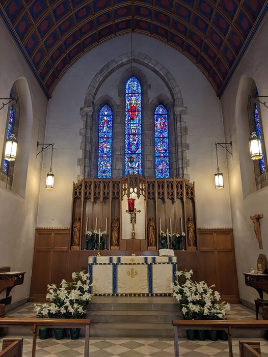
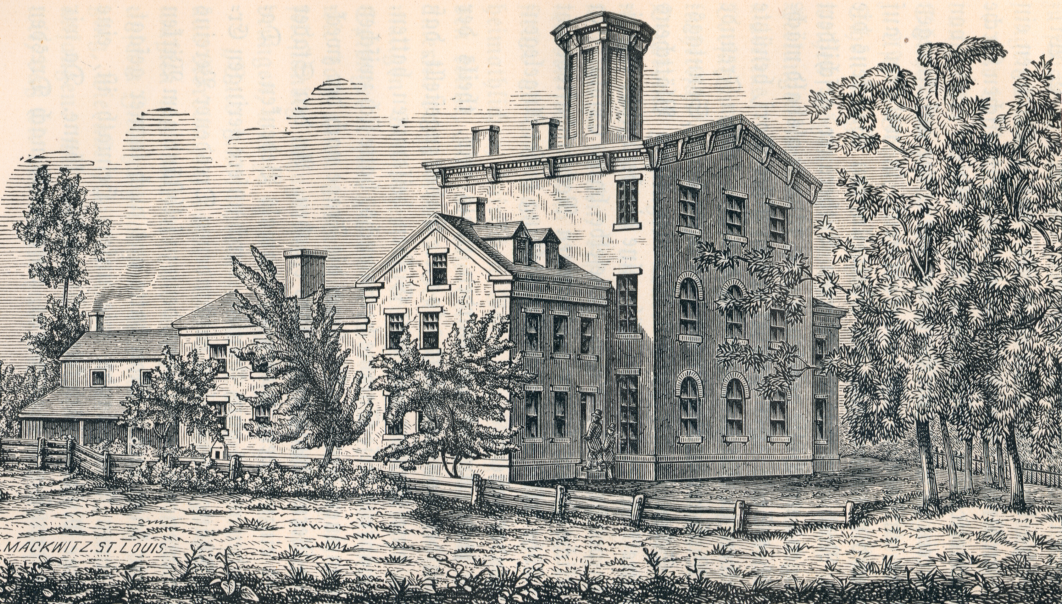
Concordia Theological Seminary is a Lutheran Church–Missouri Synod, Lutheran seminary in Fort Wayne, Indiana. It offers professional, master's degrees, and doctoral degrees affiliated with training clergy and deaconesses for the Lutheran Church–Missouri Synod (LCMS). History Formation in Fort Wayne In 1844, F. C. D. Wyneken, Frederick C. D. Wyneken, pastor of Saint Paul's Evangelical Lutheran Church (Fort Wayne, Indiana), the Lutheran church in Fort Wayne, Indiana, began pastoral training of two young men. Wyneken took a call in 1845 to a congregation in Baltimore, Maryland, and was replaced by Wilhelm Sihler, who continued the training. Wyneken had earlier written to Wilhelm Loehe in Germany, requesting help in providing pastors for German Lutheran immigrants to the United States, and in August 1846 eleven theological students and their instructor arrived in Fort Wayne, having been sent by Loehe. The seminary was formally organized at that time, with Sihler becoming the f ... [...More Info...] [...Related Items...] OR: [Wikipedia] [Google] [Baidu] |
Lutheran Church–Missouri Synod
Lutheranism is a major branch of Protestantism that emerged under the work of Martin Luther, the 16th-century German friar and Protestant Reformers, reformer whose efforts to reform the theology and practices of the Catholic Church launched the Reformation in 1517. The Lutheran Churches adhere to the Bible and the Ecumenical Creeds, with Lutheran doctrine being explicated in the Book of Concord. Lutherans hold themselves to be in continuity with the apostolic church and affirm the writings of the Church Fathers and the first four ecumenical councils. The schism between Roman Catholicism and Lutheranism, which was formalized in the Diet of Worms, Edict of Worms of 1521, centered around two points: the proper source of s:Augsburg Confession#Article XXVIII: Of Ecclesiastical Power., authority in the church, often called the formal principle of the Reformation, and the doctrine of s:Augsburg Confession#Article IV: Of Justification., justification, the material principle of Luther ... [...More Info...] [...Related Items...] OR: [Wikipedia] [Google] [Baidu] |
Indiana District (LCMS)
{{disambig ...
The Indiana District may refer to: * Indiana District of the Lutheran Church – Missouri Synod, an administrative subdivision of that denomination * Indiana District, Maynas, a district (political subdivision) of Peru Peru, officially the Republic of Peru, is a country in western South America. It is bordered in the north by Ecuador and Colombia, in the east by Brazil, in the southeast by Bolivia, in the south by Chile, and in the south and west by the Pac ... [...More Info...] [...Related Items...] OR: [Wikipedia] [Google] [Baidu] |
Sturgis, Michigan
Sturgis is a city in St. Joseph County, Michigan, St. Joseph County in the U.S. state of Michigan. The population was 11,082 at the 2020 United States census, 2020 census. The city is located at the northeast corner of Sturgis Township, Michigan, Sturgis Township and at the intersection of U.S. Route 12 in Michigan, US 12 and M-66 (Michigan highway), M-66. Sturgis is just north of the Michigan–Indiana border and the Indiana Toll Road, I-80/90 Indiana Toll Road. Sturgis has been assigned a ZIP code of 49091. Geography Sturgis is located at . According to the United States Census Bureau, the city has a total area of , all land. Transportation Major highways * runs east and west through the city. * runs north and south through the city. * has an exit within three miles of Sturgis. Airport The City owns and operates Kirsch Municipal Airport (KIRS), which is located in the northwest corner of the city. Kirsch Municipal is a general aviation airport and features two runways; th ... [...More Info...] [...Related Items...] OR: [Wikipedia] [Google] [Baidu] |
Coldwater, Michigan
Coldwater is a city in and county seat of Branch County in the U.S. state of Michigan. The city had a population of 13,822 at the 2020 census. The city is mostly surrounded by Coldwater Township, but the two are administered autonomously. History American settlers first moved into the area around 1830, with many arriving from New York and New England. Coldwater was incorporated as a village in 1837, and then incorporated by the legislature as a city in 1861. It was designated in 1842 as the county seat of Branch County. Geography The Coldwater River flows into the city from the south, originating from Coldwater Lake. The Coldwater chain of lakes also has an outlet called the Sauk River, which flows from its north end (near Quincy) and then through the south side of the city of Coldwater. Both combine to form a series of shallow, connected lakes on the city's west side. According to the United States Census Bureau, the city has a total area of , of which is land and is ... [...More Info...] [...Related Items...] OR: [Wikipedia] [Google] [Baidu] |
Michigan
Michigan ( ) is a peninsular U.S. state, state in the Great Lakes region, Great Lakes region of the Upper Midwest, Upper Midwestern United States. It shares water and land boundaries with Minnesota to the northwest, Wisconsin to the west, Indiana and Illinois to the southwest, Ohio to the southeast, and the Canadian Provinces and territories of Canada, province of Ontario to the east, northeast and north. With a population of 10.14 million and an area of , Michigan is the List of U.S. states and territories by population, 10th-largest state by population, the List of U.S. states and territories by area, 11th-largest by area, and the largest by total area east of the Mississippi River.''i.e.'', including water that is part of state territory. Georgia (U.S. state), Georgia is the largest state by land area alone east of the Mississippi and Michigan the second-largest. The state capital is Lansing, Michigan, Lansing, while its most populous city is Detroit. The Metro Detroit r ... [...More Info...] [...Related Items...] OR: [Wikipedia] [Google] [Baidu] |


