|
Vyg
The Vyg (; ) is a river in the Republic of Karelia, Russia. It consists of the Upper Vyg which is long and discharges into Lake Vygozero, and the Lower Vyg, which is long and flows from Vygozero and discharges into Onega Bay of the White Sea near Belomorsk. The Upper Vyg flows through several small lakes in a swampy land. The Lower Vyg is a part of the White Sea–Baltic Canal and is controlled by several dams. Neolithic on islands of Vyg near its mouth. There were famous ''raskolnik The Schism of the Russian Church, also known as (, , meaning 'split' or 'schism'), was the splitting of the Russian Orthodox Church into an official church and the Old Believers movement in the 1600s. It was triggered by the reforms of Patr ...'' monasteries along Vyg and its tributary , notably the (also Vygoretskaya Hermitage) References Rivers of the Republic of Karelia {{Russia-river-stub ... [...More Info...] [...Related Items...] OR: [Wikipedia] [Google] [Baidu] |
Lake Vygozero
Lake Vygozero (; ) is a large freshwater lake in the Republic of Karelia, in the northwestern part of Russia. It has an area of , and is part of the Vyg drainage in the White Sea basin. From 1933 it has been a part of the White Sea–Baltic Canal. There are more than 500 islands on the lake. Vygozero is used for its fishing Fishing is the activity of trying to catch fish. Fish are often caught as wildlife from the natural environment (Freshwater ecosystem, freshwater or Marine ecosystem, marine), but may also be caught from Fish stocking, stocked Body of water, .... The Upper Vyg and Segezha empty into the lake. Vygozero LVygozero {{RepublicofKarelia-geo-stub ... [...More Info...] [...Related Items...] OR: [Wikipedia] [Google] [Baidu] |
Republic Of Karelia
The Republic of Karelia, or simply Karelia or Karjala (; ) is a Republics of Russia, republic of Russia situated in the Northwest Russia, northwest of the country. The republic is a part of the Northwestern Federal District, and covers an area of , with a population of 533,121 residents. Its capital city, capital is Petrozavodsk. The modern Karelian Republic was founded as an autonomous republic within the Russian SFSR, by the Resolution of the Presidium of the All-Russian Central Executive Committee (VTsIK) on 27 June 1923 and by the Decree of the VTsIK and the Council of People's Commissars of 25 July 1923, from the Karelian Labor Commune, Karelian Labour Commune. From 1940 to 1956, it was known as the Karelo-Finnish Soviet Socialist Republic, one of the Republics of the Soviet Union, republics of the Soviet Union. In 1956, it was once again made an autonomous republic and remained part of Russia following the dissolution of the Soviet Union in 1991. Etymology "Karelia" deriv ... [...More Info...] [...Related Items...] OR: [Wikipedia] [Google] [Baidu] |
White Sea–Baltic Canal
The White Sea–Baltic Canal (), often abbreviated to White Sea Canal (), is a man-made ship canal in Russia opened on 2 August 1933. It connects the White Sea, in the Arctic Ocean, with Lake Onega, which is further connected to the Baltic Sea. Until 1961, it was called by its original name: the Joseph Stalin, Stalin White Sea–Baltic Canal (''Belomorsko-Baltiyskiy Kanal imeni Stalina''). The canal was constructed by forced labor of gulag inmates. Beginning and ending with a labor force of 126,000, between 12,000 and 25,000 laborers died according to official records,''Александр Кокурин, Юрий Моруков''. Сталинские стройки ГУЛАГа.1930–53, Москва, Материк 2005, — 568 с. — С. 34. while Anne Applebaum's estimate is 25,000 deaths. The canal runs , partially along several canalized rivers and Lake Vygozero. As of 2008, it carries only light traffic of between ten to forty boats per day. Its economic advantages are ... [...More Info...] [...Related Items...] OR: [Wikipedia] [Google] [Baidu] |
White Sea
The White Sea (; Karelian language, Karelian and ; ) is a southern inlet of the Barents Sea located on the northwest coast of Russia. It is surrounded by Karelia to the west, the Kola Peninsula to the north, and the Kanin Peninsula to the northeast. The whole of the White Sea is under Russian sovereignty and considered to be part of the internal waters of Russia.A. D. Dobrovolskyi and B. S. Zalogi"Seas of USSR. White Sea" Moscow University (1982) (in Russian) Administratively, it is divided between the Arkhangelsk Oblast, Arkhangelsk and Murmansk Oblast, Murmansk oblasts and the Republic of Karelia. The Port of Arkhangelsk, major port of Arkhangelsk is located on the White Sea. For much of Russia's history this was Russia's main centre of international maritime trade, conducted by the Pomors ("seaside settlers") from Kholmogory, Arkhangelsk Oblast, Kholmogory. In the modern era it became an important Soviet Union, Soviet naval and submarine base. The White Sea–Baltic Canal co ... [...More Info...] [...Related Items...] OR: [Wikipedia] [Google] [Baidu] |
Onega Bay
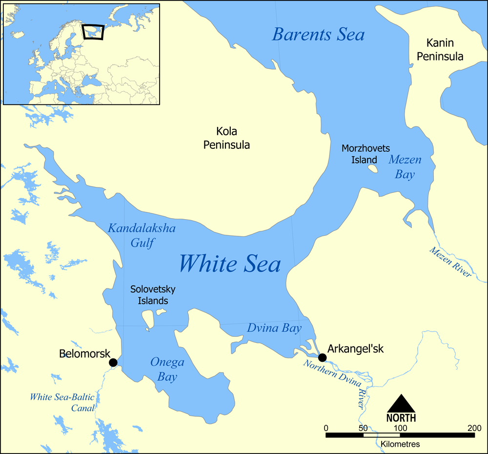
The Onega Bay () is located in the Republic of Karelia and Arkhangelsk Oblast in Northwestern Russia, west of the city of Arkhangelsk. It is the southernmost of four large bays and gulfs of the White Sea, the others being the Dvina Bay, the Mezen Bay, and the Kandalaksha Gulf. The area of the bay is . The Onega Bay is long and - wide. The average depth of the bay is , and the maximum depth is . The bay freezes in winter. Onega, Kem, and Vyg rivers flow into the bay. The bay has numerous islands. Solovetsky Islands, which are the largest and the most famous, are located on the entrance to the bay and separate it from the main body of the White Sea. Along the west coast, there are hundreds of small islands (, luda's). The biggest of these are Shuyostrov Island, Russky Kuzov Island, Myagostrov Island, Kondostrov Island, and Sumostrov Island. The group of islands around Kondostrov Island are collectively known as the Sumsky Skerries. Between the Sumsky Skerries and Solovetsky ... [...More Info...] [...Related Items...] OR: [Wikipedia] [Google] [Baidu] |
Raskolnik
The Schism of the Russian Church, also known as (, , meaning 'split' or 'schism'), was the splitting of the Russian Orthodox Church into an official church and the Old Believers movement in the 1600s. It was triggered by the reforms of Patriarch Nikon in 1653, which aimed to establish uniformity between Greek and Russian church practices. In the 1630s and 1640s, Nikon had been a part of a group known as the Zealots of Piety, a circle of church reformers whose acts included amending service books in accordance with the "correct" Russian tradition. When Nikon became Patriarch of Moscow in 1652, he continued the practice of amending books under the guidance of Greek Orthodox advisors, changing practices in the Russian Church to align with the Greek rite. This act, along with the acceptance of the Nikonian reforms by Tsar Alexei Mikhailovich and the state, led to the rupture between Old Believers and the newly reformed church and state. The schism contributed to popular upri ... [...More Info...] [...Related Items...] OR: [Wikipedia] [Google] [Baidu] |
Belomorsk
Belomorsk (; ; ) is a town and the administrative center of Belomorsky District in the Republic of Karelia, Russia, located on the Onega Bay on the shore of the White Sea. Population: History In the beginning it was a small village named Soroka (), or Sorotskaya () in the official Russian Imperial statistics. On September 11, 1938, Soroka and several nearby localities were merged to form the town of Belomorsk. In 1941–1944, during World War II, it served as the temporary capital of the Karelo-Finnish Soviet Socialist Republic. Administrative and municipal status Within the framework of administrative divisions, Belomorsk serves as the administrative center of Belomorsky District, to which it is directly subordinated.Law #871-RZK As a municipal division, the town of Belomorsk, together with eleven rural localities, is incorporated within Belomorsky Municipal District as Belomorskoye Urban Settlement.Law #813-RZK Culture Belomorsk is the cultural center of Pomo ... [...More Info...] [...Related Items...] OR: [Wikipedia] [Google] [Baidu] |
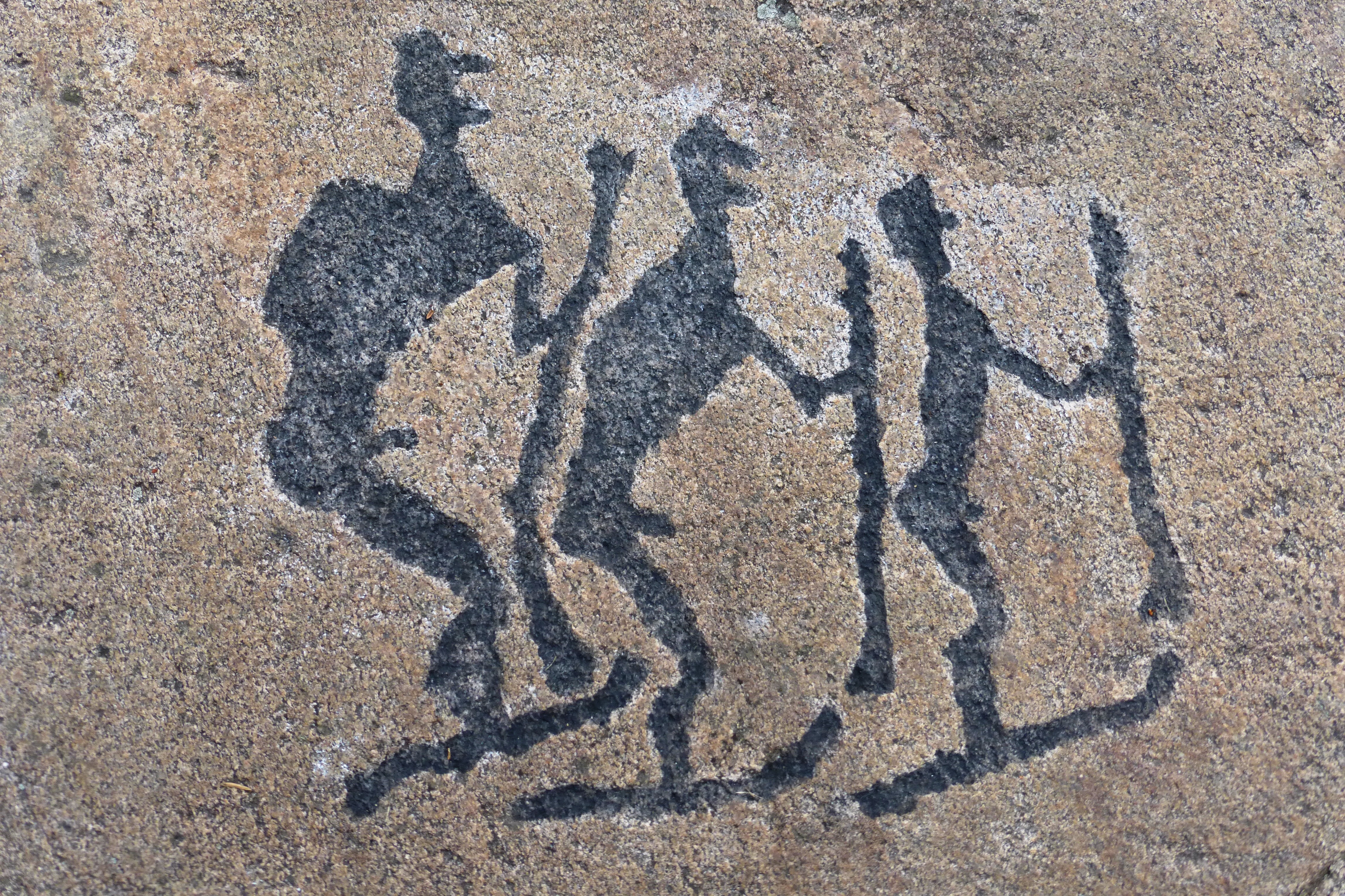
Belomorsk Petroglyphs00
Belomorsk (; ; ) is a town and the administrative center of Belomorsky District in the Republic of Karelia, Russia, located on the Onega Bay on the shore of the White Sea. Population: History In the beginning it was a small village named Soroka (), or Sorotskaya () in the official Russian Imperial statistics. On September 11, 1938, Soroka and several nearby localities were merged to form the town of Belomorsk. In 1941–1944, during World War II, it served as the temporary capital of the Karelo-Finnish Soviet Socialist Republic. Administrative and municipal status Within the framework of administrative divisions, Belomorsk serves as the administrative center of Belomorsky District, to which it is directly subordinated.Law #871-RZK As a municipal division, the town of Belomorsk, together with eleven rural localities, is incorporated within Belomorsky Municipal District as Belomorskoye Urban Settlement.Law #813-RZK Culture Belomorsk is the cultural center of Pomory ... [...More Info...] [...Related Items...] OR: [Wikipedia] [Google] [Baidu] |
Neolithic
The Neolithic or New Stone Age (from Ancient Greek, Greek 'new' and 'stone') is an archaeological period, the final division of the Stone Age in Mesopotamia, Asia, Europe and Africa (c. 10,000 BCE to c. 2,000 BCE). It saw the Neolithic Revolution, a wide-ranging set of developments that appear to have arisen independently in several parts of the world. This "Neolithic package" included the History of agriculture, introduction of farming, domestication of animals, and change from a hunter-gatherer lifestyle to one of sedentism, settlement. The term 'Neolithic' was coined by John Lubbock, 1st Baron Avebury, Sir John Lubbock in 1865 as a refinement of the three-age system. The Neolithic began about 12,000 years ago, when farming appeared in the Epipalaeolithic Near East and Mesopotamia, and later in other parts of the world. It lasted in the Near East until the transitional period of the Chalcolithic (Copper Age) from about 6,500 years ago (4500 BCE), marked by the development ... [...More Info...] [...Related Items...] OR: [Wikipedia] [Google] [Baidu] |
Rivers Of The Republic Of Karelia
A river is a natural stream of fresh water that flows on land or inside Subterranean river, caves towards another body of water at a lower elevation, such as an ocean, lake, or another river. A river may run dry before reaching the end of its course if it runs out of water, or only flow during certain seasons. Rivers are regulated by the water cycle, the processes by which water moves around the Earth. Water first enters rivers through precipitation, whether from rainfall, the Runoff (hydrology), runoff of water down a slope, the melting of glaciers or snow, or seepage from aquifers beneath the surface of the Earth. Rivers flow in channeled watercourses and merge in confluences to form drainage basins, or catchments, areas where surface water eventually flows to a common outlet. Rivers have a great effect on the landscape around them. They may regularly overflow their Bank (geography), banks and flood the surrounding area, spreading nutrients to the surrounding area. Sedime ... [...More Info...] [...Related Items...] OR: [Wikipedia] [Google] [Baidu] |


