|
Vourvourou
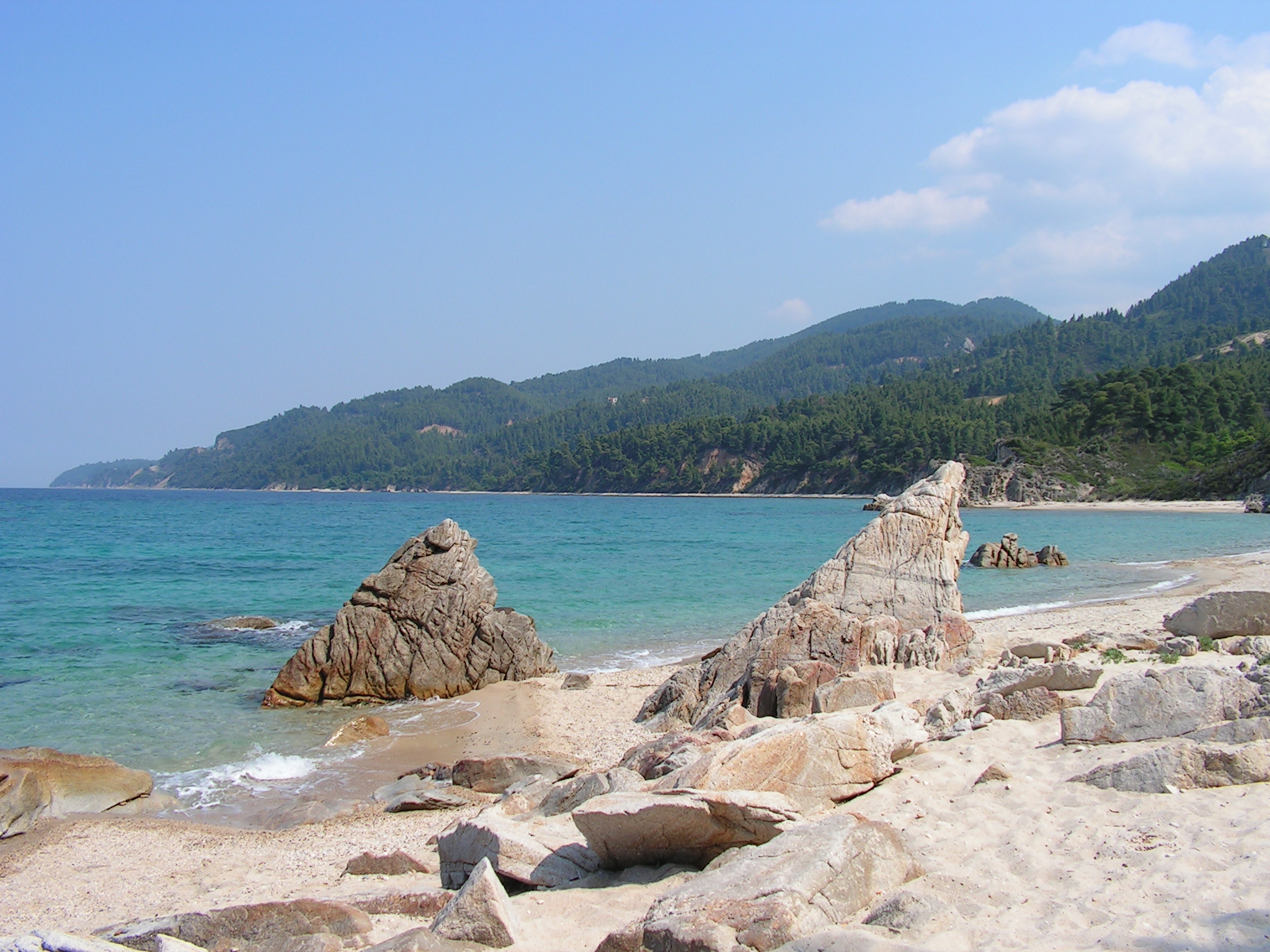
Vourvourou () is a village near Agios Nikolaos, in the Chalkidiki peninsula of northern Greece. It is best known as a holiday destination. History In the 10th century, the area was known as the "land of the ''Vourvourioi''", and was granted to the Xenophontos monastery of Mount Athos. In the 1615, the people of Agios Nikolaos acquired the land, but at the end of the 19th century the monks of Simonopetra monastery sold it to Russian monks, with the result that the latter were forcibly driven away by the local inhabitants. Vourvourou itself is not a typical village, with no square or history. Rather it is a 'strip' of shops, tavernas and rooms to rent and is almost an exclusively seasonal area with few year-round residents. During the 1960s the teaching staff of the University of Thessaloniki developed a holiday resort in a private area also known as Vourvourou. Designed by Professor Thales Argyropoulos it has become well known for its environment-friendly design and respec ... [...More Info...] [...Related Items...] OR: [Wikipedia] [Google] [Baidu] |
Agios Nikolaos, Chalkidiki
Agios Nikolaos (, meaning Saint Nicholas) is a village located 110 kilometers south-east of Thessaloniki on the Chalkidiki peninsula in Macedonia (Greece), Macedonia, Greece. Geography The village Agios Nikolaos itself is 2 km inland from the Singitic Gulf. However, its territory is quite extensive. To the north-east it borders the village of Pyrgadikia at Salonikiou Beach (8 km from Agios Nikolaos). To the north it borders the village of Metangitsi. In the west and south-west it is neighboring the village of Nikiti (9 km from Agios Nikolaos). To the south it borders the village of Sarti, Chalkidiki, Sarti at Armenistis Beach (28 km from Agios Nikolaos). Landscapes Agios Nikolaos' landscapes show a substantial variability. In the plains east and south-east of the village agriculture predominates with olive trees as the main Horticulture, cultivated plant. Toward the south, rises the Itamos mountain range of Sithonia and is completely covered with Forest, pine forest. ... [...More Info...] [...Related Items...] OR: [Wikipedia] [Google] [Baidu] |
Sithonia
Sithonia (), also known as Longos, is a peninsula and part of the larger peninsula of Chalkidiki in Greece. The Kassandra, Chalkidiki, Kassandra Peninsula lies to the west of Sithonia and the Mount Athos peninsula to the east. Sithonia is also the name of a municipality, covering the Sithonia Peninsula. The seat of the municipality is the town Nikiti. Geography Gulfs that surround the peninsula are the Singitic Gulf to the east and the Toronean Gulf to the west. The peaks of Mount Itamos, Itamos and Dragoudelis are in the center of the peninsula. The landscape is covered with vineyards, forests, grasslands, shrubland and mountains. Amongst the many historic places in Sithonia is the ancient city, the castle and the church of Agios Athanasios in Toroni, the windmills in Sykia, Chalkidiki, Sykia and the 16th century church in Nikiti. In the northern part of the peninsula are the popular beaches of Ai Giannis, Kalogria, Elia (Nikiti), Elia and Lagomandra on the west coast and ... [...More Info...] [...Related Items...] OR: [Wikipedia] [Google] [Baidu] |
Mount Itamos
Mount Itamos () is a mountain range in Chalkidiki, northern Greece. It stretches across the Sithonia peninsula (the "second" or "middle finger" of Chalkidiki) in the middle from north to south. Peaks The peaks of Mount Itamos are: *Itamos, 817 m, , east of Parthenonas *Astrapokameno, 808 m, , east of Parthenonas *Psilos, 753 m, , east of Parthenonas *Dragoudeli, 689 m, , west of Sarti *Paklara, 598 m, , west of Sarti *Karvounas, 567 m, , southeast of Vourvourou *Melitonas, 468 m, , southeast of Porto Carras *Trapezi, 366 m, , south of Sarti *Petrus Rock, 298 m, , southeast of Nikiti Description The area of the mountain range is about 27,000 hectares (270 square kilometres). Land use is about 70% forestry, 30% agriculture, 10% tourism/recreation.Greek Ornithological Society. Most of the land is located within the Oros Itamos - Sithonia Protected Area. The mountain range is predominantly covered by conifer forests. Forest fires have destroyed large areas of forests in the so ... [...More Info...] [...Related Items...] OR: [Wikipedia] [Google] [Baidu] |
Central Macedonia
Central Macedonia ( ; , ) is one of the thirteen Regions of Greece, administrative regions of Greece, consisting the central part of the Geographic regions of Greece, geographical and historical region of Macedonia (Greece), Macedonia. With a population of almost 1.8 million, it is the second most populous region in Greece after Attica (region), Attica. Geography The region of Central Macedonia is situated in Northern Greece, bordering the Administrative regions of Greece, regions of Western Macedonia (west), Thessaly (south), Eastern Macedonia and Thrace (east), and bounded to the north at the international borders of Greece by the Republic of North Macedonia and Bulgaria. The southern part is coastal and is bathed by the Thermaic Gulf, Thermaic, Toronean Gulf, Toroneos, Singitic Gulf, Singitic and Strymonian Gulf, Strymonic gulfs. The largest city and capital of the region is Thessaloniki. Serres is the second most populous city, followed by Katerini, Veria and Giannitsa. Cen ... [...More Info...] [...Related Items...] OR: [Wikipedia] [Google] [Baidu] |
Chalkidiki
Chalkidiki (; , alternatively Halkidiki), also known as Chalcidice, is a peninsula and regional unit of Greece, part of the region of Central Macedonia, in the geographic region of Macedonia in Northern Greece. The autonomous Mount Athos region constitutes the easternmost part of the peninsula, but not of the regional unit. The capital of Chalkidiki is the town of Polygyros, located in the centre of the peninsula, while the largest town is Nea Moudania. Chalkidiki is a popular summer tourist destination. Name ''Chalkidiki'' also spelled ''Halkidiki'' () or ''Chalcidice'' () is named after the ancient Greek city-state of Chalcis in Euboea, which colonised the area in the 8th century BC. Geography Chalkidiki consists of a large peninsula in the northwestern Aegean Sea, resembling a hand with three 'fingers' (though in Greek these peninsulas are often referred to as 'legs'). From west to east, these are Kassandra (highest peak 345 m), Sithonia (highest peak Mt Itamos 81 ... [...More Info...] [...Related Items...] OR: [Wikipedia] [Google] [Baidu] |
Mount Athos
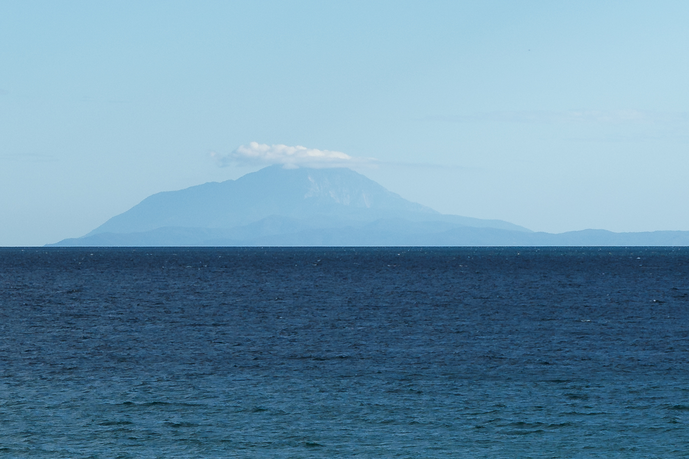
Mount Athos (; ) is a mountain on the Athos peninsula in northeastern Greece directly on the Aegean Sea. It is an important center of Eastern Orthodoxy, Eastern Orthodox monasticism. The mountain and most of the Athos peninsula are governed as an Autonomous administrative division, autonomous region in Greece by the monastic community of Mount Athos, which is ecclesiastically under the direct jurisdiction of the Ecumenical Patriarchate of Constantinople, Ecumenical Patriarch of Constantinople. The remainder of the peninsula forms part of the Aristotelis (municipality), Aristotelis municipality. By Greek law and by religious tradition, women are prohibited from entering the area governed by the monastic community. Mount Athos has been inhabited since ancient times and is known for its long Christian presence and historical monastic traditions, which date back to at least 800 AD during the Byzantine Empire, Byzantine era. Because of its long history of religious importance, the ... [...More Info...] [...Related Items...] OR: [Wikipedia] [Google] [Baidu] |
Simonopetra Monastery
Simonopetra Monastery (, literally: "Simon's Rock"), also Monastery of Simonos Petra (), is an Eastern Orthodox monastery in the monastic state of Mount Athos in Greece. It ranks 13th in the hierarchy of the Athonite monasteries. It is on the southern coast of the Athos peninsula, between the Athonite port of Dafni and Osiou Grigoriou monastery. While the southern coast of Athos is generally quite rugged, the site upon which the monastery is built is exceptionally harsh. It is built on top of a single huge rock, practically hanging from a cliff 330 metres over the sea.mountathos.gr It currently houses 54 monks. Its hegumen is Archimandrite Eliseus. History The monastery was founded in the 13th century by[...More Info...] [...Related Items...] OR: [Wikipedia] [Google] [Baidu] |
University Of Thessaloniki
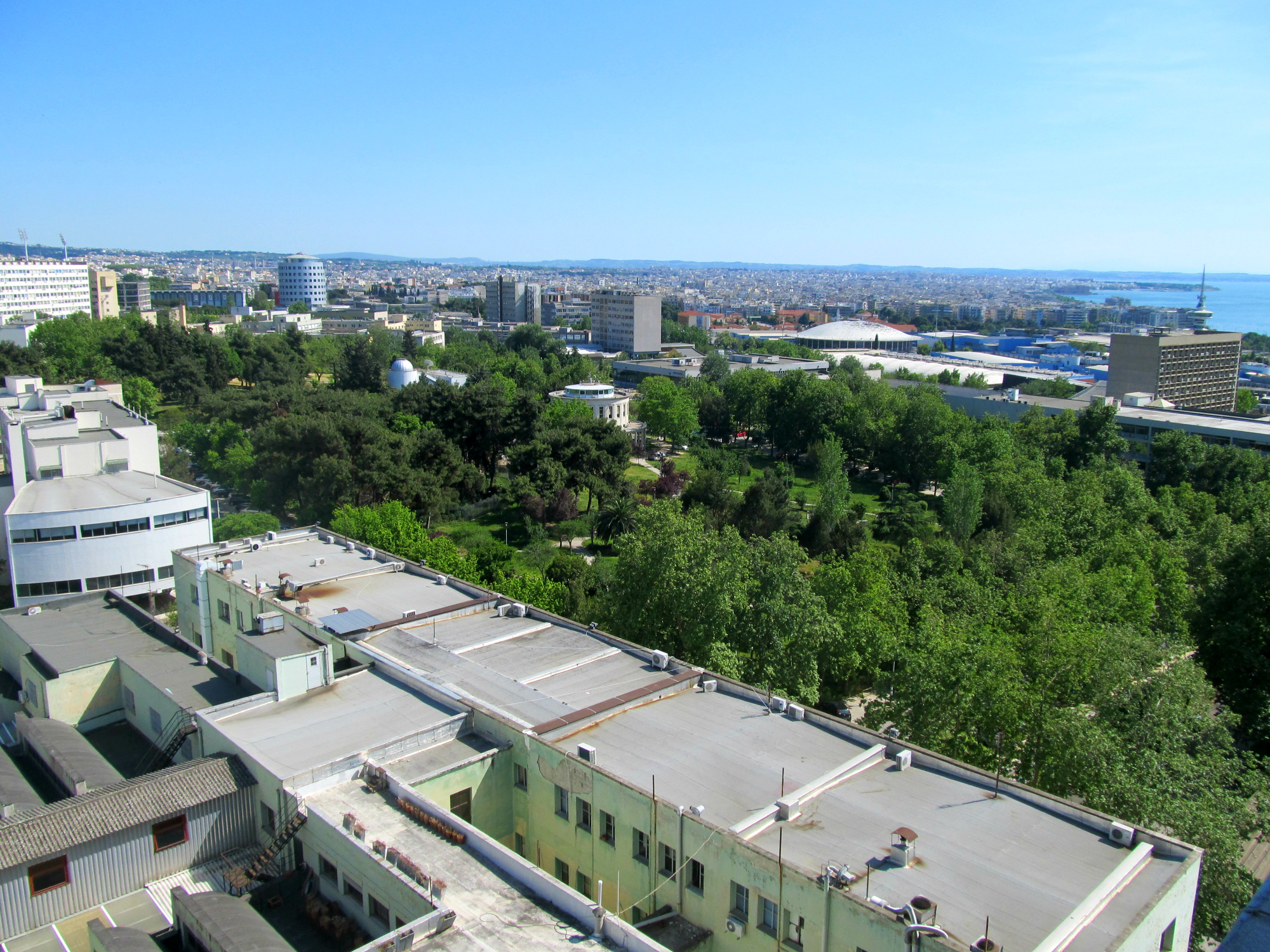
The Aristotle University of Thessaloniki ( AUTh; ), often called the University of Thessaloniki, is the second oldest Tertiary education, tertiary education institution in Greece. Named after the philosopher Aristotle, who was born in Stagira (ancient city), Stageira, about east of Thessaloniki, it is the largest university in Greece and its campus covers in the centre of Thessaloniki, with additional educational and administrative facilities elsewhere. As of 2023, it has approximately 88,283 active students enrolled at the university (77,198 at the undergraduate level and 6,588 in postgraduate programmes of which 3,952 at Doctorate, doctoral level) and 2,366 faculty members. There are additionally 248 members of the Laboratory Teaching Staff and 213 members of the Special Technical Laboratory Staff. The administrative staff consists of 400 permanent employees and 528 subcontractor employees that are contracted by the university. The language of instruction is Greek language, Gr ... [...More Info...] [...Related Items...] OR: [Wikipedia] [Google] [Baidu] |
Panagia
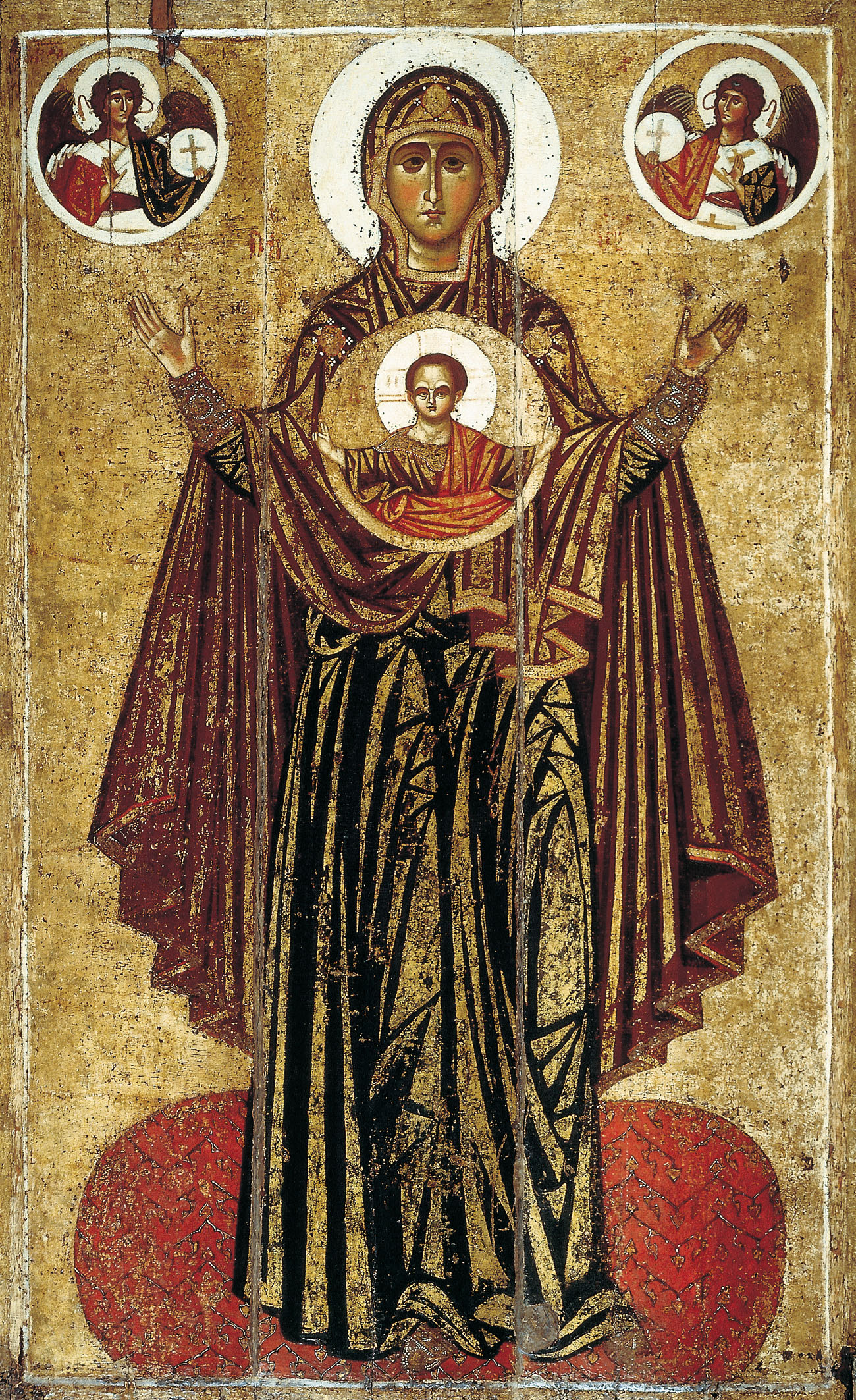
Panagia (, fem. of , + , the ''All-Holy'', or the ''Most Holy''; pronounced ) (also transliterated Panaghia or Panayia), in Medieval and Modern Greek, is one of the titles of Mary, Mother of God, used especially in Orthodox Christianity and Eastern Catholicism. Most Greek churches dedicated to the Virgin Mary are called ''Panagia''; the standard western Christian designation of "St. Mary" is rarely used in the East, as Mary is considered the holiest of all created beings and therefore of the highest status and glory of all the saints. Iconography ''Panagia'' is also the term for a particular type of icon of the Theotokos, wherein she is facing the viewer directly, usually depicted full length with her hands in the ''orans'' position, and with a medallion showing the image of Christ as a child in front of her chest. This medallion symbolically represents Jesus within the womb of the Virgin Mary at the moment of the Incarnation. This type of icon is also called the ''Platyté ... [...More Info...] [...Related Items...] OR: [Wikipedia] [Google] [Baidu] |
Poligiros
Polygyros (Greek: Πολύγυρος) is a town and municipality in Central Macedonia, Greece. It is the capital of Chalkidiki. Geography Polygyros town (pop. 7,779 at the 2021 census) is built in the shape of an amphitheatre on a plateau on the south west side of the mountain Cholomontas. It is south of Greek National Road 16 (Thessaloniki - Arnaia). Polygyros is located SE of Thessaloniki, NE of Nea Moudania, NW of Sithonia and SW of Arnaia. The municipal unit (the municipality before 2011) has a population of 11,386 inhabitants (2021) and a land area of 470.933 km2. Other large communities in the municipal unit are Ólynthos (pop. 1,053), Taxiárchis (742), and Vrástama (944). Climate Polygyros has a hot-summer Mediterranean climate (Köppen: ''Csa''), closely bordering on a humid subtropical climate (Köppen: ''Cfa'') with relatively cold winters and relatively hot summers due to its elevation. Name There are different speculations about the origin of Polygyros' ... [...More Info...] [...Related Items...] OR: [Wikipedia] [Google] [Baidu] |


