|
Vinschgau
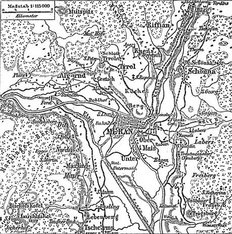
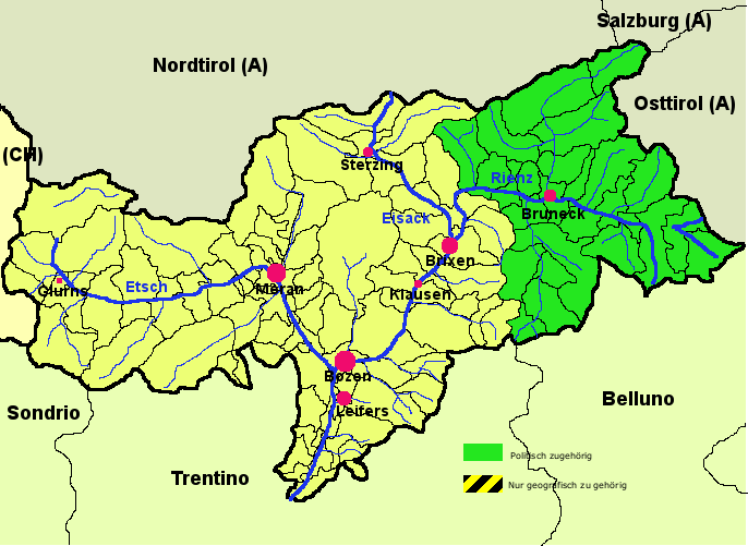
The Vinschgau, Vintschgau () or Vinschgau Valley ( ; ; ; medieval toponym: ''Finsgowe'') is the upper part of the Adige or Etsch river valley, in the western part of the province of South Tyrol, Italy. Etymology The German name ''Vinschgau'', like Italian ''Val Venosta'', is derived from the Celtic (Rhaetian) Venostes tribes mentioned on the ancient Tropaeum Alpium. A Frankish '' Gau'' was established under Charlemagne in 772; it was first mentioned in a 1077 deed, when King Henry IV of Germany granted the estates of Schlanders ''in pago Finsgowe'' to Bishop Altwin of Brixen. Geography The Vinschgau ValleyAllgemeiner historischer Handatlas, Gustav Droysen runs in a west-east orientation, from the Merano basin at Partschins up the Adige river to Reschen Pass in the northwest. The Ötztal Alps in the north, part of the Alpine crest, separate it from the upper Inn Valley. The Adige valley is further confined by the Sesvenna Alps in the west and the Ortler Alps in the south ... [...More Info...] [...Related Items...] OR: [Wikipedia] [Google] [Baidu] |
Adige
The Adige is the second-longest river in Italy, after the Po. It rises near the Reschen Pass in the Vinschgau in the province of South Tyrol, near the Italian border with Austria and Switzerland, and flows through most of northeastern Italy to the Adriatic Sea. The name of the river is of unknown origin. Nineteenth-century theories, such as a derivation from the Proto-Celtic 'the water', and alleged to be cognate with the River Tees in England (anciently ''Athesis'', ''Teesa''), have never been accepted by Celtic onomasts and are now completely obsolete. Description The river source is near the Reschen Pass () close to the borders with Austria and Switzerland above the Inn Valley. It flows through the artificial alpine Lake Reschen. The lake is known for the church tower that marks the site of the former village of Alt Graun ("Old Graun"); it was evacuated and flooded in 1953 after the dam was finished. Near Glurns, the Rom River joins from the Swiss Val Müstair. T ... [...More Info...] [...Related Items...] OR: [Wikipedia] [Google] [Baidu] |
South Tyrol
South Tyrol ( , ; ; ), officially the Autonomous Province of Bolzano – South Tyrol, is an autonomous administrative division, autonomous provinces of Italy, province in northern Italy. Together with Trentino, South Tyrol forms the autonomous Regions of Italy, region of Trentino-Alto Adige/Südtirol. The province is Italy's northernmost and the second-largest, with an area of , and has a population of about 534,000 as of 2021. Its capital and largest city is Bolzano. South Tyrol has a considerable level of self-government, consisting of a large range of exclusive legislative and executive powers and a fiscal regime that allows it to retain 90% of revenue, while remaining a net contributor to the national budget. As of 2023, it is Italy's wealthiest province and among the wealthiest in the European Union. In the wider context of the European Union, the province is one of the three members of Tyrol–South Tyrol–Trentino Euroregion, which corresponds almost exactly to the ... [...More Info...] [...Related Items...] OR: [Wikipedia] [Google] [Baidu] |
Merano
Merano (, ; ) or Meran () is a (municipality) in South Tyrol, Northern Italy. Generally best known for its Spa town, spa resorts, it is located within a Depression (geology), basin, surrounded by mountains standing up to Height above mean sea level, above sea level, at the entrance to the Passeier Valley and the Vinschgau. The city has been a popular place of residence for several scientists, literary people, and artists, including Franz Kafka, Paul Lazarsfeld and also Empress Elisabeth of Austria, who appreciated its mild climate. Name Both the Italian () and the German () names for the city are used in English. The Ladin language, Ladin form of the name is . The official name of the municipality (''comune'') is ''Comune di Merano'' in Italian and ''Stadtgemeinde Meran'' in German (both are in official use). History Archaic names of the city are ''Mairania'' (from AD 857) and ''an der Meran'' (from the 15th century). In 17th-century Latin language, Latin, the city was called ... [...More Info...] [...Related Items...] OR: [Wikipedia] [Google] [Baidu] |
Districts Of Trentino-Alto Adige/Südtirol
The Districts of Trentino-Alto Adige/Südtirol are a subdivision of the two Italy, Italian autonomous Provinces of Italy, provinces of Trento (''Trentino'') and Bolzano (''South Tyrol''). They were established by a decree of the President of Italy (Nr. 987) on 10 June 1955. In South Tyrol their name is ''Comunità comprensoriale'' or ''Comprensorio'' (in Italian language, Italian), ''Bezirksgemeinschaft'' (in German language, German), ''Cumunità raion'' or ''Comunitè comprensoriala'' (in Ladin language, Ladin). In Trentino is ''Comunità di valle'' (in Italian language, Italian) and ''Talgemeinschaft'' (in German language, German). South Tyrol South Tyrol is composed by 8 ''Comprensori''/''Bezirksgemeinschaften''. One of them, Bolzano, is urban and composed only by the city. The city is also the seat of Salten-Schlern, but not part of its territory. Trentino Until 16 June 2006, Trentino was divided into 11 ''Comprensori''/''Bezirksgemeinschaften'', abolished with a provincial ... [...More Info...] [...Related Items...] OR: [Wikipedia] [Google] [Baidu] |
Reschen Pass
Reschen Pass (, ; ) is a mountain pass across the main chain of the Alps, connecting the Upper Inn Valley in the northwest with the Vinschgau region in the southeast. Since 1919, the border between South Tyrol, Italy and Tyrol, Austria has approximately followed the watershed, the pass summit at a height of being completely on Italian territory. Geography Location Reschen is one of the principal passes of the Alps, located between Brenner Pass to the east and the Splügen to the west. It is part of the drainage divide between the Danube in the north and the Adige in the south. The village of Reschen (''Resia'') is directly located on the watershed, on the shore of the Reschensee reservoir, built in 1950 and famous for the bell tower which emerges from the water in front of Graun municipality. The border with Nauders, Austria runs about north of the pass summit towards the tripoint with Valsot, Switzerland in the west. Climate Reschen has a cool summer humid continent ... [...More Info...] [...Related Items...] OR: [Wikipedia] [Google] [Baidu] |
Venostes
The Venostes were a Celtic or Rhaetian tribe dwelling in the present-day Vinschgau Valley (Val Venosta) during the Iron Age. Name They are mentioned as ''Venostes'' by Pliny (1st c. AD). Pliny. ''Naturalis Historia''3:20 Geography The Venostes dwelled in the Vinschgau valley. Their territory extended eastwards as far as Mount Töll. They could have been located south of the Focunates, west of the Isarci and Brixentes (there is, though, no scholarly agreement where the Brixentes lived), north of the Tuliassi, and east of the Rugusci. History They are mentioned by Pliny the Elder as one of the Alpine tribes conquered by Rome in 16–15 BC, and whose name was engraved on the Tropaeum Alpium. Pliny. ''Naturalis Historia''3:20 According to Gerhard H. Waldherr, since tribes are listed in the order of their subjugation to Rome, the Venostes and the Camunni may have been subjugated in 16 BC by the Roman pro-consul P. Silius. The Venostes appear as the fourth tribe in the in ... [...More Info...] [...Related Items...] OR: [Wikipedia] [Google] [Baidu] |
Main Chain Of The Alps
The main chain of the Alps, also called the Alpine divide is the central line of mountains that forms the drainage divide of the range. Main chains of mountain ranges are traditionally designated in this way, and generally include the highest pyramidal peak, peaks of a range. The Alps are something of an unusual case in that several significant groups of mountains are separated from the main chain by sizable distances. Among these groups are the Dauphine Alps, the Eastern and Western Graian Alps, Graians, the entire Bernese Alps, the Tödi, Albula Range, Albula and Silvretta groups, the Ortler and Adamello ranges, and the Dolomites of Veneto and South Tyrol, as well as the lower Alps of Vorarlberg, Bavaria, and Salzburg (state), Salzburg. Main features The Alpine Divide is defined for much of its distance by the watershed between the drainage basin of the Po (river), Po in Italy on one side, with the other side of the divide being formed by the Rhone, the Rhine and the Danube. ... [...More Info...] [...Related Items...] OR: [Wikipedia] [Google] [Baidu] |
Ortler Alps
The Ortler Alps ( ; ; ) are a mountain range of the :Southern Limestone Alps, Southern Limestone Alps mountain group in the Central Eastern Alps, in Italy and Switzerland. Geography The Ortler Alps are separated from: # the Sesvenna Alps in the north by the Ofen Pass and the Val Müstair # the Livigno Alps in the southwest by the Passo di Fraéle and the Adda (river), Adda valley (Valtellina) # the Adamello-Presanella Alps in the south by the Tonale Pass # the Ötztal Alps in the north-east by the upper Adige valley (Vinschgau). The part west of the Gavia Pass is also called Sobretta-Gavia Group. The Ortler Alps are drained by the rivers Adda River, Italy, Adda, Oglio, Adige and its tributary Noce (river), Noce. Peaks The main peaks of the Ortler Alps are: Mountain passes The main mountain passes of the Ortler Alps are: History The Ortler Alps were part of the Italian Campaign (World War I), Italian front during World War I. In this area, the Austro-Hungarians and the Ita ... [...More Info...] [...Related Items...] OR: [Wikipedia] [Google] [Baidu] |
Gau (territory)
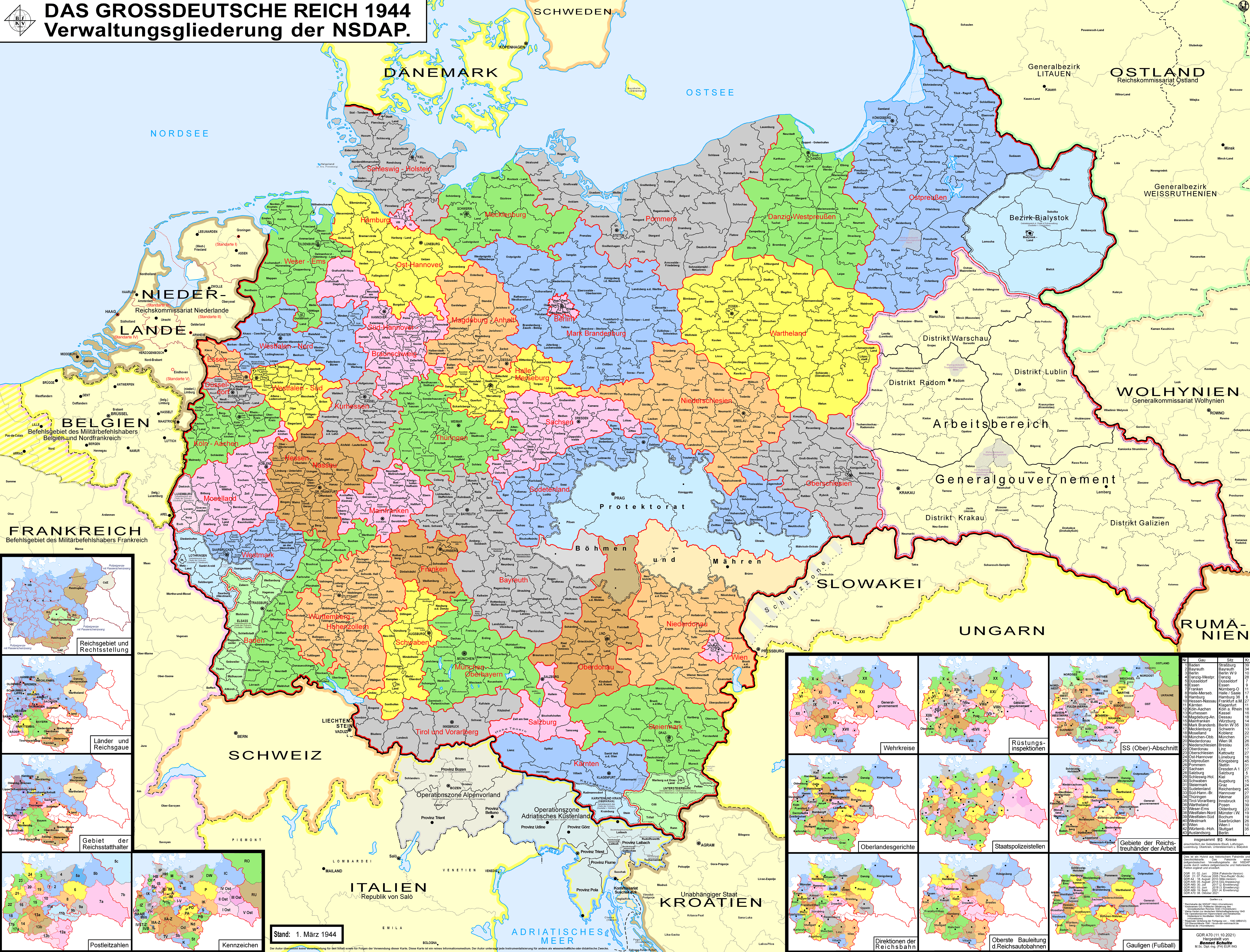
''Gau'' ( German: ; ; or ) is a Germanic term for a region within a country, often a former or current province. It was used in the Middle Ages, when it can be seen as roughly corresponding to an English shire. The administrative use of the term was revived as a subdivision during the period of Nazi Germany in 1933–1945. It still appears today in regional names, such as the Rheingau or Allgäu. Middle Ages Etymology The Germanic word is reflected in Gothic ''gawi'' (neuter; genitive ''gaujis'') and early Old High German ''gewi, gowi'' (neuter) and in some compound names ''-gawi'' as in Gothic (e.g. ''Durgawi'' " Canton of Thurgau", ''Alpagawi'' " Allgäu"), later ''gâi, gôi'', and after loss of the stem suffix ''gaw, gao'', and with motion to the feminine as ''gawa'' besides ''gowo'' (from ''gowio''). Old Saxon shows further truncation to ''gâ, gô''. As an equivalent of Latin '' pagus'', a ''gau'' is analogous with a ''pays'' of the Kingdom of France, or of Lo ... [...More Info...] [...Related Items...] OR: [Wikipedia] [Google] [Baidu] |
Schnalstal
The Schnalstal () is a side valley of the Vinschgau in the autonomous administrative division, autonomous province of South Tyrol, Italy. It belongs almost in its entirety to the municipality of Schnals, while small parts in the entrance area lie in Naturns und Kastelbell-Tschars. The Vernagt-Stausee reservoir is located in the valley. Braunes Bergschaf, a rare breed of domesticated sheep, is raised there. In 1991, Ötzi -- a well-preserved natural mummy from about 3300 BC -- was found in the nearby Schnalstal glacier. References External links Tourism agency of Schnalstal * Valleys of South Tyrol {{Expand German, topic=geo, date=December 2013 ... [...More Info...] [...Related Items...] OR: [Wikipedia] [Google] [Baidu] |
Matscher Tal
The Matscher Tal (also ; ) is a side valley of the Vinschgau in South Tyrol, Italy. It is part of the municipality of Mals Mals (; ) is a ''comune'' (municipality) and a village in South Tyrol in northern Italy, located about northwest of Bolzano, on the border with Switzerland and Austria. History Coat-of-arms The emblem is party per fess: the upper of gules a .... References Alpenverein South Tyrol External links Valleys of South Tyrol {{TrentinoAltoAdige-geo-stub ... [...More Info...] [...Related Items...] OR: [Wikipedia] [Google] [Baidu] |
Rhaetian People
The Raeti ( ; spelling variants: ''Rhaeti'', ''Rheti'' or ''Rhaetii'') were a confederation of Alpine tribes, whose language and culture were related to those of the Etruscans. Before the Roman conquest, they inhabited present-day Tyrol in Austria, eastern Switzerland and the Alpine regions of northeastern Italy. After the Roman conquest, the province of Raetia was formed, which included parts of present-day Germany south of the Danube. The etymology of the name ''Raeti'' is uncertain. The Roman province of Raetia was named after these people. Ancient sources characterise the Raeti as an Etruscan people who were displaced from the Po valley by the Gauls and took refuge in the valleys of the Alps. But it is likely that they were predominantly indigenous Alpine people. Their language, the so-called Raetian language, was probably related to Etruscan, but may not have derived from it. At least some of the Raeti tribes (those in northeastern Italy) probably continued to speak the R ... [...More Info...] [...Related Items...] OR: [Wikipedia] [Google] [Baidu] |


