|
Villach-Land
Bezirk Villach-Land is a district of the state of Carinthia in Austria. Municipalities Towns (''Städte'') are indicated in boldface; market towns (''Marktgemeinden'') in ''italics''; suburbs, hamlets and other subdivisions of a municipality are indicated in small characters. *''Arnoldstein'' ( Slov.: ''Podklošter'') (1) **Agoritschach, Arnoldstein, Erlendorf, Gailitz, Greuth, Hart, Hart, Krainberg, Krainegg, Lind, Maglern, Neuhaus an der Gail, Oberthörl, Pessendellach, Pöckau, Radendorf, Riegersdorf, Seltschach, St. Leonhard bei Siebenbrünn, Thörl-Maglern-Greuth, Tschau, Unterthörl *''Bad Bleiberg'' ( Slov.: ''Plejberk pri Beljaku'') (2) **Bad Bleiberg, Bleiberg-Kreuth, Bleiberg-Nötsch, Hüttendorf, Kadutschen *''Finkenstein am Faaker See'' ( Slov.: ''Bekštanj'') (3) **Altfinkenstein, Faak am See, Finkenstein, Fürnitz, Gödersdorf, Goritschach, Höfling, Kopein, Korpitsch, Latschach, Ledenitzen, Mallenitzen, Müllnern, Neumüllnern, Oberaichwald, Oberferlach, Outschena ... [...More Info...] [...Related Items...] OR: [Wikipedia] [Google] [Baidu] |
Bad Bleiberg
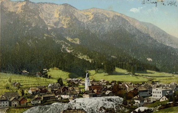
Bad Bleiberg ( sl, Plajberk pri Beljaku) is a market town in the district of Villach-Land, in Carinthia, Austria. Originally a mining area, especially for lead (german: Blei), Bad Bleiberg today due to its hot springs is a spa town. Geography Bad Bleiberg is situated west of the district's capital Villach in a high valley on the northern slope of the Dobratsch (''Villacher Alpe'') massif, the easternmost part of the Gailtal Alps mountain range. The municipal area comprises the cadastral communities of Bleiberg proper and Kreuth. History King Henry II of Germany granted the Carinthian lands around Villach to the newly created Diocese of Bamberg at the Frankfurt synod of 1 November 1007, together with other estates like Griffen or the Canal Valley around Tarvisio. When under Emperor Frederick II Bamberg was elevated to a Prince-Bishopric, the territories became ecclesiastical exclaves within the territory of the Carinthian dukes. In 1759 the Bamberg estates were finally acq ... [...More Info...] [...Related Items...] OR: [Wikipedia] [Google] [Baidu] |
Wernberg
Wernberg ( sl, Vernberk) is a municipality in the district of Villach-Land in the Austrian state of Carinthia. Geography Wernberg lies on the Drava River at the foot of the Ossiach Tauern range, east of Villach, and between Lake Ossiach on the north, Wörthersee on the east, and Lake Faak in the southern part of the municipality. It is located at the northwestern rim of the traditional settlement area of Carinthian Slovenes. The municipal area comprises the cadastral communities of Neudorf (''Nova vas''), Sand (''Pešče''), Trabenig (''Trabenče''), Umberg (''Umbar''), and Wernberg (''Vernberk''). Neighboring municipalities History Archaeological findings indicate an early settlement of the area already in Roman times. A castle near the village of Sternberg, today a ruin, was first mentioned in a deed issued at Saint Paul's Abbey about 1170/80. Wernberg itself first appeared in a document dated 17 November 1227 determining the demolition of a Drava bridge and the transfer ... [...More Info...] [...Related Items...] OR: [Wikipedia] [Google] [Baidu] |
Nötsch Im Gailtal
Nötsch im Gailtal ( sl, Čajna) is a market town in the district of Villach-Land in the Austrian state of Carinthia. Geography Located west of Villach, the municipal area stretches along the lower Gail valley in southern Carinthia at the foot of the Villacher Alpe (Dobratsch) massif, the eastern extension of the Gailtal Alps. It comprises the cadastral communities of Kerschdorf (''Črešnje''), Saak (''Čače''), and Sankt Georgen (''Šentjurij''). Nötsch can be reached from Villach and Süd Autobahn (A2) via the ''Gailtal Straße'' (B111) highway. In the north, a mountain roads leads up to the high valley of Bad Bleiberg. Nötsch station is a stop on the ''Gailtalbahn'' railway line from Arnoldstein to Kötschach-Mauthen. History The settlement in the Duchy of Carinthia was first mentioned in a 1253 deed together with ''Lewenburg'' castle, present-day Wasserleonburg, then a fief of the Prince-Bishops of Bamberg. The area was devastated in the 1348 Friuli earthquake, whic ... [...More Info...] [...Related Items...] OR: [Wikipedia] [Google] [Baidu] |
Rosegg
Rosegg ( sl, Rožek) is a town in the district of Villach-Land in Carinthia in Austria Austria, , bar, Östareich officially the Republic of Austria, is a country in the southern part of Central Europe, lying in the Eastern Alps. It is a federation of nine states, one of which is the capital, Vienna, the most populous .... Neighboring municipalities Personalities It is the birthplace of the painter Peter Markovič, after whom the local Slovene cultural association is named. Liechtenstein's Ambassador to Germany, Prince Stefan of Liechtenstein, grew up in Rosegg. Twin towns * Zuglio, Italia Sources {{Authority control Cities and towns in Villach-Land District ... [...More Info...] [...Related Items...] OR: [Wikipedia] [Google] [Baidu] |
Treffen
Treffen ( sl, Trebinje) is a market town in the district of Villach-Land in Carinthia in south-central Austria. Geography The municipality lies about 8 km north of Villach Villach (; sl, Beljak; it, Villaco; fur, Vilac) is the seventh-largest city in Austria and the second-largest in the federal state of Carinthia. It is an important traffic junction for southern Austria and the whole Alpe-Adria region. , the .... References Cities and towns in Villach-Land District {{Carinthia-geo-stub ... [...More Info...] [...Related Items...] OR: [Wikipedia] [Google] [Baidu] |
Sankt Jakob Im Rosental
Sankt Jakob im Rosental ( sl, Šentjakob v Rožu) is a town in the district of Villach-Land in the Austrian state of Carinthia. Geography The municipality borders on Slovenia in the south, and the northern boundary is formed by the Drau River. It lies in the western part of the Rosen valley. Population According to the 2001 census 16.4% of the population are Carinthian Slovenes. History In the Carinthian Plebiscite of 1920, Sankt Jakob was one of the 17 Carinthian municipalities, where the majority of the population (54%) voted for the annexation to the Kingdom of Serbs, Croats and Slovenes ( Yugoslavia). However, since 59% of the voters in the entire voting zone A were in favour of remaining with Austria, the municipal area also remained with Carinthia. Personalities Among the famous natives of the municipality were the Slovene philologists Matija Ahacel Matija Ahacel, also known in German as ''Matthias Achazel'' (24 February 1779 – 23 September 1845), born Matija K ... [...More Info...] [...Related Items...] OR: [Wikipedia] [Google] [Baidu] |
Arriach
Arriach ( sl, Arjoh) is a municipality in the district of Villach-Land in the Austrian state of Carinthia. Geography Situated within the Nock Mountains range of the Gurktal Alps, about north of the city of Villach, Arriach houses the geographical centre of the state of Carinthia. The commune is a state-recognised health resort, its economy mainly depends on tourism. The municipal area consists of the four cadastral communities: Arriach proper, Innerteuchen, Laastadt, and Sauerwald. Neighboring municipalities History The parish of ''Ovriach'' was first mentioned in a 1207 deed. In early modern times, the remote area was a centre of Crypto-protestantism in the Duchy of Carinthia. The present-day municipality was established in 1850; the Sauerwald community joined in 1898. Religion According to a 2001 census 68.8% of the population were Protestants, which is the highest percentage of all Carinthian municipalities. Therefore, the Four Evangelists parish church, a Neo-Gothic ... [...More Info...] [...Related Items...] OR: [Wikipedia] [Google] [Baidu] |
Paternion
Paternion ( sl, Špaterjan) is a market town in the district of Villach-Land in the Austrian state of Carinthia (state), Carinthia. It is located within the Drava valley about in the north-west of the city of Villach. Geography Paternion is subdivided into six Katastralgemeinden: ''Feistritz an der Drau'', ''Kamering'', ''Kreuzen'', ''Nikelsdorf'', ''Paternion'' and ''Rubland''. History Settled since the Hallstatt culture, the place was first mentioned as ''St. Paternianus'' in a 1296 deed, named after Saint Paternian, the Bishop of Fano, as the area south of the Drava then belonged to the Patriarchate of Aquileia (Episcopal), Patriarchate of Aquileia.:de:Paternion In 1530 Paternion received market rights from Archduke Ferdinand I, Holy Roman Emperor, Ferdinand I of Austria. With a percentage of about 30%, the municipality is today one of the centres of Protestantism in Carinthia. Paternion Castle was part of the Lordship of Paternion ''(Herrschaft Paternion)'', together with th ... [...More Info...] [...Related Items...] OR: [Wikipedia] [Google] [Baidu] |
Finkenstein Am Faaker See
Finkenstein am Faaker See ( sl, Bekštanj) is a market town in the district of Villach-Land in Carinthia (state), Carinthia, Austria. Geography It is located south of Villach and the Drava River, on the northern slope of the Karawanks with Mt. Mittagskogel (''Kepa''), close to the border with Slovenia. The municipal area comprises the southern shore of Lake Faak. The municipality includes the cadastral community of Faak am See (''Bače''), Ferlach (''Borovlje''), Fürnitz (''Brnca''), Greuth (''Rute''), Gödersdorf (''Vodiča vas''), Korpitsch (''Grpiče''), Latschach am Faakersee (''Loče''), Mallestig (''Malošče'') and Sankt Stefan (''Šteben''). According to the 2001 census, 5.6% of the population are Carinthian Slovenes. History The municipality is named after Burgruine Finkenstein, Finkenstein Castle, a possession of the Duchy of Carinthia, Carinthian dukes, which was first mentioned in an 1142 deed. Lend to the ducal ministerialis, ministeriales, the Lords of Finkenstein ... [...More Info...] [...Related Items...] OR: [Wikipedia] [Google] [Baidu] |
Arnoldstein
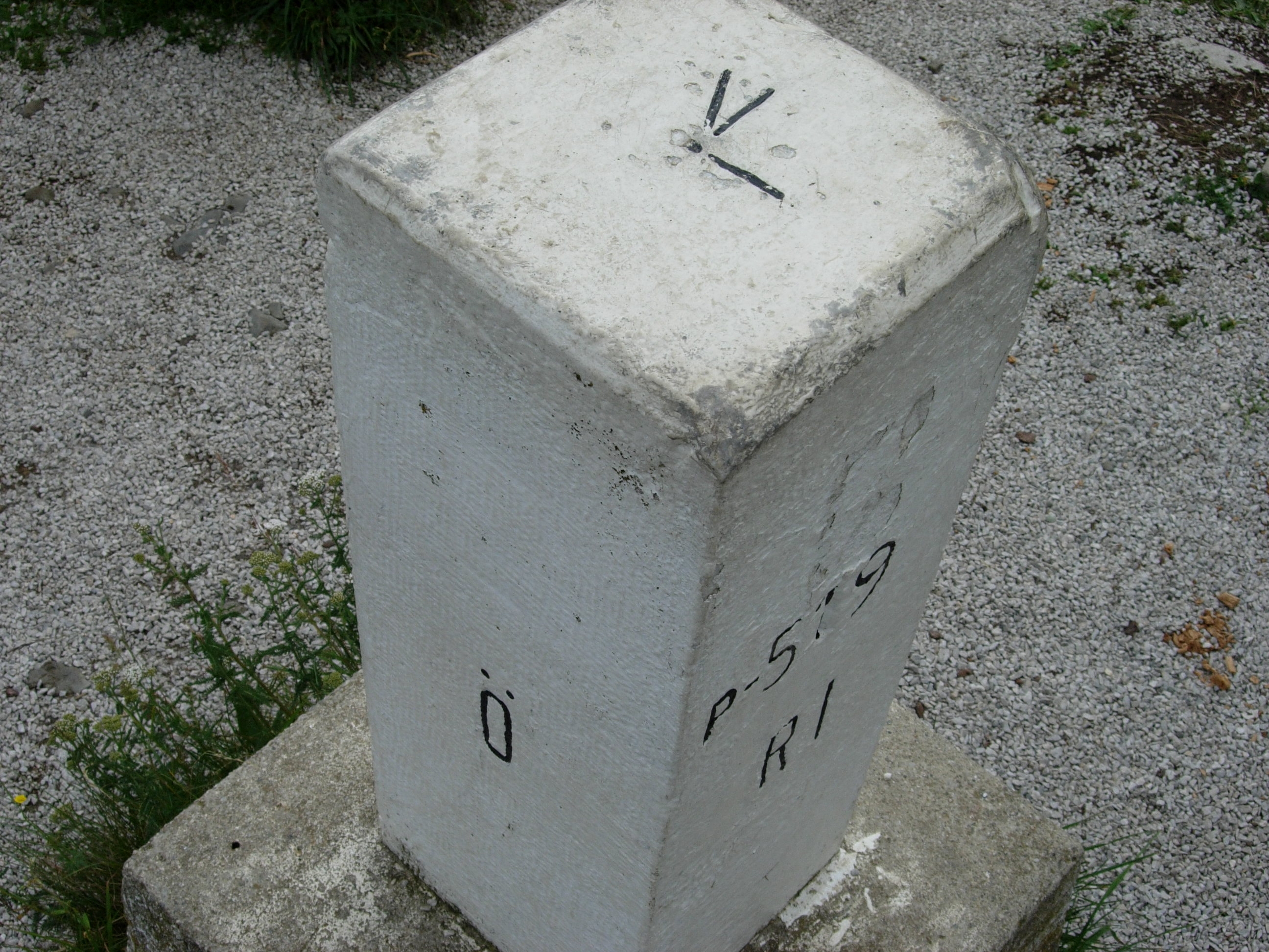
Arnoldstein ( sl, Podklošter, it, Oristagno) is a market town in the district of Villach-Land in the Austrian state of Carinthia. Geography Location Arnoldstein is located at Austria's southern border between the Carnic Alps and the Karawanken mountain range, near the confluence of the Gailitz (Slovene: ''Ziljica'', Italian: ''Slizza'') and the Gail River (Slovene: ''Zilja'', Italian: ''Zeglia''). The tripoint with Tarvisio in Italy and Kranjska Gora in Slovenia is south of the town at the top of the mountain ''Ofen'' (Slovene: ''Peč'', Italian: ''Monte Forno'') at 1,509m/4,951 ft. Today there is a marker at this location. Arnoldstein can be reached via the A2 Süd Autobahn from Vienna and the parallel Austrian Southern Railway (''Rudolfsbahn''), running from Klagenfurt to the Italian border, where it is continued by the Italian '' Pontebbana'' line to Udine. Subdivision Arnoldstein is divided into six Katastralgemeinden: Arnoldstein (''Podklošter''), Hart (''Loč ... [...More Info...] [...Related Items...] OR: [Wikipedia] [Google] [Baidu] |
Feistritz An Der Gail
Feistritz an der Gail ( sl, Bistrica na Zilji), often referred to as simply Feistritz (), is a town in the district of Villach-Land in Carinthia in Austria. It is close to the borders with both Italy and Slovenia. The Black Forest to the south of the town borders the Italian comune of Tarvisio, in the Province of Udine. There are several landmarks of importance in and around the town, including Ulli's Herb Garden, the House of Bats, the Parish Church of St. Martin and Mary Magdalene's Chapel. Geography Feistritz, the largest community in the Lower Gail Valley, covers an area of some . It is located at an elevation of . The town's population, as of 2012, was 649. The forest to the south bordering Italy is named Schwarzwald, meaning Black Forest. Nötsch im Gailtal is located approximately to the north of Feistritz an der Gail. The nearby Feistritzer Alm reaches a height of at the foot of the Oisternig (). [...More Info...] [...Related Items...] OR: [Wikipedia] [Google] [Baidu] |
Afritz Am See
Afritz am See ( sl, Zobrce) is a municipality in Villach-Land District in the Austrian state of Carinthia. Name The name ''Afritz'' is ultimately derived from the Slovene prepositional phrase ''za brdce'' 'behind the small hill'. The Slovene phrase fused to yield *''Zabrdce'', which was borrowed into Middle High German as *''Zafriz'' (from which, in turn, ''Cobrc'' was borrowed back into Slovene). The initial ''z-'' was misunderstood as the Middle High German preposition ''ze'' 'at', yielding the modern German decomposition ''Afritz''. Geography It is located within the Gegend Valley surrounded by the Nock Mountains, the western part of the Gurktal Alps mountain range, on the southern shore of small Afritzer See (Lake Afritz). The municipal area comprises the cadastral communities of Afritz and Berg ob Afritz. History The remote valley was not settled until the High Middle Ages. ''Afritz'' itself was first mentioned in a 1408 deed, then an estate held by the Counts of Ortenb ... [...More Info...] [...Related Items...] OR: [Wikipedia] [Google] [Baidu] |


