|
Vidunda People
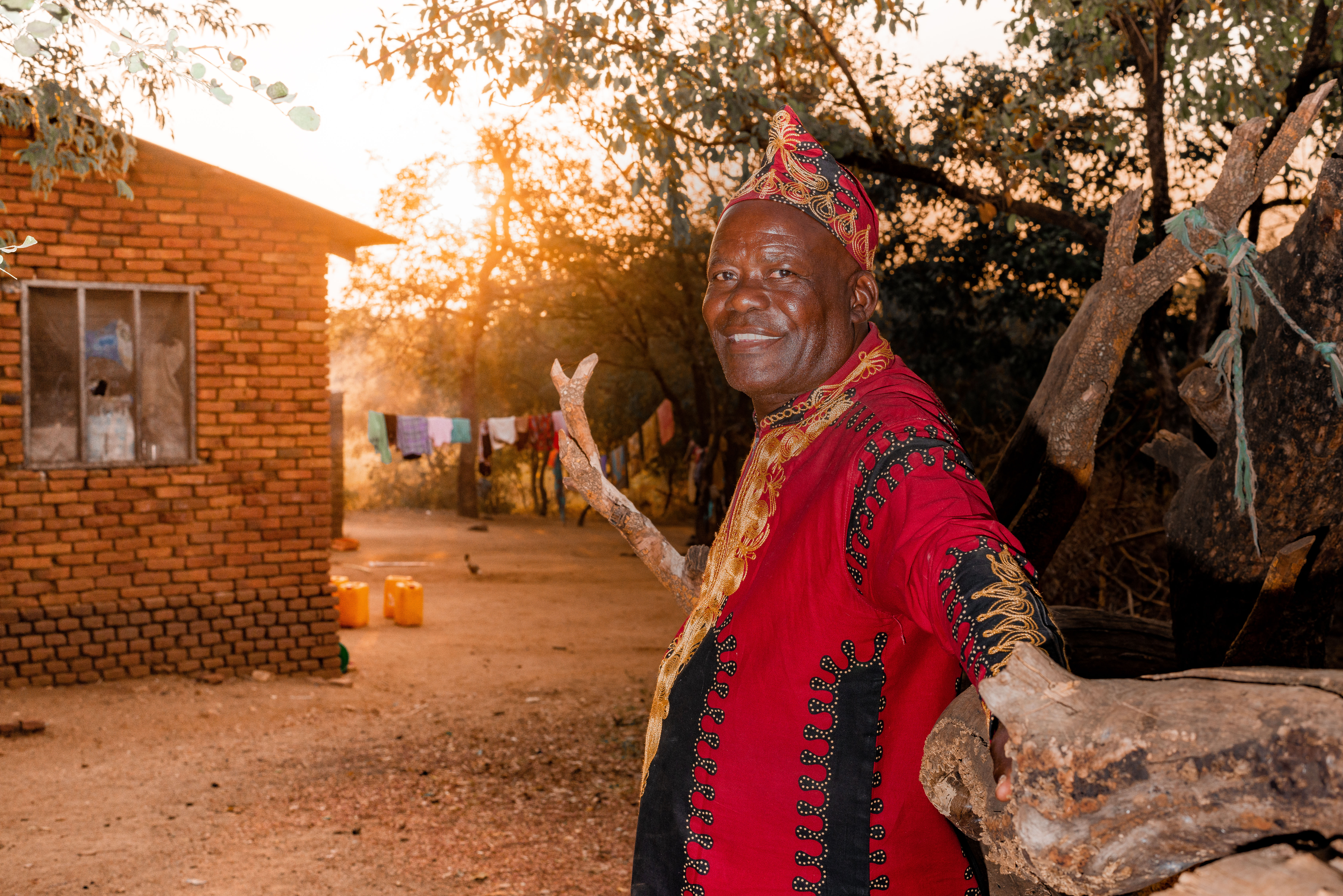
The Vidunda are a matrilineal Bantu ethnolinguistic group based in Kilosa District of Morogoro Region, Tanzania. The Vidunda live in south of Mikumi and north of the Great Ruaha River The Great Ruaha River is a river in south-central Tanzania that flows through the Usangu wetlands and the Ruaha National Park east into the Rufiji River. It traverses and marks the borders between Iringa Region, Dodoma Region and Morogoro R ..., including in the Uvidunda Mountains. The Vidunda population was estimated to number 90,000. References Ethnic groups in Tanzania {{Tanzania-ethno-group-stub ... [...More Info...] [...Related Items...] OR: [Wikipedia] [Google] [Baidu] |
Matrilineal
Matrilineality is the tracing of kinship through the female line. It may also correlate with a social system in which each person is identified with their matriline – their mother's lineage – and which can involve the inheritance of property and/or titles. A matriline is a line of descent from a female ancestor to a descendant (of either sex) in which the individuals in all intervening generations are mothersin other words, a "mother line". In a matrilineal descent system, an individual is considered to belong to the same descent group as their mother. This ancient matrilineal descent pattern is in contrast to the currently more popular pattern of patrilineal descent from which a family name is usually derived. The ''matriline'' of historical nobility was also called their enatic or uterine ancestry, corresponding to the patrilineal or "agnatic" ancestry. Early human kinship In the late 19th century, almost all prehistorians and anthropologists believed, fo ... [...More Info...] [...Related Items...] OR: [Wikipedia] [Google] [Baidu] |
Kilosa District
Kilosa District is one of the six districts of the Morogoro Region of Tanzania. Its administrative seat is the town of Kilosa. Kilosa District covers . It is bordered to the north by the Manyara Region, to the northeast by the Tanga Region, to the east by Mvomero District, to the southeast by Morogoro Rural District, to the south by Kilombero District, to the southwest by the Iringa Region and to the west by the Dodoma Region. Kilosa District is home to Mikumi National Park. According to the 2002 Tanzania National Census, the population of the Kilosa District was 489,513. Administrative subdivisions Constituencies For parliamentary elections, Tanzania is divided into constituencies. As of the 2015 elections Kilosa District had two constituencies: # Kilosa Constituency # Mikumi Constituency Divisions , Kilosa District was administratively divided into nine divisions. 1997 divisions The nine 1997 divisions were: # Gairo Division, the northernmost part of Kilosa District, ... [...More Info...] [...Related Items...] OR: [Wikipedia] [Google] [Baidu] |
Morogoro Region
Morogoro Region (''Mkoa wa Morogoro'' in Swahili) is one of Tanzania's 31 administrative regions. The region covers an area of . The region is comparable in size to the combined land area of the nation state of Ireland. Morogoro Region is bordered to the north by the Manyara Region and Tanga Region, to the east by the Pwani and Lindi Regions, to the south by the Ruvuma Region and to the west by the Iringa Njombe and Dodoma Regions. The regional capital is the municipality of Morogoro. According to the 2012 national census, the region had a population of 2,218,492. Geography The area is found in the Mid-Eastern portion of mainland Tanzania and is situated between latitudes 5° 58' and 10' south of the equator and between longitudes 35° 25' and 38° 30' east greenwich. 4,623,005 acres, or 4.9% of the area of Tanzania's Mainland, is the size of the Morogoro region (94,278,400 ha). The majority of the total land area, 1,772,597 ha (38.3%), is made up of arable land used for cro ... [...More Info...] [...Related Items...] OR: [Wikipedia] [Google] [Baidu] |
Tanzania
Tanzania (; ), officially the United Republic of Tanzania ( sw, Jamhuri ya Muungano wa Tanzania), is a country in East Africa within the African Great Lakes region. It borders Uganda to the north; Kenya to the northeast; Comoro Islands and the Indian Ocean to the east; Mozambique and Malawi to the south; Zambia to the southwest; and Rwanda, Burundi, and the Democratic Republic of the Congo to the west. Mount Kilimanjaro, Africa's highest mountain, is in northeastern Tanzania. According to the United Nations, Tanzania has a population of million, making it the most populous country located entirely south of the equator. Many important hominid fossils have been found in Tanzania, such as 6-million-year-old Pliocene hominid fossils. The genus Australopithecus ranged across Africa between 4 and 2 million years ago, and the oldest remains of the genus '' Homo'' are found near Lake Olduvai. Following the rise of ''Homo erectus'' 1.8 million years ago, humanity sprea ... [...More Info...] [...Related Items...] OR: [Wikipedia] [Google] [Baidu] |
Mikumi
Mikumi is a town in the Morogoro Region of Tanzania, adjacent to Mikumi National Park. It is at the crossroads to the Great Ruaha River valley and Kilombero sugar factory, and the southern highland regions of Iringa and Mbeya. It is near the larger town of Kidodi. Kidodi is near a railway station and junction of the Tanzania Railway Corporation. See also * Transport in Tanzania * Railway stations in Tanzania * Mikumi National Park Mikumi National Park is a national park near Morogoro, Tanzania with an area of that was established in 1964. It is the fourth largest in the country. The park is crossed by Tanzania's A-7 highway. Territory Mikumi National Park borders Se ... References {{coord, 07, 24, 26, S, 36, 58, 20, E, region:TZ_type:city, display=title Populated places in Morogoro Region ... [...More Info...] [...Related Items...] OR: [Wikipedia] [Google] [Baidu] |
Great Ruaha River
The Great Ruaha River is a river in south-central Tanzania that flows through the Usangu wetlands and the Ruaha National Park east into the Rufiji River. It traverses and marks the borders between Iringa Region, Dodoma Region and Morogoro Region. The Great Ruaha river has a basin catchment area of . The population of the basin is mainly sustained by irrigation and water-related livelihoods such as fishing and livestock keeping. Size Great Ruaha is about long, its tributary basin has a catchment area of and the mean annual discharge is per second. The Great Ruaha River supplies 22 percent of the total flow of the Rufiji catchment system. Thirty-eight species of fish have been identified in the Great Ruaha River. The river's headwaters are in the Kipengere Range In west Njombe Region. From there the Great Ruaha River descends to the Usangu plains, an important region for irrigated agriculture and livestock in Tanzania. The river eventually reaches the Mtera Dam and ... [...More Info...] [...Related Items...] OR: [Wikipedia] [Google] [Baidu] |
Uvidunda Mountains
The Uvidunda Mountains are a mountain range in Tanzania, in Tanzania's Morogoro Region. They are named for the Vidunda people. Geography The Uvidunda mountains are part of the Eastern Arc Mountains. The range consists of a single block with three distinct peaks, Chonwe, Mgwila, and Migomberama, which exceed 1500 meters elevation. The Rubeho Mountains are close to the northwest, and the Udzungwa Mountains are immediately to the southwest across the Great Ruaha River. Southeast of the mountains the Great Ruaha river emerges onto a plain. Malundwe Mountain lies to the east in Mikumi National Park. The Mkata Plain opens to the northeast. Ecology The mountains are covered in Eastern miombo woodlands, miombo woodland at lower elevations, and evergreen Eastern Arc forests at higher elevations. The remaining forests are generally limited to the valleys, likely due to extensive forest burning and land clearance for agriculture. A 2006 survey found that the largest intact forest block was ... [...More Info...] [...Related Items...] OR: [Wikipedia] [Google] [Baidu] |


