|
Vallavik Tunnel
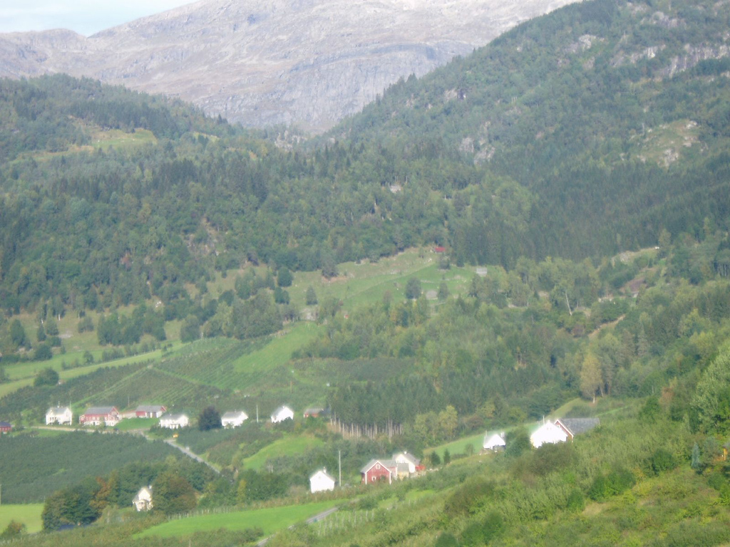
The Vallavik Tunnel () is a road tunnel in Vestland county, Norway. The tunnel begins on the north edge of the village of Eide, Granvin, Eide in the municipality of Voss and runs to the southeast, ending at the small farm of Vallaviki in the municipality of Ulvik. The tunnel is part of Norwegian National Road 13 and Norwegian County Road 7. The tunnel was originally opened on 27 April 1985. In 2013, a roundabout and a long branch were added near the southern end of the tunnel to connect with the newly constructed Hardanger Bridge. The branch passes directly over the older Djønno Tunnel. References Voss Ulvik Road tunnels in Vestland Tunnels completed in 1985 1985 establishments in Norway {{Norway-tunnel-stub ... [...More Info...] [...Related Items...] OR: [Wikipedia] [Google] [Baidu] |
Vestland
Vestland is a Counties of Norway, county in Norway. The county is located in Western Norway, and its administrative centre is Bergen, where the executive and political leadership is based. The County governor (Norway), County Governor is based in Hermansverk. Vestland is one of two counties in Norway that have Nynorsk as their official written language form. Vestland was created on 1 January 2020, when the former counties of Hordaland and Sogn og Fjordane were merged. History Vestland county is a newly created county, but it has been inhabited for millennia. The area was made up of many petty kingdoms under the Gulating during the Middle Ages. The northern part was then known as ''Firdafylke'' (now the Fjordane region; Nordfjord-Sunnfjord), the central area was known as ''Sygnafylke'' (now the Sogn region), and the southern part was known as ''Hordafylke''. In the early 16th century, Norway was divided into four ''len''. The Bergenhus len was headquartered in Bergen and encompa ... [...More Info...] [...Related Items...] OR: [Wikipedia] [Google] [Baidu] |
Norway
Norway, officially the Kingdom of Norway, is a Nordic countries, Nordic country located on the Scandinavian Peninsula in Northern Europe. The remote Arctic island of Jan Mayen and the archipelago of Svalbard also form part of the Kingdom of Norway. Bouvet Island, located in the Subantarctic, is a Dependencies of Norway, dependency, and not a part of the Kingdom; Norway also Territorial claims in Antarctica, claims the Antarctic territories of Peter I Island and Queen Maud Land. Norway has a population of 5.6 million. Its capital and largest city is Oslo. The country has a total area of . The country shares a long eastern border with Sweden, and is bordered by Finland and Russia to the northeast. Norway has an extensive coastline facing the Skagerrak strait, the North Atlantic Ocean, and the Barents Sea. The unified kingdom of Norway was established in 872 as a merger of Petty kingdoms of Norway, petty kingdoms and has existed continuously for years. From 1537 to 1814, Norway ... [...More Info...] [...Related Items...] OR: [Wikipedia] [Google] [Baidu] |
Granvin (village)
Granvin, also known as Eide, is a village in Voss Municipality in Vestland county, Norway. The village is located at the head of the Granvin Fjord in the southeastern part of the municipality. The large village of Vossevangen lies about to the northwest and the village of Ulvik lies about to the northeast. The village has a population (2019) of 485 and a population density of . Prior to 1 January 2020, the village was the administrative centre of the old Granvin Municipality which is now part of Voss Municipality. Name The village is known as Eide because it sits along a river on an isthmus of land between the fjord and the lake Granvinsvatnet. ("Eide" in Norwegian means isthmus.) The village is also known as Granvin since it is the municipal centre and largest settlement in the municipality of Granvin. Both names can be used interchangeably. There is also a small farm area called "Granvin" located about north of the village, and that is where Granvin Church is located ... [...More Info...] [...Related Items...] OR: [Wikipedia] [Google] [Baidu] |
Voss
Voss () is a Municipalities of Norway, municipality and a Districts of Norway, traditional district in Vestland Counties of Norway, county, Norway. The administrative center of the municipality is the village of Vossevangen. Other villages include Bolstadøyri, Borstrondi, Evanger (village), Evanger, Kvitheim, Mjølfjell, Oppheim, Stalheim, and Vinje, Hordaland, Vinje. The municipality is the 35th largest by area of Norway's 356 municipalities. Voss is Norway's 76th most populous municipality, with a population of 16,144. Its population density is and its population has increased by 7.9% over the last 10 years. Municipal history The prestegjeld, parish of Voss was established as a municipality on 1 January 1838 (see formannskapsdistrikt law). On 1 January 1867, a small area in northern Voss (population 28) was transferred to the municipality of Hosanger. On 1 January 1868, the municipality's northern district (population 2,009) was separated to form the new municipality of V ... [...More Info...] [...Related Items...] OR: [Wikipedia] [Google] [Baidu] |
Ulvik
Ulvik is a municipalities of Norway, municipality in Vestland Counties of Norway, county, Norway. The municipality stretches from the Hardangerfjord to the mountains that reach above sea level. The administrative centre of the municipality is the village of Ulvik (village), Ulvik. The villages of Osa, Norway, Osa and Finse are also located in Ulvik municipality. The municipality is the 158th largest by area out of the 356 municipalities in Norway. Ulvik is the 329th most populous municipality in Norway with a population of 1,056. The municipality's population density is and its population has decreased by 5.1% over the previous 10-year period. Of the municipality's total population, nearly half live in the village of Ulvik (village), Ulvik at the end of the Ulvikafjorden. The vast majority of those who do not live in the village of Ulvik live on the farms surrounding the village or at the end of the Osa Fjord in the village of Osa. In 2016, the chief of police for Vestlandet ... [...More Info...] [...Related Items...] OR: [Wikipedia] [Google] [Baidu] |
Statens Vegvesen
The Norwegian Public Roads Administration () is a Norwegian government agency responsible for national and county public roads in Norway. This includes planning, construction and operation of the national and county road networks, driver training and licensing, vehicle inspection, and subsidies to car ferries. The agency is led by the Directorate of Public Roads (Vegdirektoratet), and is subordinate to the Ministry of Transport and Communications. The Norwegian Public Roads Administration is divided into five regions and thirty districts, which are subordinate to the directorate. The directorate is based in Oslo. The Norwegian Public Roads Administration is one of the largest government agencies of Norway in terms of budget. In matters concerning national roads, the agency is subordinate to the ministry and in matters concerning county roads subordinate to the county administration. Core activities The Norwegian Public Roads Administration strives to ensure that the road transp ... [...More Info...] [...Related Items...] OR: [Wikipedia] [Google] [Baidu] |
Road Tunnel
A tunnel is an underground or undersea passageway. It is dug through surrounding soil, earth or rock, or laid under water, and is usually completely enclosed except for the two portals common at each end, though there may be access and ventilation openings at various points along the length. A pipeline differs significantly from a tunnel, though some recent tunnels have used immersed tube construction techniques rather than traditional tunnel boring methods. A tunnel may be for foot or vehicular road traffic, for rail traffic, or for a canal. The central portions of a rapid transit network are usually in the tunnel. Some tunnels are used as sewers or aqueducts to supply water for consumption or for hydroelectric stations. Utility tunnels are used for routing steam, chilled water, electrical power or telecommunication cables, as well as connecting buildings for convenient passage of people and equipment.Salazar, Waneta. ''Tunnels in Civil Engineering''. Delhi, India : Whi ... [...More Info...] [...Related Items...] OR: [Wikipedia] [Google] [Baidu] |
Eide, Granvin
Granvin, also known as Eide, is a village in Voss Municipality in Vestland county, Norway. The village is located at the head of the Granvin Fjord in the southeastern part of the municipality. The large village of Vossevangen lies about to the northwest and the village of Ulvik (village), Ulvik lies about to the northeast. The village has a population (2019) of 485 and a population density of . Prior to 1 January 2020, the village was the administrative centre of the old Granvin Municipality which is now part of Voss Municipality. Name The village is known as Eide because it sits along a river on an isthmus of land between the fjord and the lake Granvinsvatnet. ("Eide" in Norwegian means isthmus.) The village is also known as Granvin since it is the municipal centre and largest settlement in the municipality of Granvin. Both names can be used interchangeably. There is also a small farm area called "Granvin" located about north of the village, and that is where Granvin C ... [...More Info...] [...Related Items...] OR: [Wikipedia] [Google] [Baidu] |
Norwegian National Road 13
National Road 13 (, ) is a national road which runs from the town of Stavanger in Rogaland county to the village of Sogndalsfjøra in Vestland county. The route is long and runs south–north through Rogaland and Vestland counties, following a more inland path than the European route E39 highway. Prior to 2019, the northern terminus of the road was at the village of Balestrand, but in 2019, the section of Norwegian County Road 55 from Balestrand to Sogndalsfjøra was added to National Road 13, extending it all the way to Sogndalsfjøra. In 2020, a new tunnel was opened between Stavanger and Tau, Ryfylke Tunnel, the world's deepest public road tunnel. National Road 13 was then rerouted through this tunnel, making it end in Stavanger instead of Sandnes. The road between Tau and Sandnes which has a ferry crossing (Oanes to Lauvika across the Høgsfjorden) became county roads. Route description Historically, Rv13 also included the road between the village of Balestrand to t ... [...More Info...] [...Related Items...] OR: [Wikipedia] [Google] [Baidu] |
Norwegian County Road 7
County Road 7 () is a road in Vestland county, Norway. The road runs from Trengereid in the municipality of Bergen to Kollanes in the municipality of Voss. The route branches off from European route E16 and passes through the Trengereid Valley to Samnanger before crossing mountainous territory east to Norheimsund. It then continues along the north side of the Hardanger Fjord through Øystese and Ålvik and the north side of the Granvin Fjord before meeting Norwegian National Road 13 in the municipality of Voss. History The section of the road through the Toka Gorge was laid out around 1890; construction began on it in 1903 and it was opened in 1907. Large parts of the road were carved out by hand while the workers hung on ropes against the sheer mountainside. This method was used because the road lacks any natural foundation. A new route with four tunnels was opened in the 1960s. These are the Snauhaugen Tunnel (), Hansagjel Tunnel (), Tokagjel Tunnel (), and Fossagjel Tunnel ... [...More Info...] [...Related Items...] OR: [Wikipedia] [Google] [Baidu] |
Roundabout
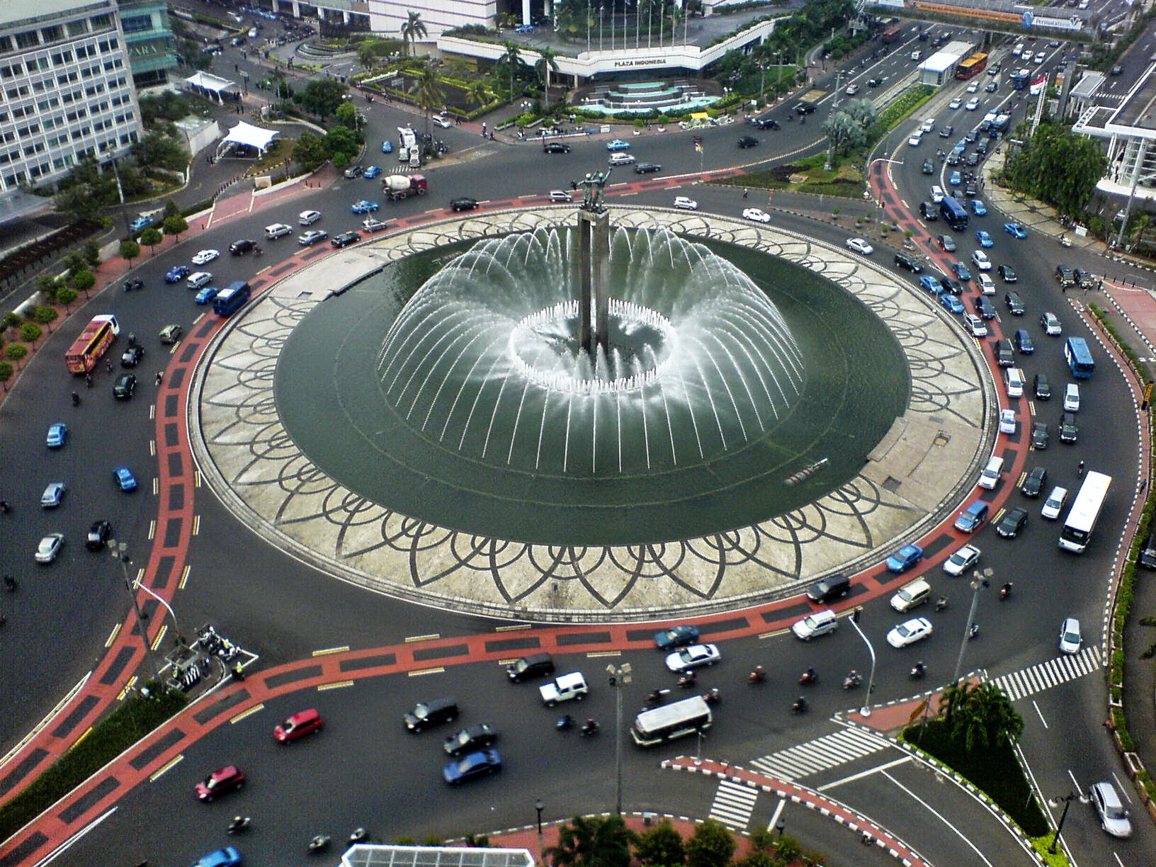
A roundabout, a rotary and a traffic circle are types of circular intersection or junction in which road traffic is permitted to flow in one direction around a central island, and priority is typically given to traffic already in the junction.''The New Shorter Oxford English Dictionary,'' Volume 2, Clarendon Press, Oxford (1993), page 2632 In the United States, engineers use the term modern roundabout to refer to junctions installed after 1960 that incorporate design rules to increase safety. Compared to stop signs, traffic signals, and earlier forms of roundabouts, modern roundabouts reduce the likelihood and severity of collisions greatly by reducing traffic speeds through horizontal deflection and minimising T-bone and head-on collisions. Variations on the basic concept include integration with tram or train lines, two-way flow, higher speeds and many others. For pedestrians, traffic exiting the roundabout comes from one direction, instead of three, simplifying the p ... [...More Info...] [...Related Items...] OR: [Wikipedia] [Google] [Baidu] |
Hardanger Bridge
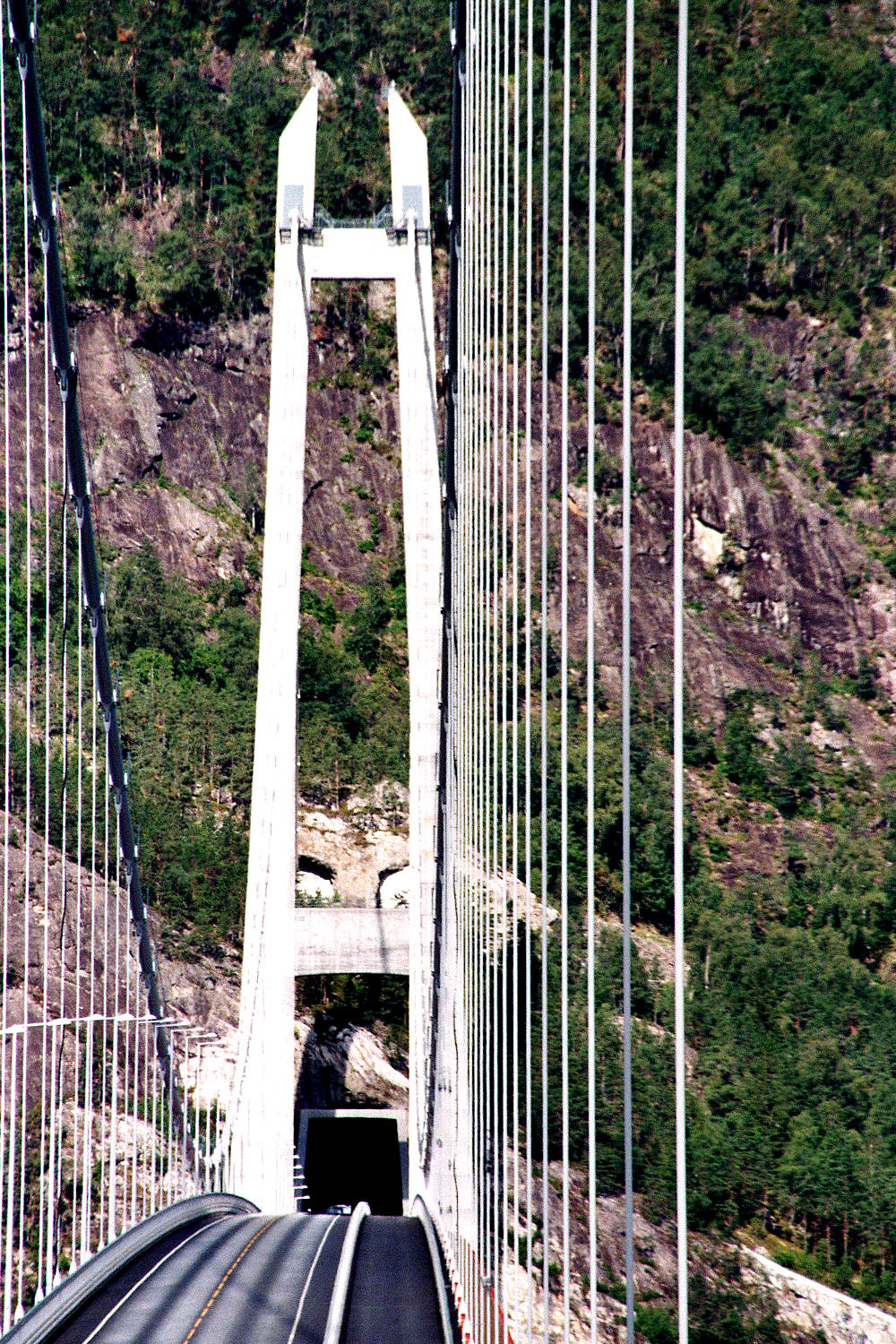
The Hardanger Bridge () is a suspension bridge across the Eidfjorden branch off of the main Hardangerfjorden in Vestland county, Norway. The bridge connects the municipalities of Ullensvang and Ulvik. It replaced a ferry connection between Bruravik and Brimnes, and thereby shortens the driving time between Oslo and Bergen. It is the longest suspension bridge in Norway. Construction The bridge was approved for building by the Norwegian Parliament on February 28, 2006, and construction began on February 26, 2009. While the bridge was engineered by the Norwegian Public Roads Administration, the construction was done by MT Højgaard. The project had a budget of () and more than half of this will be paid by toll and saved ferry subsidies. The Administration is considering a different route over a future bridge as the main connection between East and West.Nikolaisen, Per-Ivar .Hardangerbrua åpnet for 18 måneder siden. Nå vil Vegvesenet bygge ny '' Teknisk Ukeblad'', 22 ... [...More Info...] [...Related Items...] OR: [Wikipedia] [Google] [Baidu] |


