|
VMA-133
Marine Attack Squadron 133 (VMA-133) was a reserve A-4 Skyhawk fighter squadron in the United States Marine Corps. Originally known as VMSB-133, the squadron saw combat during the World War II campaigns on Bougainville and Philippines. Following the war they became part of the Marine Forces Reserve. The squadron, also known as the “Dragons”, was part of Marine Aircraft Group 42 of the 4th Marine Aircraft Wing and was based out of Naval Air Station Alameda, California. They were deactivated in 1992 as part of the post Cold War drawdown of the U.S. Military. History World War II Marine Scout Bombing Squadron 133 (VMSB-133) was activated on May 1, 1943, at Marine Corps Air Station El Toro, California.Rottman, p.440 After training over the summer they left for Hawaii and arrived at Marine Corps Air Station Ewa on September 9, 1943.Sherrod, p.458 From Ewa, the squadron was split into two sections with one heading to Johnston Atoll and the other to Palmyra Atoll for six mo ... [...More Info...] [...Related Items...] OR: [Wikipedia] [Google] [Baidu] |
United States Marine Corps
The United States Marine Corps (USMC), also referred to as the United States Marines, is the maritime land force service branch of the United States Armed Forces responsible for conducting expeditionary and amphibious operations through combined arms, implementing its own infantry, artillery, aerial, and special operations forces. The U.S. Marine Corps is one of the eight uniformed services of the United States. The Marine Corps has been part of the U.S. Department of the Navy since 30 June 1834 with its sister service, the United States Navy. The USMC operates installations on land and aboard sea-going amphibious warfare ships around the world. Additionally, several of the Marines' tactical aviation squadrons, primarily Marine Fighter Attack squadrons, are also embedded in Navy carrier air wings and operate from the aircraft carriers. The history of the Marine Corps began when two battalions of Continental Marines were formed on 10 November 1775 in Philadelphia ... [...More Info...] [...Related Items...] OR: [Wikipedia] [Google] [Baidu] |
Marine Corps Air Station El Toro
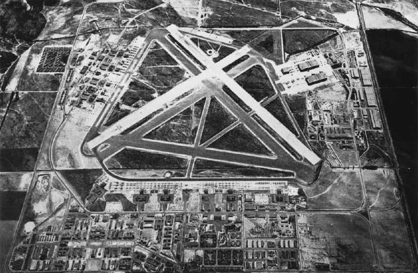
Marine Corps Air Station El Toro was a United States Marine Corps Air Station located next to the community of El Toro, near Irvine, California. Before it was decommissioned in 1999, it was the home of Marine Corps Aviation on the West Coast. Designated as a Master Jet Base, its four runways (two of and two of ) could handle the largest aircraft in the U.S. military inventory. While it was active, all U.S. Presidents in the post-World War II era landed in ''Air Force One'' at this airfield. The El Toro "Flying Bull" patch was designed by Walt Disney Studios in 1944. It survived virtually unchanged until the close of the Air Station. Following its decommissioning the site was used as a filming location, including the test track for the United States version of the BBC's '' Top Gear'' franchise. About of land originally taken by the air station was converted into a large recreational center, the Orange County Great Park, while the rest was re-zoned for residential and com ... [...More Info...] [...Related Items...] OR: [Wikipedia] [Google] [Baidu] |
Close Air Support
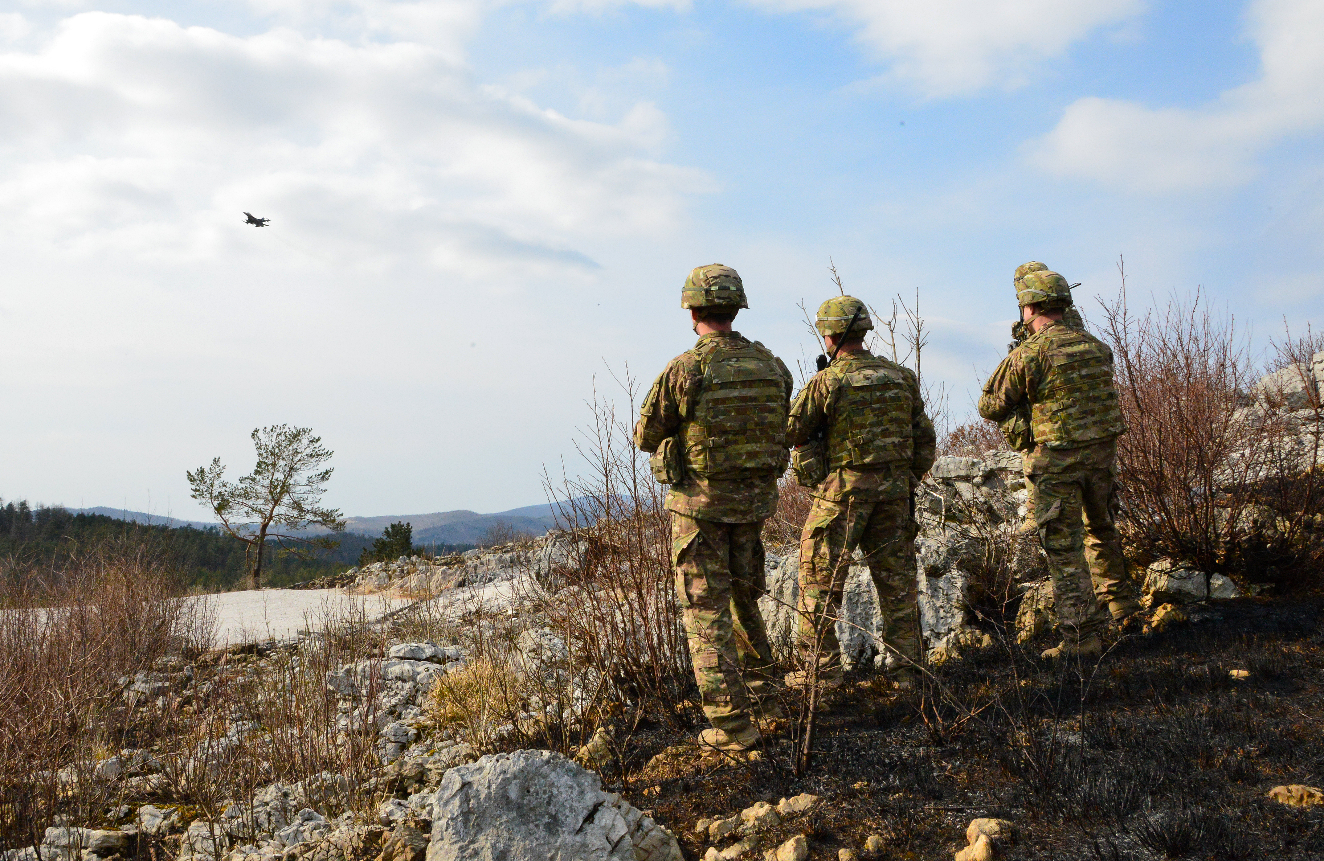
In military tactics, close air support (CAS) is defined as air action such as air strikes by fixed or rotary-winged aircraft against hostile targets near friendly forces and require detailed integration of each air mission with fire and movement of these forces and attacks with aerial bombs, glide bombs, missiles, rockets, autocannons, machine guns, and even directed-energy weapons such as lasers.''Close Air Support''. United States Department of Defense, 2014. The requirement for detailed integration because of proximity, fires or movement is the determining factor. CAS may need to be conducted during shaping operations with Special Operations Forces (SOF) if the mission requires detailed integration with the fire and movement of those forces. A closely related subset of air interdiction (AI), battlefield air interdiction, denotes interdiction against units with near-term effects on friendly units, but which does not require integration with friendly troop movements. T ... [...More Info...] [...Related Items...] OR: [Wikipedia] [Google] [Baidu] |
Mindanao
Mindanao ( ) ( Jawi: مينداناو) is the second-largest island in the Philippines, after Luzon, and seventh-most populous island in the world. Located in the southern region of the archipelago, the island is part of an island group of the same name that also includes its adjacent islands, notably the Sulu Archipelago. According to the 2020 census, Mindanao has a population of 26,252,442 people, while the entire island group has an estimated population of 27,021,036 according to the 2021 census. Mindanao is divided into six administrative regions: the Zamboanga Peninsula, Northern Mindanao, the Caraga region, the Davao region, Soccsksargen, and the autonomous region of Bangsamoro. According to the 2020 census, Davao City is the most populous city on the island, with 1,776,949 people, followed by Zamboanga City (pop. 977,234), Cagayan de Oro (pop. 728,402), General Santos (pop. 697,315), Butuan (pop. 372,910), Iligan (pop. 363,115) and Cotabato City (pop. 325, ... [...More Info...] [...Related Items...] OR: [Wikipedia] [Google] [Baidu] |
Invasion Of Lingayen Gulf
The Invasion of Lingayen Gulf ( fil, Paglusob sa Golpo ng Lingayen), 6–9 January 1945, was an Allies of World War II, Allied Amphibious warfare, amphibious operation in the Commonwealth of the Philippines, Philippines during World War II. In the early morning of 6 January 1945, a large Allied force commanded by Admiral Jesse B. Oldendorf began approaching the shores of Lingayen from Lingayen Gulf, on the island of Luzon. United States Navy, U.S. Navy and Royal Australian Navy warships began bombarding suspected Empire of Japan, Japanese positions along the coast of Lingayen from their position in Lingayen Gulf for three days. On "S-Day", 9 January, the Sixth United States Army, U.S. 6th Army landed on a roughly beachhead at the base of the Gulf between the towns of Lingayen and San Fabian, Pangasinan, San Fabian. Background During World War II, the Lingayen Gulf proved a strategically important theater of war between American and Japanese forces. Shown in the center of the fi ... [...More Info...] [...Related Items...] OR: [Wikipedia] [Google] [Baidu] |
Philippines
The Philippines (; fil, Pilipinas, links=no), officially the Republic of the Philippines ( fil, Republika ng Pilipinas, links=no), * bik, Republika kan Filipinas * ceb, Republika sa Pilipinas * cbk, República de Filipinas * hil, Republika sang Filipinas * ibg, Republika nat Filipinas * ilo, Republika ti Filipinas * ivv, Republika nu Filipinas * pam, Republika ning Filipinas * krj, Republika kang Pilipinas * mdh, Republika nu Pilipinas * mrw, Republika a Pilipinas * pag, Republika na Filipinas * xsb, Republika nin Pilipinas * sgd, Republika nan Pilipinas * tgl, Republika ng Pilipinas * tsg, Republika sin Pilipinas * war, Republika han Pilipinas * yka, Republika si Pilipinas In the recognized optional languages of the Philippines: * es, República de las Filipinas * ar, جمهورية الفلبين, Jumhūriyyat al-Filibbīn is an archipelagic state, archipelagic country in Southeast Asia. It is situated in the western Pacific Ocean and consists of aro ... [...More Info...] [...Related Items...] OR: [Wikipedia] [Google] [Baidu] |
Lingayen Gulf
The Lingayen Gulf is a large gulf on northwestern Luzon in the Philippines, stretching . It is framed by the provinces of Pangasinan and La Union and sits between the Zambales Mountains and the Cordillera Central. The Agno River and the Balili River drain into Lingayen Gulf. Geography The gulf has numerous islands, the most famous of which are in the Hundred Islands National Park. This tourist attraction features 123 islands, the majority of which are small in size. The largest island is Cabarruyan Island, which constitutes the municipality of Anda, Pangasinan, followed by Santiago Island at the mouth of the Gulf. The shore from Labrador to San Fabian is characterized by a long grey-sand beach. Other well-known beaches are at Bonuan-Tondaligan, Bolinao and San Fernando City. The waters of Lingayen Gulf are murky due to its sandy bottom. Coral reefs were all but destroyed by dynamite fishing, although efforts are made to restore some, especially inside the Hundred I ... [...More Info...] [...Related Items...] OR: [Wikipedia] [Google] [Baidu] |
New Britain
New Britain ( tpi, Niu Briten) is the largest island in the Bismarck Archipelago, part of the Islands Region of Papua New Guinea. It is separated from New Guinea by a northwest corner of the Solomon Sea (or with an island hop of Umboi the Dampier and Vitiaz Straits) and from New Ireland by St. George's Channel. The main towns of New Britain are Rabaul/ Kokopo and Kimbe. The island is roughly the size of Taiwan. While the island was part of German New Guinea, it was named Neupommern ("New Pomerania"). In common with most of the Bismarcks it was largely formed by volcanic processes, and has active volcanoes including Ulawun (highest volcano nationally), Langila, the Garbuna Group, the Sulu Range, and the volcanoes Tavurvur and Vulcan of the Rabaul caldera. A major eruption of Tavurvur in 1994 destroyed the East New Britain provincial capital of Rabaul. Most of the town still lies under metres of ash, and the capital has been moved to nearby Kokopo. Geography ... [...More Info...] [...Related Items...] OR: [Wikipedia] [Google] [Baidu] |
Bougainville Island
Bougainville Island ( Tok Pisin: ''Bogenvil'') is the main island of the Autonomous Region of Bougainville, which is part of Papua New Guinea. It was previously the main landmass in the German Empire-associated North Solomons. Its land area is . The population of the whole province, including nearby islets such as the Carterets, is approximately 300,000 (2019 census). The highest point is Mount Balbi, on the main island, at . The much smaller Buka Island, , lies to the north, across the wide Buka Strait. Even though the strait is narrow, there is no bridge across it, but there is a regular ferry service between the key settlements on either side. The main airport (or airstrip) in the north is in the town of Buka. Bougainville is the largest island in the Solomon Islands archipelago. Most of the islands in this archipelago (which are primarily concentrated in the southern and eastern portions of it) are part of the politically independent Solomon Islands. Two of these is ... [...More Info...] [...Related Items...] OR: [Wikipedia] [Google] [Baidu] |
Torokina
Torokina is a coastal village on Bougainville Island, in the Autonomous Region of Bougainville, eastern Papua New Guinea. It is administered under Torokina Rural LLG. It is located on the western coast of the island. During World War II World War II or the Second World War, often abbreviated as WWII or WW2, was a world war that lasted from 1939 to 1945. It involved the World War II by country, vast majority of the world's countries—including all of the great power ... site of Torokina Airfield. References Populated places in the Autonomous Region of Bougainville Populated coastal places in Papua New Guinea {{Bougainville-geo-stub ... [...More Info...] [...Related Items...] OR: [Wikipedia] [Google] [Baidu] |
Anti-submarine Warfare
Anti-submarine warfare (ASW, or in older form A/S) is a branch of underwater warfare that uses surface warships, aircraft, submarines, or other platforms, to find, track, and deter, damage, or destroy enemy submarines. Such operations are typically carried out to protect friendly shipping and coastal facilities from submarine attacks and to overcome blockades. Successful ASW operations typically involved a combination of sensor and weapon technologies, along with effective deployment strategies and sufficiently trained personnel. Typically, sophisticated sonar equipment is used for first detecting, then classifying, locating, and tracking a target submarine. Sensors are therefore a key element of ASW. Common weapons for attacking submarines include torpedoes and naval mines, which can both be launched from an array of air, surface, and underwater platforms. ASW capabilities are often considered of significant strategic importance, particularly following provocative instances ... [...More Info...] [...Related Items...] OR: [Wikipedia] [Google] [Baidu] |
Palmyra Atoll
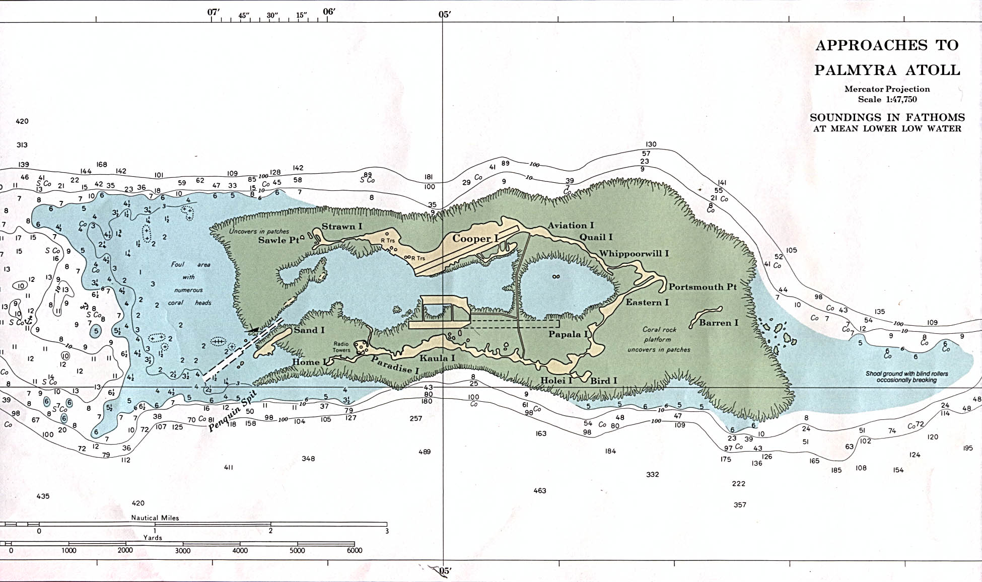
Palmyra Atoll (), also referred to as Palmyra Island, is one of the Northern Line Islands (southeast of Kingman Reef and north of Kiribati). It is located almost due south of the Hawaiian Islands, roughly one-third of the way between Hawaii and American Samoa. North America is about northeast and New Zealand the same distance southwest, placing the atoll at the approximate center of the Pacific Ocean. The land area is , with about 9 miles (14 km) of sea-facing coastline and reef. There is one boat anchorage known as West Lagoon, accessible from the sea by a narrow artificial channel. It is the second-to-northernmost of the Line Islands, and one of three American islands in the archipelago, along with Jarvis Island and Kingman Reef. Palmyra Atoll is part of the Pacific Remote Islands Marine National Monument, the world's largest marine protected area. The atoll is composed of submerged sand flats along with dry land and reefs. It consists of three lagoons separated by cor ... [...More Info...] [...Related Items...] OR: [Wikipedia] [Google] [Baidu] |


