|
Urumea
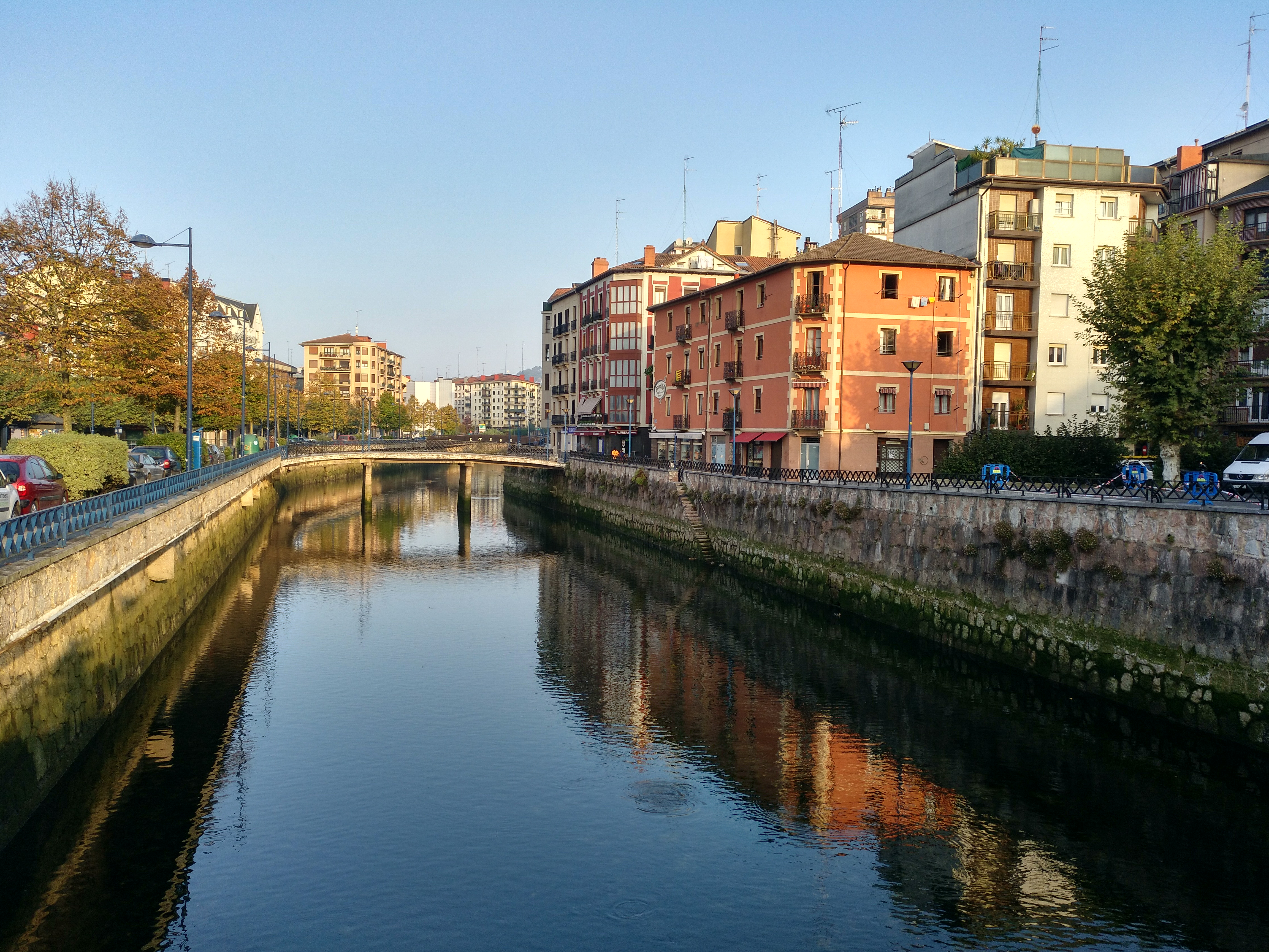
The Urumea ( or , stemming from Basque "ur" 'water' + "me(he)a" 'thin') is a river in the Basque Country at the north of the Iberian Peninsula. It's one of a series of Basque rivers flowing into the Bay of Biscay (Atlantic basin) and is best known for being the river flowing towards the sea by the city of San Sebastian. Course of the river and water data The river is 59.4 km long from its source in the Navarrese municipality of Goizueta, and 33 km of it runs through the province of Gipuzkoa. The average temperature is 13.5 °C (56.3 °F). The seasonal and year-to-year variations in water flow are less marked than in other basins of Gipuzkoa, and the natural regulation of this basin is very high. The quality of the water is fairly good, despite a slight deterioration downstream near the mouth (moderately good condition) where the city of Donostia lies. However, lately, works have been done on the treatment and cleaning of water resulting in an outstanding environ ... [...More Info...] [...Related Items...] OR: [Wikipedia] [Google] [Baidu] |
San Sebastián
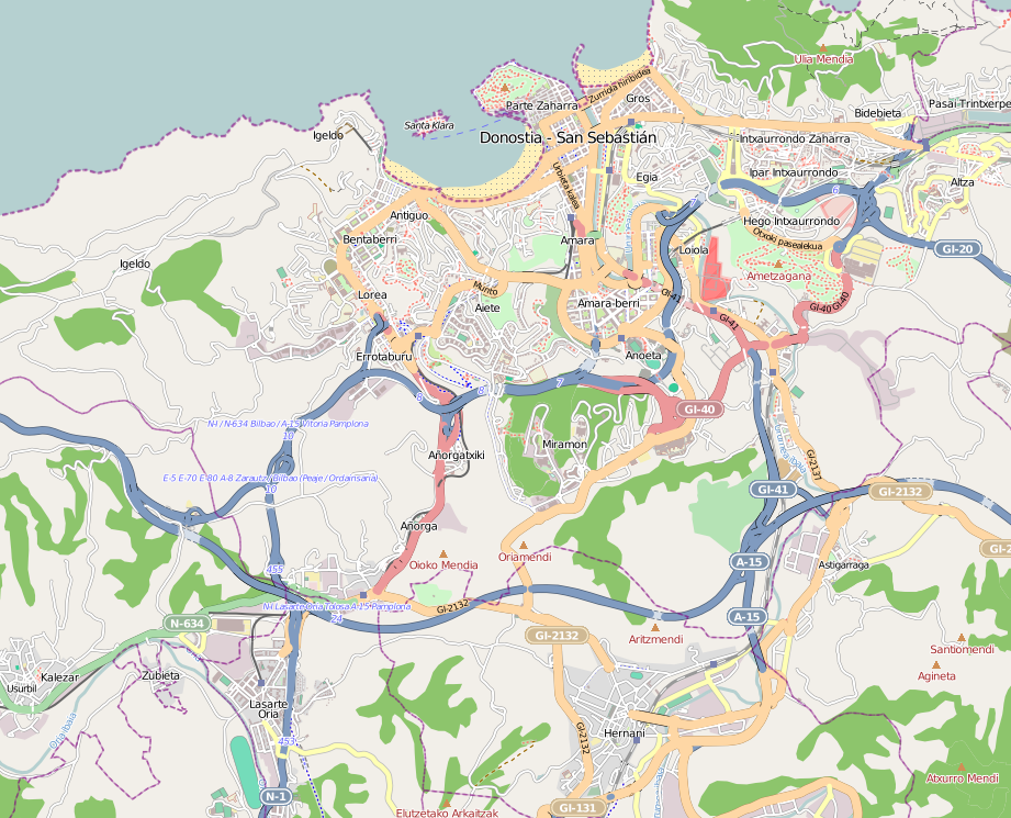
San Sebastián, officially known by the bilingual name Donostia / San Sebastián (, ), is a city and municipality located in the Basque Autonomous Community, Spain. It lies on the coast of the Bay of Biscay, from the France–Spain border. The capital city of the province of Gipuzkoa, the municipality's population is 188,102 as of 2021, with its metropolitan area reaching 436,500 in 2010. Locals call themselves ''donostiarra'' (singular) in Basque, also using this term when speaking in Spanish. It is also a part of Basque Eurocity Bayonne-San Sebastián. The economic activities in the city are dominated by the service sector, with an emphasis on commerce and tourism, as San Sebastián has long been well-known as a tourist destination. Despite the city's relatively small size, events such as the San Sebastián International Film Festival and the San Sebastian Jazz Festival have given it an international dimension. San Sebastián, along with Wrocław, Poland, was the Eur ... [...More Info...] [...Related Items...] OR: [Wikipedia] [Google] [Baidu] |
Hernani, Spain
Hernani is a town and municipality located in the province of Gipuzkoa, Basque Autonomous Community, Spain. The town sits on the left bank of the Urumea river. It is located at a distance of 9.2 km from San Sebastián. The municipality of Hernani occupies an area of approximately 40 square kilometres and is bordered by San Sebastián, Astigarraga, Arano, Elduayen, Errenteria, Lasarte-Oria and Urnieta. From the town centre, at the foot of Mount Santa Barbara, it is possible to see a large area of the valley of Urumea. Its festivities, held between 23 and 27 June in honour of John the Baptist; and between his celebrations the popular "azeri dantza" (also celebrated in celebrations of Carnival) should be emphasized. The title character of Victor Hugo's play ''Hernani'' is named after the town. History During the Middle Ages, the territory that would form the province of Gipuzkoa was divided in valleys and Hernani was one of them. The valley of Hernani formerly extended th ... [...More Info...] [...Related Items...] OR: [Wikipedia] [Google] [Baidu] |
Gipuzkoa
Gipuzkoa ( , ; ; ) is a province of Spain and a historical territory of the autonomous community of the Basque Country. Its capital city is Donostia-San Sebastián. Gipuzkoa shares borders with the French department of Pyrénées-Atlantiques at the northeast, with the province and autonomous community of Navarre at east, Biscay at west, Álava at southwest and the Bay of Biscay to its north. It is located at the easternmost extreme of the Cantabric Sea, in the Bay of Biscay. It has of coastline. With a total area of , Gipuzkoa is the smallest province of Spain. The province has 89 municipalities and a population of 720,592 inhabitants (2018), from which more than half live in the Donostia-San Sebastián metropolitan area. Apart from the capital, other important cities are Irun, Errenteria, Zarautz, Mondragón, Eibar, Hondarribia, Oñati, Tolosa, Beasain and Pasaia. Gipuzkoa is the province of the Basque Country in which the Basque language is the most ex ... [...More Info...] [...Related Items...] OR: [Wikipedia] [Google] [Baidu] |
Bay Of Biscay
The Bay of Biscay ( ) is a gulf of the northeast Atlantic Ocean located south of the Celtic Sea. It lies along the western coast of France from Point Penmarc'h to the Spanish border, and along the northern coast of Spain, extending westward to Cape Ortegal. The average depth is and the greatest depth is . Etymology The Bay of Biscay is known in Spain as the Gulf of Biscay (; ). In France, it is called the Gulf of Gascony ( ; ; ; ). In Latin, the bay was known as ( Cantabrian Gulf); the name Cantabrian Sea is still used locally for the southern area of the Bay of Biscay that washes over the northern coast of Spain ( Cantabria). The English name comes from Biscay on the northern Spanish coast, probably standing for the western Basque districts (''Biscay'' up to the early 19th century). Geography Parts of the continental shelf extend far into the bay, resulting in fairly shallow waters in many areas and thus the rough seas for which the region is known. Heavy storms ... [...More Info...] [...Related Items...] OR: [Wikipedia] [Google] [Baidu] |
List Of Rivers Of Spain
This is an incomplete list of rivers that are at least partially in Spain. The rivers flowing into the sea are sorted along the coast. Rivers flowing into other rivers are listed by the rivers they flow into. Rivers in the mainland Iberian Peninsula can be divided into those belonging to the Mediterranean watershed, those flowing into the Atlantic Ocean and those emptying into the Cantabrian sea (a marginal sea of the Atlantic off the northern coast of the Iberian peninsula). Tributaries are listed down the page in an downstream direction. The main stem river of a catchment is labelled as , left-bank tributaries are indicated by , right-bank tributaries by . Where a named river derives from the confluence of two differently named rivers these are labelled as and for the left and right forks (the rivers on the left and right, relative to an observer facing downstream). The transboundary rivers partially running through Portugal or France and/or along the borders of Spain with t ... [...More Info...] [...Related Items...] OR: [Wikipedia] [Google] [Baidu] |
Salmon
Salmon (; : salmon) are any of several list of commercially important fish species, commercially important species of euryhaline ray-finned fish from the genera ''Salmo'' and ''Oncorhynchus'' of the family (biology), family Salmonidae, native to tributary, tributaries of the North Atlantic (''Salmo'') and North Pacific (''Oncorhynchus'') basins. ''Salmon'' is a colloquial or common name used for fish in this group, but is not a scientific name. Other closely related fish in the same family include trout, Salvelinus, char, Thymallus, grayling, Freshwater whitefish, whitefish, lenok and Hucho, taimen, all coldwater fish of the subarctic and cooler temperate regions with some sporadic endorheic populations in Central Asia. Salmon are typically fish migration, anadromous: they hatch in the shallow gravel stream bed, beds of freshwater headstreams and spend their juvenile fish, juvenile years in rivers, lakes and freshwater wetlands, migrate to the ocean as adults and live like sea ... [...More Info...] [...Related Items...] OR: [Wikipedia] [Google] [Baidu] |
Landforms Of Gipuzkoa
A landform is a land feature on the solid surface of the Earth or other planetary body. They may be natural or may be anthropogenic (caused or influenced by human activity). Landforms together make up a given terrain, and their arrangement in the landscape is known as topography. Landforms include hills, mountains, canyons, and valleys, as well as shoreline features such as bays, peninsulas, and seas, including submerged features such as mid-ocean ridges, volcanoes, and the great oceanic basins. Physical characteristics Landforms are categorized by characteristic physical attributes such as elevation, slope, orientation, structure stratification, rock exposure, and soil type. Gross physical features or landforms include intuitive elements such as berms, cliffs, hills, mounds, peninsulas, ridges, rivers, valleys, volcanoes, and numerous other structural and size-scaled (e.g. ponds vs. lakes, hills vs. mountains) elements including various kinds of inland and oceanic waterbodi ... [...More Info...] [...Related Items...] OR: [Wikipedia] [Google] [Baidu] |
Cider
Cider ( ) is an alcoholic beverage made from the Fermented drink, fermented Apple juice, juice of apples. Cider is widely available in the United Kingdom (particularly in the West Country) and Ireland. The United Kingdom has the world's highest per capita consumption, as well as the largest cider-producing companies. Ciders from the South West of England are generally higher in alcoholic content. Cider is also popular in many Commonwealth of Nations, Commonwealth countries, such as India, South Africa, Canada, Australia, New Zealand, and New England. As well as the UK and its former colonies, cider is popular in Portugal (mainly in Entre-Douro-e-Minho Province, Minho and Madeira), France (particularly Normandy and Brittany), northern Italy (specifically Friuli), and northern Spain (specifically Asturias and Basque Country (greater region), Basque Country). Germany also has its own types of cider with Rhineland-Palatinate and Hesse producing a particularly tart version known as A ... [...More Info...] [...Related Items...] OR: [Wikipedia] [Google] [Baidu] |
Sagardotegi
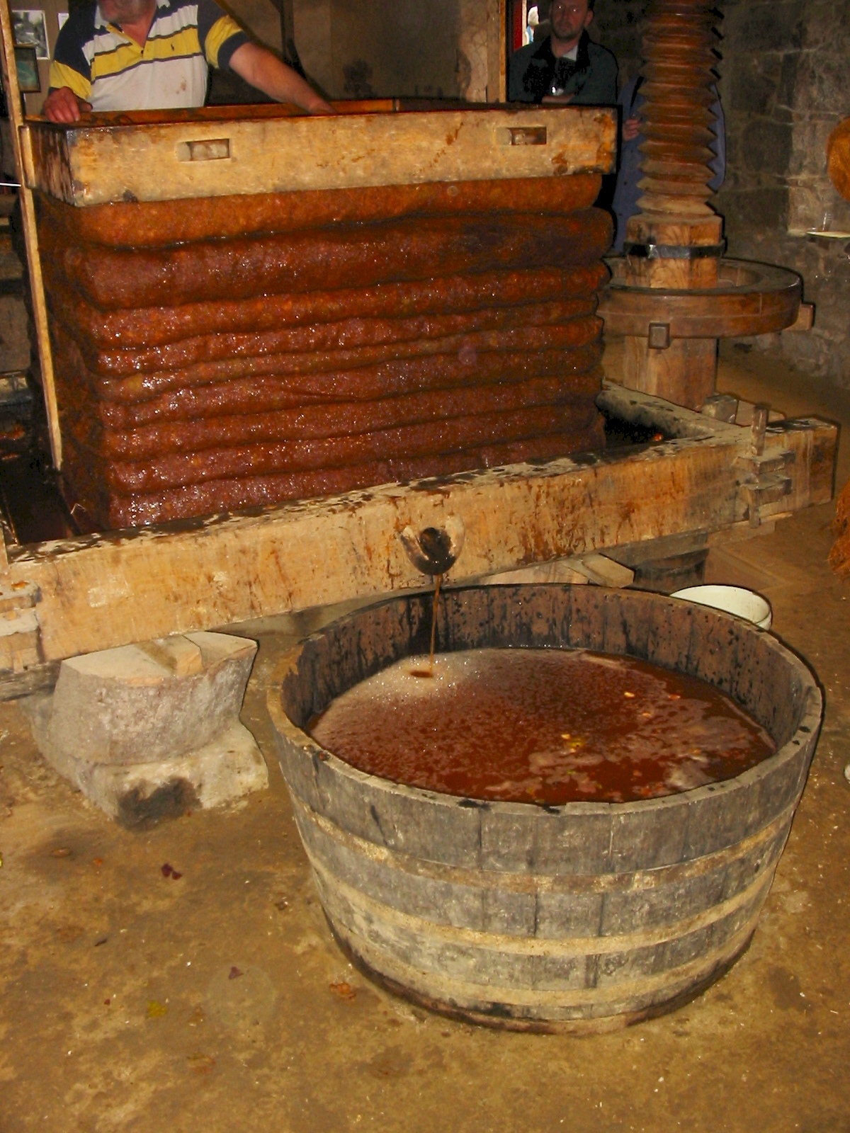
A sagardotegi (pronounced ) is a type of cider house found in the Basque Country where Basque cider and traditional foods such as cod omelettes are served. Modern sagardotegis can broadly be described as a cross between a steakhouse and a cider house. Most Basque cider, like most cider varieties in Spain, is called "natural" because, unlike many other European varieties, it is still, instead of sparkling. It normally contains 4-6% alcohol and is served directly from the barrel in a sagardotegi. Etymology The word ''sagardotegi'' is composed of three elements: ''sagar'' "apple" and ''ardo'' "wine", yielding ''sagardo'' or "cider" and the suffix ''-tegi'' which denotes a building where an activity takes place. The word thus translates as "cider house". In some Northern Basque dialects cider is called ''sagarno'' or ''sagarano'' but that only reflects a different development of the Proto-Basque root ''*ardano'' "wine". Although the word ''ardo'' today exclusively means "w ... [...More Info...] [...Related Items...] OR: [Wikipedia] [Google] [Baidu] |
Astigarraga
Astigarraga is a town located in the province of Gipuzkoa, in the Autonomous Community of Basque Country, in northern Spain Spain, or the Kingdom of Spain, is a country in Southern Europe, Southern and Western Europe with territories in North Africa. Featuring the Punta de Tarifa, southernmost point of continental Europe, it is the largest country in Southern Eur .... References External links * Municipalities in Gipuzkoa Donostialdea {{basqueCountry-geo-stub ... [...More Info...] [...Related Items...] OR: [Wikipedia] [Google] [Baidu] |
Drainage Basin
A drainage basin is an area of land in which all flowing surface water converges to a single point, such as a river mouth, or flows into another body of water, such as a lake or ocean. A basin is separated from adjacent basins by a perimeter, the drainage divide, made up of a succession of elevated features, such as ridges and hills. A basin may consist of smaller basins that merge at river confluences, forming a hierarchical pattern. Other terms for a drainage basin are catchment area, catchment basin, drainage area, river basin, water basin, and impluvium. In North America, they are commonly called a watershed, though in other English-speaking places, " watershed" is used only in its original sense, that of the drainage divide line. A drainage basin's boundaries are determined by watershed delineation, a common task in environmental engineering and science. In a closed drainage basin, or endorheic basin, rather than flowing to the ocean, water converges toward the ... [...More Info...] [...Related Items...] OR: [Wikipedia] [Google] [Baidu] |


