|
Urftsee
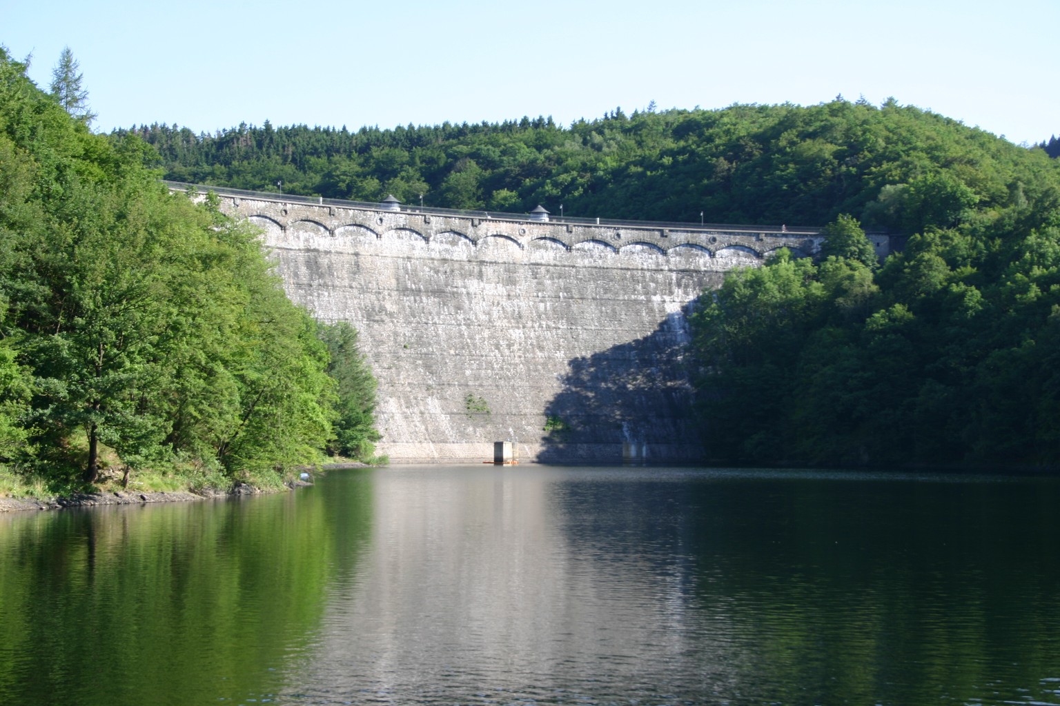
The Urft Dam () is a 58.50 metre high dam in the southwestern part of the state of North Rhine-Westphalia in Germany. It was built in 1905. The dam impounds the Urft (river), River Urft in the district of Kreis Euskirchen, Euskirchen to create the Urft Reservoir (''Urftstausee''), 2.16 km2 in area. The reservoir is also called the ''Urftsee'' (Lake Urft). The Urft Dam, which was constructed during the period 1900 to 1905, and the Urft Reservoir, which was then the biggest reservoir in Europe, having belonged since 1993 to the Eifel-Rur Water Board (''Wasserverband Eifel-Rur''). Location The Urft barrier system that comprises the Urft Dam and Urft Reservoir is located in the Rur Eifel, a subdivision of the North Eifel region, south of the Kermeter ridge, north-northeast of the Dreiborn Plateau between Simmerath-Rurberg (in the neighbouring region of Aachen) to the west-northwest and Schleiden-Gemünd (Schleiden), Gemünd (Kreis Euskirchen, Euskirchen district) to the east ... [...More Info...] [...Related Items...] OR: [Wikipedia] [Google] [Baidu] |
Dreiborn Plateau
The Dreiborn Plateau () is an area of woods and open terrain, some 33 square kilometres in area, in the Eifel National Park. It corresponds to the area of the Vogelsang Military Training Area which was handed back on 31 December 2005 and had been out-of-bounds to the public since 1 September 1946. Since 2006 parts of the area have been opened up to the public who may use certain routes through it. Location and geography The Dreiborn Plateau is bordered in the west by the Rur Dam, Obersee and Einruhr, the river and village of Erkensruhr, in the south by the L 207 state road through Dreiborn (Schleiden), Dreiborn and Herhahn, in the east by the terrain around the former Nazi fort of Ordensburg Vogelsang with the valleys of the Neffgesbach and Morsbach, in the north by the Urft (river), Urft valley and the Urft Dam, Urftsee lake, which separates the Dreiborn Plateau from the ridge of the Kermeter to the north. The plateau is bisected in an east to west direction by the B 266 feder ... [...More Info...] [...Related Items...] OR: [Wikipedia] [Google] [Baidu] |
Kermeter
The Kermeter is an upland region, up to , which is part of the Rureifel within the North Eifel in the districts of Aachen, Düren and Euskirchen in the southwestern part of the state of North Rhine-Westphalia in Germany. The Kermeter ridge is covered by a forest, some 33 km² in area, that is one of the largest contiguous, deciduous forests in the Rhineland. Since 1 January 2004 it has formed the core zone of the Eifel National Park. Location The Kermeter lies on the territory of the three Eifel parishes of Heimbach, Simmerath and Schleiden. It is bordered to the north and west by the Rur Reservoir (around ) and thus by the Rur valley near Heimbach, to the southwest by the Obersee (a pre-basin of the Rur Dam), and in the south by the Urft Reservoir (at around ) and thus the Urft valley. In the southwest the Kermeter transitions into Wolfgarten and Gemünd in the direction of the upper reaches of the Rotbach. The highest point in the Kermeter is an unnamed roun ... [...More Info...] [...Related Items...] OR: [Wikipedia] [Google] [Baidu] |
Obersee (Rur)
The Obersee near Simmerath in the borough of Aachen is the main forebay of the Rur Reservoir on the River Rur in the Eifel mountains of Germany. Its barrier is the Paulushofdamm. The reservoir, like that of the Rur Dam, belongs to the Eifel-Rur Water Company (''Wasserverband Eifel-Rur''). The reservoir provides drinking water. Location The dam system, which comprises the ''Paulushofdamm'' and ''Obersee'', lies in the Rur Eifel, a part of the North Eifel, southwest of the Kermeter, north of the Dreiborn Plateau and east of the Monschau Hedge Land near Simmerath (borough of Aachen). It is located immediately below the Urft Dam, which impounds the waters of the Urft that flow from the east to create the Urft Reservoir, and immediately above the Rur Dam which impounds the waters of the Rur to form the Rur Reservoir. While the dam belongs to the High Fens-Eifel Nature Park, the large eastern arm of the Obersee in the north lies within the Eifel National Park The Eifel ... [...More Info...] [...Related Items...] OR: [Wikipedia] [Google] [Baidu] |
Rur (river)
The Roer (, ) or Rur (; ) is a major river that flows through portions of Belgium, Germany and the Netherlands. It is a right (eastern) tributary to the Meuse (). About 90 percent of the river's course is in Germany. It is not to be confused with the rivers Ruhr (river), Ruhr and Röhr (river), Röhr, which are tributaries of the Rhine in North Rhine-Westphalia. History During the Middle Ages the valley of the Roer lay mostly within the Duchy of Jülich. In 1795, until 1814, during which time the area was part of French First Republic, the French Republic and First French Empire, Empire, it gave its name to the French ''département'' of the Roer (department), Roer. The Roer represented an important front in the Allied push towards Germany at the end of the Second World War. A fortified area known as the Roer Triangle, formed by the towns of Roermond and Sittard, in the Netherlands, and Heinsberg in Germany, was the scene of heavy fighting at the beginning of 1945. Op ... [...More Info...] [...Related Items...] OR: [Wikipedia] [Google] [Baidu] |
Water Management
Water resources are natural resources of water that are potentially useful for humans, for example as a source of drinking water supply or irrigation water. These resources can be either freshwater from natural sources, or water produced artificially from other sources, such as from reclaimed water (wastewater) or desalinated water (seawater). 97% of the water on Earth is salt water and only three percent is fresh water; slightly over two-thirds of this is frozen in glaciers and polar ice caps. The remaining unfrozen freshwater is found mainly as groundwater, with only a small fraction present above ground or in the air. Natural sources of fresh water include surface water, under river flow, groundwater and ice, frozen water. People use water resources for agriculture, agricultural, Industry (economics), industrial and household activities. Water resources are under threat from multiple issues. There is water scarcity, water pollution, water conflict and climate change. Fresh wa ... [...More Info...] [...Related Items...] OR: [Wikipedia] [Google] [Baidu] |
Silesia
Silesia (see names #Etymology, below) is a historical region of Central Europe that lies mostly within Poland, with small parts in the Czech Silesia, Czech Republic and Germany. Its area is approximately , and the population is estimated at 8,000,000. Silesia is split into two main subregions, Lower Silesia in the west and Upper Silesia in the east. Silesia’s culture reflects its complex history and diverse influences, blending Polish, Czech, and German elements. The region is known for its distinctive Silesian language (still spoken by a minority in Upper Silesia), richly decorated folk National costumes of Poland, costumes, hearty regional Silesian cuisine, cuisine, and a mix of Gothic, Baroque, and industrial-era Silesian architecture, architecture seen in its cities and towns. The largest city of the region is Wrocław. Silesia is situated along the Oder River, with the Sudeten Mountains extending across the southern border. The region contains many historical landmarks ... [...More Info...] [...Related Items...] OR: [Wikipedia] [Google] [Baidu] |
Giant Mountains
The Giant Mountains, Krkonoše, or Karkonosze (Czech: , , ), are a mountain range located in the north of the Czech Republic and the south-west of Poland, part of the Sudetes mountain system (part of the Bohemian Massif). The Czech–Polish border, which divides the historic regions of Bohemia and Silesia, runs along the main ridge. The highest peak, Sněžka (), is the Czech Republic's highest natural point with an elevation of . On both sides of the border, large areas of the mountains are designated national parks ( Krkonoše National Park in the Czech Republic and Karkonosze National Park in Poland), and these together comprise the Krkonoše/Karkonosze Transboundary Biosphere Reserve under the UNESCO Man and the Biosphere Programme. The source of the River Elbe is within the Giant Mountains. The range has a number of major ski resorts, and is a popular destination for tourists engaging in downhill and cross-country skiing, hiking, cycling and other activities. Names The ... [...More Info...] [...Related Items...] OR: [Wikipedia] [Google] [Baidu] |
Slate
Slate is a fine-grained, foliated, homogeneous, metamorphic rock derived from an original shale-type sedimentary rock composed of clay or volcanic ash through low-grade, regional metamorphism. It is the finest-grained foliated metamorphic rock. Foliation may not correspond to the original sedimentary layering, but instead is in planes perpendicular to the direction of metamorphic compression. The foliation in slate, called " slaty cleavage", is caused by strong compression in which fine-grained clay forms flakes to regrow in planes perpendicular to the compression. When expertly "cut" by striking parallel to the foliation with a specialized tool in the quarry, many slates display a property called fissility, forming smooth, flat sheets of stone which have long been used for roofing, floor tiles, and other purposes. Slate is frequently grey in color, especially when seen ''en masse'' covering roofs. However, slate occurs in a variety of colors even from a single locality; for ... [...More Info...] [...Related Items...] OR: [Wikipedia] [Google] [Baidu] |
Greywacke
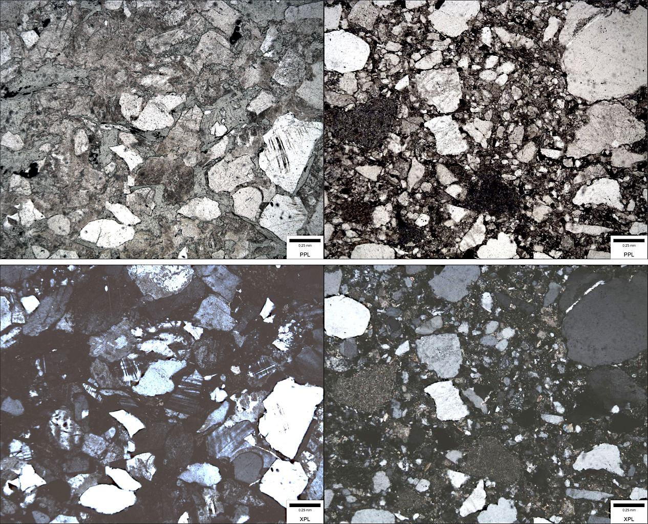
Greywacke or graywacke ( ) is a variety of sandstone generally characterized by its hardness (6–7 on Mohs scale), dark color, and Sorting (sediment), poorly sorted angular grains of quartz, feldspar, and small rock fragments or sand-size Lithic fragment (geology), lithic fragments set in a compact, clay-fine matrix. It is a texturally immature sedimentary rock generally found in Paleozoic Stratum, strata. The larger Particle size (grain size), grains can be sand- to gravel-sized, and Matrix (geology), matrix materials generally constitute more than 15% of the rock by volume. Formation The origin of greywacke was unknown until turbidity currents and turbidites were understood, since, according to the normal laws of sedimentation, gravel, sand and mud should not be laid down together. Geologists now attribute its formation to submarine avalanches or strong turbidity currents. These actions churn sediment and cause mixed-sediment slurries, in which the resulting deposits may ex ... [...More Info...] [...Related Items...] OR: [Wikipedia] [Google] [Baidu] |
Rubble Stone
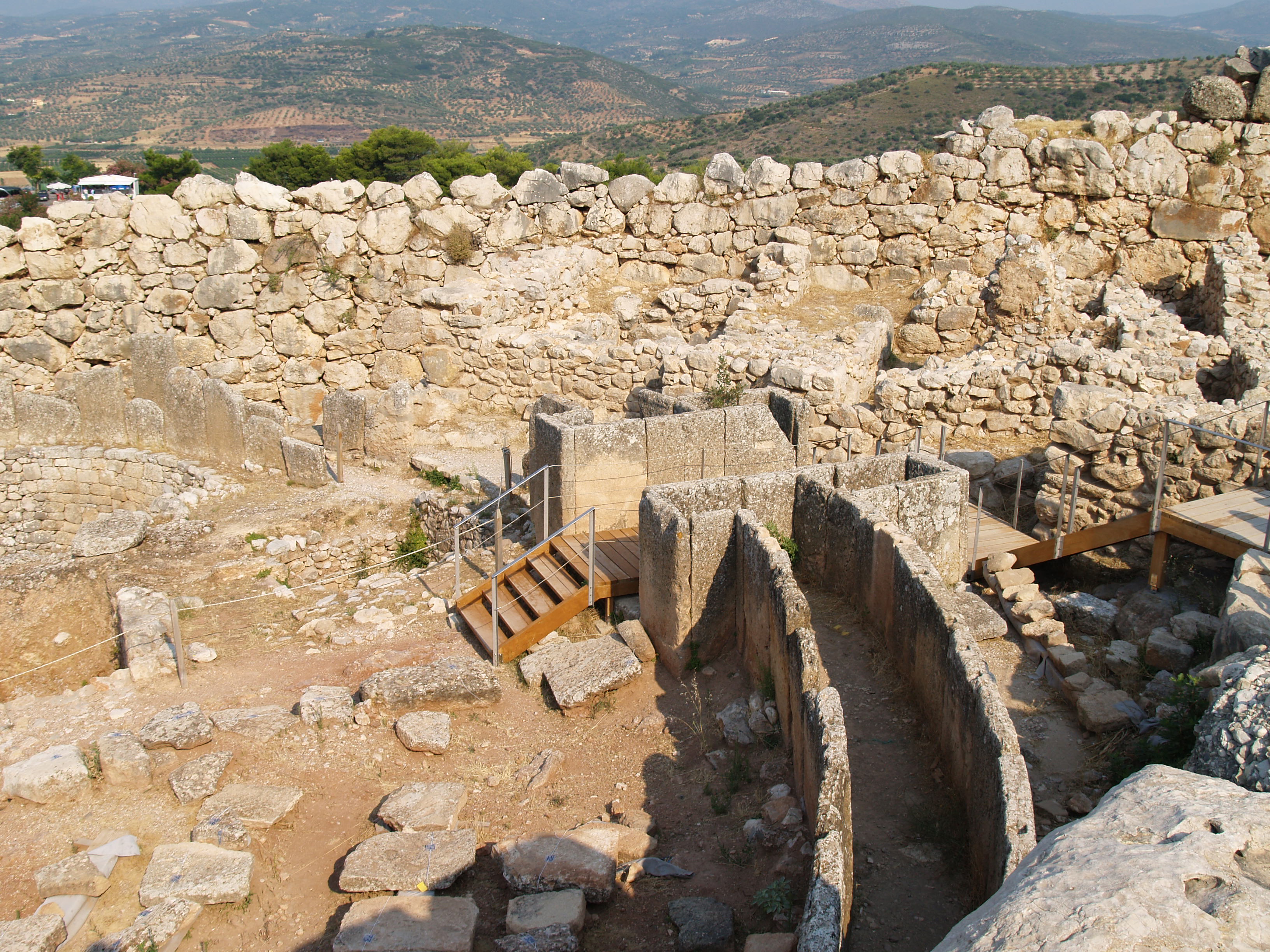
Rubble masonry or rubble stone is rough, uneven building stone not laid in regular courses. It may fill the core of a wall which is faced with unit masonry such as brick or ashlar. Some medieval cathedral walls have outer shells of ashlar with an inner backfill of mortarless rubble and dirt. Square rubble masonry Square rubble masonry consists of stones that are dressed (squared on all joints and beds) before laying, set in mortar, and make up the outer surface of a wall. History Irregular rubble, or sack, masonry evolved from embankments covered with boards, stones or bricks. That outer surface was used to give the embankment greater strength and make it more difficult for enemies to climb. The Sadd el-Khafara dam, in Wadi Al-Garawi near Helwan in Egypt, which is 14 meters high and built in rubble masonry, dates back to 2900–2600 BC The Greeks called the construction technique emplekton and made particular use of it in the construction of the defensive walls of t ... [...More Info...] [...Related Items...] OR: [Wikipedia] [Google] [Baidu] |
Intze Principle
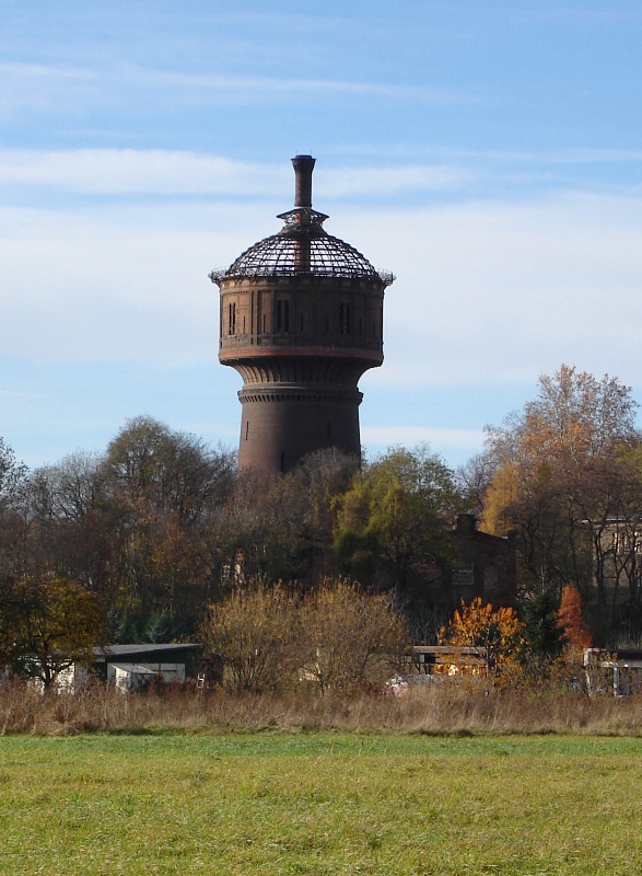
The Intze Principle () is a name given to two engineering principles, both named after the hydraulic engineer, Otto Intze, (1843–1904). In the one case, the ''Intze Principle'' relates to a type of water tower; in the other, a type of dam. Intze Principle for water towers A water tower built in accordance with the Intze Principle has a brick shaft on which the water tank sits. The base of the tank is fixed with a ring anchor (''Ringanker'') made of iron or steel, so that only vertical, not horizontal, forces are transmitted to the tower. Due to the lack of horizontal forces the tower shaft does not need to be quite as solidly built. This type of design was used in Germany between 1885 and 1905. File:Intze 1.jpg, Intze 1 tank File:Intze 1b.jpg, Intze 1 tank with inside cylinder File:Intze 2.jpg, Intze 2 tank Intze Principle for dams The method of dam construction invented by Otto Intze was used in Germany at the end of the 19th and beginning of the 20th centuries. A dam bui ... [...More Info...] [...Related Items...] OR: [Wikipedia] [Google] [Baidu] |


