|
Upper Thracian Plain
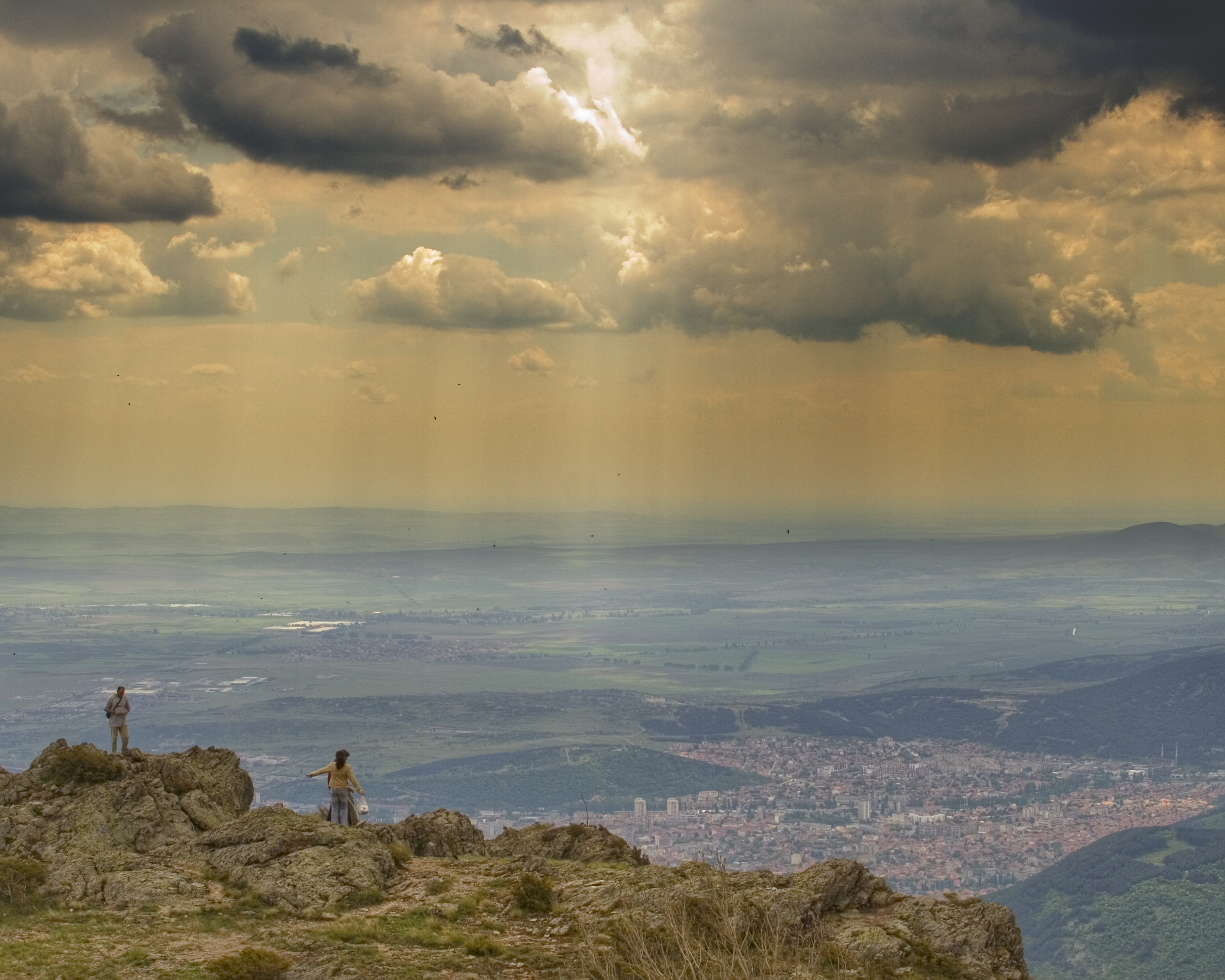
The Upper Thracian Plain (, ''Gornotrakiyska nizina'') constitutes the northern part of the historical region of Thrace. It is located in southern Bulgaria, between Sredna Gora mountains to the north and west, a secondary mountain chain parallel to the main Balkan Mountains; the Rhodopes, Sakar and Strandzha to the south; and the Black Sea to the east. A fertile agricultural region, the Upper Thracian Plain proper has an area of and an average elevation of . The plain is part of Northern Thrace. The climate is transitional continental. The highest temperature recorded in Bulgaria occurred here: it was at Sadovo in 1916. The precipitation is a year. Important rivers are the Maritsa and its tributaries, Arda, Tundzha, Stryama, Topolnitsa, and Vacha. Important cities include Plovdiv, Burgas, Stara Zagora, Pazardzhik, Asenovgrad, Haskovo, Yambol and Sliven Sliven ( ) is List of cities and towns in Bulgaria, the eighth-largest city in Bulgaria and the administrative and i ... [...More Info...] [...Related Items...] OR: [Wikipedia] [Google] [Baidu] |
Topolnitsa River
The Topolnitsa ( ) is a river in southern Bulgaria, an important left tributary of the Maritsa. The river's name is derived from the Bulgarian word топола, ''topola'' (" poplar"). Reaching length of 155 km, the Topolnitsa is the fourth longest river in the Maritsa drainage, following the Tundzha (390 km), the Arda (290 km) and the Ergene (281 km). Geography The river takes its source at an altitude of 1,413 m near the eastern foothills of the summit of Bich (1,449 m) in the mountain range of Sredna Gora. In its first 12 km, the Topolnitsa flows eastwards in a deep forested valley. It then turns in northern direction, flows through the Koprivshtitsa Valley and enters another deep valley. Following the Koprivshtitsa Railway Station, the river turns west-southwest and enters the Zlatitsa–Pirdop Valley, where its flows through its southern areas. At the village of Petrich, it turns southwards and flows through a deep valley dividing two m ... [...More Info...] [...Related Items...] OR: [Wikipedia] [Google] [Baidu] |
Landforms Of Haskovo Province
A landform is a land feature on the solid surface of the Earth or other planetary body. They may be natural or may be anthropogenic (caused or influenced by human activity). Landforms together make up a given terrain, and their arrangement in the landscape is known as topography. Landforms include hills, mountains, canyons, and valleys, as well as shoreline features such as bays, peninsulas, and seas, including submerged features such as mid-ocean ridges, volcanoes, and the great oceanic basins. Physical characteristics Landforms are categorized by characteristic physical attributes such as elevation, slope, orientation, structure stratification, rock exposure, and soil type. Gross physical features or landforms include intuitive elements such as berms, cliffs, hills, mounds, peninsulas, ridges, rivers, valleys, volcanoes, and numerous other structural and size-scaled (e.g. ponds vs. lakes, hills vs. mountains) elements including various kinds of inland and oceanic waterbodi ... [...More Info...] [...Related Items...] OR: [Wikipedia] [Google] [Baidu] |
Plains Of Bulgaria
In geography, a plain, commonly known as flatland, is a flat expanse of land that generally does not change much in elevation, and is primarily treeless. Plains occur as lowlands along valleys or at the base of mountains, as coastal plains, and as plateaus or uplands. Plains are one of the major landforms on earth, being present on all continents and covering more than one-third of the world's land area. Plains in many areas are important for agriculture. There are various types of plains and biomes on them. Description A plain or flatland is a flat expanse of land with a layer of grass that generally does not change much in elevation, and is primarily treeless. Plains occur as lowlands along valleys or at the base of mountains, as coastal plains, and as plateaus or uplands. Plains are one of the major landforms on earth, where they are present on all continents, and cover more than one-third of the world's land area. In a valley, a plain is enclosed on two sides, but in ot ... [...More Info...] [...Related Items...] OR: [Wikipedia] [Google] [Baidu] |
Geography Of Thrace
Geography (from Ancient Greek ; combining 'Earth' and 'write', literally 'Earth writing') is the study of the lands, features, inhabitants, and phenomena of Earth. Geography is an all-encompassing discipline that seeks an understanding of Earth and its human and natural complexities—not merely where objects are, but also how they have changed and come to be. While geography is specific to Earth, many concepts can be applied more broadly to other celestial bodies in the field of planetary science. Geography has been called "a bridge between natural science and social science disciplines." Origins of many of the concepts in geography can be traced to Greek Eratosthenes of Cyrene, who may have coined the term "geographia" (). The first recorded use of the word γεωγραφία was as the title of a book by Greek scholar Claudius Ptolemy (100 – 170 AD). This work created the so-called "Ptolemaic tradition" of geography, which included "Ptolemaic cartographic theory." ... [...More Info...] [...Related Items...] OR: [Wikipedia] [Google] [Baidu] |
Sliven
Sliven ( ) is List of cities and towns in Bulgaria, the eighth-largest city in Bulgaria and the administrative and industrial centre of Sliven Province and municipality in Northern Thrace. It is situated in the Sliven Valley at the foothills of the Balkan Mountains. Sliven is famous for its heroic Hajduk, Haiduts who fought against the Ottoman Turks in the 19th century and is known as the "City of the 100 voyvoda, Voyvodi", a Voyvoda being a leader of Haiduts. The famous rocky massif Sinite Kamani (Сините камъни, "The Blue Rocks") and the associated Sinite Kamani Nature Park, the fresh air and the mineral springs at Slivenski Mineralni Bani offer diverse opportunities for leisure and tourism. Investors are exploring the opportunity to use the local wind (Bora) for the production of electricity. Another point of interest and a major symbol of the city as featured on the coat of arms, is the more than thousand-year-old Stariyat Briast (Старият Бряст, "The Ol ... [...More Info...] [...Related Items...] OR: [Wikipedia] [Google] [Baidu] |
Yambol
Yambol ( ) is a city in Southeastern Bulgaria and administrative centre of Yambol Province. It lies on both banks of the Tundzha river in the historical region of Thrace. It is occasionally spelled ''Jambol''. Yambol is the administrative center of two municipalities. One is Yambol Municipality, which covers the city itself, and the other is Tundzha Municipality, which covers the rural areas around Yambol. History The area surrounding Yambol has been inhabited since the Neolithic Era. The ancient Thracian royal city of Kabile or Kabyle (), dating from the end of the 2nd millennium BCE, was located 10 km from current-day Yambol. It was one of Thracians' most important cities and contained one of the kings' palaces. The city was conquered by King Philip II of Macedon in 341 BCE and was re-established as an Ancient Greek ''polis''.An Inventory of Archaic and Classical Poleis: An Investigation Conducted by The Copenhagen Polis Centre for the Danish National Research Fou ... [...More Info...] [...Related Items...] OR: [Wikipedia] [Google] [Baidu] |
Haskovo
Haskovo ( ) is a city in the region of Northern Thrace in southern Bulgaria and the administrative centre of the Haskovo Province, not far from the borders with Greece and Turkey. According to Operative Program Regional Development of Bulgaria, the urban area of Haskovo is the seventh largest in Bulgaria and has a population of 184,731 inhabitants. Haskovo has a population of 64,564 as of 2022, making it Bulgaria's 12th largest city. The first settlement found in Haskovo is from circa 5000 BC. Haskovo celebrated its 1,000th anniversary as a town in 1985. To mark the event, a new clock tower was erected in the centre of the town. Haskovo Cove in Greenwich Island in the South Shetland Islands, Antarctica, is named after the city of Haskovo. Geography Climate Haskovo has a temperate climate (Köppen: Cfa, Trewartha: Do), closely bordring on a continental climate, with an average yearly temperature of about . Winters are cold, albeit not as snowy as the western and northern pa ... [...More Info...] [...Related Items...] OR: [Wikipedia] [Google] [Baidu] |
Asenovgrad
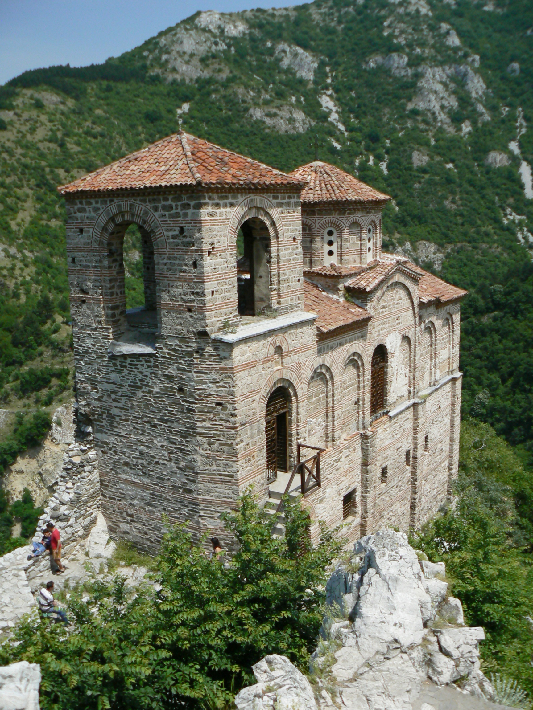
Asenovgrad ( ) is a town in central southern Bulgaria, part of Plovdiv Province. It is the largest town in Bulgaria that is not a province center. Previously known as ''Stanimaka'' (; ), it was renamed in 1934 after the 13th-century tsar Ivan Asen II. Asenovgrad also includes the districts of Gorni Voden and Dolni Voden, which until 1986 were separate villages. According to the census data of 2021, the population of the city is 47 815 people. Above the town are the remains of the Asen Fortress, an old fortress that was strengthened under Tsar Ivan Asen II and turned into an important military post in the defense of the southern borders of the Second Bulgarian Kingdom.The city is known for its many churches, monasteries and chapels and is often called Little Jerusalem. It is also known as the "City of Bridal Gowns" because of the large number of ateliers and shops for wedding dresses and accessories. The majority of Asenovgrad residents are Bulgarians, with representatives of th ... [...More Info...] [...Related Items...] OR: [Wikipedia] [Google] [Baidu] |
Pazardzhik
Pazardzhik ( ) is a city situated along the banks of the Maritsa river, southern Bulgaria. It is the centre of Pazardzhik Province and Pazardzhik Municipality. It is located in the Upper Thracian Plain and in the Pazardzhik-Plovdiv Field, a subregion of the plains. It is west of Plovdiv, about , southeast of Sofia and from Burgas. The population is 55,220, as it has been growing around from the end of the 19th century to the end of the 20th century. The city reached its highest milestone, exceeding 80,000. Due to poor economic performance in Bulgaria during the 1990s and early 2000s, emigration of Bulgarians began, which affected Pazardzhik as well. The history of Pazardzhik can be traced back to the 7th millennium BC, with early civilisations being brought from Asia-Minor. They were agro-pastralists and settled near Maritsa, Pazardzhik and Sinitovo. A clay idol named the Pazardzhik Venus was founded in 1872. The Drougoubitai tribe settled in the early Middle Ages. Many ... [...More Info...] [...Related Items...] OR: [Wikipedia] [Google] [Baidu] |
Stara Zagora
Stara Zagora (, ) is a city in Bulgaria, and the administrative capital of Stara Zagora Province. It is located in the Upper Thracian Plain, near the cities of Kazanlak, Plovdiv, and Sliven. Its population is 121,582 making it the sixth largest city of Bulgaria. The city has had different names previously, including ''Beroe, Borui, Irenepolis, Eski Zagra, Augusta Traiana,'' etc. The earliest traces of civilisation date back to the 7th millennium BC. Some scholars believe that the ancient Thracian city of Beroe was located on the present site of Stara Zagora. In 1968, Neolithic dwellings from the mid-6th millennium BC were discovered in the town, which are the best preserved and richest collection in Europe of its kind and have been turned into a museum. A high density of Neolithic and Chalcolithic settlements has been identified by researchers and a ritual structure nearly 8,000 years old has also been discovered. The first copper factory in Europe and a large ore mining centre w ... [...More Info...] [...Related Items...] OR: [Wikipedia] [Google] [Baidu] |


