|
Untersiggenthal
Untersiggenthal is a municipality in the district of Baden in the canton of Aargau in Switzerland, located in the Limmat Valley (German: ''Limmattal''). Geography Untersiggenthal has an area, , of . Of this area, 33.2% is used for agricultural purposes, while 44.3% is forested. Of the rest of the land, 18.8% is settled (buildings or roads) and the remainder (3.8%) is non-productive (rivers or lakes). Coat of arms The blazon of the municipal coat of arms is ''Gules two Keys in saltire Argent.'' Demographics Untersiggenthal has a population (as of ) of . , 26.1% of the population was made up of foreign nationals.Statistical Department of Canton Aargau -Bereich 01 -Bevölkerung accessed 20 January 2010 Over the last 10 years the population has grown at a rate of 10.9%. Most of the population () speaks ... [...More Info...] [...Related Items...] OR: [Wikipedia] [Google] [Baidu] |
Baden (district, Aargau)
Baden District is a district in the canton of Aargau, Switzerland. The district capital is the town of Baden and the largest municipality is Wettingen, located in the Limmat Valley (German: ''Limmattal''). The district has a total of 26 municipalities, an area of , and a population () of about 138,000. Geography Baden District has an area, , of . Of this area, 37.1% is used for agricultural purposes, while 38.5% is forested. The rest of the land, (22.4%) is settled. History The district is descended from the historic County of Baden, which was dissolved in 1798 upon the creation of the short-lived Canton of Baden (1798–1803). The first district of Baden existed during the existence of that canton, covering part of the former county, and upon its merging into the canton of Aargau, the contemporary district was formed. Upon the merging of the canton of Baden into Aargau in 1803, the district gained the municipalities of Würenlingen, Bellikon, Künten, Remetschwil, Stett ... [...More Info...] [...Related Items...] OR: [Wikipedia] [Google] [Baidu] |
Brugg
, neighboring_municipalities = Gebenstorf, Habsburg, Hausen, Holderbank, Lupfig, Riniken, Rüfenach, Schinznach, Untersiggenthal, Villigen, Villnachern, Veltheim, Windisch , twintowns = Rottweil (Germany) , website = www.stadt-brugg.ch Brugg (sometimes written as Brugg AG in order to distinguish it from other ''Brugg''s) is a Swiss municipality and a town in the canton of Aargau and is the seat of the district of the same name. The town is located at the confluence of the Aare, Reuss, and Limmat, with the Aare flowing through its medieval part. It is located approximately from the cantonal capital of Aarau; from Zürich; and about from Basel. Brugg is the Swiss German term for bridge (german: Brücke). This is an allusion to the purpose of the medieval town's establishment under the Habsburgs, as the town is located at the narrowest point on the Aare in the Swiss midlands. The Habsburgs’ oldest known residence is locat ... [...More Info...] [...Related Items...] OR: [Wikipedia] [Google] [Baidu] |
Ruine Freudenau
Freudenau Castle is a ruined fort in the municipality of Untersiggenthal of the Canton of Aargau in Switzerland. It is a Swiss heritage site of national significance. See also * List of castles in Switzerland This list includes castles and fortresses in Switzerland. Entries list the name and location of the castle, fortress or ruins in each Canton in Switzerland. Aargau Appenzell Ausserrhoden Appenzell Innerrhoden Basel-Landschaft, Bas ... References Cultural property of national significance in the canton of Lucerne Castles in Aargau {{Switzerland-castle-stub ... [...More Info...] [...Related Items...] OR: [Wikipedia] [Google] [Baidu] |
Limmat Valley
The Limmat Valley (German: ''Limmattal'') is a river valley and a region in the cantons of Zürich and Aargau in Switzerland. Geography The Limmat () is a long river located in the cantons of Zürich (ZH) and Aargau (AG). It is the continuation of the Linth, and is known as the Limmat from the point of effluence from Lake Zürich, in the city of Zürich, flowing in northwesterly direction to the Aare. The confluence is located northeast of the small town of Brugg (AG), shortly after the mouth of the Reuss, and shortly before the Aare joins the Rhine. The confluence of the three rivers Aare, Reuss and Limmat is known as ''Wasserschloss''. Nature In 1930 the government of the canton of Zurich set the remains of the original Limmat riverside meadows and floodplains near Dietikon (''Dietiker Altläufe'') under conservation, as well in 2005 the floodplains (''Dietiker Schachen'') near Wettingen accommodating more than 150 plant species and rare species as common kingf ... [...More Info...] [...Related Items...] OR: [Wikipedia] [Google] [Baidu] |
Gebenstorf
Gebenstorf is a municipality in the district of Baden in the canton of Aargau in Switzerland. History Gebenstorf is first mentioned in 1247 as ''Gobistorf''. From 1415 until 1798 it was a township in the county of Baden. The historical borders have been retained in the modern municipality. Geography Gebenstorf has an area, , of . Of this area, 29% is used for agricultural purposes, while 41.6% is forested. Of the rest of the land, 24.4% is settled (buildings or roads) and the remainder (5%) is non-productive (rivers or lakes). The municipality is located in the Baden district, at the confluence of the Reuss and Limmat rivers into the Aare river. It consists of the villages of Gebenstorf and Vogelsang and the hamlets of Reuss, Petersberg and Schwabenberg. In 1884, the village of Wil and the factory center of Turgi separated from Gebenstorf to form an independent municipality. Coat of arms The blazon of the municipal coat of arms is ''Per pale Gules a Sickle Argent an ... [...More Info...] [...Related Items...] OR: [Wikipedia] [Google] [Baidu] |
Obersiggenthal
Obersiggenthal is a municipality located in the Limmat Valley, within the district of Baden, in the canton of Aargau, Switzerland. History Obersiggenthal is first mentioned around 1303-08 as ''Sikental''. Geography Obersiggenthal has an area, , of . Of this area, 35.6% is used for agricultural purposes, while 43.5% is forested. Of the rest of the land, 19.6% is settled (buildings or roads) and the remainder (1.3%) is non-productive (rivers or lakes). The municipality is located in the Baden district, between the ''Siggenberg'' and the Limmat river. It consists of the villages of Nussbaumen, Kirchdorf and Rieden and the hamlets of Tromsberg, Ebnet and Hertenstein. Coat of arms The blazon of the municipal coat of arms is ''Gules two Keys Argent in saltire crossed by the third double warded in Pale.'' Demographics Obersiggenthal has a population (as of ) of . , 32.1% of the population was made up of foreign nationals. [...More Info...] [...Related Items...] OR: [Wikipedia] [Google] [Baidu] |
Turgi
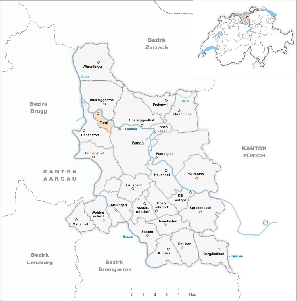
Turgi is a municipality in the district of Baden in the canton of Aargau in Switzerland, located in the Limmat Valley (German: ''Limmattal''). In 2002, Turgi received the Wakker Prize for the preservation of its architectural heritage. History In 1883 the municipality was created when it separated from Gebenstorf.Amtliches Gemeindeverzeichnis der Schweiz published by the Swiss Federal Statistical Office accessed 14 January 2010 Geography  Turgi has an area, , of . Of this area, 17.6% is used for agricultural purposes, while 35.9% is forested. Of the rest of the la ...
[...More Info...] [...Related Items...] OR: [Wikipedia] [Google] [Baidu] |
Villigen
Villigen is a municipality in the district of Brugg in the canton of Aargau in Switzerland. In January 2006, Villigen incorporated the former municipality of Stilli. The Paul Scherrer Institute is primarily located in Villigen, although part is across the Aare river in Würenlingen. Geography Villigen has an area, , of . Of this area, or 34.6% is used for agricultural purposes, while or 49.0% is forested. Of the rest of the land, or 13.5% is settled (buildings or roads), or 2.8% is either rivers or lakes.Swiss Federal Statistical Office-Land Use Statistics 2009 data accessed 25 March 2010 Of the built up area, housing and buildings made up 5.7% and transportation infrastructure made up 2.7%. Power and water infrastructure as well as other spe ... [...More Info...] [...Related Items...] OR: [Wikipedia] [Google] [Baidu] |
Würenlingen
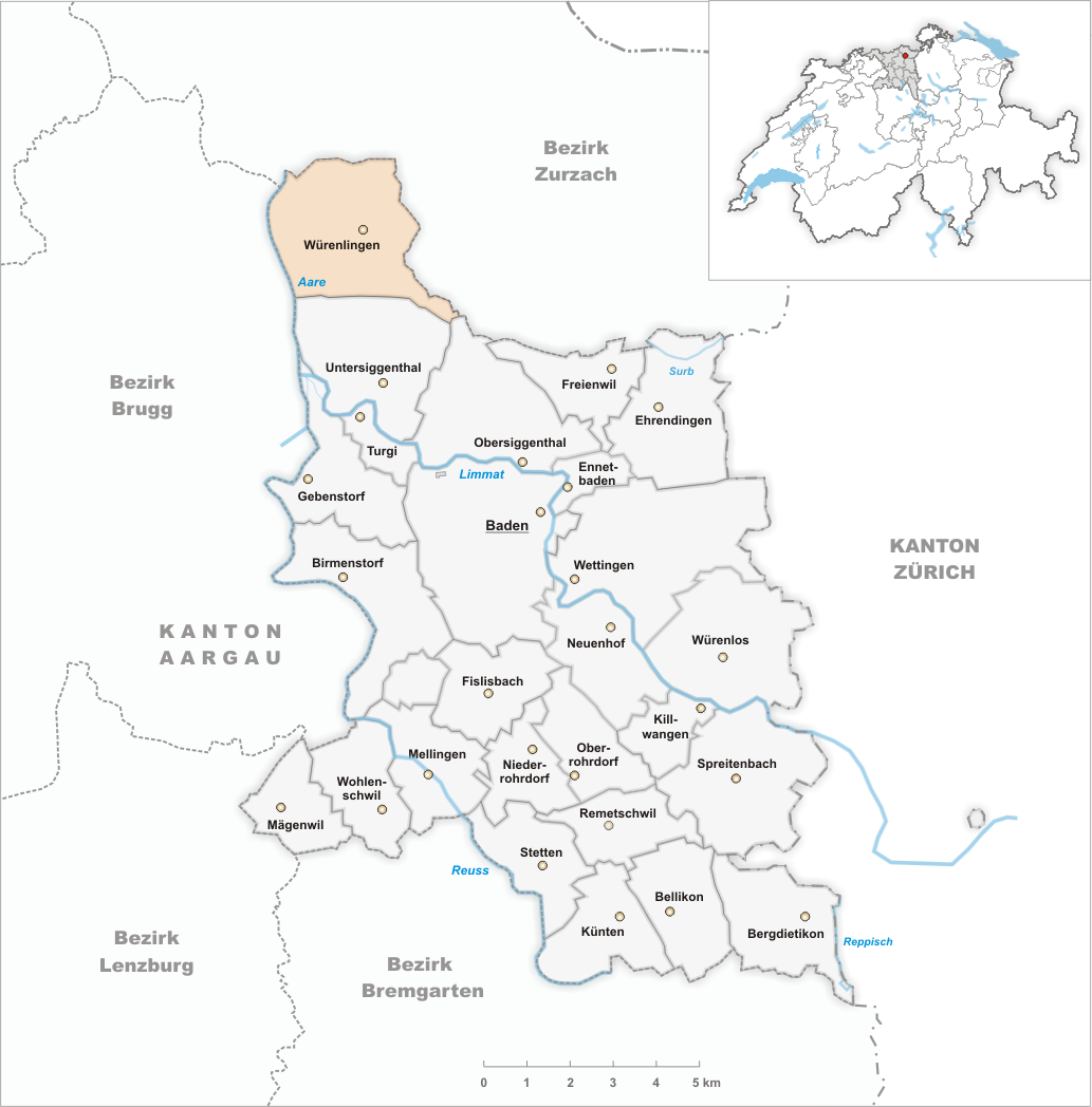
Würenlingen is a municipality in the district of Baden in the canton of Aargau in Switzerland. Geography Würenlingen has an area, , of . Of this area, 29.2% is used for agricultural purposes, while 49.4% is forested. Of the rest of the land, 19.2% is settled (buildings or roads) and the remainder (2.2%) is non-productive (rivers or lakes). Coat of arms The blazon of the municipal coat of arms is ''Argent an Acorn slipped and leaved of two Vert.'' Demographics Würenlingen had a population (on ) of . In 2008, 21.6% of the population were made foreign nationals.Statistical Department of Canton Aargau -Bereich 01 -Bevölkerung Retrieved 20 January 2010 Over the last 10 years the population has grown at a rate of 9%. Most of the population in 2000, speaks German (88.5%), with Albanian being second most ... [...More Info...] [...Related Items...] OR: [Wikipedia] [Google] [Baidu] |
Fachhochschule
A ''Fachhochschule'' (; plural ''Fachhochschulen''), abbreviated FH, is a university of applied sciences (UAS), in other words a German tertiary education institution that provides professional education in many applied sciences and applied arts, such as engineering, technology, business, architecture, design, and industrial design. ''Fachhochschulen'' were first founded in Germany and were later adopted in Austria, Liechtenstein, Switzerland, Cyprus, and Greece. An increasing number of ''Fachhochschulen'' are abbreviated as ''Hochschule'', the generic term in Germany for institutions awarding academic degrees in higher education, or expanded as ''Hochschule für angewandte Wissenschaften (HAW)'', the German translation of "universities of applied sciences", which are primarily designed with a focus on teaching professional skills. Swiss law calls ''Fachhochschulen'' and universities "separate but equal". Due to the Bologna process, universities and ''Fachhochschulen'' awa ... [...More Info...] [...Related Items...] OR: [Wikipedia] [Google] [Baidu] |
Ruine Freudenau 01
Ruine may refer to: *Alter Der Ruine, a power noise group from Tucson, Arizona *La Grande Ruine (3,765 m), a mountain in the French Alps, in the Massif des Écrins *Of Ruine or Some Blazing Starre, an album by English band Current 93 A number of castles in Austria and Germany are designated "Ruine": *Ruine Diepoldsburg, a castle in Baden-Wuerttemberg *Ruine Hauenstein, a castle in Styria, Austria *Ruine Henneberg, a castle in Styria, Austria *Ruine Hohenwang, a castle in Styria, Austria *Ruine Kalsberg, a castle in Styria, Austria *Ruine Katsch, a castle in Styria, Austria * Ruine Klöch, a castle in Styria, Austria *Ruine Liechtenstein, a castle in Styria, Austria *Ruine Ligist, a castle in Styria, Austria *Ruine Neudeck, a castle in Styria, Austria *Ruine Neu-Leonroth, a castle in Styria, Austria *Ruine Nollig, a ruined castle above the village of Lorch in Hesse, Germany *Ruine Offenburg, a castle in Styria, Austria *Ruine Pernegg, a castle in Styria, Austria *Ruine Pflinds ... [...More Info...] [...Related Items...] OR: [Wikipedia] [Google] [Baidu] |
Neolithic
The Neolithic period, or New Stone Age, is an Old World archaeological period and the final division of the Stone Age. It saw the Neolithic Revolution, a wide-ranging set of developments that appear to have arisen independently in several parts of the world. This "Neolithic package" included the introduction of farming, domestication of animals, and change from a hunter-gatherer lifestyle to one of settlement. It began about 12,000 years ago when farming appeared in the Epipalaeolithic Near East, and later in other parts of the world. The Neolithic lasted in the Near East until the transitional period of the Chalcolithic (Copper Age) from about 6,500 years ago (4500 BC), marked by the development of metallurgy, leading up to the Bronze Age and Iron Age. In other places the Neolithic followed the Mesolithic (Middle Stone Age) and then lasted until later. In Ancient Egypt, the Neolithic lasted until the Protodynastic period, 3150 BC.Karin Sowada and Peter Grave. Egypt in ... [...More Info...] [...Related Items...] OR: [Wikipedia] [Google] [Baidu] |


