|
University Endowment Lands
The University Endowment Lands (UEL) is an unincorporated area in Metro Vancouver, British Columbia, Canada. It lies west of Vancouver and east of the University of British Columbia's Point Grey campus lands. Most of the University Endowment Lands' land area is occupied by Pacific Spirit Regional Park, a large nature park operated by Metro Vancouver, with the remainder consisting of residential and commercial developments. As an unincorporated area, the University Endowment Lands is not part of any municipality. Instead, it is directly administered by the provincial government in the name of the Minister of Municipal Affairs under the terms of the University Endowment Land Act. For the purposes of representation on the Metro Vancouver Board of Directors, the UEL is part of Electoral Area A. In a 1995 referendum, UEL residents voted against establishing a municipal governing body. Geography The University Endowment Lands are located immediately west of the City of Vancouver ... [...More Info...] [...Related Items...] OR: [Wikipedia] [Google] [Baidu] |
British Columbia
British Columbia is the westernmost Provinces and territories of Canada, province of Canada. Situated in the Pacific Northwest between the Pacific Ocean and the Rocky Mountains, the province has a diverse geography, with rugged landscapes that include rocky coastlines, sandy beaches, forests, lakes, mountains, inland deserts and grassy plains. British Columbia borders the province of Alberta to the east; the territories of Yukon and Northwest Territories to the north; the U.S. states of Washington (state), Washington, Idaho and Montana to the south, and Alaska to the northwest. With an estimated population of over 5.7million as of 2025, it is Canada's Population of Canada by province and territory, third-most populous province. The capital of British Columbia is Victoria, British Columbia, Victoria, while the province's largest city is Vancouver. Vancouver and its suburbs together make up List of census metropolitan areas and agglomerations in Canada, the third-largest metropolit ... [...More Info...] [...Related Items...] OR: [Wikipedia] [Google] [Baidu] |
Pacific Spirit Regional Park
Pacific Spirit Regional Park is a park located in Point Grey to the west of the city of Vancouver, British Columbia. Located in Electoral Area A, it surrounds the University of British Columbia Vancouver campus on the shores of Georgia Strait in the Pacific Ocean. Most of Pacific Spirit Park is in the University Endowment Lands, though a portion of the shoreline around Wreck Beach is not part of any organized local government. Pacific Spirit Park was formerly owned by the British Columbia government, which in 1989 transferred the lands to Metro Vancouver to operate as a park. The park contains over 55 km of walking/hiking trails, 34 km of which are designated multi-use and available for cycling and horseback riding as well. There is a Park Centre which is located on W 16th Avenue. In 1975, BC Parks established ninety hectare The hectare (; SI symbol: ha) is a non-SI metric unit of area equal to a square with 100-metre sides (1 hm2), that is, square metres (), and ... [...More Info...] [...Related Items...] OR: [Wikipedia] [Google] [Baidu] |
2021 Canadian Census
The 2021 Canadian census was a detailed enumeration of the Canada, Canadian population with a reference date of May 11, 2021. It follows the 2016 Canadian census, which recorded a population of 35,151,728. The overall response rate was 98%, which is slightly lower than the response rate for the 2016 census. It recorded a population of 36,991,981, a 5.2% increase from 2016. It will be succeeded by 2026 Canadian census, Canada's 2026 census. Planning Consultation on census program content was from September 11 to December 8, 2017. The census was conducted by Statistics Canada, and was contactless as a result of the COVID-19 pandemic in Canada. The agency had considered delaying the census until 2022. About 900 supervisors and 31,000 field enumerators were hired to conduct the door-to-door survey of individuals and households who had not completed the census questionnaire by late May or early June. Canvassing agents wore masks and maintained a physical distance to comply with COV ... [...More Info...] [...Related Items...] OR: [Wikipedia] [Google] [Baidu] |
Bill Vander Zalm
William Nicholas Vander Zalm (born Wilhelmus Nicholaas Theodore Marie van der Zalm; May 29, 1934) is a Dutch-born Canadian businessman and politician who served as the 28th premier of British Columbia and leader of the British Columbia Social Credit Party from 1986 to 1991. He was a member of the Legislative Assembly (MLA) of British Columbia, representing the riding of Surrey from 1975 to 1983, and the riding of Richmond from 1986 to 1991. Early life Wilhelmus Nicholaas Theodore Marie van der Zalm was born and raised in Noordwijkerhout, Netherlands. He emigrated to Canada after World War II, settling in the Fraser Valley in 1947. After completing high school, he sold tulip bulbs and ultimately established himself in the gardening business. He moved to Surrey after marrying Lillian Mihalic, and purchased a nursery. Early political career Vander Zalm was elected an alderman of Surrey in 1965, and served as the municipality's mayor from 1969 to 1975. His tenure was marked b ... [...More Info...] [...Related Items...] OR: [Wikipedia] [Google] [Baidu] |
Great Depression
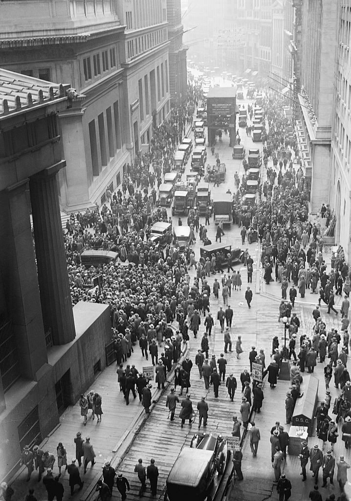
The Great Depression was a severe global economic downturn from 1929 to 1939. The period was characterized by high rates of unemployment and poverty, drastic reductions in industrial production and international trade, and widespread bank and business failures around the world. The economic contagion began in 1929 in the United States, the largest economy in the world, with the devastating Wall Street stock market crash of October 1929 often considered the beginning of the Depression. Among the countries with the most unemployed were the U.S., the United Kingdom, and Weimar Republic, Germany. The Depression was preceded by a period of industrial growth and social development known as the "Roaring Twenties". Much of the profit generated by the boom was invested in speculation, such as on the stock market, contributing to growing Wealth inequality in the United States, wealth inequality. Banks were subject to laissez-faire, minimal regulation, resulting in loose lending and wides ... [...More Info...] [...Related Items...] OR: [Wikipedia] [Google] [Baidu] |
British Columbia Interior
The British Columbia Interior, popularly referred to as the BC Interior or simply the Interior, is a geographic region of the Canadian province of British Columbia. While the exact boundaries are variously defined, the British Columbia Interior is generally defined to include the 14 regional districts that do not have coastline along the Pacific Ocean or Salish Sea, and are not part of the Lower Mainland. Other boundaries may exclude parts of or even entire regional districts, or expand the definition to include the regional districts of Fraser Valley, Squamish–Lillooet, and Kitimat–Stikine. Home to just under 1 million people, the British Columbia Interior's 14 regional districts contain many cities, towns, airports, and associated regional, provincial, and national parks connected by the province's highway and railway network. The region is known for the complexity of its landforms, the result of millions of years of tectonic plate movements. The ecology of the reg ... [...More Info...] [...Related Items...] OR: [Wikipedia] [Google] [Baidu] |
Cariboo
The Cariboo is an intermontane region of British Columbia, Canada, centered on a plateau stretching from Fraser Canyon to the Cariboo Mountains. The name is a reference to the Caribou (North America), caribou that were once abundant in the region. The Cariboo was the first region of the interior north of the lower Fraser River and its canyon to be settled by non-indigenous people, and played an important part in the early history of the colony and province. The boundaries of the Cariboo proper in its historical sense are debatable, but its original meaning was the region north of the forks of the Quesnel River and the low mountainous basins between the mouth of that river on the Fraser at the city of Quesnel and the northward end of the Cariboo Mountains, an area that is mostly in the Quesnel Highland and focused on several now-famous gold-bearing creeks near the head of the Willow River (British Columbia), Willow River. The richest of them all, Williams Creek (British Columbia ... [...More Info...] [...Related Items...] OR: [Wikipedia] [Google] [Baidu] |
Urban Heat Island
Urban areas usually experience the urban heat island (UHI) effect; that is, they are significantly warmer than surrounding rural areas. The temperature difference is usually larger at night than during the day, and is most apparent when winds are weak, under Block (meteorology), block conditions, noticeably during the summer and winter. The main cause of the UHI effect is from the modification of land surfaces, while waste heat generated by energy usage is a secondary contributor. Urban areas occupy about 0.5% of the Earth's land surface but host more than half of the world's population. As a population center grows, it tends to expand its area and increase its average temperature. The term heat island is also used; the term can be used to refer to any area that is relatively hotter than the surrounding, but generally refers to human-disturbed areas. Monthly precipitation (meteorology), rainfall is greater downwind of cities, partially due to the UHI. Increases in heat within urb ... [...More Info...] [...Related Items...] OR: [Wikipedia] [Google] [Baidu] |
English Bay (Vancouver)
English Bay is an open bay northwest of the Burrard Peninsula in British Columbia, Canada, extending from the headland between Siwash Rock and Prospect Point on Vancouver's Downtown peninsula in the northeast, to the northwestern tip of Point Grey in the southwest. The bay encompasses the coasts of Stanley Park, the West End, Kitsilano, West Point Grey and the University Endowment Lands, and makes up the southeastern portion of the outer Burrard Inlet. There is a narrow inlet named False Creek at its eastern end. Attractions English Bay Beach, near the city's West End residential neighbourhood, is a popular sunbathing, swimming, and sunset-watching beach in the downtown Vancouver area. Other downtown beaches facing English Bay include Sunset Beach, Second Beach, and Third Beach. Along the south shore of the bay lie Kitsilano Beach, Jericho Beach, Locarno Beach, and the Spanish Banks beaches, while on the North Shore are Ambleside Beach and various smaller cove- ... [...More Info...] [...Related Items...] OR: [Wikipedia] [Google] [Baidu] |
Howe Sound
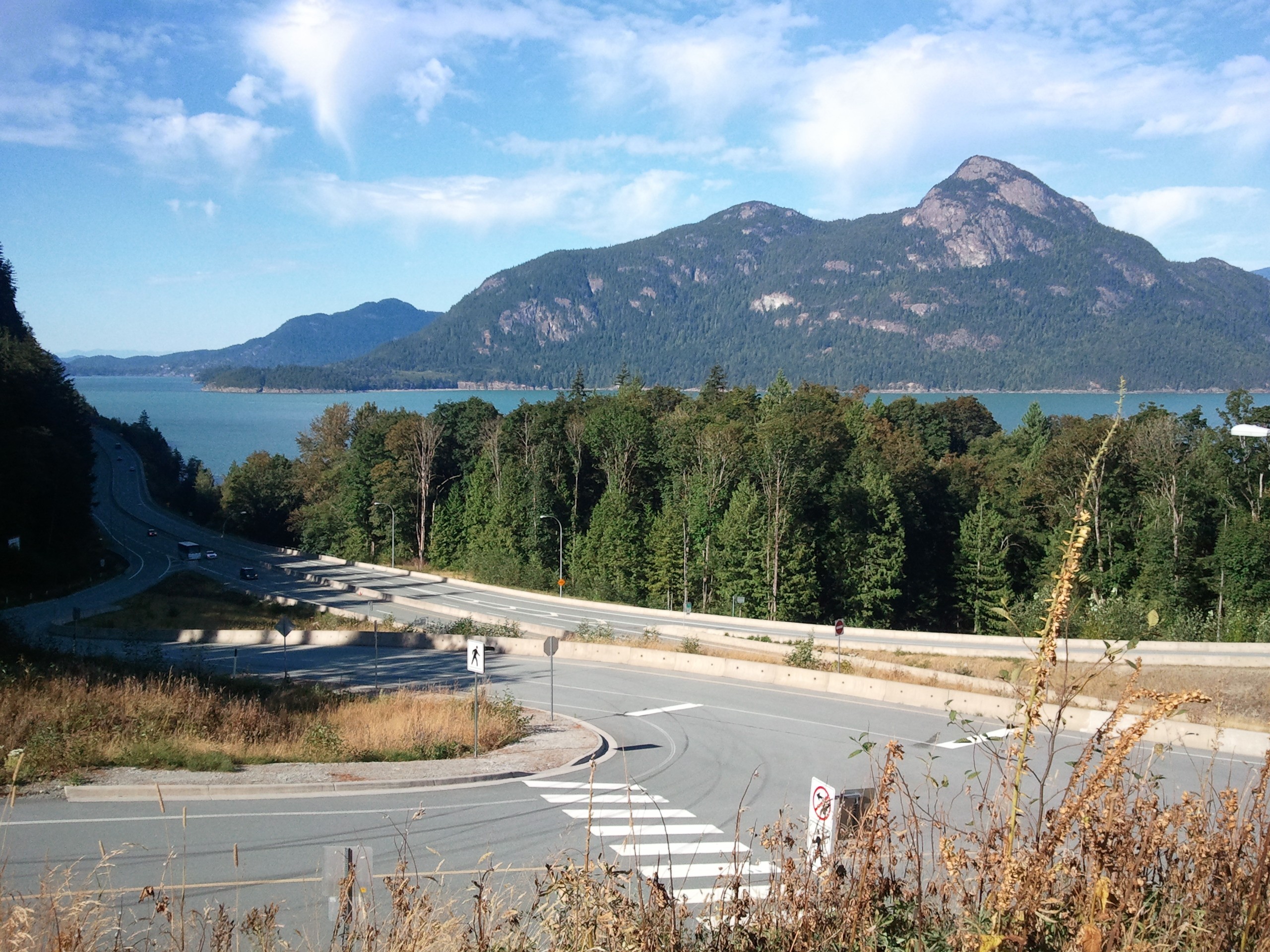
Howe Sound (, ) is a roughly triangular sound (geography), sound, that joins a network of fjords situated immediately northwest of Vancouver, British Columbia, Canada. It was designated as a UNESCO Biosphere Reserve in 2021. Geography Howe Sound's mouth at the Strait of Georgia is situated between West Vancouver and the Sunshine Coast (British Columbia), Sunshine Coast. The sound is triangular, opening to the southwest into the Strait of Georgia, and extends northeast to its head at Squamish, British Columbia, Squamish. There are several islands in the sound, three of which are large and mountainous in their own right. The steep-sided mainland shores funnel the breezes as the daily thermals build the wind to or more at the northern end of the sound on a typical summer day. A small outcrop of volcanic rock is located on the eastern shore of Howe Sound called the Watts Point volcanic centre. History The history of Howe Sound begins with the Indigenous people, the Squamish people, ... [...More Info...] [...Related Items...] OR: [Wikipedia] [Google] [Baidu] |
Strait Of Georgia
The Strait of Georgia () or the Georgia Strait is an arm of the Salish Sea between Vancouver Island and the extreme southwestern mainland coast of British Columbia, Canada, and the extreme northwestern mainland coast of Washington, United States. It is approximately long and varies in width from .Environmental History and Features of Puget Sound , NOAA-NWFSC Along with the and , it is a constituent part of the |


