|
Ugarchin
Ugarchin ( ) is a town located along the Kamenitsa river in the Lovech Province in central northern Bulgaria. It is the administrative centre of the homonymous Ugarchin Municipality. The town is about 30 kilometers away in the west from the main centre of the province (Lovech). As of December 2009, it had a population of 2,832 inhabitants which sunk to 2,354 by end of 2018. Ugarchin is situated in the northern part of the Balkan Mountains at the foot the high peaks and down the river Kamenitsa and its minor tributaries: Lepetora, Sveta, Greshki Dol and others. It is situated in a basin rounded with small hills: Ivan Dyal hill to the south; Visokata Mogila (Chukara) to the east; to the north are Beli Kamak, Sredno Bardo and Zabiti Kamak hills; and to the west are Goli Rat and Chukata. The Ugarchin town holiday takes place every year on 22 March and the traditional Autumn Fair is every 22 September. The President of Bulgaria Georgi Parvanov visited the town of Ugarchin on 22 March ... [...More Info...] [...Related Items...] OR: [Wikipedia] [Google] [Baidu] |
Ugarchin Municipality
Ugarchin Municipality () is a municipality ('' obshtina'') in Lovech Province, Central-North Bulgaria, located from the area of the so-called Fore-Balkan to the Danubian Plain. It is named after its administrative centre - the town of Ugarchin. The municipality embraces a territory of with a population of 7,181 inhabitants, as of December 2009. Settlements # Dragana ( Драгана) # Golets ( Голец) # Kalenik ( Каленик) # Katunets ( Катунец) # Kirchevo ( Кирчево) # Lesidren ( Лесидрен) # Mikre ( Микре) # Orlyane ( Орляне) # Slavshtitsa ( Славщица) # Sopot ( Сопот) # Ugarchin ( Угърчин) Demography The following table shows the change of the population during the last four decades. Religion According to the latest Bulgarian census of 2011, the religious composition, among those who answered the optional question on religious identification, was the following: See also *Province ... [...More Info...] [...Related Items...] OR: [Wikipedia] [Google] [Baidu] |
Ugarchin Point
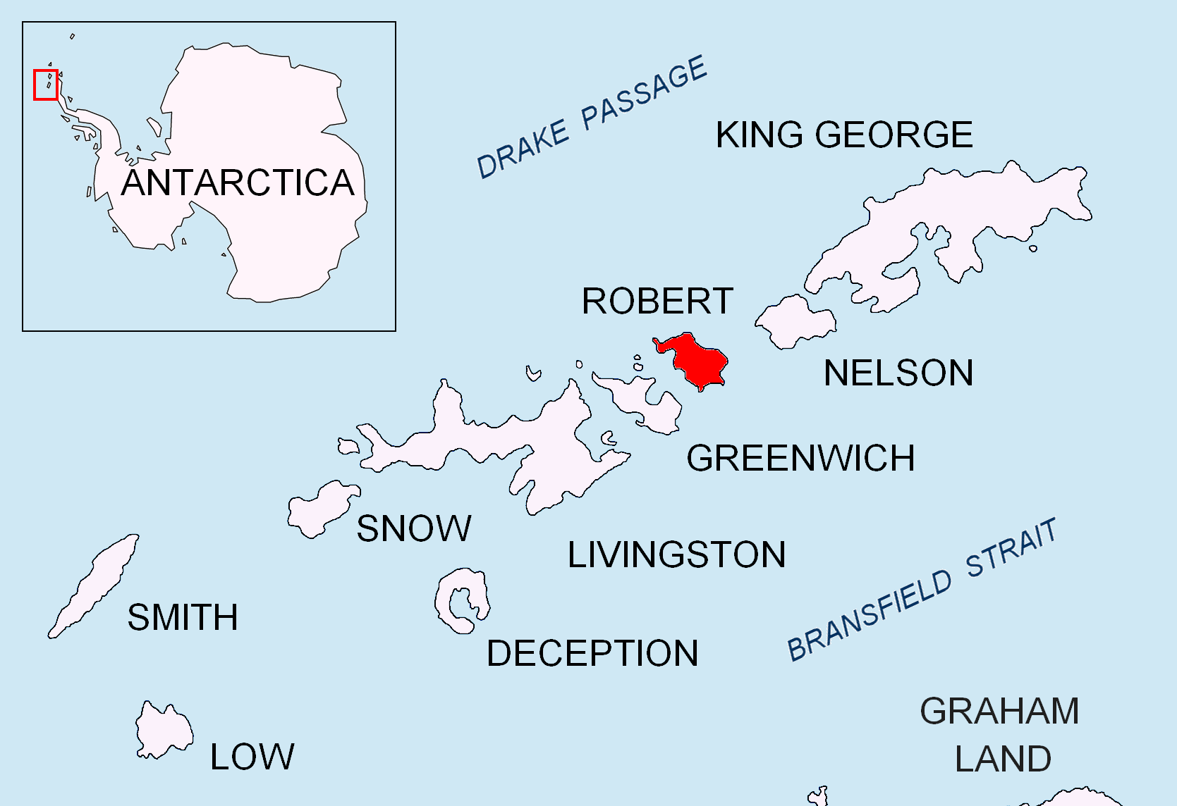
Ugarchin Point (, ‘Nos Ugarchin’ \'nos u-g&r-'chin\) is a point on the northeast coast of Robert Island in the South Shetland Islands, Antarctica projecting 300 m into Nelson Strait. Named after the town of Ugarchin in northern Bulgaria. Location The point is located at , which is 4.7 km west of Smirnenski Point and 4.2 km southeast of Newell Point (Bulgarian early mapping in 2009). Maps * L.L. Ivanov. Antarctica: Livingston Island and Greenwich, Robert, Snow and Smith Islands. Scale 1:120000 topographic map. Troyan: Manfred Wörner Foundation, 2010. (First edition 2009. ) Antarctic Digital Database (ADD).Scale 1:250000 topographic map of Antarctica. Scientific Committee on Antarctic Research (SCAR). Since 1993, regularly updated. References Ugarchin Point.SCAR Composite Antarctic Gazetteer Bulgarian Antarctic Gazetteer.Antarctic Place-names Commission The Antarctic Place-names Commission was established by the Bulgarian Antarctic Institute in 1994, and s ... [...More Info...] [...Related Items...] OR: [Wikipedia] [Google] [Baidu] |
Lovech Province
Lovech Province (, former name Okrug, Lovech okrug) is one of the 28 provinces of Bulgaria, lying at the northern centre of the country. It is named after its main city: Lovech. As of December 2009, the population of the area was151,153.Bulgarian National Statistical Institute - Bulgarian provinces and municipalities in 2009 /ref> /ref> It covers a total area of approximately 4,129 square km and includes 8 municipalities. Geography and Nature The r ...[...More Info...] [...Related Items...] OR: [Wikipedia] [Google] [Baidu] |
Katunets
Katunets () is a Bulgarian village in the Municipality of Ugarchin, northern Bulgaria. The village is situated near the towns of Lovech and Pleven. The 43,5 km long Katuneshka river flows through the village. History The first document mentioning Katunets is from the Turkish registries in 1840. According to the newspaper "Stremlenie" from 25 February 1912 the population of the village was around 2 750 people at the time. Katunets has soldiers from the Balkan War, the First World War and the second World war. The village school opened in 1914. A book about the village - "Katunets, small encyclopedia" was released by Vutzo Bobenski and Petar Bobenski. Famous people *Veselin Toetev Belomazhov — Bulgarian ambassador to Denmark Denmark is a Nordic countries, Nordic country in Northern Europe. It is the metropole and most populous constituent of the Kingdom of Denmark,, . also known as the Danish Realm, a constitutionally unitary state that includes the Autonomous a ... [...More Info...] [...Related Items...] OR: [Wikipedia] [Google] [Baidu] |
Municipalities Of Bulgaria
The 28 Provinces of Bulgaria, provinces of Bulgaria are divided into 265 municipalities (община, ''obshtina''). Municipalities typically comprise multiple towns, villages and settlements and are governed by a mayor who is elected by popular majority vote for a four-year term, and a municipal council which is elected using proportional representation for a four-year term. The creation of new municipalities requires that they must be created in a territory with a population of at least 6,000 and created around a designated settlement. They must also be named after the settlement that serves as the territory's administrative center, among other criteria. The council of a municipality is further permitted to create administrative subdivisions: mayoralties (''kmetstvo''), settlements (''naseleno myasto''), and wards or quarters (''rayon''). Mayoralties are overseen by elected mayors and typically comprises one or more villages or towns; they must contain a population of at leas ... [...More Info...] [...Related Items...] OR: [Wikipedia] [Google] [Baidu] |
Countries Of The World
The following is a list providing an overview of sovereign states around the world with information on their status and recognition of their sovereignty. The 205 listed states can be divided into three categories based on membership within the United Nations System: 193 member states of the United Nations, UN member states, two United Nations General Assembly observers#Current non-member observers, UN General Assembly non-member observer states, and ten other states. The ''sovereignty dispute'' column indicates states having undisputed sovereignty (188 states, of which there are 187 UN member states and one UN General Assembly non-member observer state), states having disputed sovereignty (15 states, of which there are six UN member states, one UN General Assembly non-member observer state, and eight de facto states), and states having a political status of the Cook Islands and Niue, special political status (two states, both in associated state, free association with New ... [...More Info...] [...Related Items...] OR: [Wikipedia] [Google] [Baidu] |
Georgi Parvanov
Georgi Sedefchov Parvanov (, ) (born 28 June 1957) is a Bulgarian historian and politician who was President of Bulgaria from 2002 to 2012. He was elected after defeating incumbent Petar Stoyanov in the second round of the November 2001 presidential election. He took office on 22 January 2002. He was reelected in a landslide victory in 2006, becoming the first Bulgarian president to serve two terms. Parvanov supported Bulgaria's entry into NATO and the European Union. According to Bulgarian law, a Bulgarian president is not allowed to be a member of a political party, thus Parvanov left the Bulgarian Socialist Party (BSP) after his election in 2001. Although he identified as a socialist, Parvanov often called himself a 'social president'. After completing his second term as president, Parvanov returned to the Socialist Party, prompting a dispute over the party leadership. In January 2014 Parvanov restarted his Alternative for Bulgarian Revival (ABV) project, announcing he w ... [...More Info...] [...Related Items...] OR: [Wikipedia] [Google] [Baidu] |
South Shetland Islands
The South Shetland Islands are a group of List of Antarctic and subantarctic islands, Antarctic islands located in the Drake Passage with a total area of . They lie about north of the Antarctic Peninsula, and between southwest of the nearest point of the South Orkney Islands. By the Antarctic Treaty System, Antarctic Treaty of 1959, the islands' sovereignty is neither recognized nor disputed by the signatories. According to British government language on the topic, "the whole of Antarctica is protected in the interests of peace and science." The islands have been claimed by three countries, beginning with the United Kingdom since 1908 (since 1962 as part of the equally unrecognized British Antarctic Territory). The islands are also claimed by the governments of Chile (since 1940, as part of the Antártica Chilena province), and by Argentina (since 1943, as part of Argentine Antarctica, Tierra del Fuego Province, Argentina, Tierra del Fuego Province). Several countries ... [...More Info...] [...Related Items...] OR: [Wikipedia] [Google] [Baidu] |
Robert Island
Robert Island or Mitchells Island or Polotsk Island or Roberts Island is an island An island or isle is a piece of land, distinct from a continent, completely surrounded by water. There are continental islands, which were formed by being split from a continent by plate tectonics, and oceanic islands, which have never been ... long and wide, situated between Nelson Island (South Shetland Islands), Nelson Island and Greenwich Island in the South Shetland Islands, Antarctica. Robert Island is located at . Its surface area is . The name "Robert Island" dates back to around 1821 and is now established in international usage. Much of the Coppermine Peninsula in the west of the island is made up by a perched strandflat erosion surface, surface that was at sea level in the past. Captain Richard Fildes may have named Robert Island for his brig . Fildes was seal hunting, sealing in the South Shetlands in 1821–1822 until ice destroyed his vessel in March 1822. Fildes Strait is ... [...More Info...] [...Related Items...] OR: [Wikipedia] [Google] [Baidu] |
Balkan Mountains
The Balkan mountain range is located in the eastern part of the Balkan peninsula in Southeast Europe, Southeastern Europe. It is conventionally taken to begin at the peak of Vrashka Chuka on the border between Bulgaria and Serbia. It then runs for about , first in a south-easterly direction along the border, then eastward across Bulgaria, forming a natural barrier between the northern and southern halves of the country, before finally reaching the Black Sea at Cape Emine. The mountains reach their highest point with Botev Peak at . In much of the central and eastern sections, the summit forms the watershed between the drainage basins of the Black Sea and the Aegean Sea, Aegean. A prominent gap in the mountains is formed by the predominantly narrow Iskar Gorge, a few miles north of the Bulgarian capital, Sofia. The karst relief determines the large number of caves, including Magura Cave, Magura, featuring the most important and extended European post-Palaeolithic cave painting, Le ... [...More Info...] [...Related Items...] OR: [Wikipedia] [Google] [Baidu] |
Lovech
Lovech (, ) is a city in north-central Bulgaria. It is the administrative centre of the Lovech Province and of the subordinate Lovech Municipality. The city is located about northeast from the capital city of Sofia. Near Lovech are the towns of Pleven, Troyan and Teteven. Name The name is possibly derived from the Slavic root ''lov'', "hunting" + the Slavic suffix ''-ech''. Geography Lovech is situated in the Forebalkan area of northern Bulgaria, on both sides of the river Osam, and unifies both mountainous and plain relief. The eastern part of the town is surrounded by a 250 m high plateau, where the largest park in Lovech, ''Stratesh'', is located, and the southwestern part is surrounded by the hills ''Hisarya'' and ''Bash Bunar''. In the northwest the relief gradually changes to the plains of the neighbouring Pleven Province. The average altitude of Lovech is about 200 m above mean sea level. The highest point of the town is ''Akbair Hill'' at 450 m. In Stratesh Park ... [...More Info...] [...Related Items...] OR: [Wikipedia] [Google] [Baidu] |


