|
USS Wakulla (AOG-44)
USS ''Wakulla'' (AOG-44) was a ''Mettawee''-class gasoline tanker acquired by the U.S. Navy for the dangerous task of transporting gasoline to warships in the fleet, and to remote Navy stations. The second ship to be named ''Wakulla'', ''AOG-44'' was laid down on 31 October 1944 under a Maritime Commission contract (MC hull 2070) at Bayonne, New Jersey, by the East Coast Shipyards, Inc.; launched on 17 December 1944; sponsored by Mrs. J. I. McClain; accepted by the Navy on 15 January 1945; converted to naval use at the builder's yard; and commissioned at the New York Navy Yard on 3 February 1945. Named in honor of Wakulla County, FL. World War II service Following trials in Long Island Sound and shakedown out of Norfolk, Virginia, ''Wakulla'' got underway on 23 March 1945 for the Netherlands West Indies. She loaded a full cargo of diesel oil and high-octane gasoline at Aruba and shaped course westward. Pacific Ocean operations She passed through the Panama Canal fro ... [...More Info...] [...Related Items...] OR: [Wikipedia] [Google] [Baidu] |
Wakulla River
The Wakulla River is an U.S. Geological Survey. National Hydrography Dataset high-resolution flowline dataThe National Map accessed April 18, 2011 river in Wakulla County, Florida. It carries the outflow from Wakulla Springs, site of the Edward Ball Wakulla Springs State Park, to the St. Marks River north of the Gulf of Mexico. Its drainage basin extends northwest into Leon County, including Munson Slough, and may extend as far north as the Georgia border.Boning, Charles R. 2007. ''Florida's Rivers''. Sarasota, Florida: Pineapple Press, Inc. The river, due to its clear, clean water, was once used to film underwater scenes during north Florida's cinema boom. Movies filmed in Wakulla Springs and river include several Tarzan movies, starring Johnny Weissmuller, and '' Creature from the Black Lagoon''. Etymology The name ''Wakulla'' is from ''Guacara''. ''Guacara'' is a Spanish phonetic spelling of an original Indian name, and ''Wakulla'' is a Muskhogean pronunciation o ... [...More Info...] [...Related Items...] OR: [Wikipedia] [Google] [Baidu] |
Diesel Oil
Diesel fuel , also called diesel oil, is any liquid fuel specifically designed for use in a diesel engine, a type of internal combustion engine in which fuel ignition takes place without a spark as a result of compression of the inlet air and then injection of fuel. Therefore, diesel fuel needs good compression ignition characteristics. The most common type of diesel fuel is a specific fractional distillation, fractional distillate of petroleum fuel oil, but alternatives that are not derived from petroleum, such as biodiesel, biomass to liquid (BTL) or gas to liquid (GTL) diesel are increasingly being developed and adopted. To distinguish these types, petroleum-derived diesel is sometimes called petrodiesel in some academic circles. In many countries, diesel fuel is standardised. For example, in the European Union, the standard for diesel fuel is EN 590. Diesel fuel has many colloquial names; most commonly, it is simply referred to as ''diesel''. In the United Kingdom, diesel f ... [...More Info...] [...Related Items...] OR: [Wikipedia] [Google] [Baidu] |
14th Naval District
The naval district was a U.S. Navy military and administrative command ashore. Apart from Naval District Washington, the Districts were disestablished and renamed United States Navy Regions, Navy Regions about 1999, and are now under Commander, Navy Installations Command (United States), Commander, Naval Installations Command (CNIC). They were established for the purpose of decentralizing the Navy Department's functions with respect to the control of the coastwise sea communications and the shore activities outside the department proper, and for the further purpose of centralizing under one command: : (a) For military coordination, all naval activities, and : (b) For administrative coordination, all naval activities with specific exceptions, within the district and the waters thereof. The limits of the naval districts are laid down in article 1480, United States Navy Regulations, Navy Regulations. Those limits extend to seaward so far as to include the coastwise sea lanes (art. ... [...More Info...] [...Related Items...] OR: [Wikipedia] [Google] [Baidu] |
ServRon
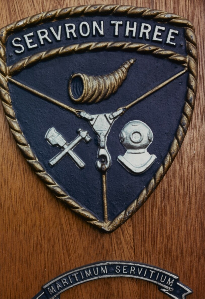
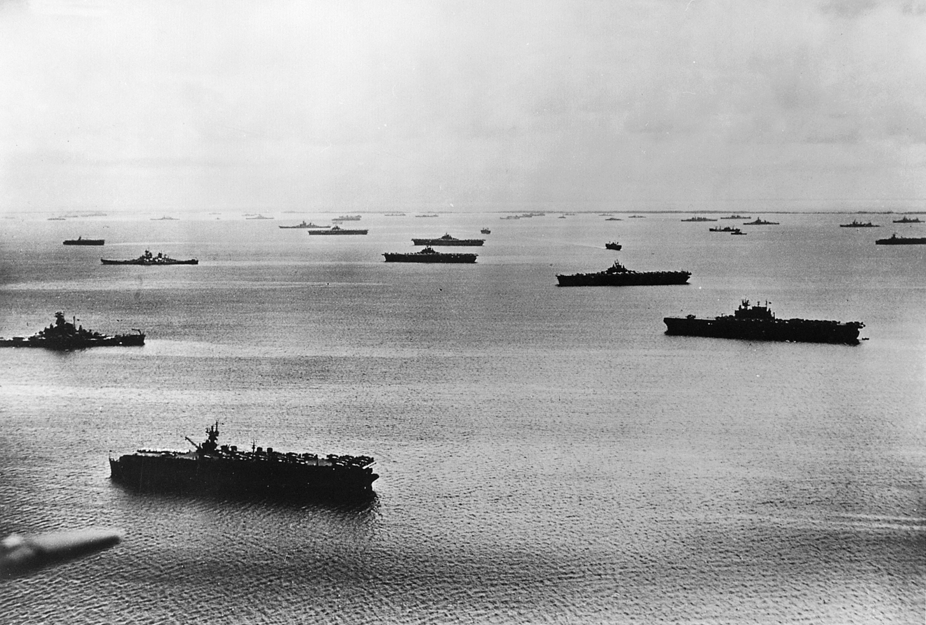
A Service Squadron (ServRon) was a United States Navy squadron that supported fleet combat ships and US Navy Auxiliary ships. Service Squadrons were used by the US Navy from their inception in 1943 to as late as the early 1980s. At the time of their inception during the Second World War they allowed the US Navy to operate across the vast reaches of the Pacific Ocean for extended periods of time. Service Squadrons created temporary forward bases to allow the naval squadrons to spend less time in transit and more time in the area of combat. Ulithi, a small volcanic atoll in the central Pacific, is an example of a site converted for use as a forward base of supply. Service Squadrons essentially created a major naval base near the area of operation. With naval bases like, Naval Base Ulithi, to refit, repair and resupply, many ships were able to deploy and operate in the western Pacific for a year or more without returning to a major port facility. Among the vessels operating in servi ... [...More Info...] [...Related Items...] OR: [Wikipedia] [Google] [Baidu] |
Rudder
A rudder is a primary control surface used to steer a ship, boat, submarine, hovercraft, aircraft, or other vehicle that moves through a fluid medium (generally air or water). On an aircraft the rudder is used primarily to counter adverse yaw and p-factor and is not the primary control used to turn the airplane. A rudder operates by redirecting the fluid past the hull or fuselage, thus imparting a turning or yawing motion to the craft. In basic form, a rudder is a flat plane or sheet of material attached with hinges to the craft's stern, tail, or after end. Often rudders are shaped so as to minimize hydrodynamic or aerodynamic drag. On simple watercraft, a tiller—essentially, a stick or pole acting as a lever arm—may be attached to the top of the rudder to allow it to be turned by a helmsman. In larger vessels, cables, pushrods, or hydraulics may be used to link rudders to steering wheels. In typical aircraft, the rudder is operated by pedals via mechanical linkages or hydr ... [...More Info...] [...Related Items...] OR: [Wikipedia] [Google] [Baidu] |
Johnston Island
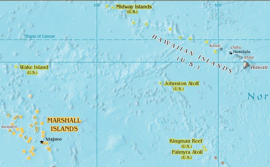
Johnston Atoll is an unincorporated territory of the United States, currently administered by the United States Fish and Wildlife Service (USFWS). Johnston Atoll is a National Wildlife Refuge and part of the Pacific Remote Islands Marine National Monument. It is closed to public entry, and limited access for management needs is only granted by Letter of Authorization from the United States Air Force and a Special Use Permit from the U.S. Fish and Wildlife Service. For nearly 70 years, the isolated atoll was under the control of the U.S. military. During that time, it was variously used as a naval refueling depot, an airbase, a testing site for nuclear and biological weapons, a secret missile base, and a site for the storage and disposal of chemical weapons and Agent Orange. Those activities left the area environmentally contaminated, and monitoring continues. The island is home to thriving communities of nesting seabirds and has significant marine biodiversity. USFWS teams car ... [...More Info...] [...Related Items...] OR: [Wikipedia] [Google] [Baidu] |
Phoenix Islands
The Phoenix Islands, or Rawaki, are a group of eight atolls and two submerged coral reefs that lie east of the Gilbert Islands and west of the Line Islands in the central Pacific Ocean, north of Samoa. They are part of the Republic of Kiribati. Their combined land area is . The only island of any commercial importance is Canton Island (also called Abariringa). The other islands are Enderbury, Rawaki (formerly Phoenix), Manra (formerly Sydney), Birnie, McKean, Nikumaroro (formerly Gardner), and Orona (formerly Hull). The Phoenix Islands Protected Area, established in 2008, is one of the world's largest protected areas, and is home to about 120 species of coral and more than 500 species of fish. All of the Phoenix Islands are uninhabited, except for a few families who live on Kanton Island. At various times in history, the Phoenix Islands have been considered to be part of the Gilberts Island group (which itself was sometimes known as the ''Kingsmill'' island group). Geograph ... [...More Info...] [...Related Items...] OR: [Wikipedia] [Google] [Baidu] |
Canton Island
Canton Island (also known as Kanton or Abariringa), previously known as Mary Island, Mary Balcout's Island or Swallow Island, is the largest, northernmost, and , the sole inhabited island of the Phoenix Islands, in the Republic of Kiribati. It is an atoll located in the South Pacific Ocean roughly halfway between Hawaii and Fiji. The island is a narrow ribbon of land around a lagoon; an area of . Canton's closest neighbour is the uninhabited Enderbury Island, west-southwest. The capital of Kiribati, South Tarawa, lies to the west. , the population was 20, down from 61 in 2000. The island's sole village is called Tebaronga. Kiribati declared the Phoenix Islands Protected Area in 2006, with the park being expanded in 2008. The marine reserve contains eight coral atolls, including Canton. Because it is inhabited, management of Canton Island is described in the Canton Resource Use Sustainability Plan (KRUSP), which covers a radius around the atoll. Over 50% of the island a ... [...More Info...] [...Related Items...] OR: [Wikipedia] [Google] [Baidu] |
Pearl Harbor
Pearl Harbor is an American lagoon harbor on the island of Oahu, Hawaii, west of Honolulu. It was often visited by the Naval fleet of the United States, before it was acquired from the Hawaiian Kingdom by the U.S. with the signing of the Reciprocity Treaty of 1875. Much of the harbor and surrounding lands are now a United States Navy deep-water naval base. It is also the headquarters of the United States Pacific Fleet. The U.S. government first obtained exclusive use of the inlet and the right to maintain a repair and coaling station for ships here in 1887. The surprise attack by the Imperial Japanese Navy on December 7, 1941, led the United States to declare war on the Empire of Japan, making the attack on Pearl Harbor the immediate cause of the United States' entry into World War II. History Pearl Harbor was originally an extensive shallow embayment called ''Wai Momi'' (meaning, “Waters of Pearl”) or ''Puuloa'' (meaning, “long hill”) by the Hawaiians. Puuloa ... [...More Info...] [...Related Items...] OR: [Wikipedia] [Google] [Baidu] |
Service Squadron
A Service Squadron (ServRon) was a United States Navy squadron that supported fleet combat ships and US Navy Auxiliary ships. Service Squadrons were used by the US Navy from their inception in 1943 to as late as the early 1980s. At the time of their inception during the Second World War they allowed the US Navy to operate across the vast reaches of the Pacific Ocean for extended periods of time. Service Squadrons created temporary forward bases to allow the naval squadrons to spend less time in transit and more time in the area of combat. Ulithi, a small volcanic atoll in the central Pacific, is an example of a site converted for use as a forward base of supply. Service Squadrons essentially created a major naval base near the area of operation. With naval bases like, Naval Base Ulithi, to refit, repair and resupply, many ships were able to deploy and operate in the western Pacific for a year or more without returning to a major port facility. Among the vessels operating in serv ... [...More Info...] [...Related Items...] OR: [Wikipedia] [Google] [Baidu] |
Hawaiian Islands
The Hawaiian Islands ( haw, Nā Mokupuni o Hawai‘i) are an archipelago of eight major islands, several atolls, and numerous smaller islets in the North Pacific Ocean, extending some from the island of Hawaii in the south to northernmost Kure Atoll. Formerly the group was known to Europeans and Americans as the Sandwich Islands, a name that James Cook chose in honor of the 4th Earl of Sandwich, the then First Lord of the Admiralty. Cook came across the islands by chance when crossing the Pacific Ocean on his Third Voyage in 1778, on board HMS ''Resolution''; he was later killed on the islands on a return visit. The contemporary name of the islands, dating from the 1840s, is derived from the name of the largest island, Hawaii Island. Hawaii sits on the Pacific Plate and is the only U.S. state that is not geographically connected to North America. It is part of the Polynesia subregion of Oceania. The state of Hawaii occupies the archipelago almost in its entirety (i ... [...More Info...] [...Related Items...] OR: [Wikipedia] [Google] [Baidu] |


