|
USS Redhead (AMS-34)
USS ''Redhead'' (AMS-34/YMS-443) was a built for the United States Navy during World War II. She was the first U.S. Navy ship to be named for the Redhead duck. History ''YMS-443'' was laid down 21 October 1943 by the Hiltebrant Dry Dock Co., Kingston, New York; launched 5 May 1944; and commissioned 15 December 1944. World War II service Following shakedown, ''YMS-443'' operated off the U.S. East Coast until the spring when she transited the Panama Canal 10 April. She served briefly at Pearl Harbor, Eniwetok, and Guam, then steamed further west for her initial combat duty, at Okinawa. Arriving 26 June 1945, she remained in the Ryukyus, engaged in minesweeping and antisubmarine patrol duties, with one interruption for availability in the Philippines until 6 September 1945. Then ordered to Japan, she swept the Kochi Channel, Wakayama and Hiro Wan areas until 12 February 1946 when, with a crew of men eligible for discharge, she departed Kobe for the United States. Arriving ... [...More Info...] [...Related Items...] OR: [Wikipedia] [Google] [Baidu] |
3"/50 Caliber Gun
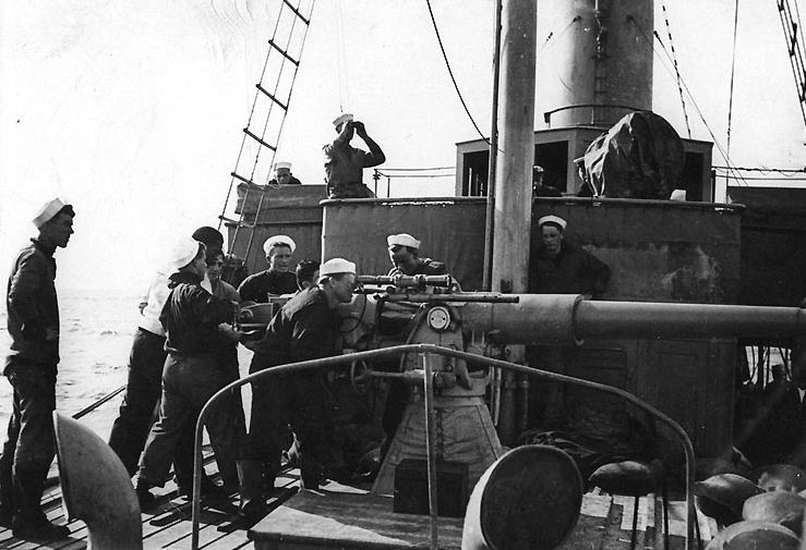
The 3"/50 caliber gun (spoken "three-inch fifty-caliber") in United States naval gun terminology indicates the gun fired a projectile in diameter, and the barrel was 50 calibers long (barrel length is 3 in × 50 = ). Different guns (identified by Mark numbers) of this caliber were used by the U.S. Navy and U.S. Coast Guard from 1890 through to 1994 on a variety of combatant and transport ship classes. The gun is still in use with the Spanish Navy on ''Serviola''-class patrol boats. Early low-angle guns The US Navy's first 3"/50 caliber gun (Mark 2) was an early model with a projectile velocity of per second. Low-angle (single-purpose/non-anti-aircraft) mountings for this gun had a range of 7000 yards at the maximum elevation of 15 degrees. The gun entered service around 1900 with the s, and was also fitted to s. By World War II these guns were found only on a few Coast Guard cutters and Defensively Equipped Merchant Ships. Low-angle 3"/50 caliber guns (Marks 3, ... [...More Info...] [...Related Items...] OR: [Wikipedia] [Google] [Baidu] |
Empire Of Japan
The also known as the Japanese Empire or Imperial Japan, was a historical nation-state and great power that existed from the Meiji Restoration in 1868 until the enactment of the post-World War II 1947 constitution and subsequent formation of modern Japan. It encompassed the Japanese archipelago and several colonies, protectorates, mandates, and other territories. Under the slogans of and following the Boshin War and restoration of power to the Emperor from the Shogun, Japan underwent a period of industrialization and militarization, the Meiji Restoration, which is often regarded as the fastest modernisation of any country to date. All of these aspects contributed to Japan's emergence as a great power and the establishment of a colonial empire following the First Sino-Japanese War, the Boxer Rebellion, the Russo-Japanese War, and World War I. Economic and political turmoil in the 1920s, including the Great Depression, led to the rise of militarism, nat ... [...More Info...] [...Related Items...] OR: [Wikipedia] [Google] [Baidu] |
Malakal
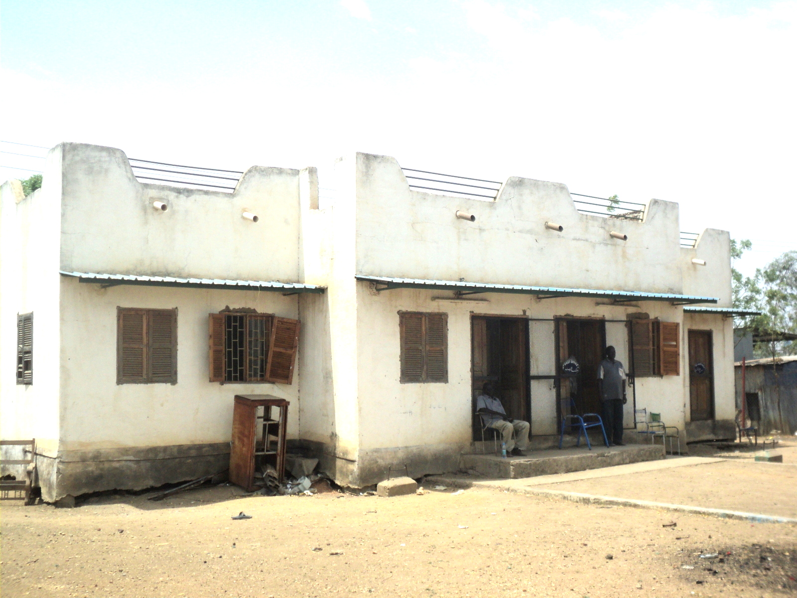
Malakal is a city in South Sudan. It is the capital of Upper Nile State, South Sudan, along the White Nile River. It also serves as the headquarter of Malakal county and it used to be the headquarter of Upper Nile Region from 1970s to late 1990s. Geography The city of Malakal is located along the White Nile, in upper Nile state, South Sudan, close to the International borders with the Republic of Sudan and with Ethiopia.BritannicaJuba britannica.com, USA, accessed on July 7, 2019 The town is located on the banks of the White Nile, just north of its confluence with the Sobat River. This location lies approximately , by road, directly north of Juba, the capital of South Sudan and the largest city in that county. History Historically, Malakal was known as the former Sobat District which was then divided into Balliet and Akoka counties in the Eastern Bank of White Nile and Northern Sobat River. The Malakal town started as a tiny District administrative unit which later expa ... [...More Info...] [...Related Items...] OR: [Wikipedia] [Google] [Baidu] |
Palau
Palau,, officially the Republic of Palau and historically ''Belau'', ''Palaos'' or ''Pelew'', is an island country and microstate in the western Pacific. The nation has approximately 340 islands and connects the western chain of the Caroline Islands with parts of the Federated States of Micronesia. It has a total area of . The most populous island is Koror, home to the country's most populous city of the same name. The capital Ngerulmud is located on the nearby island of Babeldaob, in Melekeok State. Palau shares maritime boundaries with international waters to the north, the Federated States of Micronesia to the east, Indonesia to the south, and the Philippines to the northwest. The country was originally settled approximately 3,000 years ago by migrants from Maritime Southeast Asia. Palau was first drawn on a European map by the Czech missionary Paul Klein based on a description given by a group of Palauans shipwrecked on the Philippine coast on Samar. Pal ... [...More Info...] [...Related Items...] OR: [Wikipedia] [Google] [Baidu] |
Ngulu (Municipality)
Ngulu Atoll is a coral atoll of three islands in the Caroline Islands in the Pacific Ocean, and forms a legislative district in Yap State in the Federated States of Micronesia. Ngulu extends for by with 18 reef segments enclosing a deep central lagoon of . The eastern portion of the reef is deeply submerged. Its total land area of the nine islets is only . Nugulu is located approximately south-southwest of Yap and is the westernmost atoll in the Federated States of Micronesia. The population of Ngulu was 26 in 2000. History First recorded sighting of Ngulu Atoll was by the Spanish navigator Alonso de Arellano on 23 January 1565 on board of the patache ''San Lucas''.Sharp, Andrew ''The discovery of the Pacific Islands'' Oxford, 1960, p.36. In 1802 it was explored by Spanish naval officer Don Juan Lafita. As with all of the Caroline Islands, sovereignty was sold by Spain to the Empire of Germany in 1899. The island came under the control of the Empire of Japan af ... [...More Info...] [...Related Items...] OR: [Wikipedia] [Google] [Baidu] |
Saipan
Saipan ( ch, Sa’ipan, cal, Seipél, formerly in es, Saipán, and in ja, 彩帆島, Saipan-tō) is the largest island of the Northern Mariana Islands, a commonwealth of the United States in the western Pacific Ocean. According to 2020 estimates by the United States Census Bureau, the population of Saipan was 43,385, a decline of 10% from its 2010 count of 48,220. The legislative and executive branches of Commonwealth government are located in the village of Capitol Hill on the island while the judicial branch is headquartered in the village of Susupe. Since the entire island is organized as a single municipality, most publications designate Saipan as the Commonwealth's capital. As of 2015, Saipan's mayor is David M. Apatang and the governor of the Northern Mariana Islands is Ralph Torres. History Prehistory Traces of human settlements on Saipan have been found by archaeologists ranging over 4,000 years, including petroglyphs, ancient Latte Stones, and other artifa ... [...More Info...] [...Related Items...] OR: [Wikipedia] [Google] [Baidu] |
Satawan
Satawan Atoll is an atoll located about southeast of Chuuk Lagoon proper. Geographically it is part of the Nomoi or Mortlock Islands in the Carolines and administratively it is part of Chuuk State in the Federated States of Micronesia. About 3,000 people live on a land area of A Japanese people, Japanese airfield was located on the atoll during World War II. Administrative divisions Satawan Atoll administratively consists of four of the 40 municipalities of Chuuk State, named after the principal islets: *Satowan (Satawan) (east) *Ta (south) *Kuttu (Kutu) (west) * Moch (More) (north) Satowan and Ta municipalities are statistically grouped with the " Lower Mortlocks", and Kuttu and Moch municipalities with the " Mid Mortlocks". Satawan Atoll had a population of 2,935 . Satawan Atoll is located at and has a total area of (including the lagoon), but a land area of only . History Captain James Mortlock was sailing from Port Jackson to Whampoa in ''Young William'' when ... [...More Info...] [...Related Items...] OR: [Wikipedia] [Google] [Baidu] |
Chuuk Lagoon
Chuuk Lagoon, previously Truk Atoll, is an atoll in the central Pacific. It lies about northeast of New Guinea, and is part of Chuuk State within the Federated States of Micronesia (FSM). A protective reef, around, encloses a natural harbour , with an area of . It has a land area of , with a population of 36,158 people and a maximal elevation of . Weno city on Moen Island functions as the atoll's capital and also as the state capital and is the largest city in the FSM with its 13,700 people. Chuuk Lagoon was the Empire of Japan's main naval base in the South Pacific theatre during World War II. It was the site of a major U.S. attack during Operation Hailstone in February 1944, and Operation Inmate, a small assault conducted by British and Canadian forces during June 1945. Name Chuuk means ''mountain'' in the Chuukese language. The lagoon was known mainly as Truk (a mispronunciation of Ruk), until 1990. Other names included Hogoleu, Torres, Ugulat, and Lugulus. ... [...More Info...] [...Related Items...] OR: [Wikipedia] [Google] [Baidu] |
Woleai
Woleai, also known as Oleai, is a coral atoll of twenty-two islands in the western Caroline Islands in the Pacific Ocean, and forms a legislative district in the Yap State in the Federated States of Micronesia and is located approximately west-northwest of Ifalik and northeast of Eauripik. Woleai is also the name of the largest of the islets constituting the atoll, lying to the northeast. The population of the atoll was 1,081 in 2000, on an area of 4.5 km2. Geography The islands constitute a double atoll forming the number eight, with a total length of and up to wide; however, most of reef on the southern rim is submerged or poorly developed. The northern and eastern rims have several relatively large islets. The western lagoon is deeper and larger than its eastern counterpart. Both components are part of the same seamount. The total land area for both components combined is only . History The Austronesian ancestors of the Micronesians who make up the indigenous popu ... [...More Info...] [...Related Items...] OR: [Wikipedia] [Google] [Baidu] |
Johnston Island
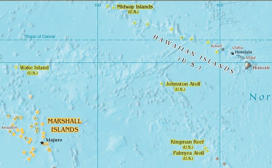
Johnston Atoll is an unincorporated territory of the United States, currently administered by the United States Fish and Wildlife Service (USFWS). Johnston Atoll is a National Wildlife Refuge and part of the Pacific Remote Islands Marine National Monument. It is closed to public entry, and limited access for management needs is only granted by Letter of Authorization from the United States Air Force and a Special Use Permit from the U.S. Fish and Wildlife Service. For nearly 70 years, the isolated atoll was under the control of the U.S. military. During that time, it was variously used as a naval refueling depot, an airbase, a testing site for nuclear and biological weapons, a secret missile base, and a site for the storage and disposal of chemical weapons and Agent Orange. Those activities left the area environmentally contaminated, and monitoring continues. The island is home to thriving communities of nesting seabirds and has significant marine biodiversity. USFWS teams car ... [...More Info...] [...Related Items...] OR: [Wikipedia] [Google] [Baidu] |
San Francisco, California
San Francisco (; Spanish for "Saint Francis"), officially the City and County of San Francisco, is the commercial, financial, and cultural center of Northern California. The city proper is the fourth most populous in California and 17th most populous in the United States, with 815,201 residents as of 2021. It covers a land area of , at the end of the San Francisco Peninsula, making it the second most densely populated large U.S. city after New York City, and the fifth most densely populated U.S. county, behind only four of the five New York City boroughs. Among the 91 U.S. cities proper with over 250,000 residents, San Francisco was ranked first by per capita income (at $160,749) and sixth by aggregate income as of 2021. Colloquial nicknames for San Francisco include ''SF'', ''San Fran'', ''The '', ''Frisco'', and ''Baghdad by the Bay''. San Francisco and the surrounding San Francisco Bay Area are a global center of economic activity and the arts and sciences, spurred ... [...More Info...] [...Related Items...] OR: [Wikipedia] [Google] [Baidu] |
Kobe
Kobe ( , ; officially , ) is the capital city of Hyōgo Prefecture Japan. With a population around 1.5 million, Kobe is Japan's seventh-largest city and the third-largest port city after Tokyo and Yokohama. It is located in Kansai region, which makes up the southern side of the main island of Honshū, on the north shore of Osaka Bay. It is part of the Keihanshin metropolitan area along with Osaka and Kyoto. The Kobe city centre is located about west of Osaka and southwest of Kyoto. The earliest written records regarding the region come from the '' Nihon Shoki'', which describes the founding of the Ikuta Shrine by Empress Jingū in AD 201.Ikuta Shrine official website – "History of Ikuta Shrine" (Japanese) [...More Info...] [...Related Items...] OR: [Wikipedia] [Google] [Baidu] |


