|
USS Pentheus (ARL-20)
USS ''Pentheus'' (ARL-20) was one of 39 ''Achelous''-class landing craft repair ships built for the United States Navy during World War II. Named for Pentheus (a king of Thebes, according to Greek legend), she was the only U.S. Naval vessel to bear the name. Originally laid down as ''LST–1115'' by the Chicago Bridge and Iron Company of Seneca, Illinois on 29 September 1944; launched 22 December 1944; and placed in reduced commission 4 January 1945. Proceeding to Baltimore, Maryland, she decommissioned 6 February 1945; underwent conversion; and was commissioned in full as USS ''Pentheus'' (ARL–20) 7 June 1945. Service history Following shakedown in Chesapeake Bay, ''Pentheus'' took on pontoons at Providence, Rhode Island, and on 15 July got underway for the Canal Zone. Crossing into the Pacific 26 July, she steamed on to Subic Bay, Philippines. Arriving 17 October, she engaged in repair work there until sailing for Pearl Harbor 5 January 1946. From Pearl Harbor, she steamed ... [...More Info...] [...Related Items...] OR: [Wikipedia] [Google] [Baidu] |
Pentheus ARL-20
In Greek mythology, Pentheus (; grc, Πενθεύς, Pentheús) was a king of Thebes. His father was Echion, the wisest of the Spartoi. His mother was Agave, the daughter of Cadmus, the founder of Thebes, and the goddess Harmonia. His sister was Epeiros. Much of what is known about the character comes from the interpretation of the myth in Euripides' tragic play, ''The Bacchae''. Mythological biography The story of Pentheus' resistance to Dionysus and his subsequent punishment is presented by Euripides as follows. Cadmus, the king of Thebes, abdicated due to his old age in favour of his grandson Pentheus. Pentheus soon banned the worship of the god Dionysus, who was the son of his aunt Semele, and forbade the women of Cadmeia to partake in his rites. An angered Dionysus caused Pentheus' mother Agave and his aunts Ino and Autonoë, along with all the other women of Thebes, to rush to Mount Cithaeron in a Bacchic frenzy. Accordingly, Pentheus imprisoned Dionysus, thinking the ... [...More Info...] [...Related Items...] OR: [Wikipedia] [Google] [Baidu] |
Chesapeake Bay
The Chesapeake Bay ( ) is the largest estuary in the United States. The Bay is located in the Mid-Atlantic (United States), Mid-Atlantic region and is primarily separated from the Atlantic Ocean by the Delmarva Peninsula (including the parts: the Eastern Shore of Maryland / Eastern Shore of Virginia and the state of Delaware) with its mouth of the Bay at the south end located between Cape Henry and Cape Charles (headland), Cape Charles. With its northern portion in Maryland and the southern part in Virginia, the Chesapeake Bay is a very important feature for the ecology and economy of those two states, as well as others surrounding within its watershed. More than 150 major rivers and streams flow into the Bay's drainage basin, which covers parts of six states (New York, Pennsylvania, Delaware, Maryland, Virginia and West Virginia) and all of District of Columbia. The Bay is approximately long from its northern headwaters in the Susquehanna River to its outlet in the Atlantic Ocea ... [...More Info...] [...Related Items...] OR: [Wikipedia] [Google] [Baidu] |
Florida
Florida is a state located in the Southeastern region of the United States. Florida is bordered to the west by the Gulf of Mexico, to the northwest by Alabama, to the north by Georgia, to the east by the Bahamas and Atlantic Ocean, and to the south by the Straits of Florida and Cuba; it is the only state that borders both the Gulf of Mexico and the Atlantic Ocean. Spanning , Florida ranks 22nd in area among the 50 states, and with a population of over 21 million, it is the third-most populous. The state capital is Tallahassee, and the most populous city is Jacksonville. The Miami metropolitan area, with a population of almost 6.2 million, is the most populous urban area in Florida and the ninth-most populous in the United States; other urban conurbations with over one million people are Tampa Bay, Orlando, and Jacksonville. Various Native American groups have inhabited Florida for at least 14,000 years. In 1513, Spanish explorer Juan Ponce de León became th ... [...More Info...] [...Related Items...] OR: [Wikipedia] [Google] [Baidu] |
Naval Vessel Register
The ''Naval Vessel Register'' (NVR) is the official inventory of ships and service craft in custody of or titled by the United States Navy. It contains information on ships and service craft that make up the official inventory of the Navy from the time a vessel is authorized through its life cycle and disposal. It also includes ships that have been removed from the register (often termed ''stricken'' or ''struck''), but not disposed of by sale, transfer to another government, or other means. Ships and service craft disposed of prior to 1987 are currently not included, but are gradually being added along with other updates. History The NVR traces its origin back to the 1880s, having evolved from several previous publications. In 1911, the Bureau of Construction and Repair published ''Ships Data US Naval Vessels'', which subsequently became the ''Ships Data Book'' in 1952 under the Bureau of Ships. The Bureau of Ordnance's ''Vessel Register'', first published in 1942 and retitl ... [...More Info...] [...Related Items...] OR: [Wikipedia] [Google] [Baidu] |
Green Cove Springs, Florida
Green Cove Springs is a city in and the county seat of Clay County, Florida, United States. The population was 5,378 at the 2000 census. As of 2010, the population recorded by the U.S. Census Bureau was 6,908. The city is named after the portion of the St. Johns River upon which it is built. The river bends here, and the area is sheltered by trees that are perennially green. History The area was first inhabited over 7,000 years ago by Native Americans by the warm mineral spring. The hydrological spring of the same name, locally known as the "Original Fountain of Youth", attracted guests in the 19th century; more than a dozen hotels were near the spring. Today, the sulfur-scented spring water feeds an adjacent public swimming pool before flowing the short distance to the St. Johns River. The Green Cove Springs area was first developed by George J. F. Clarke in 1816 when he was provided land, under a Spanish land grant, to build a sawmill. Green Cove Springs was establishe ... [...More Info...] [...Related Items...] OR: [Wikipedia] [Google] [Baidu] |
Johnston Island
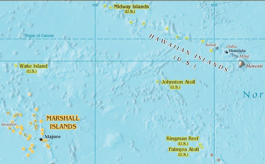
Johnston Atoll is an unincorporated territory of the United States, currently administered by the United States Fish and Wildlife Service (USFWS). Johnston Atoll is a National Wildlife Refuge and part of the Pacific Remote Islands Marine National Monument. It is closed to public entry, and limited access for management needs is only granted by Letter of Authorization from the United States Air Force and a Special Use Permit from the U.S. Fish and Wildlife Service. For nearly 70 years, the isolated atoll was under the control of the U.S. military. During that time, it was variously used as a naval refueling depot, an airbase, a testing site for nuclear and biological weapons, a secret missile base, and a site for the storage and disposal of chemical weapons and Agent Orange. Those activities left the area environmentally contaminated, and monitoring continues. The island is home to thriving communities of nesting seabirds and has significant marine biodiversity. USFWS teams car ... [...More Info...] [...Related Items...] OR: [Wikipedia] [Google] [Baidu] |
Pearl Harbor
Pearl Harbor is an American lagoon harbor on the island of Oahu, Hawaii, west of Honolulu. It was often visited by the Naval fleet of the United States, before it was acquired from the Hawaiian Kingdom by the U.S. with the signing of the Reciprocity Treaty of 1875. Much of the harbor and surrounding lands are now a United States Navy deep-water naval base. It is also the headquarters of the United States Pacific Fleet. The U.S. government first obtained exclusive use of the inlet and the right to maintain a repair and coaling station for ships here in 1887. The surprise attack by the Imperial Japanese Navy on December 7, 1941, led the United States to declare war on the Empire of Japan, making the attack on Pearl Harbor the immediate cause of the United States' entry into World War II. History Pearl Harbor was originally an extensive shallow embayment called ''Wai Momi'' (meaning, “Waters of Pearl”) or ''Puuloa'' (meaning, “long hill”) by the Hawaiians. Puuloa ... [...More Info...] [...Related Items...] OR: [Wikipedia] [Google] [Baidu] |
Philippines
The Philippines (; fil, Pilipinas, links=no), officially the Republic of the Philippines ( fil, Republika ng Pilipinas, links=no), * bik, Republika kan Filipinas * ceb, Republika sa Pilipinas * cbk, República de Filipinas * hil, Republika sang Filipinas * ibg, Republika nat Filipinas * ilo, Republika ti Filipinas * ivv, Republika nu Filipinas * pam, Republika ning Filipinas * krj, Republika kang Pilipinas * mdh, Republika nu Pilipinas * mrw, Republika a Pilipinas * pag, Republika na Filipinas * xsb, Republika nin Pilipinas * sgd, Republika nan Pilipinas * tgl, Republika ng Pilipinas * tsg, Republika sin Pilipinas * war, Republika han Pilipinas * yka, Republika si Pilipinas In the recognized optional languages of the Philippines: * es, República de las Filipinas * ar, جمهورية الفلبين, Jumhūriyyat al-Filibbīn is an archipelagic state, archipelagic country in Southeast Asia. It is situated in the western Pacific Ocean and consists of aro ... [...More Info...] [...Related Items...] OR: [Wikipedia] [Google] [Baidu] |
Subic Bay
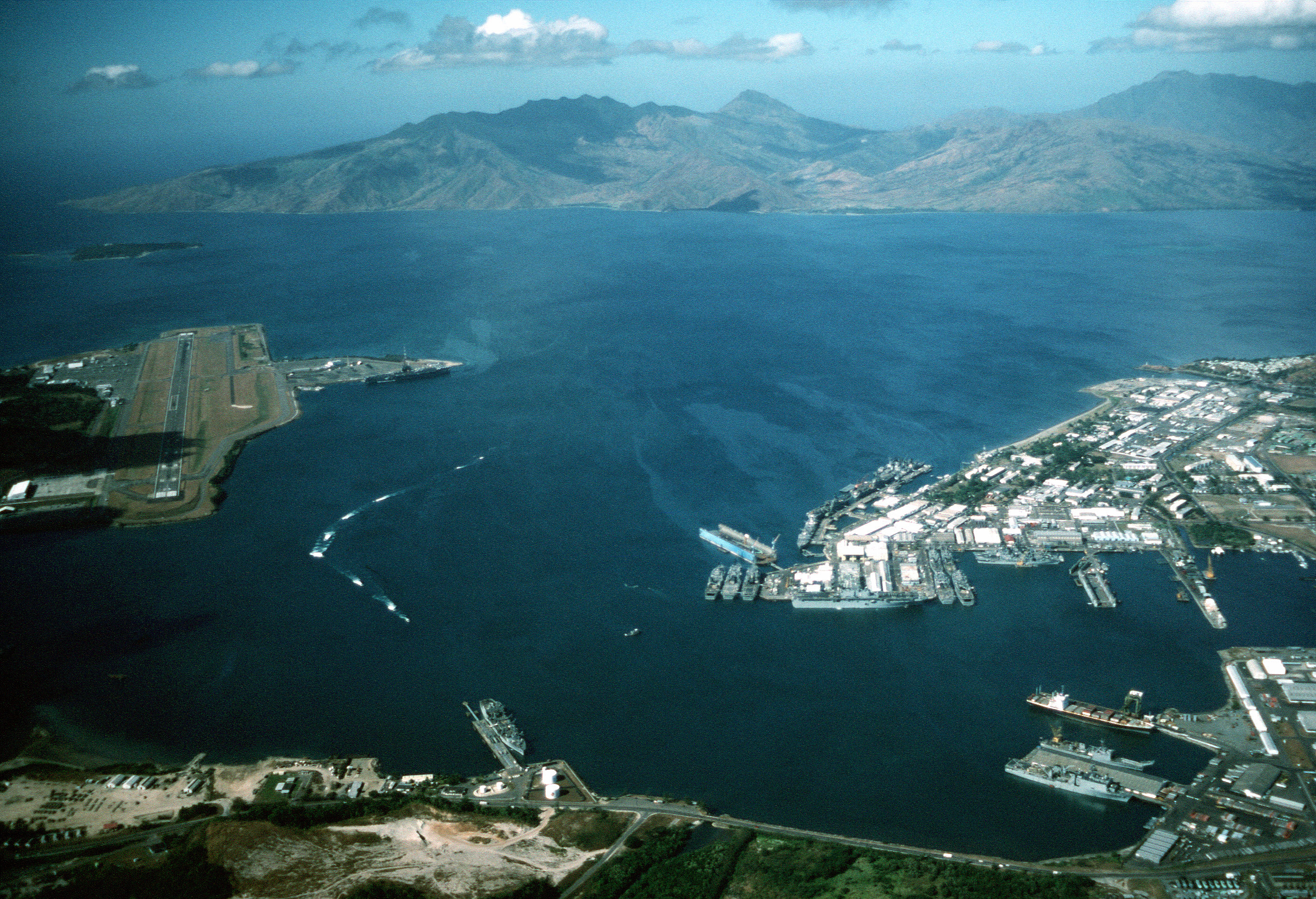
Subic Bay is a bay on the west coast of the island of Luzon in the Philippines, about northwest of Manila Bay. An extension of the South China Sea, its shores were formerly the site of a major United States Navy facility, U.S. Naval Base Subic Bay, now an industrial and commercial area known as the Subic Bay Freeport Zone under the Subic Bay Metropolitan Authority. Today, water as well as the towns and establishments surrounding the bay are collectively known as Subic Bay. This includes the former naval base, Hanjin shipyard, Olongapo city, the municipal town of Subic, and the erstwhile US defense housing areas of Binictican and Kalayan housing, up to Morong, Bataan. The bay was long recognized for its deep and protected waters, but development was slow due to lack of level terrain around the bay. History In 1542, Spanish conquistador Juan de Salcedo sailed into Subic Bay but no port developed there because the main Spanish naval base would be established in the near ... [...More Info...] [...Related Items...] OR: [Wikipedia] [Google] [Baidu] |
Pacific
The Pacific Ocean is the largest and deepest of Earth's five oceanic divisions. It extends from the Arctic Ocean in the north to the Southern Ocean (or, depending on definition, to Antarctica) in the south, and is bounded by the continents of Asia and Oceania in the west and the Americas in the east. At in area (as defined with a southern Antarctic border), this largest division of the World Ocean—and, in turn, the hydrosphere—covers about 46% of Earth's water surface and about 32% of its total surface area, larger than Earth's entire land area combined .Pacific Ocean . '' Britannica Concise.'' 2008: Encyclopædia Britannica, Inc. The centers of both the [...More Info...] [...Related Items...] OR: [Wikipedia] [Google] [Baidu] |


.jpg)