|
Ténéré
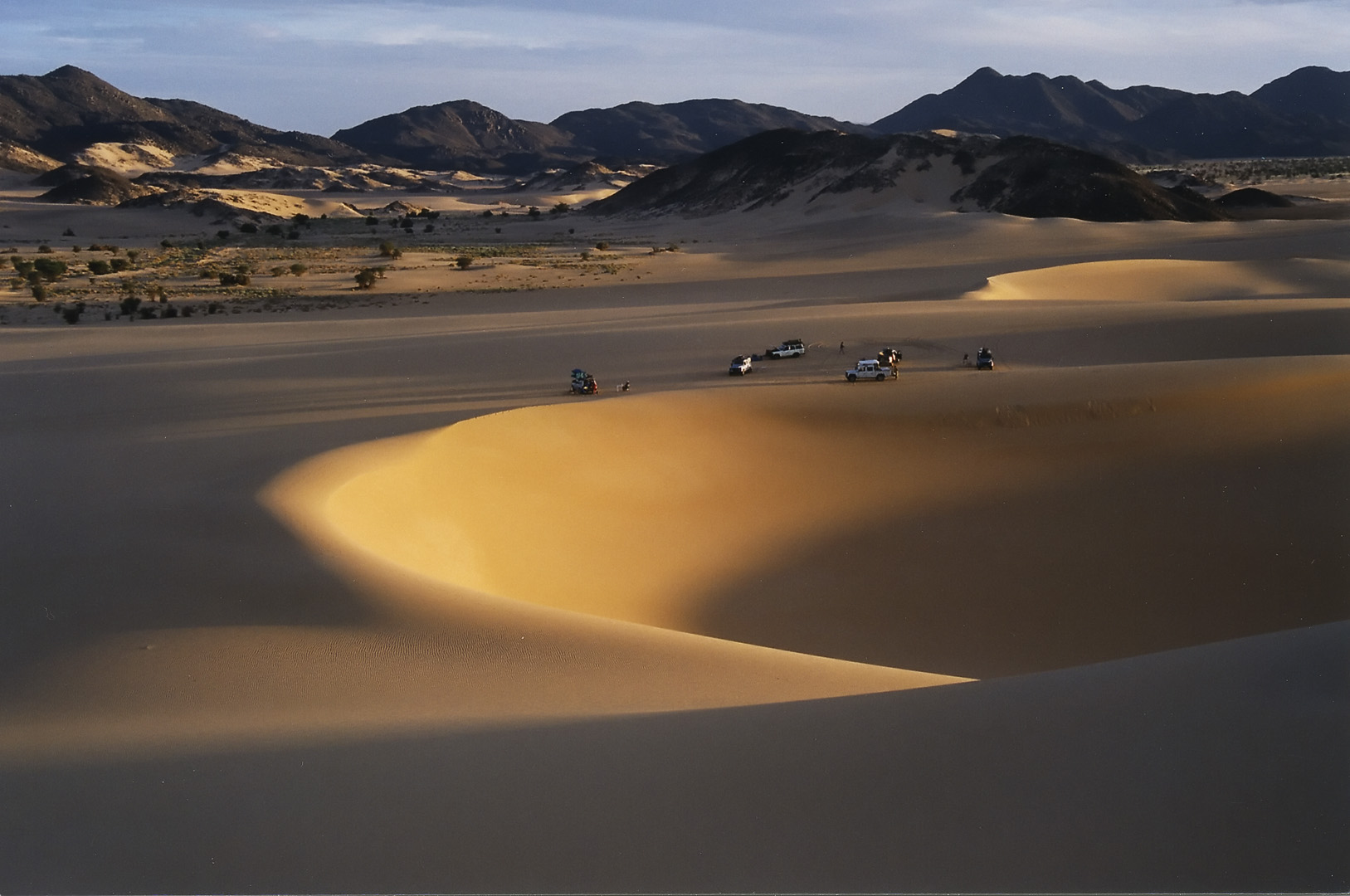
The Ténéré ( Tuareg: Tenere, literally: "desert") is a desert region in the south central Sahara. It comprises a vast plain of sand stretching from northeastern Niger into western Chad, occupying an area of over . The Ténéré's boundaries are said to be the Aïr Mountains in the west, the Hoggar Mountains in the north, the Djado Plateau in the northeast, the Tibesti Mountains in the east, and the basin of Lake Chad in the south. The central part of the desert, the Erg du Bilma, is centred at approximately . It is the locus of the Neolithic Tenerian culture. Name The name ''Ténéré'' comes from the Tuareg language, meaning "desert", in much the same way that the Arabic word for "desert", '' Sahara'', came to be applied to the region as a whole. Climate The Ténéré has a hot desert climate (Köppen climate classification ''BWh''), typical of the large Sahara Desert. The climate is hyper-arid, extremely hot, sunny and dry year-round and there is virtually no plant li ... [...More Info...] [...Related Items...] OR: [Wikipedia] [Google] [Baidu] |
Ténéré - Aïr Natural Reserve
The Ténéré (Tuareg: Tenere, literally: "desert") is a desert region in the south central Sahara. It comprises a vast plain of sand stretching from northeastern Niger into western Chad, occupying an area of over . The Ténéré's boundaries are said to be the Aïr Mountains in the west, the Hoggar Mountains in the north, the Djado Plateau in the northeast, the Tibesti Mountains in the east, and the basin of Lake Chad in the south. The central part of the desert, the Erg du Bilma, is centred at approximately . It is the locus of the Neolithic Tenerian culture. Name The name ''Ténéré'' comes from the Tuareg language, meaning "desert", in much the same way that the Arabic word for "desert", '' Sahara'', came to be applied to the region as a whole. Climate The Ténéré has a hot desert climate (Köppen climate classification ''BWh''), typical of the large Sahara Desert. The climate is hyper-arid, extremely hot, sunny and dry year-round and there is virtually no plant life. ... [...More Info...] [...Related Items...] OR: [Wikipedia] [Google] [Baidu] |
Aïr Mountains
The Aïr Mountains or Aïr Massif ( tmh, Ayăr; Hausa: Eastern ''Azbin'', Western ''Abzin'') is a triangular massif, located in northern Niger, within the Sahara. Part of the West Saharan montane xeric woodlands ecoregion, they rise to more than and extend over . Lying in the midst of desert north of the 17th parallel, the Aïr plateau, with an average altitude between , forms an island of Sahel climate which supports a wide variety of life, many pastoral and farming communities, and dramatic geological and archaeological sites. There are notable archaeological excavations in the region that illustrate the prehistoric past of this region. The endangered African wild dog (''Lycaon pictus'') once existed in this region, but may now be extirpated due to human population pressures in this region. Geology The Precambrian to Cenozoic Aïr Mountains consist of peralkaline granite intrusions which appear dark in colour (unusual since most granitic masses are lig ... [...More Info...] [...Related Items...] OR: [Wikipedia] [Google] [Baidu] |
Sahara
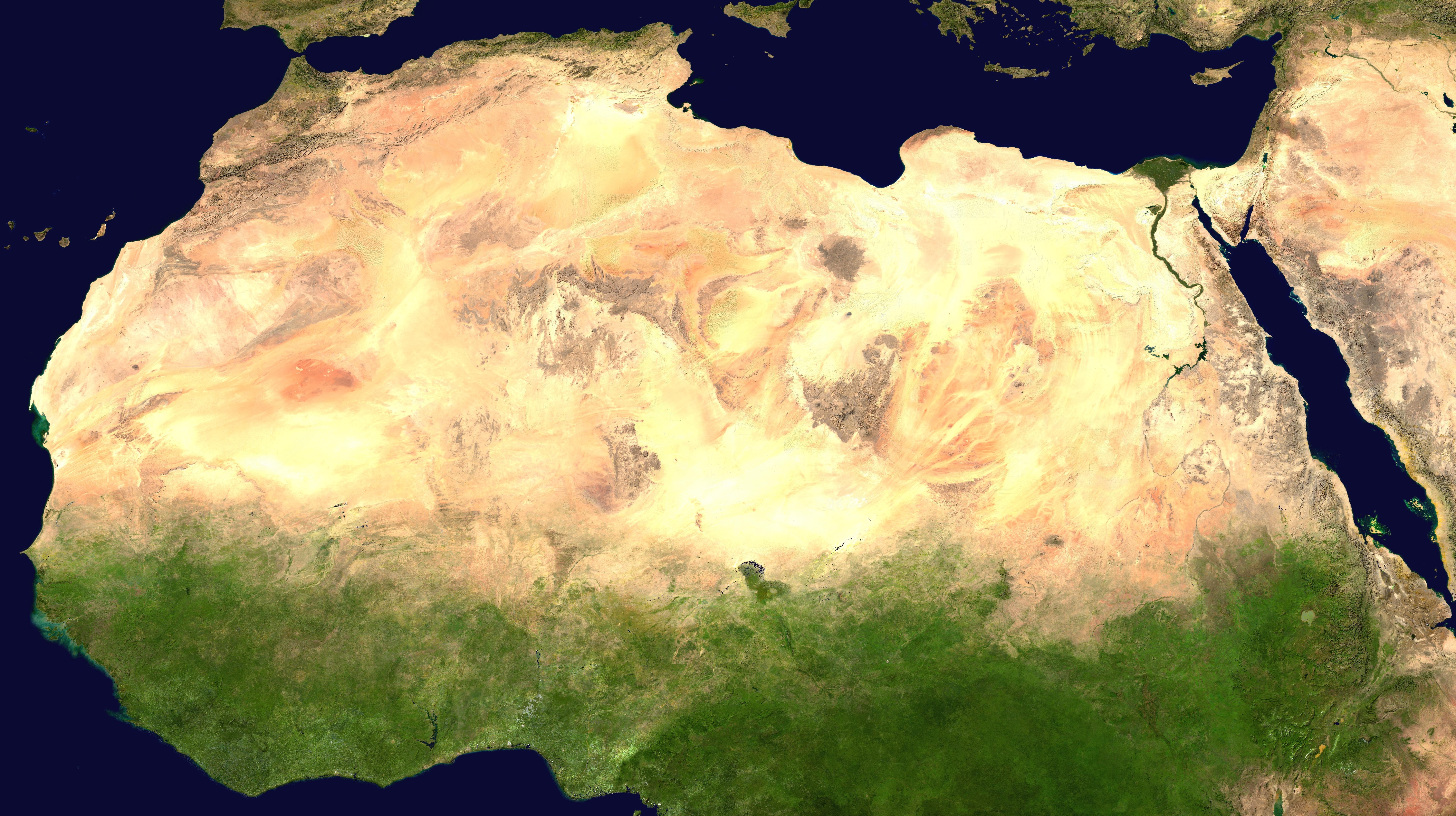
, photo = Sahara real color.jpg , photo_caption = The Sahara taken by Apollo 17 astronauts, 1972 , map = , map_image = , location = , country = , country1 = , country2 = , country3 = , country4 = , country5 = , country6 = , country7 = , country8 = , country9 = , country10 = (disputed) , region = , state = , district = , city = , relief = , label = , label_position = , coordinates = , coordinates_ref = , elevation = , elevation_m = , elevation_ft = , elevation_ref = , length = , length_mi = , length_km = 4,800 , length_orientation = , length_note = , width = , width_mi = , width_ ... [...More Info...] [...Related Items...] OR: [Wikipedia] [Google] [Baidu] |
Sahara Desert
, photo = Sahara real color.jpg , photo_caption = The Sahara taken by Apollo 17 astronauts, 1972 , map = , map_image = , location = , country = , country1 = , country2 = , country3 = , country4 = , country5 = , country6 = , country7 = , country8 = , country9 = , country10 = (disputed) , region = , state = , district = , city = , relief = , label = , label_position = , coordinates = , coordinates_ref = , elevation = , elevation_m = , elevation_ft = , elevation_ref = , length = , length_mi = , length_km = 4,800 , length_orientation = , length_note = , width = , width_mi = , width_ ... [...More Info...] [...Related Items...] OR: [Wikipedia] [Google] [Baidu] |
Tibesti Mountains
The Tibesti Mountains are a mountain range in the central Sahara, primarily located in the extreme north of Chad, with a small portion located in southern Libya. The highest peak in the range, Emi Koussi, lies to the south at a height of and is the highest point in both Chad and the Sahara. Bikku Bitti, the highest peak in Libya, is located in the north of the range. The central third of the Tibesti is of volcanic origin and consists of five volcanoes topped by large depressions: Emi Koussi, Tarso Toon, Tarso Voon, Tarso Yega and Toussidé. Major lava flows have formed vast plateaus that overlie Paleozoic sandstone. The volcanic activity was the result of a continental hotspot that arose during the Oligocene and continued in some places until the Holocene, creating fumaroles, hot springs, mud pools and deposits of natron and sulfur. Erosion has shaped volcanic spires and carved an extensive network of canyons through which run rivers subject to highly irregular flows that ... [...More Info...] [...Related Items...] OR: [Wikipedia] [Google] [Baidu] |
Blue Mountains (Niger)
The Blue Mountains (french: Montagnes Bleus, Tamasheq: ''Izouzaouene'', ''Izouzaoenehe'') are an outcrop off the northeastern section of the Aïr Massif in Niger, about 100 km ENE of the town of Iférouane and 30 km NE of the Tezerik oasis. Isolated from the main massif by dunes of the Erg Temet and a flat gravelly desert pavement plain, the rocky outcrop from the desert rises to a height of 924m, almost 300m over the surrounding topography. The area is in Aïr and Ténéré National Nature Reserve, which is a UNESCO World Heritage Site. The mountains themselves are also within the smaller Aïr and Ténéré Addax Sanctuary. They are characterised by cipollino marble outcroppings, which give the hills a bluish tint. Despite their relative remoteness, they became a tourist destination during the upsurge of desert tourism Tourism is travel for pleasure or business; also the theory and practice of touring, the business of attracting, accommodating, and entertainin ... [...More Info...] [...Related Items...] OR: [Wikipedia] [Google] [Baidu] |
Kaouar
The Kaouar (or Kawar) is a series of ten oases in the southern Sahara in northeast Niger, covering about from north to south, and east to west. They are on the eastern edge of the Ténéré desert, between the Tibesti Mountains in the east and the Aïr Mountains in the west and between the Fezzan in the north and Lake Chad in the south. They lie on the leeward side of a 100-meter-high north–south escarpment and easterly winds striking the escarpment provide easy access to groundwater for the oases. Running south to north, Bilma, Dirkou, Aney and Séguédine are the largest towns. The Kaouar oases are famous for salt and date production, and were along the route of the great Bornu to Fezzan caravan trail. This was the major point of contact between the African Sahel and the Mediterranean civilisations until the 19th century. Numerous archeological sites and rock paintings attest to human habitation here reaching back some 10,000 years to when the area was surrounded ... [...More Info...] [...Related Items...] OR: [Wikipedia] [Google] [Baidu] |
Azalai
The Azalai (Tamasheq, var. Azalay) is a semi-annual salt caravan route practiced by Tuareg traders in the Sahara desert between Timbuktu and the Taoudenni salt mine in Mali, or the act of traveling with a caravan along that route. The other major West African salt caravan route, heading from around Agadez to Fachi and Bilma in Niger, is called Taghlamt (in Tamasheq, or Taglem or Tagalem in Hausa language). The two are among the last caravan routes in the Sahara that are still in use. Both caravans have largely been replaced by unpaved truck routes. Timbuktu-Taoudenni At one time the caravan route from Timbuktu extended through Taoudenni to Taghaza, another salt-mining site, and on to the lands north of the Sahara on the Mediterranean Sea. Caravans with up to 10,000 camels carried gold and slaves north, returning with manufactured goods and salt from Taghaza and Taoudenni. Until the 1940s, the Taoudenni caravans were made up of thousands of camels, departing Timbuktu at ... [...More Info...] [...Related Items...] OR: [Wikipedia] [Google] [Baidu] |
Erg Of Bilma
The Erg of Bilma is a dune sea (Arabic: ''erg'') in the Ténéré desert region of the south central Sahara Desert. The Erg of Bilma stretches southwest from Fachi and the Tibesti Mountains. On the west it is bounded by the Aïr Mountains in north central Niger, and to the east it passes Bilma, continuing on to the Chadian border. It surrounds on three sides the oasis of Bilma, southernmost of a north–south string of oases of the Kaouar rise. The Erg covers an area of approximately . At its southernmost edge, some of the dunes have been stabilized by the growth of vegetation, allowing human cultivation of crops like millet and sorghum on the slopes. History The ancient Bornu Empire to Fezzan caravan routes had to cross the dunes of the erg south of Bilma as the last major obstacle before reaching the sahel. While that traffic largely ceased after 1820, trade though the erg of Bilma continues from the Lake Chad region and the Termit Massif on a small scale.. See also *List ... [...More Info...] [...Related Items...] OR: [Wikipedia] [Google] [Baidu] |
Erg Du Bilma
The Erg of Bilma is a dune sea (Arabic: ''erg'') in the Ténéré desert region of the south central Sahara Desert. The Erg of Bilma stretches southwest from Fachi and the Tibesti Mountains. On the west it is bounded by the Aïr Mountains in north central Niger, and to the east it passes Bilma, continuing on to the Chadian border. It surrounds on three sides the oasis of Bilma, southernmost of a north–south string of oases of the Kaouar rise. The Erg covers an area of approximately . At its southernmost edge, some of the dunes have been stabilized by the growth of vegetation, allowing human cultivation of crops like millet and sorghum on the slopes. History The ancient Bornu Empire to Fezzan caravan routes had to cross the dunes of the erg south of Bilma as the last major obstacle before reaching the sahel. While that traffic largely ceased after 1820, trade though the erg of Bilma continues from the Lake Chad region and the Termit Massif on a small scale.. See also *List ... [...More Info...] [...Related Items...] OR: [Wikipedia] [Google] [Baidu] |
Niger
) , official_languages = , languages_type = National languagesRépublique du Niger, "Loi n° 2001-037 du 31 décembre 2001 fixant les modalités de promotion et de développement des langues nationales." L'aménagement linguistique dans le monde (accessed 21 September 2016) , languages = , religion_ref = , religion_year = 2012 , religion = , demonym = Nigerien , capital = Niamey , coordinates = , largest_city = Niamey , government_type = Unitary state, Unitary Semi-presidential s ... [...More Info...] [...Related Items...] OR: [Wikipedia] [Google] [Baidu] |
Bilma
Bilma is an oasis town and commune in north east Niger with, as of the 2012 census, a total population of 4,016 people. It lies protected from the desert dunes under the Kaouar Cliffs and is the largest town along the Kaouar escarpment. It is known for its gardens, for salt and natron production through evaporation ponds, date cultivation, and as the destination of one of the last Saharan caravan routes (the Azalai, from Agadez). Population Its population is mostly Kanuri, with smaller Toubou, Tuareg, and Hausa populations, the last being a reminder of Bilma's role as a key stop in the Trans Saharan trade. Administration and economy Bilma is the administrative seat of the Bilma Department, covering some of north eastern Niger. While it continues to produce salt in large ''natron'' salt pans, and this salt is still sold for livestock use throughout west Africa, tourism (based out of Agadez and the Aïr Mountains some to the west) is of growing importance. Climate ... [...More Info...] [...Related Items...] OR: [Wikipedia] [Google] [Baidu] |


