|
Typhoon Hattie
Typhoon Hattie, known in the Philippines as Typhoon Pasing, was the fifth tropical cyclone of a record-six to hit Japan during the 1990 Pacific typhoon season. Hattie originated from an area of disturbed weather that developed within the Western Pacific monsoon trough towards the end of September. Tracking westward, the disturbance initially was slow to develop, although on September 30, the system was classified as a tropical depression. Following an improvement of its convective structure and an increase in associated convection, the depression was upgraded into Tropical Storm Hattie on October 1. Following the development of an eye, Hattie attained typhoon intensity on October 2. The typhoon continued to slowly deepen as its forward speed slowed. Despite a decrease in cloud top temperatures around the eye, Hattie was estimated to have attained peak intensity on October 5. After recurving to the north and then northeast, Hattie began to slowly weaken due to increased wind she ... [...More Info...] [...Related Items...] OR: [Wikipedia] [Google] [Baidu] |
Japan
Japan is an island country in East Asia. Located in the Pacific Ocean off the northeast coast of the Asia, Asian mainland, it is bordered on the west by the Sea of Japan and extends from the Sea of Okhotsk in the north to the East China Sea in the south. The Japanese archipelago consists of four major islands—Hokkaido, Honshu, Shikoku, and Kyushu—and List of islands of Japan, thousands of smaller islands, covering . Japan has a population of over 123 million as of 2025, making it the List of countries and dependencies by population, eleventh-most populous country. The capital of Japan and List of cities in Japan, its largest city is Tokyo; the Greater Tokyo Area is the List of largest cities, largest metropolitan area in the world, with more than 37 million inhabitants as of 2024. Japan is divided into 47 Prefectures of Japan, administrative prefectures and List of regions of Japan, eight traditional regions. About three-quarters of Geography of Japan, the countr ... [...More Info...] [...Related Items...] OR: [Wikipedia] [Google] [Baidu] |
Japan Meteorological Agency
The Japan Meteorological Agency (JMA; ''気象庁, Kishō-chō'') is a division of the Ministry of Land, Infrastructure, Transport and Tourism dedicated to the Scientific, scientific observation and research of natural phenomena. Headquartered in Minato, Tokyo the government agency, agency collects data on meteorology, hydrology, seismology, volcanology, and other related fields. The JMA is responsible for collecting and disseminating weather data and Forecasting, forecasts to the public, as well as providing specialized information for aviation and Marine weather forecasting, marine sectors. Additionally, the JMA issues warnings for volcanic eruptions and is integral to the nationwide Earthquake Early Warning (Japan), Earthquake Early Warning (EEW) system. As one of the Regional Specialized Meteorological Centers designated by the World Meteorological Organization (WMO), the JMA also Forecasting, forecasts, Tropical cyclone naming, names, and distributes warnings for tropical ... [...More Info...] [...Related Items...] OR: [Wikipedia] [Google] [Baidu] |
Ryukyu Islands
The , also known as the or the , are a chain of Japanese islands that stretch southwest from Kyushu to Geography of Taiwan, Taiwan: the Ryukyu Islands are divided into the Satsunan Islands (Ōsumi Islands, Ōsumi, Tokara Islands, Tokara and Amami Islands, Amami) and Okinawa Prefecture (Daitō Islands, Daitō, Miyako Islands, Miyako, Yaeyama Islands, Yaeyama, Senkaku Islands, Senkaku, Okinawa Islands, Okinawa, Sakishima Islands (further divided into the Miyako Islands, Miyako and Yaeyama Islands), and Yonaguni as the westernmost). The larger ones are mostly volcanic islands and the smaller mostly coral island, coral. The largest is Okinawa Island. The climate of the islands ranges from humid subtropical climate (Köppen climate classification ''Cfa'') in the north to tropical rainforest climate (Köppen climate classification ''Af'') in the south. Precipitation is very high and is affected by the rainy season and typhoons. Except the outlying Daitō Islands, the island chain ha ... [...More Info...] [...Related Items...] OR: [Wikipedia] [Google] [Baidu] |
Barometric Pressure
Atmospheric pressure, also known as air pressure or barometric pressure (after the barometer), is the pressure within the atmosphere of Earth. The standard atmosphere (symbol: atm) is a unit of pressure defined as , which is equivalent to 1,013.25 millibars, 760 mm Hg, 29.9212 inchesHg, or 14.696 psi.International Civil Aviation Organization. ''Manual of the ICAO Standard Atmosphere'', Doc 7488-CD, Third Edition, 1993. . The atm unit is roughly equivalent to the mean sea-level atmospheric pressure on Earth; that is, the Earth's atmospheric pressure at sea level is approximately 1 atm. In most circumstances, atmospheric pressure is closely approximated by the hydrostatic pressure caused by the weight of air above the measurement point. As elevation increases, there is less overlying atmospheric mass, so atmospheric pressure decreases with increasing elevation. Because the atmosphere is thin relative to the Earth's radius—especially the dense atmospheric layer at low altitudes ... [...More Info...] [...Related Items...] OR: [Wikipedia] [Google] [Baidu] |
Maximum Sustained Wind
The maximum sustained wind associated with a tropical cyclone is a common indicator of the intensity of the storm. Within a mature tropical cyclone, it is found within the eyewall at a certain distance from the center, known as the radius of maximum wind, or RMW. Unlike gusts, the value of these winds are determined via their sampling and averaging the sampled results over a period of time. Wind measuring has been standardized globally to reflect the winds at above mean sea level, and the maximum sustained wind represents the highest average wind over either a one-minute (US) or ten-minute time span (see the definition, below), anywhere within the tropical cyclone. Surface winds are highly variable due to friction between the atmosphere and the Earth's surface, as well as near hills and mountains over land. Over the ocean, satellite imagery is often used to estimate the maximum sustained winds within a tropical cyclone. Land, ship, aircraft reconnaissance observations, an ... [...More Info...] [...Related Items...] OR: [Wikipedia] [Google] [Baidu] |
Subtropical Ridge
The horse latitudes are the latitudes about 30 degrees north and south of the Equator. They are characterized by sunny skies, calm winds, and very little precipitation. They are also known as subtropical ridges or highs. It is a high-pressure area at the divergence of trade winds and the westerlies. Etymology A likely and documented explanation is that the term is derived from the "dead horse" ritual of seamen (see Beating a dead horse). In this practice, the seaman paraded a straw-stuffed effigy of a horse around the deck before throwing it overboard. Seamen were paid partly in advance before a long voyage, and they frequently spent their pay all at once, resulting in a period of time without income. This period was called the "dead horse" time, and it usually lasted a month or two. The seaman's ceremony was to celebrate having worked off the "dead horse" debt. As west-bound shipping from Europe usually reached the subtropics at about the time the "dead horse" was worke ... [...More Info...] [...Related Items...] OR: [Wikipedia] [Google] [Baidu] |
Tropical Cyclone Scales
Tropical cyclones are ranked on one of five tropical cyclone intensity scales, according to their maximum sustained winds and which tropical cyclone basins they are located in. Only a few classifications are used officially by the meteorological agencies monitoring the tropical cyclones, but other scales also exist, such as accumulated cyclone energy, the Power Dissipation Index, the Integrated Kinetic Energy Index, and the Hurricane Severity Index. Tropical cyclones that develop in the Northern Hemisphere are classified by the warning centres on one of three intensity scales. Tropical cyclones or subtropical cyclones that exist within the North Atlantic Ocean or the North-eastern Pacific Ocean are classified as either tropical depressions or tropical storms. Should a system intensify further and become a hurricane, then it will be classified on the Saffir–Simpson hurricane wind scale, and is based on the estimated maximum sustained winds over a 1-minute period. In the W ... [...More Info...] [...Related Items...] OR: [Wikipedia] [Google] [Baidu] |
Low Pressure Area
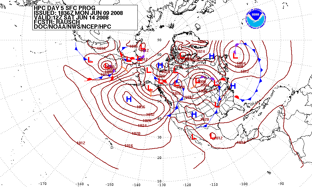
In meteorology, a low-pressure area (LPA), low area or low is a region where the atmospheric pressure is lower than that of surrounding locations. It is the opposite of a high-pressure area. Low-pressure areas are commonly associated with inclement weather (such as cloudy, windy, with possible rain or storms), while high-pressure areas are associated with lighter winds and clear skies. Winds circle anti-clockwise around lows in the northern hemisphere, and clockwise in the southern hemisphere, due to opposing Coriolis forces. Low-pressure systems form under areas of wind divergence that occur in the upper levels of the atmosphere (aloft). The formation process of a low-pressure area is known as cyclogenesis. In meteorology, atmospheric divergence aloft occurs in two kinds of places: * The first is in the area on the east side of upper troughs, which form half of a Rossby wave within the Westerlies (a trough with large wavelength that extends through the troposphere). * A sec ... [...More Info...] [...Related Items...] OR: [Wikipedia] [Google] [Baidu] |
Outflow (meteorology)
Outflow, in meteorology, is air that flows outwards from a storm system. It is associated with ridging, or anticyclone, anticyclonic flow. In the low levels of the troposphere, outflow radiates from thunderstorms in the form of a wedge of rain-cooled air, which is visible as a thin rope-like cloud on weather satellite imagery or a fine line on weather radar imagery. For observers on the ground, a thunderstorm outflow boundary often approaches in otherwise clear skies as a low, thick cloud that brings with it a gust front. Low-level outflow boundaries can disrupt the center of small tropical cyclones. However, outflow aloft is essential for the strengthening of a tropical cyclone. If this outflow is restricted or undercut, the tropical cyclone weakens. If two tropical cyclones are close, the upper-level outflow from the upwind system can limit the development of the other system. Thunderstorms For thunderstorms, outflow tends to indicate the development of a system. Large quan ... [...More Info...] [...Related Items...] OR: [Wikipedia] [Google] [Baidu] |
Dvorak Technique
The Dvorak technique (developed between 1969 and 1984 by Vernon Dvorak) is a widely used system to estimate tropical cyclone intensity (which includes tropical depression, tropical storm, and hurricane/typhoon/intense tropical cyclone intensities) based solely on visible and infrared Weather satellite, satellite images. Within the Dvorak satellite strength estimate for tropical cyclones, there are several Pattern recognition, visual patterns that a cyclone may take on which define the upper and lower bounds on its intensity. The primary patterns used are curved rainband, band pattern (T1.0-T4.5), Wind shear#Effects on tropical cyclones, shear pattern (T1.5–T3.5), central dense overcast (CDO) pattern (T2.5–T5.0), central cold cover (CCC) pattern, banding eye pattern (T4.0–T4.5), and Eye (cyclone), eye pattern (T4.5–T8.0). Both the central dense overcast and embedded eye pattern use the size of the CDO. The CDO pattern intensities start at T2.5, equivalent to minimal trop ... [...More Info...] [...Related Items...] OR: [Wikipedia] [Google] [Baidu] |
Maximum Sustained Winds
The maximum sustained wind associated with a tropical cyclone is a common indicator of the intensity of the storm. Within a mature tropical cyclone, it is found within the eyewall at a certain distance from the center, known as the radius of maximum wind, or RMW. Unlike gusts, the value of these winds are determined via their sampling and averaging the sampled results over a period of time. Wind measuring has been standardized globally to reflect the winds at above mean sea level, and the maximum sustained wind represents the highest average wind over either a one-minute (US) or ten-minute time span (see the definition, below), anywhere within the tropical cyclone. Surface winds are highly variable due to friction between the atmosphere and the Earth's surface, as well as near hills and mountains over land. Over the ocean, satellite imagery is often used to estimate the maximum sustained winds within a tropical cyclone. Land, ship, aircraft reconnaissance observations, an ... [...More Info...] [...Related Items...] OR: [Wikipedia] [Google] [Baidu] |


