|
Tydavnet
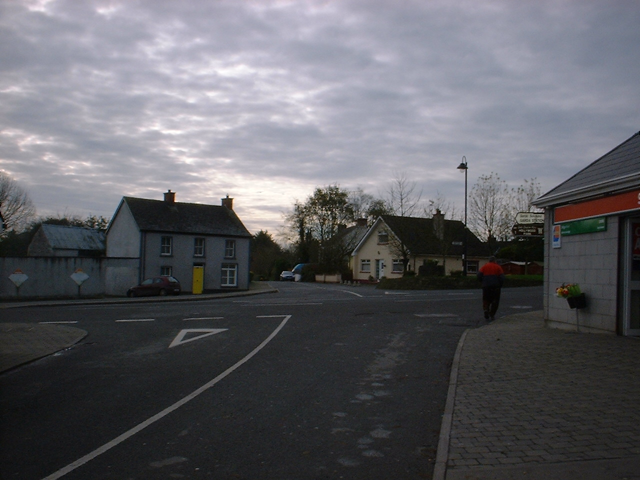
Tydavnet, officially Tedavnet (), is a village in northern County Monaghan, Ireland, and also the name of the townland and civil parish in which the village sits. Both the Church of Ireland and Catholic church have Tydavnet named as a parish and in both cases, the geographical area is almost identical. The village is located on the R186 regional road. History Bronze Age gold Evidence of ancient settlement in the area includes the Atlantic Bronze Age Tydavnet gold discs. Dating from circa 2100 BC, these discs were discovered in the roots of an old tree. Raised lines, rows of dots and zig-zags produce a central cross surrounded by concentric patterns, were used to decorate the discs. The techniques of repoussé, punching and polishing, and doming of the surfaces are not seen on other similar discs. The pair of discs are on permanent display in the National Museum of Ireland. Foundation and name The Irish name of the townland and village, , derives from the area's asso ... [...More Info...] [...Related Items...] OR: [Wikipedia] [Google] [Baidu] |
Scotstown
Scotstown () is a village in the townland of Bough () in north County Monaghan, Ireland. Scotstown is located in the parish of Tydavnet, along the Monaghan Blackwater, Scotstown being the village closest to the river's source. Scotstown is centred in the townland of Bough, but extends into Carrowhatta, Teraverty, Drumdesco and Stracrunnion townlands. Name Several theories exist around the origin of the English Language name, either deriving from the fact that a lot of Scots were located there during the Plantation of Monaghan (County Monaghan not having been part of the Plantation of Ulster), or it may have been named after a local landowner, George Scott, in the 1660s. Older documents, including Thom's ''Irish Almanac'' of 1862, alternate between referencing the village as Scottstown and Scotstown. With regard to its Irish language names, the traditional name of ''An Bhoth'' or ''An Bhothach'' comes from the townland of Bough, where the village is centered, with the likely ... [...More Info...] [...Related Items...] OR: [Wikipedia] [Google] [Baidu] |
R186 Road (Ireland)
The R186 road is a regional road in Ireland linking Monaghan in County Monaghan and the Republic of Ireland–United Kingdom border. The road passes through the village of Tydavnet. The road is long. See also * Roads in Ireland * National primary road * National secondary road A national secondary road ( ga, Bóthar Náisiúnta den Dara Grád) is a category of road in Ireland. These roads form an important part of the national route network but are secondary to the main arterial routes which are classified as national ... References Regional roads in the Republic of Ireland Roads in County Monaghan {{Ireland-road-stub ... [...More Info...] [...Related Items...] OR: [Wikipedia] [Google] [Baidu] |
Corlat
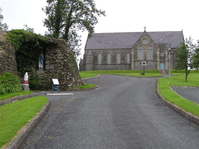
Corlat () or Corlatt is a townland in the north of County Monaghan in Ireland, being located in the parish of Tydavnet. The Church of Ireland parish church is located in the village of Tydavnet itself. Corlat is often referred to as part of Knockatallon, which is an adjacent townland. Corlat is situated entirely on foothills of the Sliabh Beagh mountains. It is the location of one of the three Catholic chapels in the parish, erected in 1887, was the last of the three to be erected, and the only one not to have a cemetery. The chapel here is known locally as Knockatallon Chapel, taking its name from a larger neighbouring townland to the south, but is officially called St. Joseph's Church. On 1 April 1990, a monument to Provisional Irish Republican Army volunteer Séamus McElwaine was erected in Corlat. Corlat has been somewhat revived in the late 1990s with the building of The Sliabh Beagh Hotel and Tourism Centre, on the site of the original Lady of Fatima Community Hall ... [...More Info...] [...Related Items...] OR: [Wikipedia] [Google] [Baidu] |
Damnat
Saint Damnat ( ga, Damhnait; also known as Davnet or Dymphna) was a nun who seems to have lived and died at Tydavnet (from ''Tech nDamnat'', meaning "House of Damnat") at Sliabh Beagh, County Monaghan, Ireland. Tradition speaks of Saint Damnat as a virgin and the founder of a church or monastery. A ''bachall'' (staff) said to have belonged to her has been preserved; in the past it was used as a lie detector. It is now in the National Museum of Ireland in Dublin. She is sometimes confused with Dymphna Dymphna is a Christian saint honoured in Catholic and Eastern Orthodox traditions. According to tradition, she lived in the 7th century and was martyred by her father. The story of Dymphna was first recorded in the 13th century by a canon of ..., the saint of Geel in Flanders, since John Colgan identified them as the same person in the mid seventeenth century. Both George Petrie and John O’Donovan of the antiquities division of the Ordnance Survey c.1830/40s doubted the lin ... [...More Info...] [...Related Items...] OR: [Wikipedia] [Google] [Baidu] |
County Monaghan
County Monaghan ( ; ga, Contae Mhuineacháin) is a county in Ireland. It is in the province of Ulster and is part of Border strategic planning area of the Northern and Western Region. It is named after the town of Monaghan. Monaghan County Council is the local authority for the county. The population of the county was 61,386 according to the 2016 census. The county has existed since 1585 when the Mac Mathghamhna rulers of Airgíalla agreed to join the Kingdom of Ireland. Following the 20th-century Irish War of Independence and the signing of the Anglo-Irish Treaty, Monaghan was one of three Ulster counties to join the Irish Free State rather than Northern Ireland. Geography and subdivisions County Monaghan is the fifth smallest of the Republic's 26 counties by area, and the fourth smallest by population. It is the smallest of Ulster's nine counties in terms of population. Baronies * Cremorne ( ga, Críoch Mhúrn) * Dartree ( ga, Dartraighe) * Farney ( ga, Fearn ... [...More Info...] [...Related Items...] OR: [Wikipedia] [Google] [Baidu] |
Republic Of Ireland
Ireland ( ga, Éire ), also known as the Republic of Ireland (), is a country in north-western Europe consisting of 26 of the 32 Counties of Ireland, counties of the island of Ireland. The capital and largest city is Dublin, on the eastern side of the island. Around 2.1 million of the country's population of 5.13 million people resides in the Greater Dublin Area. The sovereign state shares its only land border with Northern Ireland, which is Countries of the United Kingdom, part of the United Kingdom. It is otherwise surrounded by the Atlantic Ocean, with the Celtic Sea to the south, St George's Channel to the south-east, and the Irish Sea to the east. It is a Unitary state, unitary, parliamentary republic. The legislature, the , consists of a lower house, ; an upper house, ; and an elected President of Ireland, President () who serves as the largely ceremonial head of state, but with some important powers and duties. The head of government is the (Prime Minister, liter ... [...More Info...] [...Related Items...] OR: [Wikipedia] [Google] [Baidu] |
National Museum Of Ireland
The National Museum of Ireland ( ga, Ard-Mhúsaem na hÉireann) is Ireland's leading museum institution, with a strong emphasis on national and some international archaeology, Irish history, Irish art, culture, and natural history. It has three branches in Dublin, the archaeology and natural history museums adjacent on Kildare Street and Merrion Square, and a newer Decorative Arts and History branch at the former Collins Barracks, and the Country Life museum in County Mayo. History Predecessors The National Museum of Ireland descends from the amalgamation of parts of the collections of a number of Dublin cultural institutions from the 18th and 19th centuries, including primarily the Royal Dublin Society (RDS) and the Royal Irish Academy (RIA). The earliest parts of the collections are largely geological and mineralogical specimens, which the RDS collected as a means to improve the knowledge and use of such resources in Ireland. The establishment of the museum collection ... [...More Info...] [...Related Items...] OR: [Wikipedia] [Google] [Baidu] |
National Lottery (Ireland)
The National Lottery ( ga, An Crannchur Náisiúnta) is the state-licensed lottery operator in the Republic of Ireland. Established in 1986 to raise funds for good causes, it began operations on 27 March 1987 when it issued its first scratchcards. It launched the weekly drawing game Lotto the following year, holding the first draw on 16 April 1988. The National Lottery now offers Lotto and Lotto Plus draws on Wednesdays and Saturdays, EuroMillions and Plus draws on Tuesdays and Fridays, and two Daily Million draws each day. Its other games include televised bingo, Millionaire Raffles, and online instant-win games. The minimum age to play all National Lottery games is 18. Almost 40 percent of Irish adults play National Lottery games regularly, with nearly 30 percent of sales going toward good causes in the areas of sport and recreation, national culture and heritage, the arts, community health, youth welfare and amenities, and the natural environment. In 2020, total sales were ... [...More Info...] [...Related Items...] OR: [Wikipedia] [Google] [Baidu] |
National School (Ireland)
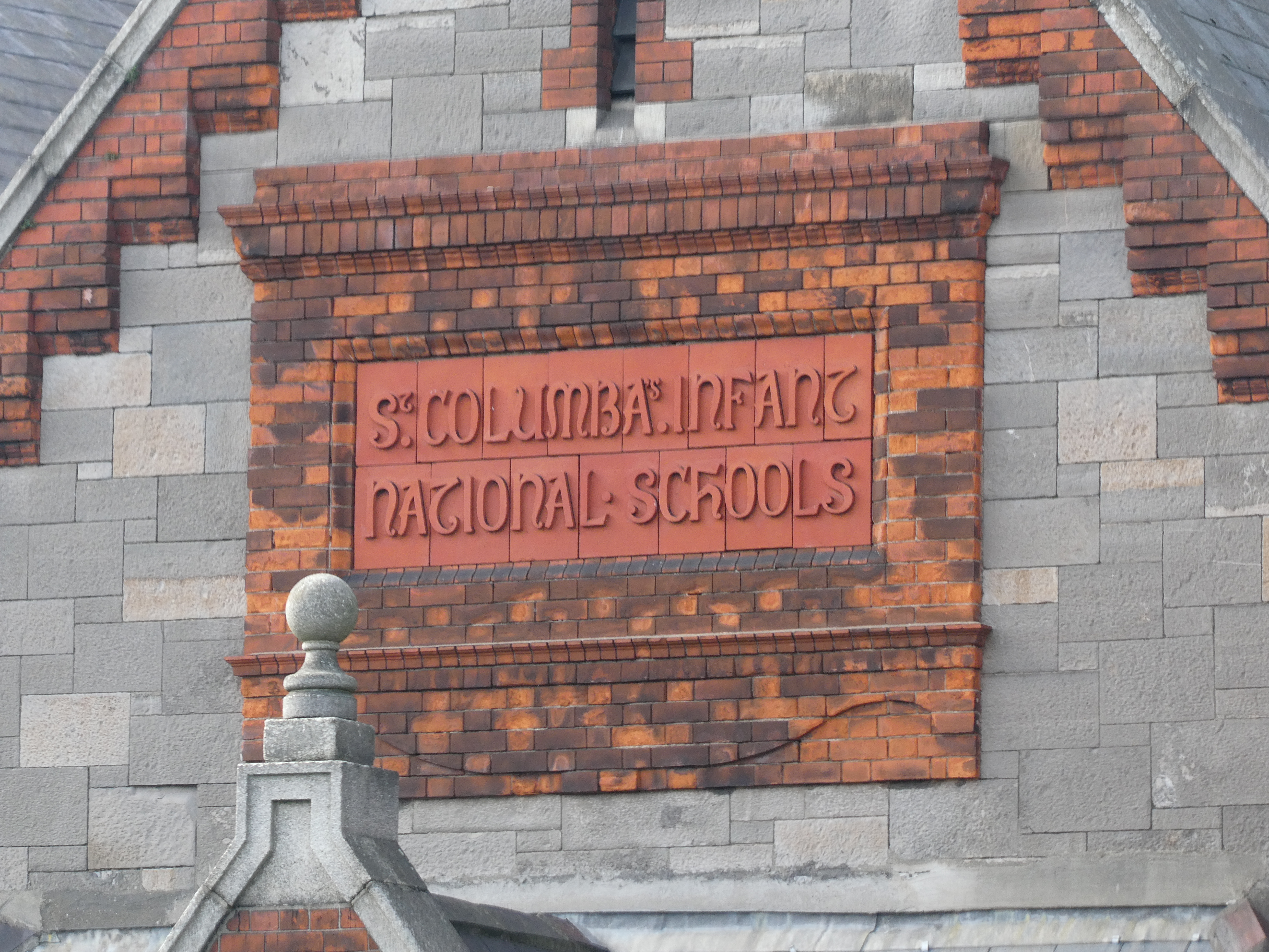
In Ireland, a national school () is a type of primary school that is financed directly by the state, but typically administered jointly by the state, a patron body, and local representatives. In national schools, most major policies, such as the curriculum and teacher salaries and conditions, are managed by the state through the Department of Education and Skills. Minor policies of the school are managed by local people, sometimes directed by a member of the clergy, as representative of the patron, through a local 'board of management'. Most primary schools in Ireland fall into this category, which is a pre-independence concept. While there are other forms of primary school in Ireland, including a relatively small number of private denominational schools which do not receive state aid, there were just 34 such private primary schools in 2012, with a combined enrollment of 7,600 pupils. By comparison there were, as of 2019, over 3,200 national schools in Ireland with a combined en ... [...More Info...] [...Related Items...] OR: [Wikipedia] [Google] [Baidu] |
Moovit
Moovit ( he, מוביט) is an Israel-based mobility as a service provider and journey planner app. It has been owned by Intel through the Mobileye subsidiary since 2020. The company uses both crowdsourced and official public transit data to provide route planning to users as well as transit data APIs to transit companies, cities, and transit agencies. Because Moovit integrates crowdsourced data, it is able to provide transit information for areas where no data is officially available. History Originally called Tranzmate, Moovit was founded as a startup in Israel in 2012 by developers Nir Erez, Roy Bick, and Yaron Evron. The company raised $3.5 million in its first round of funding from Gemini Funds and BRM Capital. By the beginning of 2013, the company launched worldwide. In 2013, Moovit went on to receive $28 million of funding from venture-capital Sequoia Capital, BRM Group, and Gemini Funds. In March 2014, Moovit launched a "community editor" allowing volunteer editors to ... [...More Info...] [...Related Items...] OR: [Wikipedia] [Google] [Baidu] |
Monaghan
Monaghan ( ; ) is the county town of County Monaghan, Ireland. It also provides the name of its civil parish and barony. The population of the town as of the 2016 census was 7,678. The town is on the N2 road from Dublin to Derry and Letterkenny. Etymology The Irish name ''Muineachán'' derives from a diminutive plural form of the Irish word ''muine'' meaning "brake" (a thickly overgrown area) or sometimes "hillock". The Irish historian and writer Patrick Weston Joyce interpreted this as "a place full of little hills or brakes". Monaghan County Council's preferred interpretation is "land of the little hills", a reference to the numerous drumlins in the area. History Early history The Menapii Celtic tribe are specifically named on Ptolemy's 150 AD map of Ireland, where they located their first colony – Menapia – on the Leinster coast circa 216 BC. They later settled around Lough Erne, becoming known as the Fir Manach, and giving their name to Fermanagh and Monaghan. Mong ... [...More Info...] [...Related Items...] OR: [Wikipedia] [Google] [Baidu] |
Geograph Britain And Ireland
Geograph Britain and Ireland is a web-based project, begun in March 2005, to create a freely accessible archive of geographically located photographs of Great Britain and Ireland. Photographs in the Geograph collection are chosen to illustrate significant or typical features of each 1 km × 1 km (100 ha) grid square in the Ordnance Survey National Grid and the Irish national grid reference system.Hawgood D. Geograph or supplemental (June 2007) (accessed 13 March 2008) There are 332,216 such grid squares containing at least some land or permanent structure (at low tide), of which 280,037 have Geographs. [...More Info...] [...Related Items...] OR: [Wikipedia] [Google] [Baidu] |


