|
Turtle Mound
Turtle Mound is a prehistoric archaeological site located south of New Smyrna Beach, Florida, United States, on State Road A1A, between the Mosquito Lagoon and the Atlantic Ocean. On September 29, 1970, it was added to the National Register of Historic Places. Today the site is owned and managed by the National Park Service as part of Canaveral National Seashore. Characteristics A refuse deposit composed mostly of oyster shells, the mound ranges for over along the lagoon shoreline and holds over of shells. It is the largest shell midden on the mainland United States, with an approximate height of , but no extensive excavations have been made. Sparsely vegetated in the early 19th century, it has since been covered by a dense maritime hammock, its primary cover being woody. Along with similar mounds regionally, it is the northernmost outpost of several tropical plant taxa, possibly due to its secluded, elevated, seaside location and to heat retention by shells; a stu ... [...More Info...] [...Related Items...] OR: [Wikipedia] [Google] [Baidu] |
New Smyrna Beach, Florida
New Smyrna Beach is a city in Volusia County, Florida, United States, located on the central east coast of the state, with the Atlantic Ocean to the east. The downtown section of the city is located on the west side of the Indian River and the Indian River Lagoon system. The Coronado Beach Bridge crosses the Intracoastal Waterway just south of Ponce de Leon Inlet, connecting the mainland with the beach on the coastal barrier island. The population was 30,142 at the 2020 census; according to 2023 census estimates, the city is estimated to have a population of 32,655. The surrounding area offers many opportunities for outdoor recreation; these include fishing, sailing, motorboating, golfing, and hiking. Visitors participate in water sports of all kinds, including swimming, scuba diving, kitesurfing, and surfing. In July 2009, New Smyrna Beach was ranked number nine on the list of "best surf towns" in '' Surfer.'' It was recognized as one of the "world's top 20 surf towns" by '' ... [...More Info...] [...Related Items...] OR: [Wikipedia] [Google] [Baidu] |
Eldora, Florida
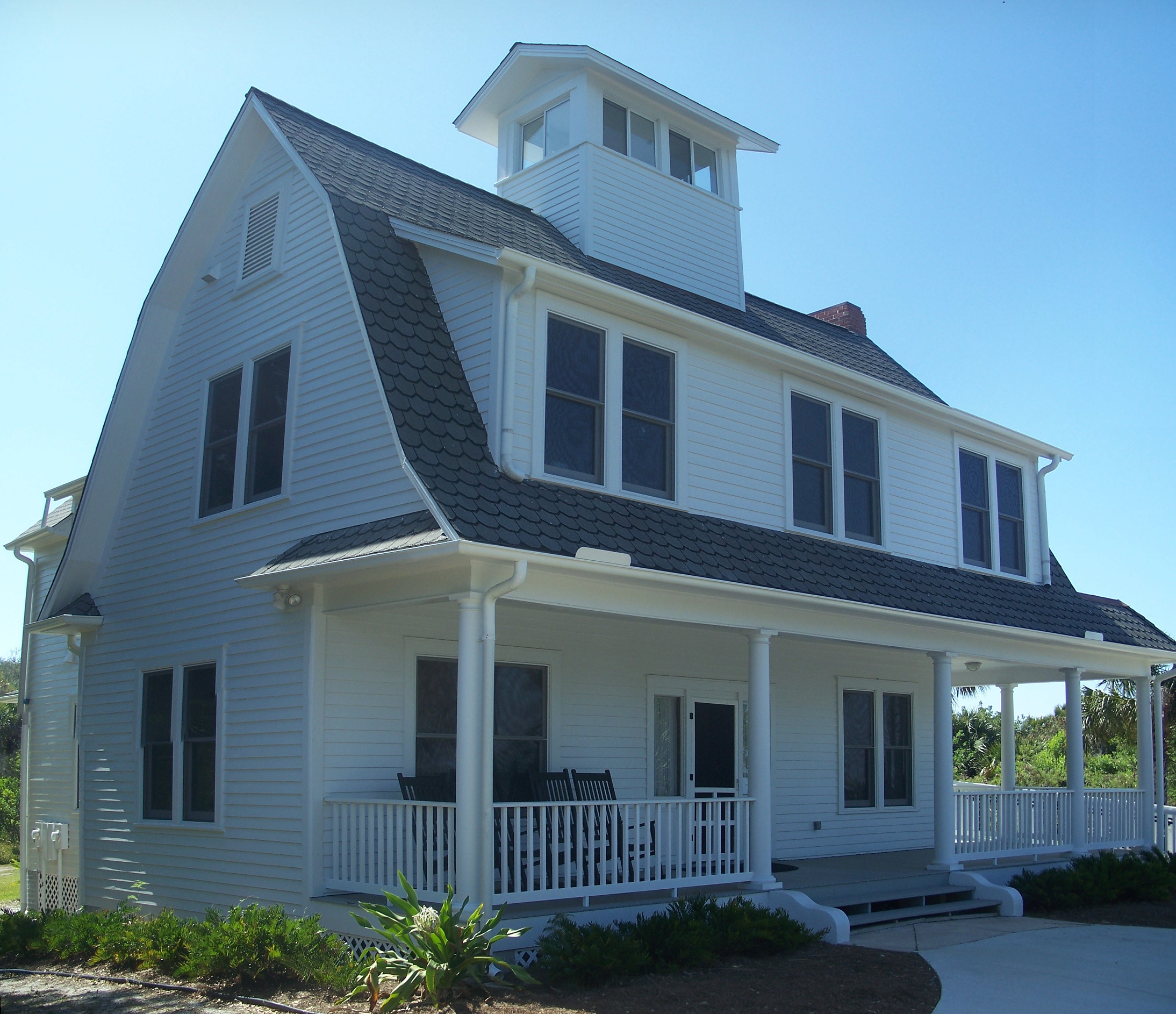
Eldora is an uninhabited place in Volusia County, Florida, United States. It is located within Canaveral National Seashore, south of Bethune Beach and west of County Road A1A. The average elevation is 3 feet above sea level. History Eldora was a community of orange groves in the latter part of the 19th century. After the Great Freeze in the winter of 1894–95 destroyed most of its crops, it was nearly completely abandoned and has never regained its population. After the death of its last resident, Doris "Doc" Leeper in 2000, a locally famous artist and conservationist in the 1980s, the management of the town was officially turned over to the federal government, and the town is now located more than two miles within the borders of the Canaveral National Seashore. The town claims no permanent residents, and visitation is limited and subject to park hours. Only two of its original buildings remain. The largest, " The Eldora House", now holds a museum. Although the town's orang ... [...More Info...] [...Related Items...] OR: [Wikipedia] [Google] [Baidu] |
Agave Angustifolia
''Agave angustifolia'' (Caribbean agave) is a species of agave plant which is native to Mexico and Central America. It is used to make mezcal and also as an ornamental plant. The cultivar 'Marginata' that white margins on the leaves is a popular variety cultivated in botanical gardens and backyards. It is very closely related to blue agave ''Agave tequilana'', but is used to make the distilled alcoholic beverage mezcal instead of tequila, and is the predominant agave species grown in the Mexican state of Oaxaca. Image:Caribbean Agave (Agave angustifolia) with inflorescence at Secunderabad, AP W IMG 6676.jpg, with inflorescence in Hyderabad, India Image:Caribbean Agave (Agave angustifolia) inflorescence- close up at Secunderabad, AP W IMG 6679.jpg, inflorescence- close up in Hyderabad, India File:Agave angustifolia (Caribbean Agave) in Hyderabad W IMG 8663.jpg, in Hyderabad, India Hyderabad is the capital and largest city of the Indian state of Telangana. It occupies on ... [...More Info...] [...Related Items...] OR: [Wikipedia] [Google] [Baidu] |
John B
John Bryn Williams (born 1977), known as John B, is an English disc jockey and electronic music producer. He is widely recognised for his eccentric clothing, wild hair, and his production of several cutting edge drum and bass tracks. John B ranked number 76 in '' DJ Magazine''s 2010 Top 100 DJs annual poll, announced on 27 October 2010. Career Williams was born on 12 July 1977 in Maidenhead, Berkshire. He started producing music around the age of 14, and now is the head of drum and bass record label Beta Recordings, together with its more specialist drum and bass sub-labels Nu Electro, Tangent, and Chihuahua. He also has releases on Formation Records, Metalheadz and Planet Mu. Williams was ranked 92nd drum and bass DJ on the 2009 '' DJ Magazine'' top 100. Style While his trademark sound has evolved through the years, it generally involves female vocals and trance-like synths (a style which has been dubbed "trance and bass", "trancestep" and "futurestep" by listeners). Hi ... [...More Info...] [...Related Items...] OR: [Wikipedia] [Google] [Baidu] |
Bartram's Travels
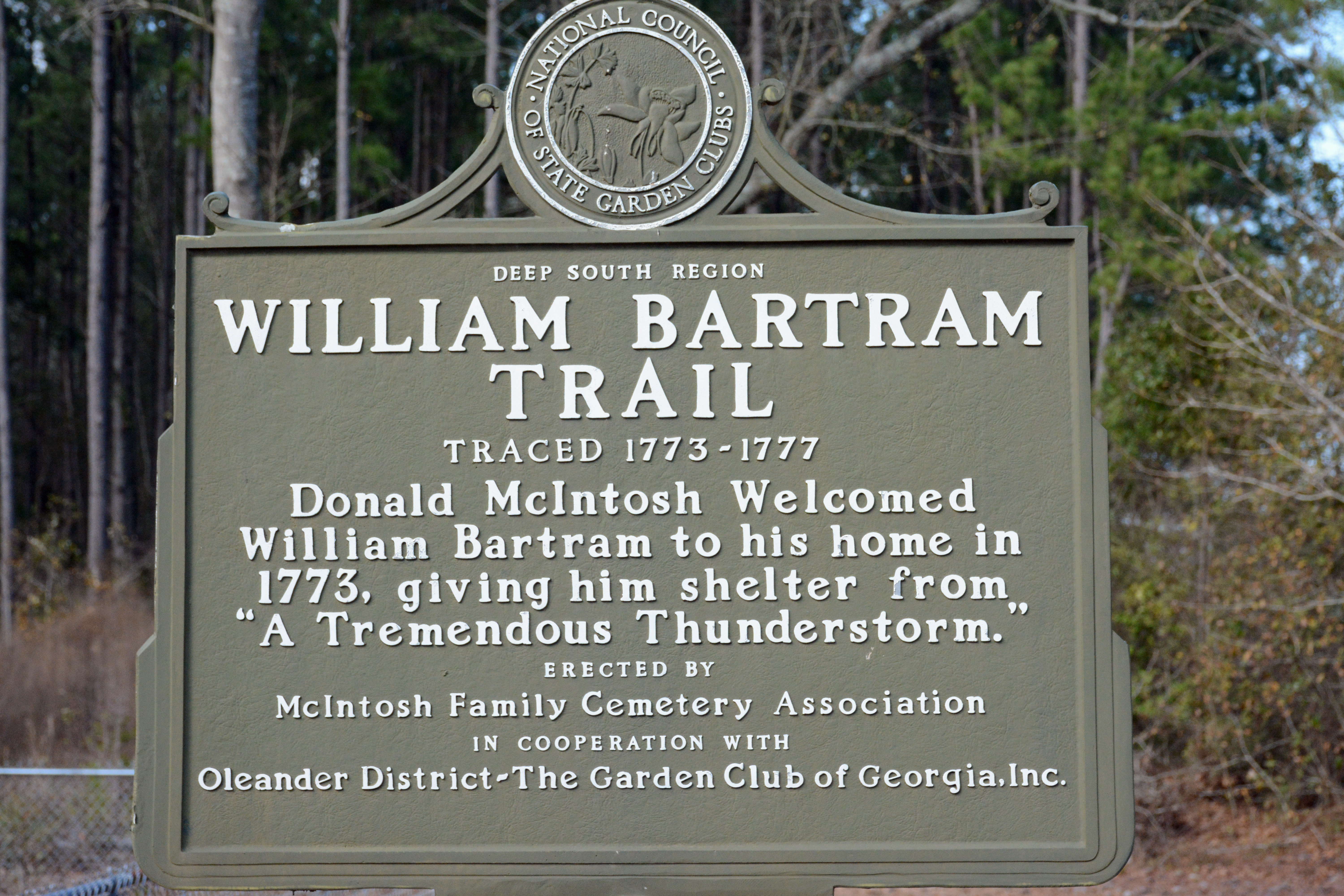
Bartram's ''Travels'' is the short title of naturalist William Bartram's book describing his travels in the American South and encounters with American Indians between 1773 and 1777. The book was published in Philadelphia, Pennsylvania in 1791 by the firm of James & Johnson. The book's full title is ''Travels through North and South Carolina, Georgia, East and West Florida, the Cherokee Country, the Extensive Territories of the Muscogulges or Creek Confederacy, and the Country of the Chactaws. Containing an Account of the Soil and Natural Productions of Those Regions; Together with Observations on the Manners of the Indians.'' The travels William Bartram was a Quaker and the son of naturalist John Bartram. In 1772, Dr. John Fothergill of London commissioned William Bartram to explore the Florida territories, collecting seeds, making drawings, and taking specimens of unfamiliar plants. Bartram sailed from Philadelphia in March 1773, explored Georgia, and began exploring E ... [...More Info...] [...Related Items...] OR: [Wikipedia] [Google] [Baidu] |
William Bartram
William Bartram (April 20, 1739 – July 22, 1823) was an American naturalist, writer and explorer. Bartram was the author of an acclaimed book, now known by the shortened title Bartram's ''Travels'', which chronicled his explorations of the Southern Colonies of British North America from 1773 to 1777. Bartram has been described as "the first naturalist who penetrated the dense tropical forests of Florida". Bartram was one of the first ornithologists born in America. In 1756, at the age of 17, he collected the type specimens of 14 species of American birds, which were illustrated and described by the English naturalist George Edwards in ''Gleanings of Natural History'' vol. 2 (1760). These accounts formed the basis of the scientific descriptions of Linnaeus (1707–1778), Johann Friedrich Gmelin (1748–1804) and John Latham (1740–1837). Bartram also made significant contributions to botanical literature. Like his father, he was a member of the American Philosophical Societ ... [...More Info...] [...Related Items...] OR: [Wikipedia] [Google] [Baidu] |
Cacique
A cacique, sometimes spelled as cazique (; ; feminine form: ), was a tribal chieftain of the Taíno people, who were the Indigenous inhabitants of the Bahamas, the Greater Antilles, and the northern Lesser Antilles at the time of European contact with those places. The term is a Spanish transliteration of the Taíno word . Cacique was initially translated as "king" or "prince" for the Spanish. In the colonial era, the conquistadors and the administrators who followed them used the word generically to refer to any leader of practically any indigenous group they encountered in the Western Hemisphere. In Hispanic and Lusophone countries, the term has also come to mean a political boss, similar to a ''caudillo,'' exercising power in a system of caciquism. Spanish colonial-era caciques The Taíno word descends from the Taíno word , which means "to keep house". In 1555 the word first entered the English language, defined as "prince". In Taíno culture, the rank was heredita ... [...More Info...] [...Related Items...] OR: [Wikipedia] [Google] [Baidu] |
Surruque
The Surruque people lived along the middle Atlantic coast of Florida during the 16th and 17th centuries. They may have spoken a dialect of the Timucua language, but were allied with the Ais. The Surruque became clients of the Spanish government in St. Augustine, but were not successfully brought into the Spanish mission system. Demography The Surruque lived around the Mosquito Lagoon (called Surruque Lagoon by the Spanish), near Cape Canaveral, and along the Atlantic coast north from the Cape up to near Ponce de Leon Inlet. The northern limit of Surruque territory was Turtle Mound, which was called "Surruque" in the early 17th century. To the north of Surruque territory was the territory of the Timucua-speaking town of Nocoroco, at the mouth of the Tomoka River. Its territory extended south of the Ponce de Leon Inlet to Caparaca, near present-day New Smyrna Beach. The northern boundary of Surruque territory was around Turtle Mound. The province of Ais was to the south of ... [...More Info...] [...Related Items...] OR: [Wikipedia] [Google] [Baidu] |
Álvaro Mexía
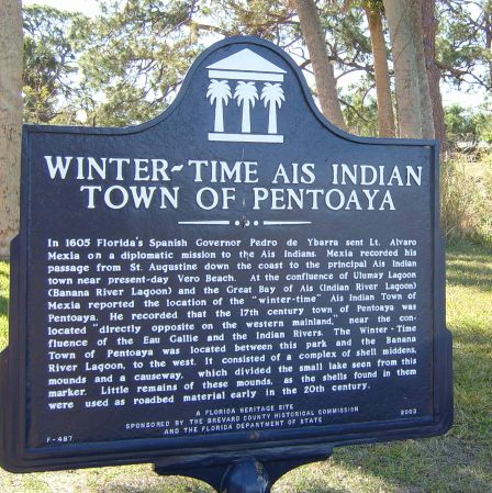
Alvaro Mexia was a 17th-century Spain, Spanish explorer and cartography, cartographer of the east coast of Florida. Mexia was stationed in St. Augustine, Florida, St Augustine and was given a diplomatic mission to the Indigenous peoples of Florida, native populations living south of St. Augustine and in the Cape Canaveral, Florida, Cape Canaveral area. This mission resulted in a "Period of Friendship" between the Spanish and the Ais (tribe), Ais native population. When Pedro de Ibarra (governor of La Florida), Pedro de Ibarra became the Spanish Governor of Florida, he knew the Spanish needed to improve relations with the natives, so he sent Mexia on a diplomatic mission in Timeline of Florida History, 1605 to gain knowledge of the lands and populations south of St. Augustine, as well as to assist that year's treasure fleet on its way back to Spain. Mexia wrote about his experiences among the native Ais (tribe), Ais in a document known as a ''Derrotero'', a self-proclaimed "truthf ... [...More Info...] [...Related Items...] OR: [Wikipedia] [Google] [Baidu] |
Green Mound
Green Mound is one of the largest Pre-Columbian shell mounds, or shell middens, in the United States. Located in Ponce Inlet, Florida, the peak of the mound is the highest elevation in the small city. While it once stood at forty feet above sea level, a combination of public works projects on the nearby roads and natural erosion have reduced the height of the mound by about 10 feet. The mound was built by Native Americans of the late St. Johns II cultural period, as indicated by the finding of pre-Columbian "chalky ware" ceramics dating to later than 800 AD. These overlie earlier relics of the St. Johns I cultural period, the cultural period following the Archaic period. The St. Johns period was characterized by the introduction of mound-building and a more sedentary, rather than nomadic, lifestyle. The natives who once lived at this location were closely tied to both the nearby Atlantic Ocean and the resource-rich saltwater estuaries of the Halifax River immediately ... [...More Info...] [...Related Items...] OR: [Wikipedia] [Google] [Baidu] |
Spanish Florida
Spanish Florida () was the first major European land-claim and attempted settlement-area in northern America during the European Age of Discovery. ''La Florida'' formed part of the Captaincy General of Cuba in the Viceroyalty of New Spain, and the Spanish Empire during Spanish colonization of the Americas. While its boundaries were never clearly or formally defined, the territory was initially much larger than the present-day state of Florida, extending over much of what is now the southeastern United States, including all of present-day Florida plus portions of Georgia, South Carolina, North Carolina, Alabama, Mississippi, and the Florida Parishes, Florida Parishes of Louisiana. Spain based its claim to this vast area on several wide-ranging expeditions mounted during the 16th century. A number of missions, settlements, and small forts existed in the 16th and to a lesser extent in the 17th century; they were eventually abandoned due to pressure from the expanding English and Fre ... [...More Info...] [...Related Items...] OR: [Wikipedia] [Google] [Baidu] |
Landmark
A landmark is a recognizable natural or artificial feature used for navigation, a feature that stands out from its near environment and is often visible from long distances. In modern-day use, the term can also be applied to smaller structures or features that have become local or national symbols. Etymology In Old English, the word ''landmearc'' (from ''land'' + ''mearc'' (mark)) was used to describe a boundary marker, an "object set up to mark the boundaries of a kingdom, estate, etc." Starting around 1560, this interpretation of "landmark" was replaced by a more general one. A landmark became a "conspicuous object in a landscape". A ''landmark'' literally meant a geographic feature used by explorers and others to find their way back to their departure point, or through an area. For example, Table Mountain near Cape Town, South Africa, was used as a landmark to help sailors navigate around the southern tip of Africa during the Age of Exploration. Artificial structures ar ... [...More Info...] [...Related Items...] OR: [Wikipedia] [Google] [Baidu] |


