|
Turkana Jet
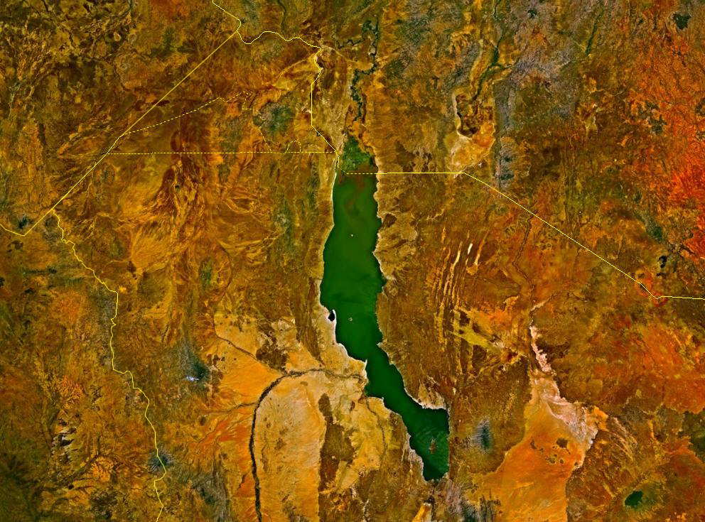
The Turkana jet is a low-level, south-easterly wind flowing from Kenya to South Sudan. The jet passes through the Turkana channel between the Ethiopian and East African highlands. The Lake Turkana Wind Power Station (the largest wind farm in Africa, as of 2024) benefits from the semi-permanence of the jet throughout the year. The jet was first presented in scientific literature by Kinuthia and Asnani in 1982 using measurements collected in Marsabit, Kenya. At Marsabit, the wind is strongest around 200–500 m above the ground, and has been known to reach speeds of 50 m/s. There is a variation in jet strength throughout the day, peaking between 00 and 06 UTC. Causes The factors influencing the Turkana jet and its diurnal cycle are complex. The general wind flow is onto the African continent from the Indian Ocean in association with north-easterly or south-easterly Trade winds, depending on the time of year. The strong winds of the jet are a synoptic scale (~1000 km) feature ... [...More Info...] [...Related Items...] OR: [Wikipedia] [Google] [Baidu] |
Trade Winds
The trade winds or easterlies are permanent east-to-west prevailing winds that flow in the Earth's equatorial region. The trade winds blow mainly from the northeast in the Northern Hemisphere and from the southeast in the Southern Hemisphere, strengthening during the winter and when the Arctic oscillation is in its warm phase. Trade winds have been used by captains of sailing ships to cross the world's oceans for centuries. They enabled European colonization of the Americas, and trade routes to become established across the Atlantic Ocean and the Pacific Ocean. In meteorology, they act as the steering flow for tropical storms that form over the Atlantic, Pacific, and southern Indian oceans and cause rainfall in North America, Southeast Asia, and Madagascar and East Africa. Shallow cumulus clouds are seen within trade wind regimes and are capped from becoming taller by a trade wind inversion, which is caused by descending air aloft from within the subtropical ridge. The ... [...More Info...] [...Related Items...] OR: [Wikipedia] [Google] [Baidu] |
Lake Turkana
Lake Turkana () is a saline lake in the Kenyan Rift Valley, in northern Kenya, with its far northern end crossing into Ethiopia. It is the world's largest permanent desert lake and the world's largest alkaline lake. By volume it is the world's fourth-largest salt lake after the Caspian Sea, Issyk-Kul, and Lake Van (passing the shrinking South Aral Sea), and among all lakes it ranks 24th. Lake Turkana is now threatened by the construction of the Gilgel Gibe III Dam in Ethiopia due to the damming of the Omo river which supplies most of the lake's water. Although the lake commonly has been—and to some degree still is—used for drinking water, its salinity (slightly brackish) and very high levels of fluoride (much higher than in fluoridated water) generally make it unsuitable for drinking directly, and it has also been a source of diseases spread by contaminated water. Increasingly, communities on the lake's shores rely on underground springs for drinking water. The ... [...More Info...] [...Related Items...] OR: [Wikipedia] [Google] [Baidu] |
Atmospheric Reanalysis
An atmospheric reanalysis (also: meteorological reanalysis and climate reanalysis) is a meteorological and climate data assimilation project which aims to assimilate historical atmospheric observational data spanning an extended period, using a single consistent assimilation (or "analysis") scheme throughout. Operational data analysis In operational numerical weather prediction, forecast models are used to predict future states of the atmosphere, based on how the climate system evolves with time from an initial state. The initial state provided as input to the forecast must consist of data values for a range of "prognostic" meteorological fields – that is, those fields which determine the future evolution of the model. Spatially varying fields are required in the form used by the model, for example at each intersection point on a regular grid of longitude and latitude circles, and initial data must be valid at a single time that corresponds to the present or the recent past ... [...More Info...] [...Related Items...] OR: [Wikipedia] [Google] [Baidu] |
Katabatic Wind
A katabatic wind (named ) is a downslope wind caused by the flow of an elevated, high-density air mass into a lower-density air mass below under the force of gravity. The spelling catabatic is also used. Since air density is strongly dependent on temperature, the high-density air mass is usually cooler, and the katabatic winds are relatively cool or cold. Examples of katabatic winds include the downslope valley and mountain breezes, the piteraq winds of Greenland, the Bora in the Adriatic, the Bohemian Wind or ''Böhmwind'' in the Ore Mountains, the Santa Ana winds in southern California, the oroshi in Japan, or "the Barber" in New Zealand. Not all downslope winds are katabatic. For instance, winds such as the föhn and chinook are rain shadow winds where air driven upslope on the windward side of a mountain range drops its moisture and descends leeward drier and warmer. Mechanism A katabatic wind originates from the difference of density of two air masses located ... [...More Info...] [...Related Items...] OR: [Wikipedia] [Google] [Baidu] |
Bernoulli's Principle
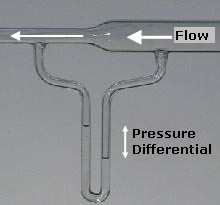
Bernoulli's principle is a key concept in fluid dynamics that relates pressure, speed and height. For example, for a fluid flowing horizontally Bernoulli's principle states that an increase in the speed occurs simultaneously with a decrease in static pressure, pressure The principle is named after the Swiss mathematician and physicist Daniel Bernoulli, who published it in his book ''Hydrodynamica'' in 1738. Although Bernoulli deduced that pressure decreases when the flow speed increases, it was Leonhard Euler in 1752 who derived Bernoulli's equation in its usual form. Bernoulli's principle can be derived from the principle of conservation of energy. This states that, in a steady flow, the sum of all forms of energy in a fluid is the same at all points that are free of viscous forces. This requires that the sum of kinetic energy, potential energy and internal energy remains constant. Thus an increase in the speed of the fluid—implying an increase in its kinetic energy—occur ... [...More Info...] [...Related Items...] OR: [Wikipedia] [Google] [Baidu] |
Orography
Orography is the study of the topographic relief of mountains, and can more broadly include hills, and any part of a region's elevated terrain. Orography (also known as ''oreography'', ''orology,'' or ''oreology'') falls within the broader discipline of geomorphology. The term orography comes from the Greek: , hill, , to write. Uses Mountain ranges and elevated land masses have a major impact on global climate. For instance, the elevated areas of East Africa substantially determine the strength of the Indian monsoon.Srinivasan, J., Nanjundiah, Ravi S. and Chakraborty, Arindam (2005)"Impact of Orography on the Simulation of Monsoon Climate in a General Circulation Model" Indian Institute of Science. In scientific models, such as general circulation models, orography defines the lower boundary of the model over land. When a river's tributaries or settlements by the river are listed in 'orographic sequence', they are in order from the highest (nearest the source of the river) to t ... [...More Info...] [...Related Items...] OR: [Wikipedia] [Google] [Baidu] |
Indian Ocean
The Indian Ocean is the third-largest of the world's five oceanic divisions, covering or approximately 20% of the water area of Earth#Surface, Earth's surface. It is bounded by Asia to the north, Africa to the west and Australia (continent), Australia to the east. To the south it is bounded by the Southern Ocean or Antarctica, depending on the definition in use. The Indian Ocean has large marginal or regional seas, including the Andaman Sea, the Arabian Sea, the Bay of Bengal, and the Laccadive Sea. Geologically, the Indian Ocean is the youngest of the oceans, and it has distinct features such as narrow continental shelf, continental shelves. Its average depth is 3,741 m. It is the warmest ocean, with a significant impact on global climate due to its interaction with the atmosphere. Its waters are affected by the Indian Ocean Walker circulation, resulting in unique oceanic currents and upwelling patterns. The Indian Ocean is ecologically diverse, with important ecosystems such ... [...More Info...] [...Related Items...] OR: [Wikipedia] [Google] [Baidu] |
Kenya
Kenya, officially the Republic of Kenya, is a country located in East Africa. With an estimated population of more than 52.4 million as of mid-2024, Kenya is the 27th-most-populous country in the world and the 7th most populous in Africa. Kenya's capital and largest city is Nairobi. Its second-largest and oldest city is Mombasa, a major port city located on Mombasa Island. Other major cities within the country include Kisumu, Nakuru & Eldoret. Going clockwise, Kenya is bordered by South Sudan to the northwest (though much of that border includes the disputed Ilemi Triangle), Ethiopia to the north, Somalia to the east, the Indian Ocean to the southeast, Tanzania to the southwest, and Lake Victoria and Uganda to the west. Kenya's geography, climate and population vary widely. In western, rift valley counties, the landscape includes cold, snow-capped mountaintops (such as Batian, Nelion and Point Lenana on Mount Kenya) with vast surrounding forests, wildlife and ... [...More Info...] [...Related Items...] OR: [Wikipedia] [Google] [Baidu] |
Africa
Africa is the world's second-largest and second-most populous continent after Asia. At about 30.3 million km2 (11.7 million square miles) including adjacent islands, it covers 20% of Earth's land area and 6% of its total surface area.Sayre, April Pulley (1999), ''Africa'', Twenty-First Century Books. . With nearly billion people as of , it accounts for about of the world's human population. Demographics of Africa, Africa's population is the youngest among all the continents; the median age in 2012 was 19.7, when the worldwide median age was 30.4. Based on 2024 projections, Africa's population will exceed 3.8 billion people by 2100. Africa is the least wealthy inhabited continent per capita and second-least wealthy by total wealth, ahead of Oceania. Scholars have attributed this to different factors including Geography of Africa, geography, Climate of Africa, climate, corruption, Scramble for Africa, colonialism, the Cold War, and neocolonialism. Despite this lo ... [...More Info...] [...Related Items...] OR: [Wikipedia] [Google] [Baidu] |
Coordinated Universal Time
Coordinated Universal Time (UTC) is the primary time standard globally used to regulate clocks and time. It establishes a reference for the current time, forming the basis for civil time and time zones. UTC facilitates international communication, navigation, scientific research, and commerce. UTC has been widely embraced by most countries and is the effective successor to Greenwich Mean Time (GMT) in everyday usage and common applications. In specialised domains such as scientific research, navigation, and timekeeping, other standards such as Universal Time, UT1 and International Atomic Time (TAI) are also used alongside UTC. UTC is based on TAI (International Atomic Time, abbreviated from its French name, ''temps atomique international''), which is a weighted average of hundreds of atomic clocks worldwide. UTC is within about one second of mean solar time at 0° longitude, the currently used prime meridian, and is not adjusted for daylight saving time. The coordination of t ... [...More Info...] [...Related Items...] OR: [Wikipedia] [Google] [Baidu] |


