|
Tsona City
Tsona City (, zh, s=错那市), formerly Tsona County, is a county-level city in Shannan Prefecture in the southeastern part of the Tibet region of China. Tsona means "The face of the ara Yumcolake" in Tibetan. It lies immediately to the north of the McMahon Line agreed as the mutual border between British India and Tibet in 1914. China has not accepted the 1914 border delineation, but treats it as the Line of Actual Control (LAC). Tsona also borders Bhutan on its southwest. History In 1354, the Phagmodrupa dynasty established Tsona County (''mtsho sna rdzong''). In the 17th century, sectarian rivalries developed between the Gelugpa sect that was in the ascendant in Central Tibet and the Drukpa sect that got consolidated in Bhutan. The Mera lama of the Merag-Sagteng region in present-day Bhutan, belonging to the Gelugpa sect, was chased out of his native village by the Drukpa forces. He fled to the neighbouring Tawang region. The people of Tawang were apparently indiffe ... [...More Info...] [...Related Items...] OR: [Wikipedia] [Google] [Baidu] |
County-level City
A county-level city () is a County-level divisions of China, county-level administrative division of the China, People's Republic of China. County-level cities have judiciary, judicial but no legislature, legislative rights over their own local ordinance, local law and are usually governed by Administrative divisions of China#Prefectural level (2nd), prefecture-level divisions, but a few are governed directly by Administrative divisions of China#Provincial level (1st), province-level divisions. A county-level city is a "city" () and "county" () that have been merged into one unified jurisdiction. As such, it is simultaneously a city, which is a municipal entity, and a county, which is an administrative division of a prefecture. Most county-level cities were created in the 1980s and 1990s by replacing denser populated Counties of China, counties. County-level cities are not "city, cities" in the strictest sense of the word, since they usually contain rural areas many times the size ... [...More Info...] [...Related Items...] OR: [Wikipedia] [Google] [Baidu] |
Bhutan
Bhutan, officially the Kingdom of Bhutan, is a landlocked country in South Asia, in the Eastern Himalayas between China to the north and northwest and India to the south and southeast. With a population of over 727,145 and a territory of , Bhutan ranks List of countries and dependencies by area, 133rd in land area and List of countries and dependencies by population, 160th in population. Bhutan is a Democracy, democratic constitutional monarchy with a King of Bhutan, King as the head of state and a Prime Minister of Bhutan, prime minister as the head of government. The Je Khenpo is the head of the state religion, Vajrayana Buddhism. The Himalayas, Himalayan mountains in the north rise from the country's lush subtropical plains in the south. In the Mountains of Bhutan, Bhutanese Himalayas, there are peaks higher than above sea level. Gangkhar Puensum is Bhutan's highest peak and is the highest unclimbed mountain in the world. The wildlife of Bhutan is notable for its diversi ... [...More Info...] [...Related Items...] OR: [Wikipedia] [Google] [Baidu] |
Chinese Communist Party
The Communist Party of China (CPC), also translated into English as Chinese Communist Party (CCP), is the founding and One-party state, sole ruling party of the People's Republic of China (PRC). Founded in 1921, the CCP emerged victorious in the Chinese Civil War against the Kuomintang and Proclamation of the People's Republic of China, proclaimed the establishment of the PRC under the leadership of Mao Zedong in October 1949. Since then, the CCP has governed China and has had sole control over the People's Liberation Army (PLA). , the CCP has more than 99 million members, making it the List of largest political parties, second largest political party by membership in the world. In 1921, Chen Duxiu and Li Dazhao led the founding of the CCP with the help of the Far Eastern Bureau of the Communist Party of the Soviet Union, Russian Communist Party (Bolsheviks) and Far Eastern Bureau of the Communist International. Although the CCP aligned with the Kuomintang (KMT) during its initia ... [...More Info...] [...Related Items...] OR: [Wikipedia] [Google] [Baidu] |
Tsedang
Tsetang () or Zedang (), is the fourth largest city in Tibet and is located in the Yarlung Valley, southeast of Lhasa in Nedong District of the Shannan Prefecture in the Tibet region of China. It is the capital of Shannan Prefecture (which is also referred to as "Shannan City"). Tsetang has been the capital of the Yarlung region since antiquity and was the seat of the ancient emperors of Tibet and, as such, a place of great importance. In the 19th century, it is said to have comprised some 1,000 houses, a bazaar, a gompa and a fort. As the capital of Shannan, it is the second-largest settlement in the historical Ü-Tsang region. It lies at an elevation of above sea level and has a population of approximately 52,000 persons. It is only about to the northeast of the town of Nedong and they have now essentially merged into one city. Tsetang is situated near the flank of Mount Gongbori () where many ancient ruins (such as ruins of Gajiu Monastery) are located. It is known as ... [...More Info...] [...Related Items...] OR: [Wikipedia] [Google] [Baidu] |
Sixth Dalai Lama
The 6th Dalai Lama, Tsangyang Gyatso (; 1 March 1683 – after 1706), was recognized as the 6th Dalai Lama after a delay of many years, permitting the Potala Palace to be completed. He was an unconventional Dalai Lama that preferred a Nyingma school yogi's life to that of an ordained monk. He was later kidnapped and deposed by the Koshut Lha-bzang Khan. The death of the 5th Dalai Lama remained concealed for many years by his Kalon, in order to complete the building of the Potala Palace. The 6th Dalai Lama was born in southern Tibet, known as "Monyul", at Urgelling Monastery, which is in modern-day Tawang district, Arunachal Pradesh, India. He was officially located at the age of either 13 or 14. As a youth, he showed high levels of intelligence with unconventional views. Later and while living as a lay practitioner and a yogi, he grew his hair long, dressed as a regular Tibetan, and was said to also drink alcohol and openly accept women as companions. He was said to be a p ... [...More Info...] [...Related Items...] OR: [Wikipedia] [Google] [Baidu] |
West Kameng District
West Kameng (pronounced ) is a district of Arunachal Pradesh in northeastern India. It accounts for 8.86% of the total area of the state. The name is derived from the Kameng river, a tributary of the Brahmaputra, that flows through the district. History The area around the Kameng river has traditionally come under the control of the Mon kingdom, Bhutan, Tibet and the Ahom kingdom. Tibetan Buddhism got a strong foothold among the tribal groups as early as in the 7th century, where the Kachen Lama constructed the Lhagyala Gompa in Morshing. Whenever loose control was exerted over the area, small, feudal chiefdoms ruled by the Miji and the Aka chiefs dominated control over the area. This can be evidenced in the fact that ruined fortresses like those in Bhalukpong constructed in the 10th to 12th century and the Dirang fort, which was constructed in the 17th century to defend against invasions from neighbouring chiefdoms. Upon the arrival of the British, the present- ... [...More Info...] [...Related Items...] OR: [Wikipedia] [Google] [Baidu] |
Sela Pass
The Sela Pass () ( more appropriately called ''Se La'', as La means Pass in Tibetan language) is a high-altitude mountain pass located on the border between the Tawang and West Kameng districts in the Indian state of Arunachal Pradesh. It has an elevation of 4170 m (13,700 ft) and connects the Indian Buddhist town of Tawang to Dirang and Guwahati. The pass carries the National Highway 13 (previously NH 229), connecting Tawang with the rest of India. The pass supports scarce amounts of vegetation and is usually snow-covered to some extent throughout the year. Sela Lake, near the summit of the pass, is one of approximately 101 lakes in the area that are sacred in Tibetan Buddhism. While Sela Pass does get heavy snowfall in winters, it is usually open throughout the year unless landslides or snow require the pass to be shut down temporarily. Sela pass is one of the highest motorable mountain passes in the world Etymology During the 1962 Sino-Indian War, ... [...More Info...] [...Related Items...] OR: [Wikipedia] [Google] [Baidu] |
Dirang
Dirang H.Q. (simply Dirang) is a village in the district of West Kameng in the Indian state of Arunachal Pradesh Arunachal Pradesh (; ) is a States and union territories of India, state in northeast India. It was formed from the North-East Frontier Agency (NEFA) region, and India declared it as a state on 20 February 1987. Itanagar is its capital and la .... Dirang is one of the 60 constituencies of Legislative Assembly of Arunachal Pradesh. , Phurpa Tsering is the current MLA of Dirang. See also * List of constituencies of Arunachal Pradesh Legislative Assembly * Arunachal Pradesh Legislative Assembly References {{Reflist Villages in West Kameng district Dzongs in Tibet ... [...More Info...] [...Related Items...] OR: [Wikipedia] [Google] [Baidu] |
Tawang
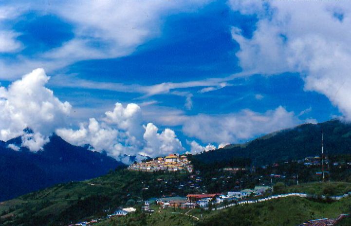
Tawang is a town and administrative headquarter of Tawang district in the Indian state of Arunachal Pradesh. It lies on NH-13 section of Trans-Arunachal Highway. The town was once the headquarter of the Tawang Tract, which is now divided into the Tawang district and the West Kameng district. Tawang continues as the headquarters of the former. Tawang is the number one tourist destination of Arunachal Pradesh. Tawang became part of British Raj ruled India after the 1914 Simla Convention, where the McMahon Line placed it within the British Raj, though actual control remained loose. In 1951, Major Bob Khathing led an expedition and established full Indian administrative control over Tawang. Since then, it has been part of India. China continues to claim Tawang as its territory. It is situated 448 km north-west of state capital Itanagar at an elevation of approximately . It lies to the north of the Tawang Chu river valley, roughly south of the Line of Actual Control wit ... [...More Info...] [...Related Items...] OR: [Wikipedia] [Google] [Baidu] |
Fifth Dalai Lama
The 5th Dalai Lama, Ngawang Lobsang Gyatso (; ; 1617–1682) was recognized as the 5th Dalai Lama, and he became the first Dalai Lama to hold both Tibet's political and spiritual leadership roles. He is often referred to simply as the Great Fifth, being the key religious and temporal leader of Tibetan Buddhism and Tibet. He is credited with unifying all of Tibet under the Ganden Phodrang, after Gushri Khan's successful military interventions. As an independent head of state, he established priest and patron relations with both Mongolia and the Qing dynasty simultaneously, and had positive relations with other neighboring countries. He began the custom of meeting early European explorers. The 5th Dalai Lama built the Potala Palace, and also wrote 24 volumes' worth of scholarly and religious works on a wide range of subjects. Early life To understand the context within which the Dalai Lama institution came to hold temporal power in Tibet during the lifetime of the 5th, it ... [...More Info...] [...Related Items...] OR: [Wikipedia] [Google] [Baidu] |
Tawang District
Tawang district (Pron:/tɑ:ˈwæŋ or təˈwæŋ/) is the smallest of the 26 Districts of Arunachal Pradesh, administrative districts of Arunachal Pradesh state in northeastern India. With a population of 49,977, it is the eighth least populous district in the country (out of Districts of India, 707). History Tawang is inhabited by the Monpa people. From 500 BC to 600 AD a kingdom known as Lhomon or Monyul ruled the area. The Monyul kingdom was later absorbed into the control of neighbouring Bhutan and Tibet. Tawang Monastery was founded by the Merak Lama Lodre Gyatso in 1681 in accordance with the wishes of the 5th Dalai Lama, Ngawang Lobsang Gyatso, and has an interesting legend surrounding its name, which means "Chosen by Horse". The sixth Dalai Lama, Tsangyang Gyatso, 6th Dalai Lama, Tsangyang Gyatso, was born in Tawang. Tawang was historically part of Tibet. The Simla Accord (1914), 1914 Simla Accord defined the McMahon Line as the new boundary between British India a ... [...More Info...] [...Related Items...] OR: [Wikipedia] [Google] [Baidu] |
Merag-Sagteng
Merag-Sagteng (Dzongkha: མེ་རག་ སག་སྟེང་; Sakten Dungkhag;also called "Mera Sagteng," "Mera Sagten," "Merak Sagteng,""Mira Sagteng," and "Mira-Sakden") is a Dungkhag ( sub-district of a dzongkhag) of Trashigang District, Bhutan Bhutan, officially the Kingdom of Bhutan, is a landlocked country in South Asia, in the Eastern Himalayas between China to the north and northwest and India to the south and southeast. With a population of over 727,145 and a territory of , .... Sakten Dungkhag is composed of Merag Gewog and Sakten Gewog. References Gewogs of Bhutan Trashigang District {{Bhutan-geo-stub ... [...More Info...] [...Related Items...] OR: [Wikipedia] [Google] [Baidu] |


