|
Trout Lake (Ontario)
Trout Lake is a lake in the municipalities of East Ferris and North Bay, Nipissing District, Northeastern Ontario, Canada. It lies approximately east of the much larger Lake Nipissing, with the city of North Bay in between them. Trout Lake is the source of the Mattawa River and a significant body of water on a well-known historic North American voyageur (fur-trading) route. It is about long and wide and exits eastward into the Mattawa River, which flows via the Ottawa River to the St. Lawrence River. Some of the most difficult portages are found on this part of the voyageur route between Trout Lake and the end of the Mattawa River, e.g., Portage de Mauvaise Musique, located at the Talon Chute (named after explorer and voyageur Jean Talon). History Due to the short overland distance to Lake Nipissing, Trout Lake became a natural waypoint for Voyageurs en route to and from Mattawa. A train derailment in the 1980's resulted in a significant toxic spill, which ended up wipi ... [...More Info...] [...Related Items...] OR: [Wikipedia] [Google] [Baidu] |
East Ferris, Ontario
East Ferris is a township (Canada), township in northeastern Ontario, Canada located between Trout Lake (Ontario), Trout Lake and Lake Nosbonsing in the Nipissing District, Ontario, District of Nipissing. West Ferris Township, Ontario, West Ferris has long been annexed into the city of North Bay, Ontario, North Bay. Communities The main communities within East Ferris are Astorville and Corbeil. There are also smaller residential areas in the township, known as Derland Road and Lake Nosbonsing. Astorville and Derland were formerly stops along the Canadian National Railway Alderdale Subdivision. Rail service declined in the mid-20th century and was eliminated altogether in 1996. In July 2005, Astorville hosted the first Northern Ontario Ball Hockey Championship. In November 2005, Astorville was one of nine communities that voted on whether to accept private funding for a health centre.Brandi Cramer, "Plebiscite draws thousands- organizer," ''North Bay Nugget'', November 21, 2005 ... [...More Info...] [...Related Items...] OR: [Wikipedia] [Google] [Baidu] |
Lake Nipissing
Lake Nipissing (; , ) is a lake in the Provinces and territories of Canada, Canadian province of Ontario. It has a surface area of , a mean elevation of above sea level, and is located between the Ottawa River and Georgian Bay. Lake Nipissing is the third-largest lake entirely in Ontario. It is relatively shallow for a large lake, with an average depth of only . The shallowness of the lake makes for many Shoal, sandbars along the lake's irregular shoreline. The lake reaches a maximum depth of 64 m (210 ft) near the mouth of the French River (Ontario), French River, off the shore of Blueberry Island. The lake has many islands most of which are protected under the Protection of Significant Wetlands scheme, controlled by the Ministry of Natural Resources and Forestry. The largest population centre on the lake's shoreline is the city of North Bay, Ontario, North Bay. North Bay sits along the lake's northeastern shoreline. Other notable towns include Callander, Ontario, Cal ... [...More Info...] [...Related Items...] OR: [Wikipedia] [Google] [Baidu] |
Four Mile Bay
Four Mile Bay is a bay on Trout Lake in the city of North Bay, Nipissing District in Northeastern Ontario, Canada. The bay is about long, and is separated from the rest of Trout Lake by an equally long peninsula A peninsula is a landform that extends from a mainland and is only connected to land on one side. Peninsulas exist on each continent. The largest peninsula in the world is the Arabian Peninsula. Etymology The word ''peninsula'' derives , . T .... It varies from wide, the former at the mouth of the bay. The community of Camp Champlain is on it southern shore, and Four Mile Creek enters Trout Lake at the bay. References * * Landforms of Nipissing District Bays of Ontario {{NorthernOntario-geo-stub ... [...More Info...] [...Related Items...] OR: [Wikipedia] [Google] [Baidu] |
Seaplane
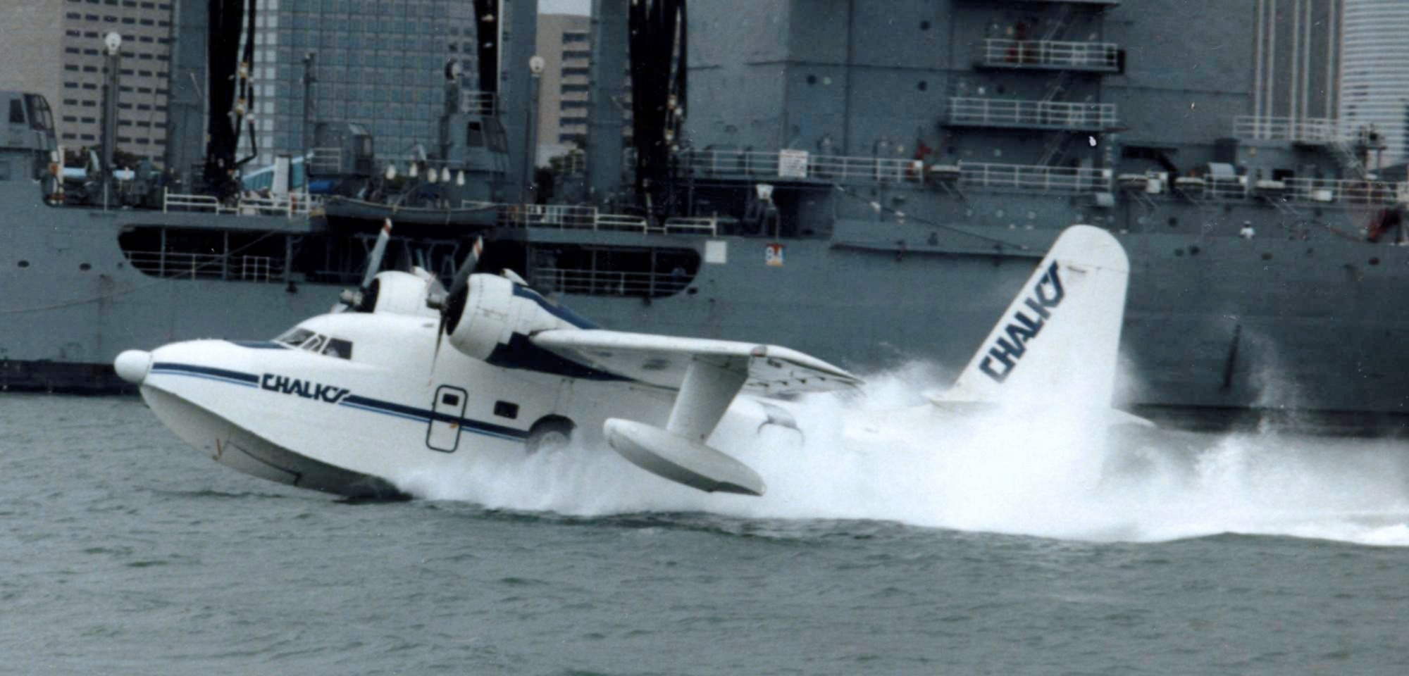
A seaplane is a powered fixed-wing aircraft capable of takeoff, taking off and water landing, landing (alighting) on water.Gunston, "The Cambridge Aerospace Dictionary", 2009. Seaplanes are usually divided into two categories based on their technological characteristics: floatplanes and flying boats; the latter are generally far larger and can carry far more. Seaplanes that can also take off and land on airfields are in a subclass called amphibious aircraft, or amphibians. Seaplanes were sometimes called ''hydroplanes'', but currently this term applies instead to Hydroplane (boat), motor-powered watercraft that use the technique of Planing (boat), hydrodynamic lift to skim the surface of water when running at speed. The use of seaplanes gradually tapered off after World War II, partially because of the investments in airports during the war but mainly because landplanes were less constrained by weather conditions that could result in sea states being too high to operate seaplanes ... [...More Info...] [...Related Items...] OR: [Wikipedia] [Google] [Baidu] |
Location Identifier
A location identifier is a symbolic representation for the name and the location of an airport, navigation aid, or weather station, and is used for staffed air traffic control facilities in air traffic control, telecommunications, computer programming, weather reports, and related services. ICAO location indicator The International Civil Aviation Organization establishes sets of four-letter location indicators which are published in ''ICAO Publication 7910''. These are used by air traffic control agencies to identify airports and by weather agencies to produce METAR weather reports. The first letter indicates the region; for example, K for the contiguous United States, C for Canada, E for northern Europe, R for the Asian Far East, and Y for Australia. Examples of ICAO location indicators are RPLL for Manila Ninoy Aquino Airport, KCEF for Westover Joint Air Reserve Base and EGLL for London Heathrow Airport. IATA identifier The International Air Transport Association uses set ... [...More Info...] [...Related Items...] OR: [Wikipedia] [Google] [Baidu] |
North Bay Water Aerodrome
North Bay Water Aerodrome is located on Trout Lake, adjacent to North Bay, Ontario, Canada. See also * North Bay/Jack Garland Airport North Bay Airport or North Bay/Jack Garland Airport in North Bay, Ontario, Canada is located at Neighbourhoods in North Bay, Ontario#Hornell Heights, Hornell Heights, north-northeast of the city. It is located adjacent to CFB North Bay, Canadian ... References Registered aerodromes in Ontario Transport in North Bay, Ontario Seaplane bases in Ontario Airports in Nipissing District {{Ontario-airport-stub ... [...More Info...] [...Related Items...] OR: [Wikipedia] [Google] [Baidu] |
Northern Pike
The northern pike (''Esox lucius'') is a species of carnivorous fish of the genus ''Esox'' (pikes). They are commonly found in brackish water, moderately salty and fresh waters of the Northern Hemisphere (''i.e.'' holarctic in distribution). They are known simply as a pike (Plural, : pike) in Great Britain, Ireland, most of Eastern Europe, Canada and the United States, U.S., although in the Midwestern United States, they may just be called a Northern. Pike can grow to a relatively large size. Their average length is about , with maximum recorded lengths of up to and maximum weights of . The International Game Fish Association, IGFA currently recognises a pike caught by Lothar Louis on Greffern Lake, Germany, on 16 October 1986, as the all-tackle world-record holding northern pike. Northern pike grow to larger sizes in Eurasia than in North America, and in coastal Eurasian regions than inland ones. Etymology The northern pike gets its common name from its resemblance to the ... [...More Info...] [...Related Items...] OR: [Wikipedia] [Google] [Baidu] |
Largemouth Bass
The largemouth bass (''Micropterus nigricans'') is a carnivorous, freshwater fish, freshwater, ray-finned fish in the Centrarchidae (sunfish) family, native to the eastern United States, eastern and central United States, southeastern Canada and northern Mexico. It is known by a variety of regional names, such as the widemouth bass, ''bigmouth bass'', ''black bass'', ''largie'', Potter's fish, Florida bass or ''Florida largemouth'', ''green bass'', bucketmouth bass, ''green trout'', growler, Gilsdorf bass, Oswego bass, LMB, and southern largemouth and northern largemouth. The largemouth bass, as it is known today, was first described by French naturalist Georges Cuvier in 1828. A recent study concluded that the correct scientific name for the Florida bass is ''Micropterus salmoides'', while the largemouth bass is ''Micropterus nigricans''. It is the largest species of the black bass, with a maximum recorded length of and an unofficial weight of . The largemouth bass is the Lis ... [...More Info...] [...Related Items...] OR: [Wikipedia] [Google] [Baidu] |
Lake Trout
The lake trout (''Salvelinus namaycush'') is a freshwater Salvelinus, char living mainly in lakes in Northern North America. Other names for it include mackinaw, namaycush, lake char (or charr), touladi, togue, laker, and grey trout. In Lake Superior, it can also be variously known as siscowet, paperbelly and lean. The lake trout is prized both as a game fish and as a Fish as food, food fish. Those caught with dark coloration may be called ''mud hens''. Taxonomy and etymology It is the only member of the subgenus ''Cristovomer'', which is more derived than the subgenus ''Salvelinus#Taxonomy, Baione'' (the most Basal (phylogenetics), basal clade of ''Salvelinus'', containing the brook trout (''S. fontinalis'') and silver trout (''S. agasizii'')) but still basal to the other members of ''Salvelinus''. The binominal nomenclature, specific epithet ''namaycush'' derives from ''namekush'', a form of the word used in some inland Southern East Cree language, Southern East Cree commun ... [...More Info...] [...Related Items...] OR: [Wikipedia] [Google] [Baidu] |
Zinc
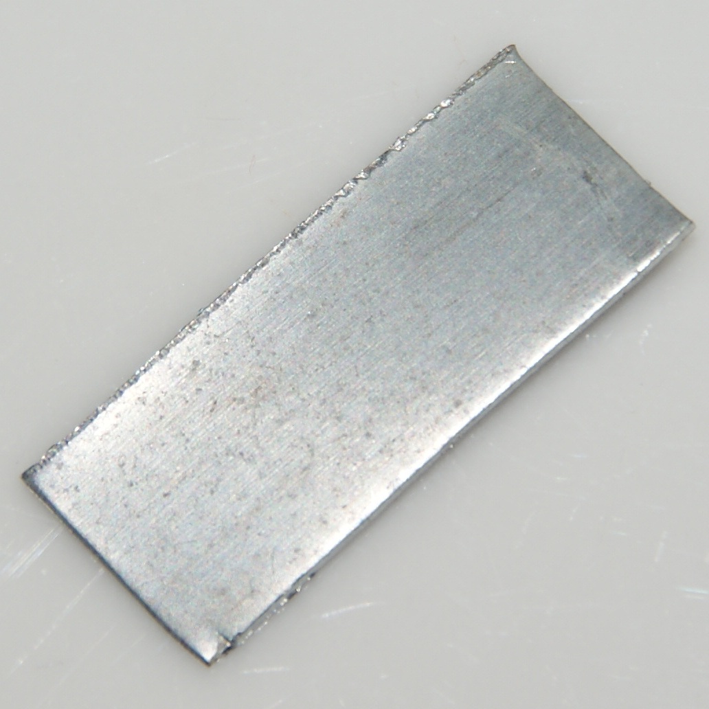
Zinc is a chemical element; it has symbol Zn and atomic number 30. It is a slightly brittle metal at room temperature and has a shiny-greyish appearance when oxidation is removed. It is the first element in group 12 (IIB) of the periodic table. In some respects, zinc is chemically similar to magnesium: both elements exhibit only one normal oxidation state (+2), and the Zn2+ and Mg2+ ions are of similar size. Zinc is the 24th most abundant element in Earth's crust and has five stable isotopes. The most common zinc ore is sphalerite (zinc blende), a zinc sulfide mineral. The largest workable lodes are in Australia, Asia, and the United States. Zinc is refined by froth flotation of the ore, roasting, and final extraction using electricity ( electrowinning). Zinc is an essential trace element for humans, animals, plants and for microorganisms and is necessary for prenatal and postnatal development. It is the second most abundant trace metal in humans after iron, an import ... [...More Info...] [...Related Items...] OR: [Wikipedia] [Google] [Baidu] |
Atlantic Salmon
The Atlantic salmon (''Salmo salar'') is a species of ray-finned fish in the family Salmonidae. It is the third largest of the Salmonidae, behind Hucho taimen, Siberian taimen and Pacific Chinook salmon, growing up to a meter in length. Atlantic salmon are found in the northern Atlantic Ocean and in rivers that flow into it. Most populations are anadromous, hatching in streams and rivers but moving out to sea as they grow where they mature, after which the adults seasonally move upstream again to spawn. When the mature fish re-enter rivers to spawn, they change in colour and appearance. Some populations of this fish only migrate to large lakes, and are "landlocked", spending their entire lives in freshwater. Such populations are found throughout the range of the species. Unlike Pacific species of salmon, ''S. salar'' is iteroparous, which means it can survive spawning and return to sea to repeat the process again in another year with 5–10% returning to the sea to spawn again ... [...More Info...] [...Related Items...] OR: [Wikipedia] [Google] [Baidu] |
Mattawa, Ontario
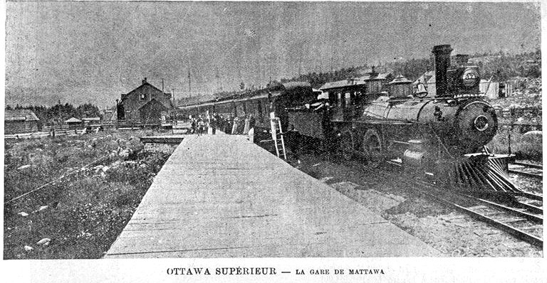
Mattawa is a town in northeastern Ontario, Canada at the confluence of the Mattawa and Ottawa Rivers in Nipissing District. The first Europeans to pass through this area were Étienne Brûlé and Samuel de Champlain. History In 1610, Étienne BrûléCanadian Heritage Rivers System: Mattawa River fact sheet, Ministry of Natural ResourcesOnline version) and in 1615, Samuel de Champlain were the first Europeans to travel through the Mattawa area.Archeological and Historic Sites Board of Canada For some 200 years thereafter, it was a link in the Canadian canoe routes (early)#St. Lawrence River basin, important water route leading from Montreal west to Lake Superior. Canoes travelling west up the Ottawa turned left at "the Forks" (the mouth of the Mattawa) to enter the "''Petite Rivière''" ("Small River", as compared to the Ottawa), before continuing on to Lake Nipissing. Other notable travellers who passed by Mattawa include: Jean Nicolet in 1620, Jean de Brébeuf in 1626, Gabrie ... [...More Info...] [...Related Items...] OR: [Wikipedia] [Google] [Baidu] |


