|
Trefasser
Trefasser (variations: Tref-Asser, or Trêf Asser, or Asserton; translation: "town" of "Asser") is a hamlet, located to the west of Fishguard in western Wales. Historically, it is part of the parish of Llanwnda. It lies on the coast of St George's Channel within the Pembrokeshire Coast National Park. A stream named Cledde Goch runs close by. Trefasser's farms, houses and cottages are the only settled area of Pen Caer. David Tress has painted the place in an abstract painting. History Trefasser was mentioned in the survey of episcopal lands in 1326. It at one time belonged to Major Thomas Askwith Jenkins (1809–1877) of Trevigin. In July 2009, the body of a 47-year-old man from Stourbridge in the West Midlands was found at the bottom of the cliffs of Trefasser. Etymology There are opposing views as to from whom the name derives. One possibility is that it is the namesake of Bishop Asser, a friend and biographer of King Alfred in the 9th century. Another possibility is t ... [...More Info...] [...Related Items...] OR: [Wikipedia] [Google] [Baidu] |
Llanwnda, Pembrokeshire
Llanwnda is a rural village and parish to the north of the Welsh county of Pembrokeshire and part of the community of Pencaer. It lies some two miles northwest of the port of Fishguard and is inside the boundaries of the Pembrokeshire Coast National Park. History Ancient and ritualistic remains are scattered about the area of the parish, indicating occupation from prehistoric times. The hamlet of Trefasser, according to topographer Samuel Lewis, was stated to be the birthplace of Asser, the biographer of the 9th century king of Wessex, Alfred the Great. In about 1076, forces of north and south Wales met in battle, with the north Welsh victorious. Lewis also noted that Gerald of Wales was incumbent in the parish for a time in the 12th century. To the north of the village is the rocky outcrop of Garnwnda, which was the site of a French soldiers' camp during the Battle of Fishguard in 1797. A tattered Welsh Bible of 1620, in Llanwnda church, is said to have been rescued from t ... [...More Info...] [...Related Items...] OR: [Wikipedia] [Google] [Baidu] |
Stourbridge
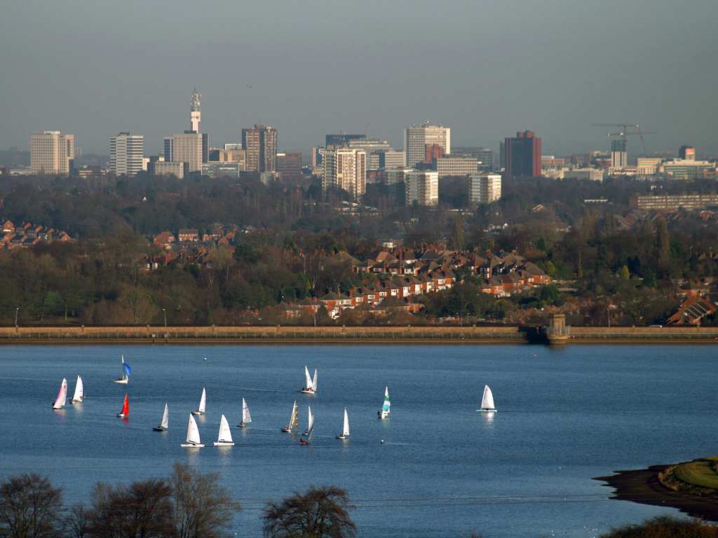
Stourbridge is a market town in the Metropolitan Borough of Dudley in the West Midlands, England, situated on the River Stour. Historically in Worcestershire, it was the centre of British glass making during the Industrial Revolution. The 2011 UK census recorded the town's population as 63,298. Geography Stourbridge is about west of Birmingham. Sitting within the Metropolitan Borough of Dudley at the southwestern edge of the Black Country and West Midlands conurbation, Stourbridge includes the suburbs of Amblecote, Lye, Norton, Oldswinford, Pedmore,Stambermill, Stourton, Wollaston, Wollescote and Wordsley. Much of Stourbridge consists of residential streets interspersed with green spaces. Mary Stevens Park, opened in 1931, has a lake, a bandstand, a cafe, and a mixture of open spaces and woodland. Bordered by green belt land, Stourbridge is close to countryside with the Clent Hills to the south and southwest Staffordshire and Kinver Edge to the west. Closest ... [...More Info...] [...Related Items...] OR: [Wikipedia] [Google] [Baidu] |
Castell Poeth
A ''castell'' () is a human tower built traditionally at festivals in Catalonia, the Balearic islands and the Valencian Community. At these festivals, several ''colles castelleres'' (teams that build towers) attempt to build and dismantle a tower's structure. On 16 November 2010, ''castells'' were declared by UNESCO to be amongst the Masterpieces of the Oral and Intangible Heritage of Humanity. Origin Although based on the earlier traditional Muixeranga of Algemesí in Valencia, the tradition of ''castells'' within Catalonia originated in the ''Ball dels Valencians'' (Valencian Dance) in Valls, near the city of Tarragona, first documented in 1712. Over the course of the 18th century, they spread to other towns and cities in the area, including Vilafranca del Penedès and Tarragona, though it was not until the last 50 years that the practice of building ''castells'' began to spread to the rest of Catalonia. Interest in castells began to grow in the 1960s and 1970s. In the 198 ... [...More Info...] [...Related Items...] OR: [Wikipedia] [Google] [Baidu] |
Tumulus
A tumulus (plural tumuli) is a mound of earth and stones raised over a grave or graves. Tumuli are also known as barrows, burial mounds or '' kurgans'', and may be found throughout much of the world. A cairn, which is a mound of stones built for various purposes, may also originally have been a tumulus. Tumuli are often categorised according to their external apparent shape. In this respect, a long barrow is a long tumulus, usually constructed on top of several burials, such as passage graves. A round barrow is a round tumulus, also commonly constructed on top of burials. The internal structure and architecture of both long and round barrows has a broad range; the categorization only refers to the external apparent shape. The method of may involve a dolmen, a cist, a mortuary enclosure, a mortuary house, or a chamber tomb. Examples of barrows include Duggleby Howe and Maeshowe. Etymology The word ''tumulus'' is Latin for 'mound' or 'small hill', which is deri ... [...More Info...] [...Related Items...] OR: [Wikipedia] [Google] [Baidu] |
King Alfred
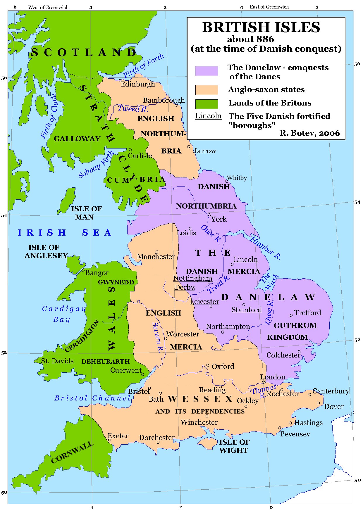
Alfred the Great (alt. Ælfred 848/849 – 26 October 899) was King of the West Saxons from 871 to 886, and King of the Anglo-Saxons from 886 until his death in 899. He was the youngest son of King Æthelwulf and his first wife Osburh, who both died when Alfred was young. Three of Alfred's brothers, Æthelbald, Æthelberht and Æthelred, reigned in turn before him. Under Alfred's rule, considerable administrative and military reforms were introduced, prompting lasting change in England. After ascending the throne, Alfred spent several years fighting Viking invasions. He won a decisive victory in the Battle of Edington in 878 and made an agreement with the Vikings, dividing England between Anglo-Saxon territory and the Viking-ruled Danelaw, composed of northern England, the north-east Midlands and East Anglia. Alfred also oversaw the conversion of Viking leader Guthrum to Christianity. He defended his kingdom against the Viking attempt at conquest, becoming the dominant r ... [...More Info...] [...Related Items...] OR: [Wikipedia] [Google] [Baidu] |
Asser
Asser (; ; died 909) was a Welsh monk from St David's, Dyfed, who became Bishop of Sherborne in the 890s. About 885 he was asked by Alfred the Great to leave St David's and join the circle of learned men whom Alfred was recruiting for his court. After spending a year at Caerwent because of illness, Asser accepted. In 893, Asser wrote a biography of Alfred, called the ''Life of King Alfred''. The manuscript survived to modern times in only one copy, which was part of the Cotton library. That copy was destroyed in a fire in 1731, but transcriptions that had been made earlier, together with material from Asser's work which was included by other early writers, have enabled the work to be reconstructed. The biography is the main source of information about Alfred's life and provides far more information about Alfred than is known about any other early English ruler. Asser assisted Alfred in his translation of Gregory the Great's ''Pastoral Care'', and possibly with other w ... [...More Info...] [...Related Items...] OR: [Wikipedia] [Google] [Baidu] |
West Midlands (region)
The West Midlands is one of nine official regions of England at the first level of International Territorial Level for statistical purposes. It covers the western half of the area traditionally known as the Midlands. The region consists of the counties of Herefordshire, Shropshire, Staffordshire, Warwickshire, West Midlands and Worcestershire. The region has seven cities; Birmingham, Coventry, Hereford, Lichfield, Stoke-on-Trent, Wolverhampton and Worcester. The West Midlands region is geographically diverse, from the urban central areas of the West Midlands conurbation to the rural counties of Herefordshire, Shropshire and Worcestershire which border Wales. The region is landlocked. However, the longest river in the UK, the River Severn, traverses the region southeastwards, flowing through the county towns of Shrewsbury and Worcester, and the Ironbridge Gorge, a UNESCO World Heritage Site. Staffordshire is home to the industrialised Potteries conurbati ... [...More Info...] [...Related Items...] OR: [Wikipedia] [Google] [Baidu] |
Pembrokeshire
Pembrokeshire ( ; cy, Sir Benfro ) is a county in the south-west of Wales. It is bordered by Carmarthenshire to the east, Ceredigion to the northeast, and the rest by sea. The county is home to Pembrokeshire Coast National Park. The Park occupies more than a third of the area of the county and includes the Preseli Hills in the north as well as the Pembrokeshire Coast Path. Historically, mining and fishing were important activities, while industry nowadays is focused on agriculture (86 per cent of land use), oil and gas, and tourism; Pembrokeshire's beaches have won many awards. The county has a diverse geography with a wide range of geological features, habitats and wildlife. Its prehistory and modern history have been extensively studied, from tribal occupation, through Roman times, to Welsh, Irish, Norman, English, Scandinavian and Flemish influences. Pembrokeshire County Council's headquarters are in the county town of Haverfordwest. The council has a majority of Independ ... [...More Info...] [...Related Items...] OR: [Wikipedia] [Google] [Baidu] |
Fishguard
Fishguard ( cy, Abergwaun, meaning "Mouth of the River Gwaun") is a coastal town in Pembrokeshire, Wales, with a population of 3,419 in 2011; the community of Fishguard and Goodwick had a population of 5,407. Modern Fishguard consists of two parts, Lower Fishguard and the "Main Town". Fishguard and Goodwick are twin towns with a joint Town Council. Lower Fishguard is believed to be the site of the original hamlet from which modern Fishguard has grown. It is in a deep valley where the River Gwaun meets the sea, hence the Welsh name for Fishguard. It is a typical fishing village with a short tidal quay. The settlement stretches along the north slope of the valley. The main town contains the parish church, the High Street and most of the modern development, and lies upon the hill to the south of Lower Fishguard, to which it is joined by a steep and winding road. The west part of the town that faces Goodwick grew in the first decade of the 20th century with the development of ... [...More Info...] [...Related Items...] OR: [Wikipedia] [Google] [Baidu] |


