|
Tree Of Knowledge, Camooweal
Tree of Knowledge is a heritage-listed tree on the Barkly Highway, Camooweal, City of Mount Isa, Queensland, Australia. It was added to the Queensland Heritage Register on 8 September 2005. History The Tree of Knowledge on the Camooweal Camping, Pasturage & Stock Dipping Reserve is a mature Coolibah tree, on the eastern side of the Georgina River and about west of the town. It is said that for many years drovers and teamsters camped nearby and met and yarned beneath the shade of the tree. Following William Landsborough's exploration of the Camooweal area during his search for Burke and Wills in 1861-62 pastoralists moved into the district. The first was John Sutherland who took up the Rocklands lease in 1865. Loss of stock to dingos combined with isolation, scarcity of labour and transport difficulties forced him to abandon his lease. It was not until the mid-1870s that squatters moved back to the area. In 1883 local squatters petitioned the Queensland Government, requesti ... [...More Info...] [...Related Items...] OR: [Wikipedia] [Google] [Baidu] |
Barkly Highway
The Barkly Highway is a national highway of both Queensland and the Northern Territory in Australia. It is the only sealed road between Queensland and the Northern Territory. Description The highway runs between Cloncurry and the junction with the Stuart Highway north of Tennant Creek, known as the "Threeways". The entire highway is part of the National Highway system: in the Northern Territory it is assigned National Route 66; the Queensland portion is designated as National Route A2. The Northern Territory section has a speed limit of along most of its length. It is the main transport route between Queensland and the Northern Territory, consequently many road trains use it. Upgrades An upgrade of the Queensland section of the highway between Mount Isa and Camooweal was completed in 2008 and despite floods of 2009, 2010 and 2011, the Queensland sections of road were in good condition (as of 2015). The Northern Australia Roads Program announced in 2016 included the ... [...More Info...] [...Related Items...] OR: [Wikipedia] [Google] [Baidu] |
Burketown, Queensland
Burketown is an isolated outback town and coastal locality in the Shire of Burke, Queensland, Australia. In the , the locality of Burketown had a population of 238 people. It is located west of Cairns and west of Normanton on the Albert River and Savannah Way in the area known as the Gulf Savannah. Geography Burketown is located on the Albert River to the north west of the state capital, Brisbane, with the nearest larger town being Normanton, to the east, and the nearest city being Mount Isa, to the south. The town is roughly inland from the Gulf of Carpentaria. It is located west of Cairns via the Savannah Way passing through the area known as the Gulf Savannah. The town is the administrative centre of the Burke Shire Council. History Aboriginal History Aboriginal Australian peoples had inhabited the region for millennia before European explorers travelled the area. The Yukulta / Ganggalidda and Garawa peoples are recognised as the traditional owners of ... [...More Info...] [...Related Items...] OR: [Wikipedia] [Google] [Baidu] |
Camooweal
Camooweal is an outback town and locality in the City of Mount Isa, Queensland, Australia. The locality is on the Queensland border with the Northern Territory. In the , the locality of Camooweal had a population of 208 people. Geography The locality of Camooweal is in north-western in the Gulf Region bounded by the west by the Northern Territory. The town of Camooweal is located in the south-west corner of the locality. The town is north-west of the city of Mount Isa and east of the Northern Territory border. The Barkly Highway enters the locality from the south ( Barkly), passes from east to west through the town centre (where it is known as Barkly Street) and then exits to the west (Northern Territory). The Georgina River enters the locality from the west (Northern Territory), passes to the immediate west of the town and then exits to south of the locality (Barkly). Lake Francis () and Lake Canellan () are both on the Georgina River and lie to the south-east of the town. L ... [...More Info...] [...Related Items...] OR: [Wikipedia] [Google] [Baidu] |
Eucalyptus Microtheca
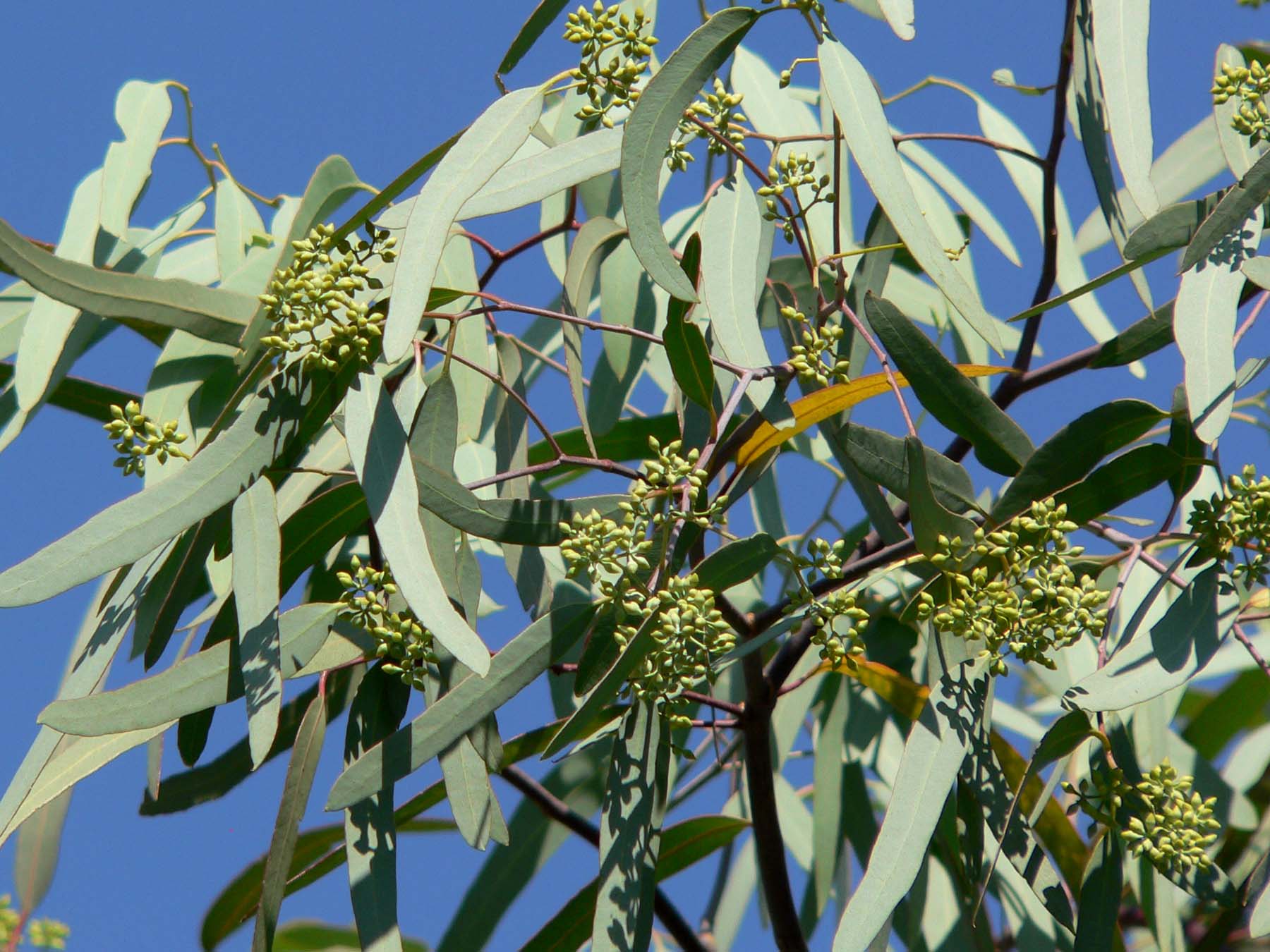
''Eucalyptus microtheca'', commonly known as the coolibah, is a species of tree that is endemic to northern Australia. It has rough, flaky or fibrous bark on the trunk and branches, lance-shaped adult leaves, flower buds in groups of seven, white flowers and spherical to conical fruit. It is widely distributed from the Kimberley region of Western Australia to Cape York in Queensland. Description ''Eucalyptus microtheca'' is a tree, sometimes a mallee, that typically grows to a height of and forms a lignotuber. It has a whitish grey to dark grey, box-type bark that is often deeply fissured, coarsely flaky or tessellated as it ages. Young plants and coppice regrowth have narrow lance-shaped leaves that are long, wide and petiolate. Adult plants have leaves that are the same shade of dull green to bluish on both sides, lance-shaped to curved, long and wide, tapering to a petiole long. The flower buds are arranged on a thin, branched peduncle in groups of seven, the peduncl ... [...More Info...] [...Related Items...] OR: [Wikipedia] [Google] [Baidu] |
Flash Flood
A flash flood is a rapid flooding of low-lying areas: washes, rivers, dry lakes and depressions. It may be caused by heavy rain associated with a severe thunderstorm, hurricane, or tropical storm, or by meltwater from ice or snow flowing over ice sheets or snowfields. Flash floods may also occur after the collapse of a natural ice or debris dam, or a human structure such as a man-made dam, as occurred before the Johnstown Flood of 1889. Flash floods are distinguished from regular floods by having a timescale of fewer than six hours between rainfall and the onset of flooding. Flash floods are a significant hazard, causing more fatalities in the U.S. in an average year than lightning, tornadoes, or hurricanes. Flash floods can also deposit large quantities of sediments on floodplains and can be destructive of vegetation cover not adapted to frequent flood conditions. Causes Flash floods most often occur in dry areas that have recently received precipitation, but th ... [...More Info...] [...Related Items...] OR: [Wikipedia] [Google] [Baidu] |
Rabbit-proof Fence (Queensland)
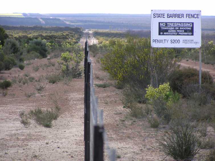
The State Barrier Fence of Western Australia, formerly known as the Rabbit-Proof Fence, the State Vermin Fence, and the Emu Fence, is a pest-exclusion fence constructed between 1901 and 1907 to keep rabbits, and other agricultural pests from the east, out of Western Australian pastoral areas. There are three fences in Western Australia: the original No. 1 Fence crosses the state from north to south, No. 2 Fence is smaller and further west, and No. 3 Fence is smaller still and runs east–west. The fences took six years to build. When completed, the rabbit-proof fence (including all three fences) stretched . The cost to build each kilometre of fence at the time was about $250 (). When it was completed in 1950, the No. 1 Fence was the longest unbroken fence in the world. History Rabbits were introduced to Australia by the First Fleet in 1788, but they became a problem after October 1859, when Thomas Austin released 24 wild rabbits from England for hunting purposes, believin ... [...More Info...] [...Related Items...] OR: [Wikipedia] [Google] [Baidu] |
Cloncurry, Queensland
Cloncurry is a rural town and locality in the Shire of Cloncurry, Queensland, Australia. In the the locality of Cloncurry had a population of 2,719 people. Cloncurry is the administrative centre of the Shire of Cloncurry. Cloncurry is known as the ''Friendly Heart of the Great North West'' and celebrated its 150th anniversary in 2017.Community Research Report - Cloncurry (QLD) Introduction (20 September 2002) Cloncurry was recognised for its liveability, winning the Queensland's Friendliest Town award twice by environmental movement Keep Queensland Beautiful, first in 2013 and again in 2018. Geography Cloncurry is situated in the north-west of |
South Australia
South Australia (commonly abbreviated as SA) is a state in the southern central part of Australia. It covers some of the most arid parts of the country. With a total land area of , it is the fourth-largest of Australia's states and territories by area, and second smallest state by population. It has a total of 1.8 million people. Its population is the second most highly centralised in Australia, after Western Australia, with more than 77 percent of South Australians living in the capital Adelaide, or its environs. Other population centres in the state are relatively small; Mount Gambier, the second-largest centre, has a population of 33,233. South Australia shares borders with all of the other mainland states, as well as the Northern Territory; it is bordered to the west by Western Australia, to the north by the Northern Territory, to the north-east by Queensland, to the east by New South Wales, to the south-east by Victoria, and to the south by the Great Australian B ... [...More Info...] [...Related Items...] OR: [Wikipedia] [Google] [Baidu] |
Northern Territory
The Northern Territory (commonly abbreviated as NT; formally the Northern Territory of Australia) is an Australian territory in the central and central northern regions of Australia. The Northern Territory shares its borders with Western Australia to the west ( 129th meridian east), South Australia to the south ( 26th parallel south), and Queensland to the east ( 138th meridian east). To the north, the territory looks out to the Timor Sea, the Arafura Sea and the Gulf of Carpentaria, including Western New Guinea and other islands of the Indonesian archipelago. The NT covers , making it the third-largest Australian federal division, and the 11th-largest country subdivision in the world. It is sparsely populated, with a population of only 249,000 – fewer than half as many people as in Tasmania. The largest population center is the capital city of Darwin. The archaeological history of the Northern Territory may have begun more than 60,000 years ago when humans first se ... [...More Info...] [...Related Items...] OR: [Wikipedia] [Google] [Baidu] |
Queensland Government
The Queensland Government is the democratic administrative authority of the Australian state of Queensland. The Government of Queensland, a parliamentary constitutional monarchy was formed in 1859 as prescribed in its Constitution, as amended from time to time. Since the Federation of Australia in 1901, Queensland has been a State of Australia, with the Constitution of Australia regulating the relationships between all state and territory governments and the Australian Government. Under the Australian Constitution, all states and territories (including Queensland) ceded powers relating to certain matters to the federal government. The government is influenced by the Westminster system and Australia's federal system of government. The Governor of Queensland, as the representative of Charles III, King of Australia, holds nominal executive power, although in practice only performs ceremonial duties. In practice executive power lies with the Premier and Cabinet. The Cabinet ... [...More Info...] [...Related Items...] OR: [Wikipedia] [Google] [Baidu] |
Camooweal, Queensland
Camooweal is an outback town and locality in the City of Mount Isa, Queensland, Australia. The locality is on the Queensland border with the Northern Territory. In the , the locality of Camooweal had a population of 208 people. Geography The locality of Camooweal is in north-western in the Gulf Region bounded by the west by the Northern Territory. The town of Camooweal is located in the south-west corner of the locality. The town is north-west of the city of Mount Isa and east of the Northern Territory border. The Barkly Highway enters the locality from the south ( Barkly), passes from east to west through the town centre (where it is known as Barkly Street) and then exits to the west (Northern Territory). The Georgina River enters the locality from the west (Northern Territory), passes to the immediate west of the town and then exits to south of the locality (Barkly). Lake Francis () and Lake Canellan () are both on the Georgina River and lie to the south-east of the ... [...More Info...] [...Related Items...] OR: [Wikipedia] [Google] [Baidu] |
Dingo
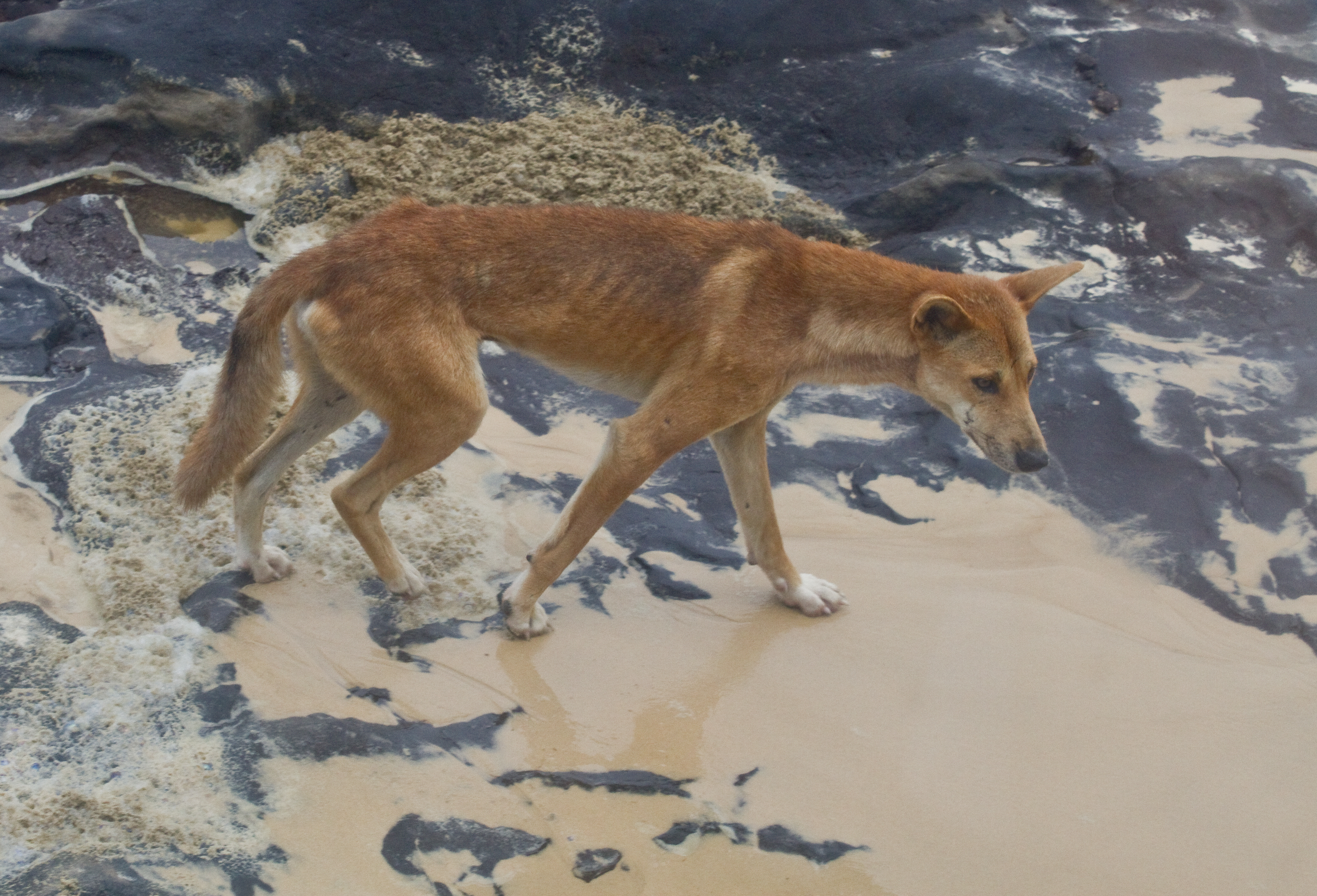
The dingo (''Canis familiaris'', ''Canis familiaris dingo'', ''Canis dingo'', or '' Canis lupus dingo'') is an ancient (basal) lineage of dog found in Australia. Its taxonomic classification is debated as indicated by the variety of scientific names presently applied in different publications. It is variously considered a form of domestic dog not warranting recognition as a subspecies, a subspecies of dog or wolf, or a full species in its own right. The dingo is a medium-sized canine that possesses a lean, hardy body adapted for speed, agility, and stamina. The dingo's three main coat colourations are light ginger or tan, black and tan, or creamy white. The skull is wedge-shaped and appears large in proportion to the body. The dingo is closely related to the New Guinea singing dog: their lineage split early from the lineage that led to today's domestic dogs, and can be traced back through the Maritime Southeast Asia to Asia. The earliest known dingo fossil, found in Wes ... [...More Info...] [...Related Items...] OR: [Wikipedia] [Google] [Baidu] |
.png)


