|
Transdnieper
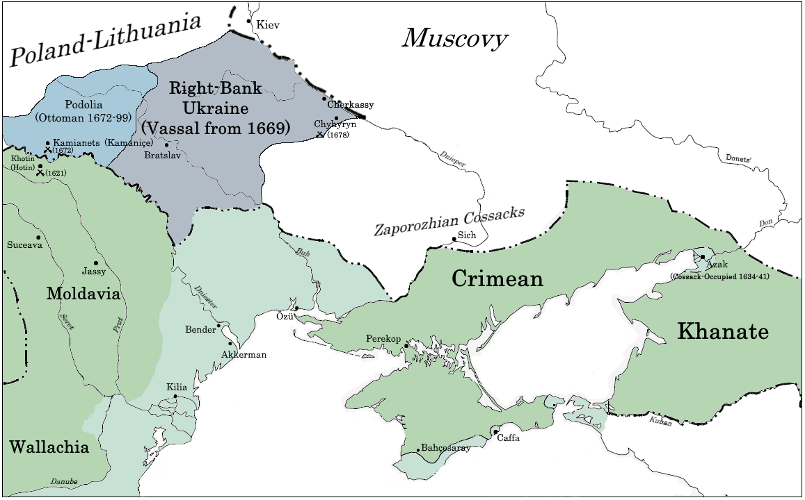
Transdnieper (, , ) is a historical steppe region on the bank of the Dnieper and beyond. The term was used mostly in the 16th and 17th centuries. Which bank of the Dnieper it refers to varies between languages, since which side is "across" the Dnieper depends on which direction you're coming from: * In Ukrainian and Polish it approximately corresponds to Left-bank Ukraine, which is a territorial name for the part of modern Ukraine located on the east bank of the Dnieper River. * In Russian it approximately corresponds to Right-bank Ukraine The Right-bank Ukraine is a historical and territorial name for a part of modern Ukraine on the right (west) bank of the Dnieper River, corresponding to the modern-day oblasts of Vinnytsia, Zhytomyr, Kirovohrad, as well as the western parts o ..., which is a territorial name for the part of modern Ukraine located on the west bank of the Dnieper River. References Historical regions in Ukraine {{Ukraine-geo-stub ... [...More Info...] [...Related Items...] OR: [Wikipedia] [Google] [Baidu] |
Steppe
In physical geography, a steppe () is an ecoregion characterized by grassland plains without closed forests except near rivers and lakes. Steppe biomes may include: * the montane grasslands and shrublands biome * the tropical and subtropical grasslands, savannas, and shrublands biome * the temperate grasslands, savannas, and shrublands biome A steppe is usually covered with grass and shrubs, depending on the season and latitude. The term ''steppe climate'' denotes a semi-arid climate, which is encountered in regions too dry to support a forest, but not dry enough to be a desert. Steppes are usually characterized by a semi-arid or continental climate. Temperature extremes can be recorded in the summer of up to and in winter of down to . Besides this major seasonal difference, fluctuations between day and night are also significant: in both the highlands of Mongolia and northern Nevada, can be reached during the day with sub-freezing readings at night. Steppes ave ... [...More Info...] [...Related Items...] OR: [Wikipedia] [Google] [Baidu] |
Dnieper
The Dnieper or Dnepr ( ), also called Dnipro ( ), is one of the major transboundary rivers of Europe, rising in the Valdai Hills near Smolensk, Russia, before flowing through Belarus and Ukraine to the Black Sea. Approximately long, with a drainage basin of , it is the longest river of Ukraine and Belarus and the fourth- longest river in Europe, after the Volga, Danube, and Ural rivers. In antiquity, the river was part of the Amber Road trade routes. During the Ruin in the later 17th century, the area was contested between the Polish–Lithuanian Commonwealth and Russia, dividing what is now Ukraine into areas described by its right and left banks. During the Soviet period, the river became noted for its major hydroelectric dams and large reservoirs. The 1986 Chernobyl disaster occurred on the Pripyat River, a tributary of the Dnieper, just upstream from its confluence with the Dnieper. The Dnieper is an important navigable waterway for the economy of Ukraine and i ... [...More Info...] [...Related Items...] OR: [Wikipedia] [Google] [Baidu] |
Left-bank Ukraine
The Left-bank Ukraine is a historic name of the part of Ukraine on the left (east) bank of the Dnieper River, comprising the modern-day oblasts of Chernihiv, Poltava and Sumy as well as the eastern parts of Kyiv and Cherkasy. Left-bank Ukraine is bordered by the historical regions of Right-bank Ukraine to the southwest, Zaporizhzhia to the southeast, Sloboda Ukraine to the east, and Polesia and White Ruthenia to the north. History Since the Middle Ages, the region formed part of the Khazar Khanate, Kievan Rus', Mongol Empire, Golden Horde, Grand Duchy of Lithuania and the Kingdom of Poland. The term appeared in 1663 with the election of Ivan Bryukhovetsky as the hetman of Ukraine in opposition to Pavlo Teteria. Bryukhovetsky was the first known "left-bank Ukraine" hetman over the area, that was under the Russian influence. Up until the mid-17th century, the area had belonged to the Polish–Lithuanian Commonwealth. The Treaty of Pereyaslav of 1654 saw the region tent ... [...More Info...] [...Related Items...] OR: [Wikipedia] [Google] [Baidu] |
Right-bank Ukraine
The Right-bank Ukraine is a historical and territorial name for a part of modern Ukraine on the right (west) bank of the Dnieper River, corresponding to the modern-day oblasts of Vinnytsia, Zhytomyr, Kirovohrad, as well as the western parts of Kyiv and Cherkasy. It was separated from the left bank during the Ruin. Right-bank Ukraine is bordered by the historical regions of Volhynia and Podolia to the west, Moldavia to the southwest, Yedisan and Zaporizhzhia to the south, left-bank Ukraine to the east, and Polesia to the north. Main cities of the region include Cherkasy, Kropyvnytskyi, Bila Tserkva, Zhytomyr and Oleksandriia. History Since the Middle Ages, the region formed part of the Khazar Khanate, Kievan Rus', Mongol Empire, Golden Horde, Grand Duchy of Lithuania and the Kingdom of Poland. Right-bank Ukraine was the target of slave raids by Tatars from the Black Sea steppes. The history of right- and left-bank Ukraine is closely associated with the Khmelnyt ... [...More Info...] [...Related Items...] OR: [Wikipedia] [Google] [Baidu] |

