|
Trams In Stockholm
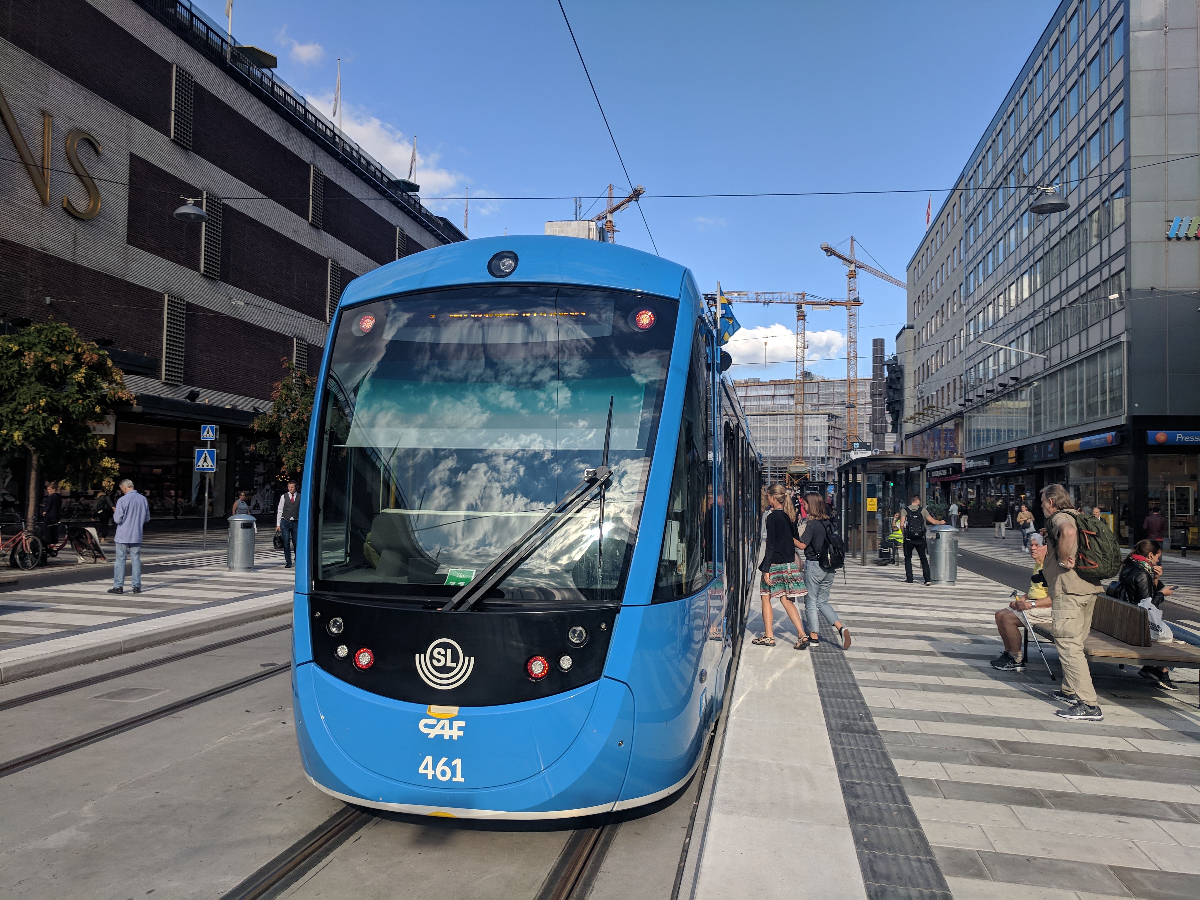
The Stockholm tramway network forms part of the public transport system in Stockholm, the capital city of Sweden. Beginning with horse trams in 1877, the Stockholm tram network reached its largest extent in 1946. Many of the former suburban tram lines became parts of the Stockholm Metro between the years 1950-1964. In September 1967, in conjunction with the Swedish switch from left-hand to right-hand traffic, the last parts of the once large inner city street running tram network were closed. What little remained of the former network following 1967 were isolated suburban feeder lines to the Metro. However, in 1991 a long heritage line opened to the recreational area Djurgården; and in 2000, the non-radial half-circle line Tvärbanan opened with articulated low floor vehicles connecting an inner ring of Metro and commuter rail stations just outside the inner city proper, with subsequent extensions in 2003 and 2014; and in 2010 the heritage line was extended and converted ... [...More Info...] [...Related Items...] OR: [Wikipedia] [Google] [Baidu] |
Stockholm
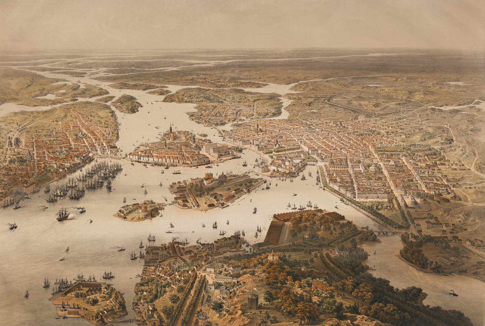
Stockholm (; ) is the Capital city, capital and List of urban areas in Sweden by population, most populous city of Sweden, as well as the List of urban areas in the Nordic countries, largest urban area in the Nordic countries. Approximately 1 million people live in the Stockholm Municipality, municipality, with 1.6 million in the Stockholm urban area, urban area, and 2.5 million in the Metropolitan Stockholm, metropolitan area. The city stretches across fourteen islands where Mälaren, Lake Mälaren flows into the Baltic Sea. Outside the city to the east, and along the coast, is the island chain of the Stockholm archipelago. The area has been settled since the Stone Age, in the 6th millennium BC, and was founded as a city in 1252 by Swedish statesman Birger Jarl. The city serves as the county seat of Stockholm County. Stockholm is the cultural, media, political, and economic centre of Sweden. The Stockholm region alone accounts for over a third of the country's Gros ... [...More Info...] [...Related Items...] OR: [Wikipedia] [Google] [Baidu] |
Djurgården
Djurgården ( or ) or, more officially, , is an island in central Stockholm, Sweden. Djurgården is home to historical buildings and monuments, museums, galleries, the amusement park Gröna Lund, the open-air museum Skansen, the small residential area ''Djurgårdsstaden'', yacht harbours, and extensive stretches of forest and meadows. It is one of the Stockholmers' favorite recreation areas and tourist destinations alike, attracting over 10 million visitors per year, of which some 5 million come to visit the museums and amusement park. The island belongs to the Ekoparken, National City park founded in 1995. Since the 15th century the Swedish monarch has owned or held Royal Right of Disposal (Sweden), the right of disposition of Royal Djurgården. Today, this right is exercised by the Royal Djurgården Administration which is a part of the Royal Court of Sweden. A larger area of the city, separated from Djurgården proper by Djurgårdsbrunnsviken is Norra Djurgården (''Northern ... [...More Info...] [...Related Items...] OR: [Wikipedia] [Google] [Baidu] |
Heritage Streetcar
Heritage streetcars or heritage trams are a part of the efforts to preserve rail transit heritage. In addition to preserving street-running rail vehicles, heritage streetcar operations can include upkeep of historic rail infrastructure. Working heritage streetcars are closely related to the growing global heritage railway movement and form a part of the living history of rail transport. The vehicles are called streetcars or trolleys in North America and trams or tramcars elsewhere. The first two terms are often used interchangeably in the United States,Young, Andrew D. (1997). ''Veteran & Vintage Transit'' (). St. Louis: Archway Publishing. with ''trolley'' being preferred in the eastern US and ''streetcar'' in Canada and the western US. In parts of the United States, internally powered buses made to resemble a streetcar are often referred to as "trolleys". To avoid further confusion with trolley buses, the American Public Transportation Association (APTA) refers to them as "trol ... [...More Info...] [...Related Items...] OR: [Wikipedia] [Google] [Baidu] |
Norrmalmstorg
Norrmalmstorg () is a town square in central Stockholm, Sweden. It connects shopping streets Hamngatan and Biblioteksgatan and is the starting point for tram travellers with the Djurgården line. Close to the southwest is the park Kungsträdgården. In the Swedish edition of ''Monopoly'', Norrmalmstorg is the most expensive lot. . Accessed October 21, 2012. The square is famous for the 1973 Norrmalmstorg robbery, in which events gave name to the . The building in question is now occupied by the [...More Info...] [...Related Items...] OR: [Wikipedia] [Google] [Baidu] |
Tram
A tram (also known as a streetcar or trolley in Canada and the United States) is an urban rail transit in which Rolling stock, vehicles, whether individual railcars or multiple-unit trains, run on tramway tracks on urban public streets; some include segments on segregated Right-of-way (property access), right-of-way. The tramlines or tram networks operated as public transport are called tramways or simply trams/streetcars. Because of their close similarities, trams are commonly included in the wider term ''light rail'', which also includes systems separated from other traffic. Tram vehicles are usually lighter and shorter than Main line (railway), main line and rapid transit trains. Most trams use electrical power, usually fed by a Pantograph (transport), pantograph sliding on an overhead line; older systems may use a trolley pole or a bow collector. In some cases, a contact shoe on a third rail is used. If necessary, they may have dual power systems—electricity in city stre ... [...More Info...] [...Related Items...] OR: [Wikipedia] [Google] [Baidu] |
T-Centralen
T-Centralen is the largest and busiest station on the Stockholm Metro. It is located in the Norrmalm district of central Stockholm, directly adjacent to Stockholm Central Station and Stockholm City Station, Stockholm City commuter train station. T-Centralen is also the name of the terminus for the Spårväg City tram line. T-Centralen is the only station in Stockholm Metro where all three metro lines converge. In 2018, approximately 340,000 passengers used the metro station daily, with 174,550 boarding and 166,850 alighting. The station is located between Sergels torg and Vasagatan, Stockholm, Vasagatan. A pedestrian underpass connects T-Centralen to the nearby Central Station running underneath Vasagatan, Stockholm, Vasagatan. It is also linked to the Cityterminalen long-distance bus terminal. History T-Centralen opened on 24 November 1957 as part of the section connecting Slussen metro station, Slussen and Hötorget metro station, Hötorget, linking the southern and north ... [...More Info...] [...Related Items...] OR: [Wikipedia] [Google] [Baidu] |
Stockholm Metropolitan Area
Sweden has three metropolitan areas consisting of the areas surrounding the three largest cities, Stockholm, Gothenburg, and Malmö. The statistics have been retrieved from Statistics Sweden and the statistics released on 10 November 2014. The official land areas for each municipality have also been retrieved from Statistics Sweden, the agency that defines these areas. Population centers , Sweden had 2 metropolitan areas with a population of over 1,000,000 people each. The following table shows the populations of the top ten metropolitan areas. Metropolitan Stockholm Metropolitan Stockholm (also known as Greater Stockholm or, in Swedish, ''Storstockholm''), is a metropolitan area surrounding the Swedish capital of Stockholm. Since 2005, Metropolitan Stockholm is defined by official Swedish Statistics as all of Stockholm County. It is the largest of the three metropolitan areas in Sweden. Metropolitan Stockholm is divided into 5 areas: Stockholm City Centre, Söderort, Vä ... [...More Info...] [...Related Items...] OR: [Wikipedia] [Google] [Baidu] |
Spårväg City
Spårväg City () is a tram line in central Stockholm, inaugurated in 2010. It is the first tram line in regular traffic in central Stockholm since 1967. The service is run by Stockholms Spårvägar for Storstockholms Lokaltrafik (SL), using the name "Route 7" ("Linje 7"). It is essentially an elongation of Djurgårdslinjen, which has been operated with historical cars since 1991 between Norrmalmstorg and Waldemarsudde. Djurgårdslinjen was first considered to be just a museum-tourist line, but has proven to be in much demand also by regular travels. Plans are to build the Spårväg City to reach from Kungsholmen in the west to the Lidingö bridge in the east, where it is suggested to be connected to Lidingöbanan. The regular tram service between Sergels torg and Waldemarsudde started on 23 August 2010 with six Bombardier Flexity Classic trams. The cars were at first a dark, almost black, brown colour with gold stripes, as opposed to the traditional light blue trams of Stockh ... [...More Info...] [...Related Items...] OR: [Wikipedia] [Google] [Baidu] |
Solna
Solna ( or , ), also known as Solna Municipality, is a municipality in central Stockholm County, Sweden, located just north of Stockholm City Centre. Its seat is located in the town of Solna, which is a part of the Stockholm urban area. Solna is one of the wealthiest municipalities in Sweden. The municipality is part of Metropolitan Stockholm. None of the area is considered rural, which is unusual for Swedish municipalities, which normally are of mixed rural/urban character. Solna is the third-smallest municipality in Sweden in terms of area, after nearby Sundbyberg, as well as Burlöv, Scania County. Solna borders Stockholm Municipality to the south, southeast, and northwest; Sundbyberg Municipality to the west; Sollentuna Municipality to the north; and Danderyd Municipality to the northeast. The boundary with Danderyd Municipality is delineated by the Stocksundet strait. There are two parishes in Solna Municipality: Råsunda (population 29,677) and Solna (population ... [...More Info...] [...Related Items...] OR: [Wikipedia] [Google] [Baidu] |
Nockebybanan
Nockebybanan () is a tram/light-rail line between Nockeby and Alvik in the western suburbs of Stockholm, Sweden. The long line is part of the Storstockholms Lokaltrafik public transport network, and connects with the Stockholm metro and Tvärbanan tram at Alvik metro station. The Nockebybanan, also known as line 12, is operated by Stockholms Spårvägar. History The first part of the current line to Alléparken was opened in 1914, following the construction of a pontoon bridge across Tranebergssund. The line was then gradually extended westwards, reaching the current terminus at Nockeby in 1929. To the east, the line ran to Tegelbacken in central Stockholm. The pontoon bridge was replaced in 1934 with the new Tranebergsbron. Planning for a Metro system started around this time, and in 1944 the Ängbybanan route was built from Alvik to Åkeshov (and later Islandstorget), operated initially with trams but designed as a grade-separated route for later conversion. Conversion happen ... [...More Info...] [...Related Items...] OR: [Wikipedia] [Google] [Baidu] |
Lidingöbanan
Lidingöbanan () is a light-rail line in Stockholm, Sweden, between Ropsten and Gåshaga brygga, serving the southern half of Lidingö island. History The Lidingöbanan has its origins in the ''Stockholm-Södra Lidingöns Järnväg'' (Stockholm-Southern Lidingö Railway), proposed by inventor Gustaf Dalén, opened for traffic 1914. It got ferry-less access to Stockholm when the Lidingö bridge was opened 1925. Public transportation on Lidingöbanan has always been provided using tram cars, but in the past Lidingöbanan also carried goods traffic. At its largest, Lidingöbanan extended to Humlegården in Stockholm through Stockholms Spårvägar's tramway network, with access to the Värtabanan freight railway track. There was also traffic on a track on the north side of Lidingö island which terminated at Kyrkviken, but that section closed in 1971. Lidingö town centre is now accessible only by bus. Lidingöbanan formally became part of SL's public transportation network in ... [...More Info...] [...Related Items...] OR: [Wikipedia] [Google] [Baidu] |


