|
Tracy Subdivision
The Tracy Subdivision or Tracy Sub is a railway line in southern Minnesota owned and operated by the Dakota, Minnesota and Eastern Railroad (DM&E) subsidiary of Canadian Pacific. It begins at the end of the Waseca Subdivision in Waseca, Minnesota in the east and runs approximately west to Tracy, Minnesota. At Tracy, the rails continue as the Huron Subdivision of the Rapid City, Pierre and Eastern Railroad (RCPE). U.S. Highway 14 closely follows the train route. The rail line had been built westward from Winona by the Winona and St. Peter Railroad. The Chicago and North Western Railway had taken ownership of the W&StP in 1867, and continued building the line west, though the Winona and St. Peter continued to operate under the old name for a considerable time afterward. The Winona & St Peter Railroad Company was organized March 10, 1862, and completed its line from Winona to Rochester, Minnesota, in 1864. In August it reached Owatonna. In 1867 the Chicago and Northwestern Railwa ... [...More Info...] [...Related Items...] OR: [Wikipedia] [Google] [Baidu] |
Railway
Rail transport (also known as train transport) is a means of transport that transfers passengers and goods on wheeled vehicles running on rails, which are incorporated in Track (rail transport), tracks. In contrast to road transport, where the vehicles run on a prepared flat surface, rail vehicles (rolling stock) are directionally guided by the tracks on which they run. Tracks usually consist of steel rails, installed on Railroad tie, sleepers (ties) set in track ballast, ballast, on which the rolling stock, usually fitted with metal wheels, moves. Other variations are also possible, such as "slab track", in which the rails are fastened to a concrete foundation resting on a prepared subsurface. Rolling stock in a rail transport system generally encounters lower friction, frictional resistance than rubber-tyred road vehicles, so passenger and freight cars (carriages and wagons) can be coupled into longer trains. The rail transport operations, operation is carried out by a ... [...More Info...] [...Related Items...] OR: [Wikipedia] [Google] [Baidu] |
Janesville, Minnesota
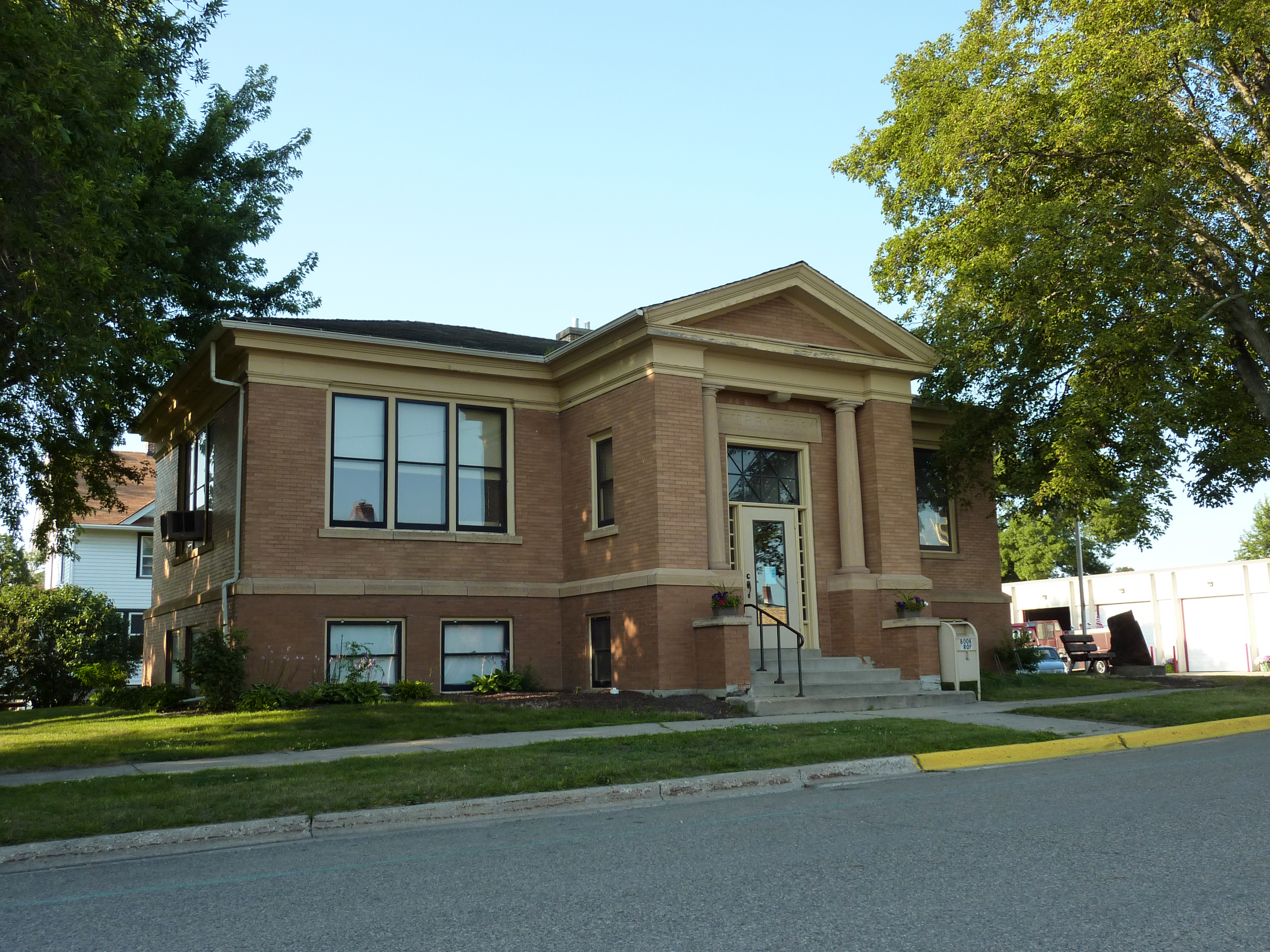
Janesville is a city in Waseca County, Minnesota, United States. The population was 2,256 at the 2010 census. U.S. Highway 14 serves as a main route in the community, running east–west, south of Janesville. County Road 3 runs north–south through the town. There is one disabled stoplight, now a four way stop, in Janesville at the intersection of County Road 3 (Main Street) and old Highway 14. History The city of Janesville was established in 1856. A post office called Janesville has been in operation since 1858. The city was named for Mrs. Jane Sprague, an early settler. Janesville was incorporated in 1870. Janesville contains two properties listed on the National Register of Historic Places, the Hofmann Apiaries established in 1907 and the 1912 Janesville Free Public Library. Geography According to the United States Census Bureau, the city has a total area of , all land. Demographics 2010 census As of the census of 2010, there were 2,256 people, 889 households, a ... [...More Info...] [...Related Items...] OR: [Wikipedia] [Google] [Baidu] |
Pierre, South Dakota
Pierre ( ; lkt, Čhúŋkaške, lit=fort) is the capital city of South Dakota, United States, and the seat of Hughes County. The population was 14,091 at the 2020 census, making it the second-least populous US state capital after Montpelier, Vermont. It is South Dakota's ninth-most populous city. Founded in 1880, it was selected as the state capital when the territory was admitted as a state. Pierre is the principal city of the Pierre Micropolitan Statistical Area, which includes all of Hughes and Stanley counties. History Pierre was founded in 1880 on the east bank of the Missouri River opposite Fort Pierre, a former trading post that developed as a community. It was designated as the state capital when South Dakota gained statehood on November 2, 1889. Huron challenged the city to be selected as the capital, but Pierre was selected for its geographic centrality in the state. Fort Pierre had developed earlier, with a permanent settlement since ''circa'' 1817 around ... [...More Info...] [...Related Items...] OR: [Wikipedia] [Google] [Baidu] |
Volga, South Dakota
Volga ( ) is a city in Brookings County, South Dakota, United States with a population of 2,113 at the 2020 census. History Volga was founded by the Western Town Lot Company on December 27, 1879, by Col. Arthur Jacoby, who had platted the area in September of that year. It was originally named "Bandy Town" after the Bandy family, early settlers there. In December 1879, the railroad assigned it the name "Volga", either after the Volga River in Russia, or the town (and river) of Volga, Iowa. From November 1879 to May 1880, Volga was at the end of the railroad, which stimulated the settlement's growth. By 1881, there were around 400 inhabitants. By the next year, Volga had five general stores and two hardware stores, as well as two hotels and three lumber yards. By sometime in the early 1880s, there were four hotels, chief of which was the Farrington. The lumber yard owned by the Laird, Norton Company was closed in 1884. Volga is mentioned in the 1940 novel '' The Long Winter' ... [...More Info...] [...Related Items...] OR: [Wikipedia] [Google] [Baidu] |
Lake Kampeska
Lake Kampeska is a inland glacial lake in the U.S. state of South Dakota. It is located west-northwest of Watertown, South Dakota and lies entirely within Codington County and the Coteau des Prairies. The lake is naturally shaped and the most urban developed lake in South Dakota with approximately of residential shoreline. Lake Kampeska is connected to the Big Sioux River through a single inlet-outlet channel located on the northeast side. It is the third largest natural lake within the borders of South Dakota. Lake Kampeska is well-known for its depictions in art from wildlife and nature artists such as Terry Redlin, John Greene, John Wilson, and Joshua Spies. Lake Kampeska is perhaps featured most prominently in the artworks of Terry Redlin and are displayed in the Redlin Art Center nearby in Watertown, South Dakota.It is located in the north near the grainery. History It is known in the expressive language of the Dakotas as Lake Kampeska, signifying the "Lake of the Shin ... [...More Info...] [...Related Items...] OR: [Wikipedia] [Google] [Baidu] |
Watertown, South Dakota
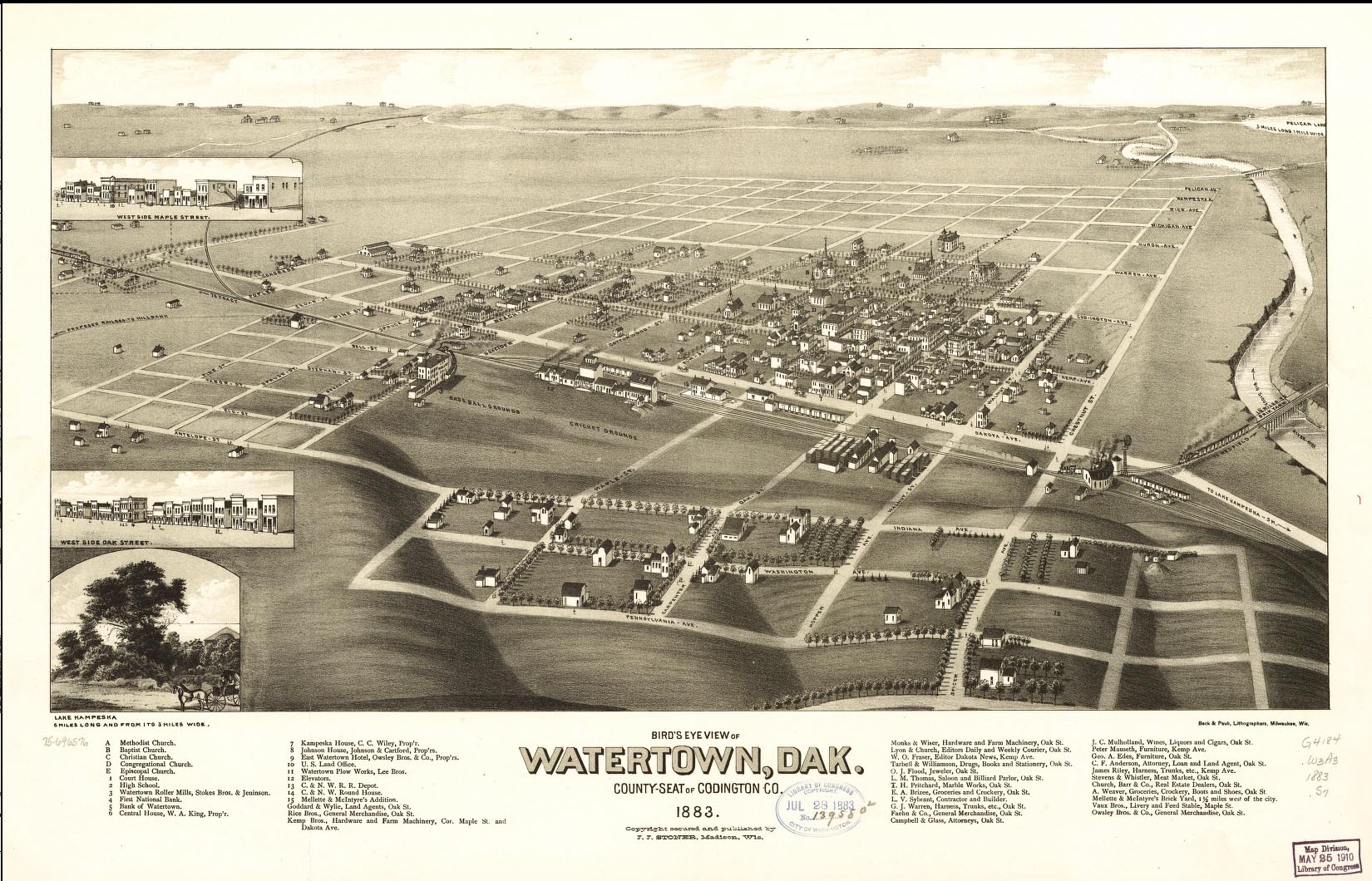
Watertown is a city in and the county seat of Codington County, South Dakota, United States. Watertown is home to the Redlin Art Center which houses many of the original art works produced by Terry Redlin, one of America's most popular wildlife artists. Watertown is located between Pelican Lake and Lake Kampeska, from which Redlin derived inspiration for his artwork. The population was 22,655 at the 2020 census, making Watertown the 5th largest city in South Dakota. It is also the principal city of the Watertown Micropolitan Statistical Area, which includes all of Codington and Hamlin counties. Watertown also is home to the Bramble Park Zoo. Watertown's residential real estate is considered the most expensive in South Dakota for cities of its size; the median price for a home in Watertown is approximately $200,000. Geography Watertown is located at (44.903433, -97.120437), along the Big Sioux River. According to the United States Census Bureau, the city has a total ar ... [...More Info...] [...Related Items...] OR: [Wikipedia] [Google] [Baidu] |
Redwood Falls, Minnesota
Redwood Falls is a city in Redwood County, located along the Redwood River near its confluence with the Minnesota River, in the U.S. state of Minnesota. The population was 5,102 at the 2020 census. It is the county seat. History As the immigrant and the Euro-American population of the North American east coast region grew, population pressures affected people far inland. People moved west to find new homes as more and more land was used by farmers. The Minnesota area is the ancestral homeland of the several Dakota peoples, who consisted of the loosely confederated ''Oceti sakowin'' (Seven Council Fires). By 1700, Ojibwe, who spoke an Anishinaabe language, had also come to what is now Minnesota from the further east around the Great Lakes. At times they came into conflict with the Dakota over land and resources and began to push them to the west. 19th century By the mid-19th century, the traditional Dakota yearly cycle of farming, hunting, fishing, and gathering wild rice ha ... [...More Info...] [...Related Items...] OR: [Wikipedia] [Google] [Baidu] |
Sleepy Eye, Minnesota
Sleepy Eye is a small city in rural Brown County, Minnesota, United States. The city is named after a famed local Dakota chief from the 1800s. The population was 3,599 at the 2010 census. History Sleepy Eye took its name from Sleepy Eye Lake, which was named after Chief Sleepy Eye, who was known as a compassionate person with droopy eyelids (or maybe just one). The chief was one of four Sioux Native Americans (four Ojibwe also attended) chosen to meet President James Monroe in 1824 in the nation's capital. Later, Sleepy Eye was an integral player in the 1851 signing of the Treaty of Traverse des Sioux, which gave all the land but a 10-mile swath on each side of the upper Minnesota River to the U.S. government. His recommendations to traders led to the successful settlement of Mankato, away from flood areas, and the chief eventually settled his people near the lake now known as Sleepy Eye Lake. Sleepy Eye was platted in 1872 and incorporated as a city in 1903. Geography ... [...More Info...] [...Related Items...] OR: [Wikipedia] [Google] [Baidu] |
Mankato, Minnesota
Mankato ( ) is a city in Blue Earth, Nicollet, and Le Sueur counties in the state of Minnesota. The population was 44,488 according to the 2020 census, making it the 21st-largest city in Minnesota, and the 5th-largest outside of the Minneapolis–Saint Paul metropolitan area. It is along a large bend of the Minnesota River at its confluence with the Blue Earth River. Mankato is across the Minnesota River from North Mankato. Mankato and North Mankato have a combined population of 58,763 according to the 2020 census. It completely encompasses the town of Skyline. North of Mankato Regional Airport, a tiny non-contiguous part of the city lies within Le Sueur County. Most of the city is in Blue Earth County. Mankato is the larger of the two principal cities of the Mankato-North Mankato metropolitan area, which covers Blue Earth and Nicollet Counties and had a combined population of 103,566 at the 2020 census. The U.S. Census Bureau designated Mankato a Metropolitan Statistica ... [...More Info...] [...Related Items...] OR: [Wikipedia] [Google] [Baidu] |
Courtland, Minnesota
Courtland is a city in Nicollet County, Minnesota, United States. The population was 734 at the 2020 census. It is part of the Mankato- North Mankato Metropolitan Statistical Area. History The place occupied by the current town was named Courtland in 1865, but was previously named Hilo. Courtland was platted in 1882. There are conflicting records for the origin of the name. According to Bryant (1882) the city was named for Cortland County, New York and not spelled the same; however, Stennett (1908) suggests it is named after Courland, a once-Germanized region of present-day Latvia by an emigrant, J.H. Stewart, and was accidentally misspelled on the official record. Geography According to the U.S. Census Bureau, the city has a total area of , all land. Demographics 2010 census As of the census of 2010, there were 611 people, 237 households, and 176 families living in the city. The population density was . There were 251 housing units at an average density of . The racial ma ... [...More Info...] [...Related Items...] OR: [Wikipedia] [Google] [Baidu] |
Nicollet, Minnesota
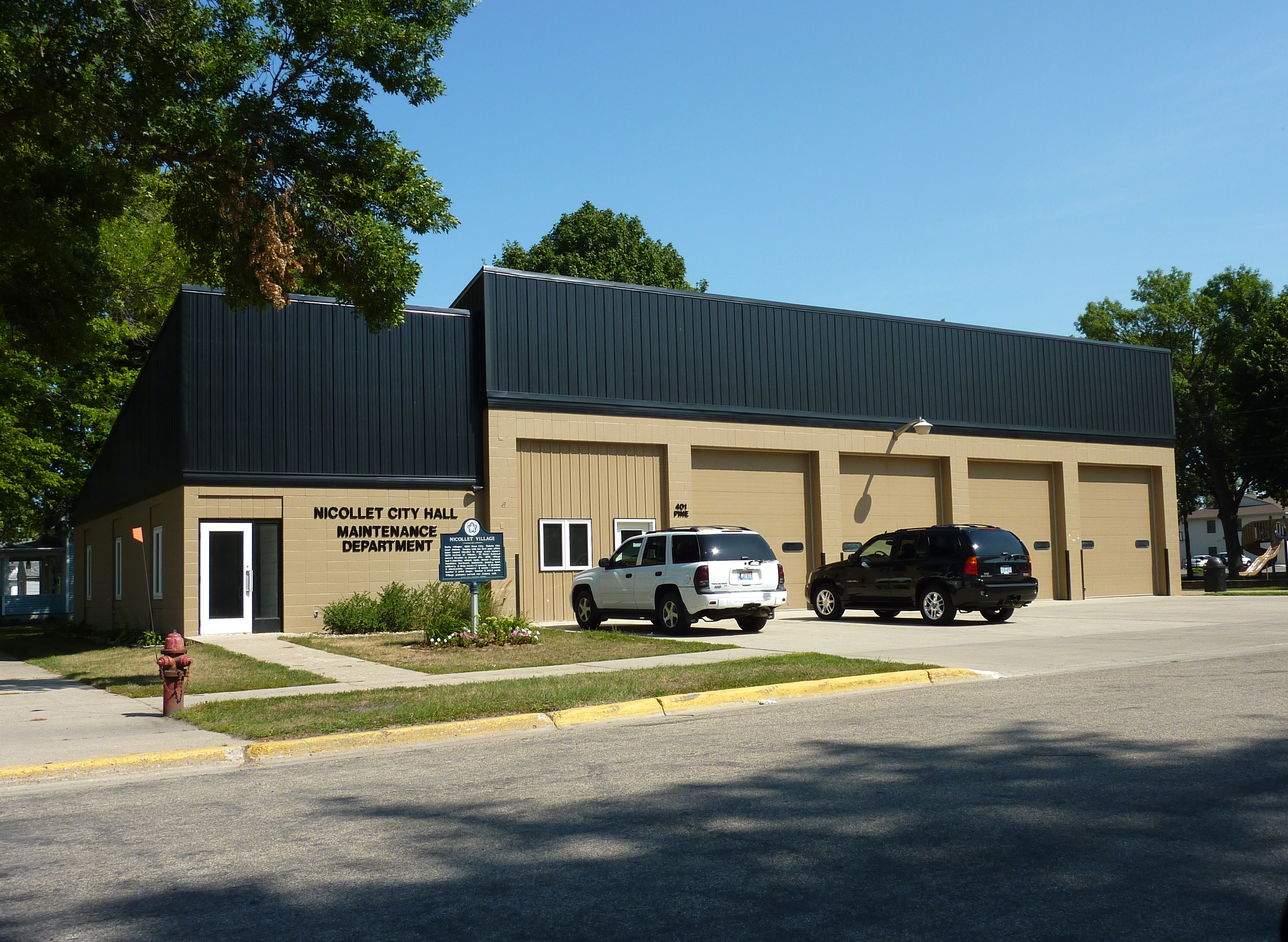
Nicollet is a city in Nicollet County, Minnesota, United States. The population was 1,143 at the 2020 census. It is part of the Mankato— North Mankato Metropolitan Statistical Area. U.S. Route 14 and Minnesota State Highways 99 and 111 are the three main arterial routes in the community. Nearby Swan Lake Wildlife Management Area is one of the most significant waterfowl breeding areas in the upper Midwest. History The city of Nicollet was named for Joseph Nicollet, a French explorer. A post office called Nicollet, along with the town of Nicollet, was established in 1858 by William A. Mills. Nicollet was platted on June 30, 1874 by James H. Stewart and Walter L. Brackenridge as a railroad town. Nicollet was incorporated in 1881. Geography According to the U.S. Census Bureau, the city has a total area of , all land. Demographics 2010 census As of the census of 2010, there were 1,093 people, 429 households, and 307 families living in the city. The population density was . ... [...More Info...] [...Related Items...] OR: [Wikipedia] [Google] [Baidu] |
New Ulm, Minnesota
New Ulm is a city in Brown County, Minnesota, United States. The population was 14,120 at the 2020 census. It is the county seat of Brown County. It is located on the triangle of land formed by the confluence of the Minnesota River and the Cottonwood River. The city is home to the Hermann Heights Monument, Flandrau State Park, the historic August Schell Brewing Company, and the Minnesota Music Hall of Fame. The city is known for its German heritage and its historical sites and landmarks dating back to the Dakota War of 1862. New Ulm is the episcopal see of the Roman Catholic Diocese of New Ulm. The Dakota called New Ulm the "Village on the Cottonwood" or Wakzupata. U.S. Highway 14 and Minnesota State Highways 15 and 68 are three of the main routes in the city. History Settlement The city was founded in 1854 by the German Land Company of Chicago. The city was named after the city of Neu-Ulm in the state of Bavaria in southern Germany. Ulm and Neu-Ulm are twin c ... [...More Info...] [...Related Items...] OR: [Wikipedia] [Google] [Baidu] |


