|
Tourism In Senegal
Tourism in Senegal is a vital part of the West African nation's Economy of Senegal, economy. Scale From a relatively small industry at the introduction of the first Club Med resort in the 1970s, tourism has grown to be an important part of the Economy of Senegal, Senegalese economy. Since the 1990s, Senegal has made an effort to reach beyond visitors from the former colonial power France and is attracting tourists from Spain, Britain and Italy, in part motivated by the example of neighboring Gambia, which draws a relatively larger tourist share from Northern Europe and the Americas to its Banjul coastal resorts.Senegal's fading tourism dreams Julian Bedford, BBC World Service. 13 March 2009 In 2008, Senegal's foreign tourist visitors had reached 1 million, attracted to luxury beach resorts, natural and histor ... [...More Info...] [...Related Items...] OR: [Wikipedia] [Google] [Baidu] |
Gorée
(; "Gorée Island"; ) is one of the 19 (i.e. districts) of the city of Dakar, Senegal. It is an island located at sea from the main harbour of Dakar (), famous as a destination for people interested in the Atlantic slave trade. Its population as of the 2013 census was 1,680 inhabitants, giving a density of , which is only half the average density of the city of Dakar. Gorée is both the smallest and the least populated of the 19 of Dakar. Other important centres for the slave trade from Senegal were further north, at Saint-Louis, Senegal, or to the south in the Gambia, at the mouths of major rivers for trade.''Les Guides Bleus: Afrique de l'Ouest'' (1958 ed.), p. 123 It is a UNESCO World Heritage Site and was one of the first 12 locations in the world to be designated as such in 1978. The name is a corruption of its original Dutch language, Dutch name Goeree, named after the Dutch island of Goeree-Overflakkee, Goeree. The island was also known as Palma, or in Portuguese. ... [...More Info...] [...Related Items...] OR: [Wikipedia] [Google] [Baidu] |
Niokolo-Koba National Park
The Niokolo-Koba National Park (, PNNK) is a World Heritage Site and natural protected area in southeastern Senegal, near the Guinea border. It is served by Niokolo-Koba Airport, an unpaved airstrip. National park Established as a reserve in 1925, Niokolo-Koba was declared a Senegalese national park on 1 January 1954. Expanded in 1969, it was inscribed as a World Heritage Site in 1981 as a UNESCO-MAB Biosphere Reserve. In 2007, it was added to the UNESCO List of Endangered World Heritage sites. It was removed from the list in 2024, following improvements in the park's state of conservation. Since 2005, the protected area is considered a West African lion, Lion Conservation Unit. Geography The park lies in an upland region through which the upper stretch of the Gambia River flows, towards the northwestern border of Guinea. The biosphere park itself covers some 9,130 square kilometres, in a great arc running from Upper Casamance/Kolda Region at the Guinea-Bissau border into t ... [...More Info...] [...Related Items...] OR: [Wikipedia] [Google] [Baidu] |
Senegal River
The Senegal River ( or "Senegal" - compound of the Serer term "Seen" or "Sene" or "Sen" (from Roog Seen, Supreme Deity in Serer religion) and "O Gal" (meaning "body of water")); , , , ) is a river in West Africa; much of its length marks part of the border between Senegal and Mauritania. It has a drainage basin of , a mean flow of , and an annual discharge of . Important tributaries are the Falémé River, Karakoro River, and the Gorgol River. The river divides into two branches once it passes Kaédi. The left branch, called the Doué, runs parallel to the main river to the north. After the two branches rejoin a few kilometers downstream of Podor. In 1972 Mali, Mauritania and Senegal founded the Organisation pour la mise en valeur du fleuve Sénégal (OMVS) to manage the river basin. Guinea joined in 2005. , only very limited use was made of the river for the transportation of goods and passengers. The OMVS have looked at the feasibility of creating a navigable ... [...More Info...] [...Related Items...] OR: [Wikipedia] [Google] [Baidu] |
Djoudj National Bird Sanctuary
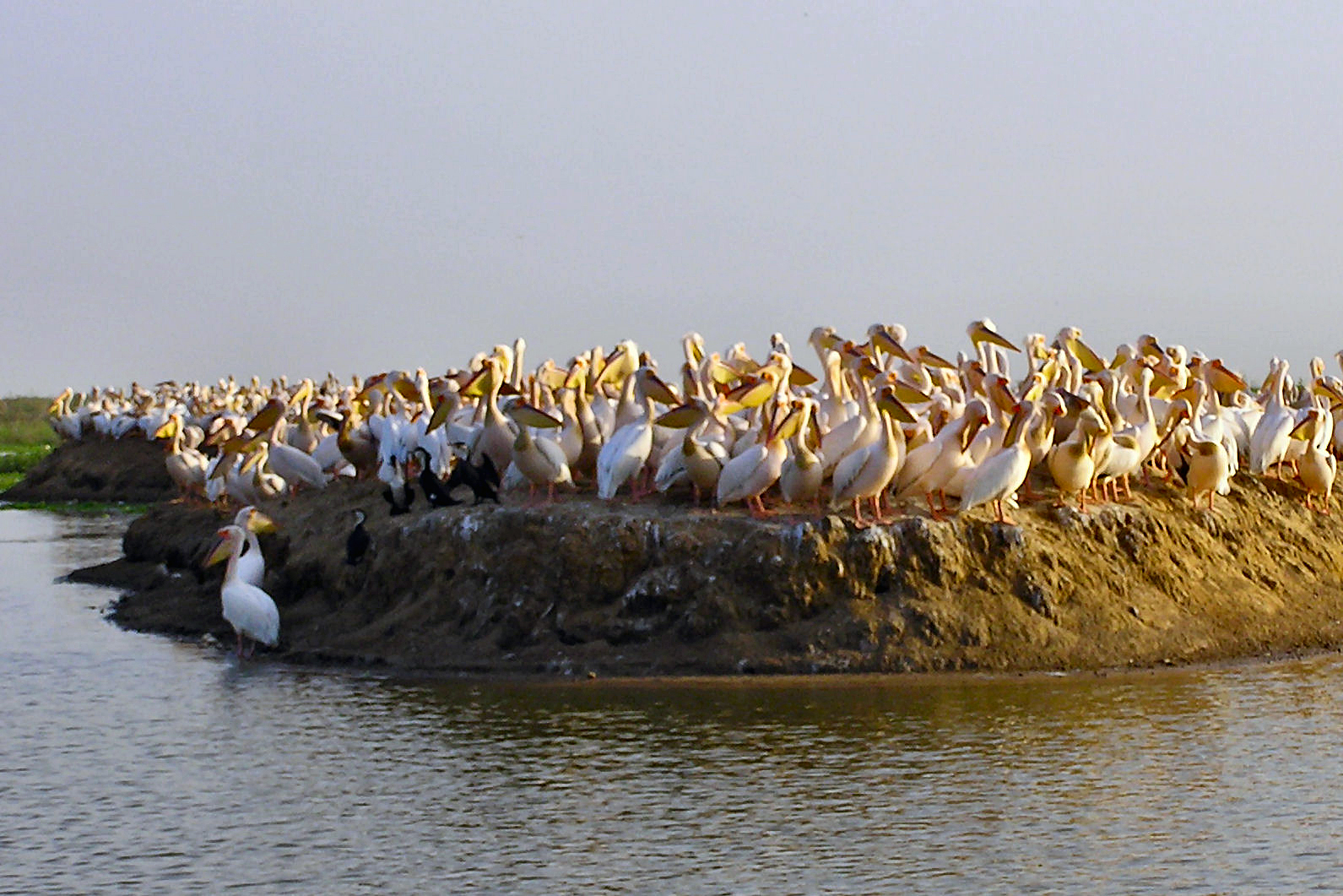
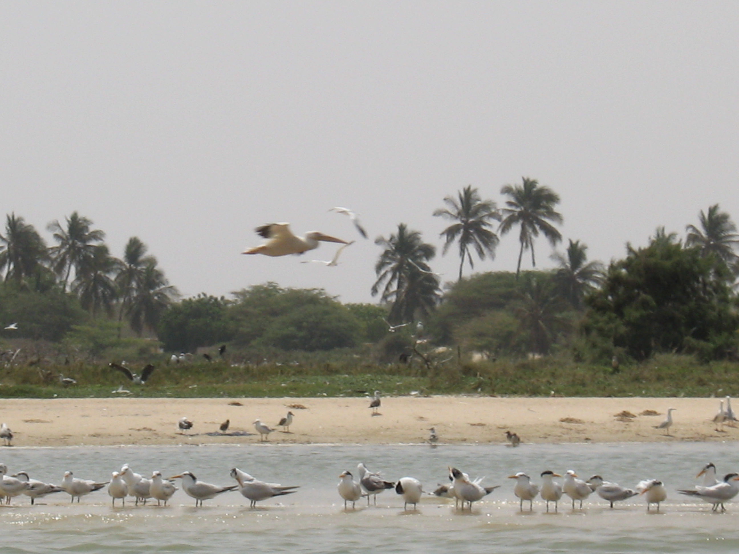
The Djoudj National Bird Sanctuary (, ) lies on the southeast bank of the Senegal River in Senegal, in northern Biffeche, north east of St-Louis. It provides a variety of wetland habitats which prove very popular with migrating birds, many of which have just crossed the Sahara. Of almost 400 species of birds, the most visible are pelicans and flamingos. Less conspicuous are the aquatic warblers migrating there from Europe; for these, the park is the single most important wintering site yet discovered. A wide range of wildlife also inhabits the park, which is designated a World Heritage Site. The site was added to the list of World Heritage in Danger in 1984 due to the introduction of the invasive giant salvinia plant, which threatens to choke out the park's native vegetation. However it was removed from the list in 2006. Environmental issues Since operation of the Diama Dam on the Senegal River began in 1988, experts have observed a lowering of the water level, desalinizati ... [...More Info...] [...Related Items...] OR: [Wikipedia] [Google] [Baidu] |
Langue De Barbarie National Park
The Langue de Barbarie (French for "Barbary spit of land", named after the Barbary Coast) is a thin, sandy peninsula, adjacent to the Atlantic Ocean, located in western Senegal, in the neighbourhood of the city of Saint-Louis. The peninsula separates the ocean from the final section of the Senegal River. National park The Langue de Barbarie National Park () is located at the southern edge of the peninsula. Covering an area of , it is home to an abundant variety of bird species and three species of turtle, including the critically endangered hawksbill sea turtle. The park was named a Ramsar site A Ramsar site is a wetland site designated to be of international importance under the Ramsar Convention,8 ha (O) *** Permanent 8 ha (P) *** Seasonal Intermittent < 8 ha(Ts) ** 2003 breach and environmental disaster [...More Info...] [...Related Items...] OR: [Wikipedia] [Google] [Baidu] |
List Of National Parks Of Africa
This is a list of national parks in Africa. The nature of the parks varies considerably not only between countries but also within some nations - the degree of protection, accessibility and type of environment for which it is intended to deliver protection. Some parks have been cleared of their original human population, others have always been essentially uninhabited, while yet others contain significant population centers. National parks can be found in a large majority of African countries, being most numerous in Gabon, Kenya and Tanzania. Some nations also have considerable areas designated as private parks, game reserves, forest reserves, marine reserves, national reserves and natural parks. These are not included in the list below, even though some of these may resemble some national parks. For more information on such zones, see the individual articles on each country. Algeria * Ahaggar National Park *Belezma National Park * Chrea National Park * Djebel Aissa Nationa ... [...More Info...] [...Related Items...] OR: [Wikipedia] [Google] [Baidu] |
Lac Rose
Lake Retba, also known as Lac Rose (meaning "pink lake"), lies north of the Cap Vert peninsula in Senegal, some north-east of the capital, Dakar, in northwest Africa. It is named for its pink waters caused by ''Dunaliella salina'' algae and is known for its high salt content, up to 40% in some areas. Its colour is usually particularly strong from late January to early March, during the dry season. Flooding in September 2022 not only disrupted salt harvesting activities on the lake, but also led the lake to lose its colour, causing a negative effect on tourism. However, as of 2025, the lake has regained some of its colour. The lake is under consideration by UNESCO as a World Heritage Site. Description The lake is situated north-east of Dakar, separated from the Atlantic Ocean only by a narrow corridor of dunes, and is named for its pink waters, which are caused by ''Dunaliella salina'' algae. The algae produce a red pigment to help them absorb sunlight, which gives them energ ... [...More Info...] [...Related Items...] OR: [Wikipedia] [Google] [Baidu] |
Sine-Saloum
Sine-Saloum is a region in Senegal located north of the Gambia and south of the Petite Côte. It encompasses an area of 24,000 square kilometers, about 12% of Senegal, with a population in the 1990s of 1,060,000. The western portion contains the Saloum Delta, a river delta at the junction of the Saloum River, Saloum and the North Atlantic. It is in this region that the Saloum Delta National Park is located. 145,811 hectares of the Delta were designated a UNESCO Heritage Site in 2011. Because it flows so slowly, this delta allows saltwater to travel deep inland. Long ago, the Serer people, Serer kingdoms of Kingdom of Sine, Sine and Saloum were rivals. In 1984, the area was divided into two administrative regions: Kaolack Region, Kaolack and Fatick Region, Fatick. Economy Primary economic activities in the 2000s consisted of fishing, salt production, peanut farming, and millet farming. A secondary economy is the construction of fishing boats. Transportation is difficult because ... [...More Info...] [...Related Items...] OR: [Wikipedia] [Google] [Baidu] |
Petite Côte
The Petite Côte is a stretch of coast in Senegal, running south from the Cap-Vert peninsula to the Saloum Delta, near the border with the Gambia. The northern section near Dakar contains seaside resorts such as Saly Portudal, Rufisque, Nianing and Popenguine-Ndayane. The entire coast is part of the city of M'Bour, with fishing villages, such as Toubab Dialaw, Joal-Fadiout, Palmarin and Djiffer.Connolly, Sean,''Senegal'', Bradt Travel Guides (2015), p. 139-140, (Retrieved 14 April 2019) History During the late fifteenth and early sixteenth centuries, Portuguese emigrants known as lançados formed communities along Petite Côte in the region of Senegambia. Some were Jews fleeing the Portuguese Inquisition, who married African women and formed local families. During the early sixteenth century these Luso-Africans had established trading centers in Petite Côte and elsewhere along coastal West Africa. Luso-Africans descended from continental Africans, Portuguese settlers, ... [...More Info...] [...Related Items...] OR: [Wikipedia] [Google] [Baidu] |
Saly
Saly (also called Sali or Saly Portudal) is a seaside resort and urban commune in Thiès Region on the Petite Côte of Senegal, south of Dakar. It is a major tourist destination in Senegal. History Saly was originally a Portuguese trading post known as ''Porto de Ale'', which became ''Portudal'', and later ''Sali Portudal''. It hosted Dutch merchants as well as the Portuguese by at least the late 16th century. On February 24, 1984, the resort was created on a previously unoccupied tract of land near the former trading post. It was about this time that Tourism in Senegal, tourism began to take off in Senegal. Administration Saly is part of M'bour Department, M'bour, Thiès Region, Thiès. Flora The resort is located on a sandy beach lined with coconut palm trees. Population The population is difficult to quantify because of the constant stream of tourists in and out of the area as well as the number of temporary residents. It has been suggested that an average of 20,000 people ... [...More Info...] [...Related Items...] OR: [Wikipedia] [Google] [Baidu] |


