|
Torodi Emirate
Torodi is a small town and a rural Communes of Niger, commune in Niger. As of 2012, it had a population of 109,342. As a rural center, Torodi hosts a large weekly market and the seat of local tribal authority (canton). Torodi is in the Say Department of the Tillaberi Region, which surrounds the national capital, Niamey. Say Department, with its capital at the large Niger River town of Say, abuts Niamey to the southwest and across the river to the west. The town of Torodi lies about 60 km due west of the city of Say and 50 km east of the border with Burkina Faso. Torodi itself lies on a tributary of the Niger, the Gourbi river. Torodi has historically been a crossroads of Zarma and Songhay people form the north, and the Gourma people, who dominated most of the area that is now Say Department until the 18th century CE. The 18th century saw expansion of Fulani people, south along the Niger from Gao and the Inland Niger Delta, as well as east from what is now northeast Burk ... [...More Info...] [...Related Items...] OR: [Wikipedia] [Google] [Baidu] |
Communes Of Niger
The Departments of Niger, Departments of Niger are subdivided into communes. As of 2005, in the seven Regions of Niger, Regions and one Capital Area, there were 36 ''départements'', divided into 265 ''communes'', 122 ''cantons'' and 81 ''groupements''. The latter two categories cover all areas not covered by ''Urban Communes'' (population over 10000) or ''Rural Communes'' (population under 10000), and are governed by the Department, whereas Communes have (since 1999) elected councils and mayors. Additional semi-autonomous sub-divisions include ''Sultanates'', ''Provinces'' and ''Tribes'' (''tribus''). The Nigerien government estimates there are an additional 17000 Villages administered by ''Rural Communes'', while there are over 100 ''Quartiers'' (boroughs or neighborhoods) administered by ''Urban Communes''. The territorial reorganisation of Niger's local administration, known informally as the ''Decentralisation process'', was carried out through a series of laws from 1998 ... [...More Info...] [...Related Items...] OR: [Wikipedia] [Google] [Baidu] |
Torodi Emirate
Torodi is a small town and a rural Communes of Niger, commune in Niger. As of 2012, it had a population of 109,342. As a rural center, Torodi hosts a large weekly market and the seat of local tribal authority (canton). Torodi is in the Say Department of the Tillaberi Region, which surrounds the national capital, Niamey. Say Department, with its capital at the large Niger River town of Say, abuts Niamey to the southwest and across the river to the west. The town of Torodi lies about 60 km due west of the city of Say and 50 km east of the border with Burkina Faso. Torodi itself lies on a tributary of the Niger, the Gourbi river. Torodi has historically been a crossroads of Zarma and Songhay people form the north, and the Gourma people, who dominated most of the area that is now Say Department until the 18th century CE. The 18th century saw expansion of Fulani people, south along the Niger from Gao and the Inland Niger Delta, as well as east from what is now northeast Burk ... [...More Info...] [...Related Items...] OR: [Wikipedia] [Google] [Baidu] |
Liptako
Liptako is an historic region of West Africa. It today falls in eastern Burkina Faso, southwestern Niger and a small portion of southeast central Mali. A hilly region beginning on the right back of the Niger river, Liptako is usually associated with the Liptako Emirate, an early 19th-century Fulani Islamic state, founded by Brahima Saidu. A modern remnant of the emirate continues to exist as a non-sovereign monarchy. The current emir, Ousmane Amirou Dicko, lives in Dori. With the semi nomadic Fula, the main historic population of Liptako are the Gourmantche, a minority population in each of the three nations, as well as the Mossi and Songhai. The other common name for the region, Liptako–Gourma, is a reference to the Gourmantche people. Modern Liptako, most of which falls in 10 to 19 provinces of Burkina Faso, along with Niger's Tera Department and Say Department, and small parts of Mali, is a hilly and in parts sparsely populated area. As elsewhere, the Fula population ... [...More Info...] [...Related Items...] OR: [Wikipedia] [Google] [Baidu] |
Inland Niger Delta
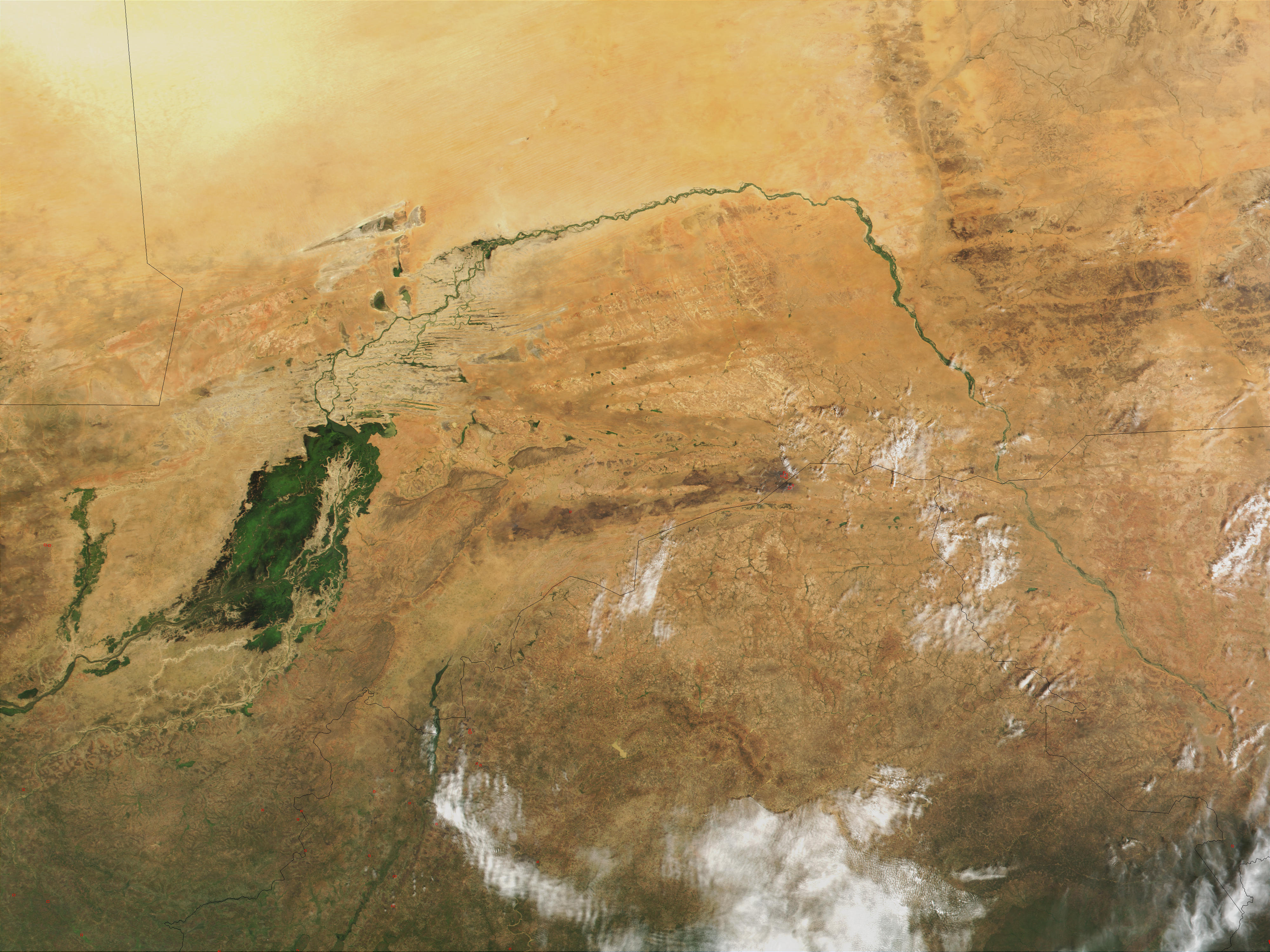
The Inner Niger Delta, also known as the Macina or Masina, is the inland river delta of the Niger River. It is an area of fluvial wetlands, lakes and floodplains in the semi-arid Sahel area of central Mali, just south of the Sahara Desert. Location and description The delta consists of the middle course of the Niger River, between the bifurcated Niger and its tributary the Bani, which from here run north towards the desert. The Niger is the longest river in West Africa. Towns such as the river-port of Mopti, Sévaré and Djenné, with its mud-brick Great Mosque lie in the 400 km-long region. The Fulani and Dogon inhabit the Macina region and the surrounding area, which has a population of over 500,000. Most of the year the area has a hot and dry climate, with hot winds from the nearby Sahara raising the temperature up to . During the wet season, which generally lasts from June to September but is longer the further south one goes, the swamp floods into a lake and na ... [...More Info...] [...Related Items...] OR: [Wikipedia] [Google] [Baidu] |
Fulani People
The Fula, Fulani, or Fulɓe people are an ethnic group in Sahara, Sahel and West Africa, widely dispersed across the region. Inhabiting many countries, they live mainly in West Africa and northern parts of Central Africa, South Sudan, Darfur, and regions near the Red Sea coast in Sudan. The approximate number of Fula people is unknown, due to clashing definitions regarding Fula ethnicity. Various estimates put the figure between 25 and 40 million people worldwide. A significant proportion of the Fula – a third, or an estimated 7 to 10 million – are pastoralism, pastoralists, and their ethnic group has the largest nomadic pastoral community in the world., Quote: The Fulani form the largest pastoral nomadic group in the world. The Bororo'en are noted for the size of their cattle herds. In addition to fully nomadic groups, however, there are also semisedentary Fulani – Fulbe Laddi – who also farm, although they argue that they do so out of necessity, not choice. The major ... [...More Info...] [...Related Items...] OR: [Wikipedia] [Google] [Baidu] |
Gourma People
Gurma (also called Gourma or Gourmantché) is an ethnic group living mainly in northeastern Ghana, Burkina Faso, around Fada N'gourma, Fada N'Gourma, and also in northern areas of Togo and Benin, as well as southwestern Niger. They might include the Bassaries who live in northern Togo and the Northern Volta of Kingdom of Dagbon, Ghana. ''Gurma'' is also the name of a language spoken by the Gurma people, which is part of the Gur languages, Gur language family. See Gourmanché and Oti–Volta languages for related languages spoken by the Gurma. Overview In 1985, Dr. Richard Alan Swanson wrote a book about the Gourmantché, ''Gourmantché cultural anthropology, Ethnoanthropology: A Theory of Human Being''. The book presents Gourmantché perception of 'human being' from the perspective of the people themselves, using their own language texts to illustrate concepts. Concepts of God (''Otienu''), destiny (''licabili''), the body (''gbannandi''), life (''limiali''), death (''mikuu ... [...More Info...] [...Related Items...] OR: [Wikipedia] [Google] [Baidu] |
Niger River
The Niger River ( ; ) is the main river of West Africa, extending about . Its drainage basin is in area. Its source is in the Guinea Highlands in south-eastern Guinea near the Sierra Leone border. It runs in a crescent shape through Mali, Niger, on the border with Benin and then through Nigeria, discharging through a massive River delta, delta, known as the Niger Delta, into the Gulf of Guinea in the Atlantic Ocean. The Niger is the third-longest river in Africa, exceeded by the Nile and the Congo River. Its main tributary is the Benue River. Etymology The Niger has different names in the different languages of the region: * Fula language, Fula: ''Maayo Jaaliba'' * Manding languages, Manding: ''Jeliba'' or ''Joliba'' "great river" * Tuareg languages, Tuareg: ''Eġərəw n-Igərǝwăn'' "river of rivers" * Songhay languages, Songhay: ''Isa'' "the river" * Zarma language, Zarma: ''Isa Beeri'' "great river" * Hausa language, Hausa: ''Kwara'' *Nupe language, Nupe: ''Èdù'' ... [...More Info...] [...Related Items...] OR: [Wikipedia] [Google] [Baidu] |
Regions Of Niger
Niger is divided into seven regions (French: ''régions;'' singular''région)'', each of which is named after its capital. Additionally, the national capital, Niamey, comprises a capital district. Current regions *capital district. Current administrative structure Each of Niger's regions are subdivided into departments and communes. As of 2005, there were 36 ''départements'', divided into 265 communes, 122 cantons and 81 ''groupements''. The latter two categories cover all areas not covered by urban communes (population over 10000) or rural communes (total population 13 million), and are governed by the department, whereas communes have had elected councils and mayors since 1999. Additional semi-autonomous subdivisions include sultanates, provinces and tributaries (''tribus''). The Nigerien government estimates there are an additional 17000 villages administered by rural communes, while there are a number of ''quartiers'' (boroughs or neighborhoods) administered by urban ... [...More Info...] [...Related Items...] OR: [Wikipedia] [Google] [Baidu] |
Niamey
Niamey () is the capital and largest city of Niger. As the Niamey Urban Community (, CUN), it is a Regions of Niger, first-level division of Niger, surrounded by the Tillabéri Region, in the western part of the country. Niamey lies on the Niger River, primarily situated on the river's east bank. The capital of Niger since the Colony of Niger, colonial era, Niamey is an ethnically diverse city and the country's main economic centre. Before the French developed it as a colonial centre, Niamey was the site of villages inhabited by Fula people, Fula, Zarma people, Zarma, Maouri people, Maouri, and Songhai people, Songhai people. French expeditions first visited Niamey in the 1890s before Captain established a military post in 1901. Niamey replaced Zinder as the territorial capital from 1903 to 1911 and again in 1926, after which large-scale development occurred. The first city plan in 1930 relocated neighbourhoods and enacted Racial segregation, segregation of European and indigen ... [...More Info...] [...Related Items...] OR: [Wikipedia] [Google] [Baidu] |
Niger
Niger, officially the Republic of the Niger, is a landlocked country in West Africa. It is a unitary state Geography of Niger#Political geography, bordered by Libya to the Libya–Niger border, north-east, Chad to the Chad–Niger border, east, Nigeria to the Niger–Nigeria border, south, Benin and Burkina Faso to the Benin-Niger border, south-west, Mali to the Mali–Niger border, west, and Algeria to the Algeria–Niger border, north-west. It covers a land area of almost , making it the largest landlocked country in West Africa and the second-largest landlocked nation in Africa behind Chad. Over 80% of its land area lies in the Sahara. Its Islam in Niger, predominantly Muslim population of about million lives mostly in clusters in the south and west of the country. The capital Niamey is located in Niger's south-west corner along the namesake Niger River. Following the spread of Islam to the region, Niger was on the fringes of some states, including the Kanem–Bornu Empire ... [...More Info...] [...Related Items...] OR: [Wikipedia] [Google] [Baidu] |


