|
Tormsdale
Tormsdale is a megalithic site on the banks of the River Thurso, in Caithness, Scotland. It is south of Westerdale. The site consists of some low stone rows which are difficult to trace as the stones are small and have been partly overgrown by grass. Tormsdale is near to another stone row at Dirlot, and is also close to the brochs at Tulach Beag and Tulach Mor. References External links * Archaeological sites in Caithness Megalithic monuments in Scotland {{Caithness-geo-stub ... [...More Info...] [...Related Items...] OR: [Wikipedia] [Google] [Baidu] |
Megalithic
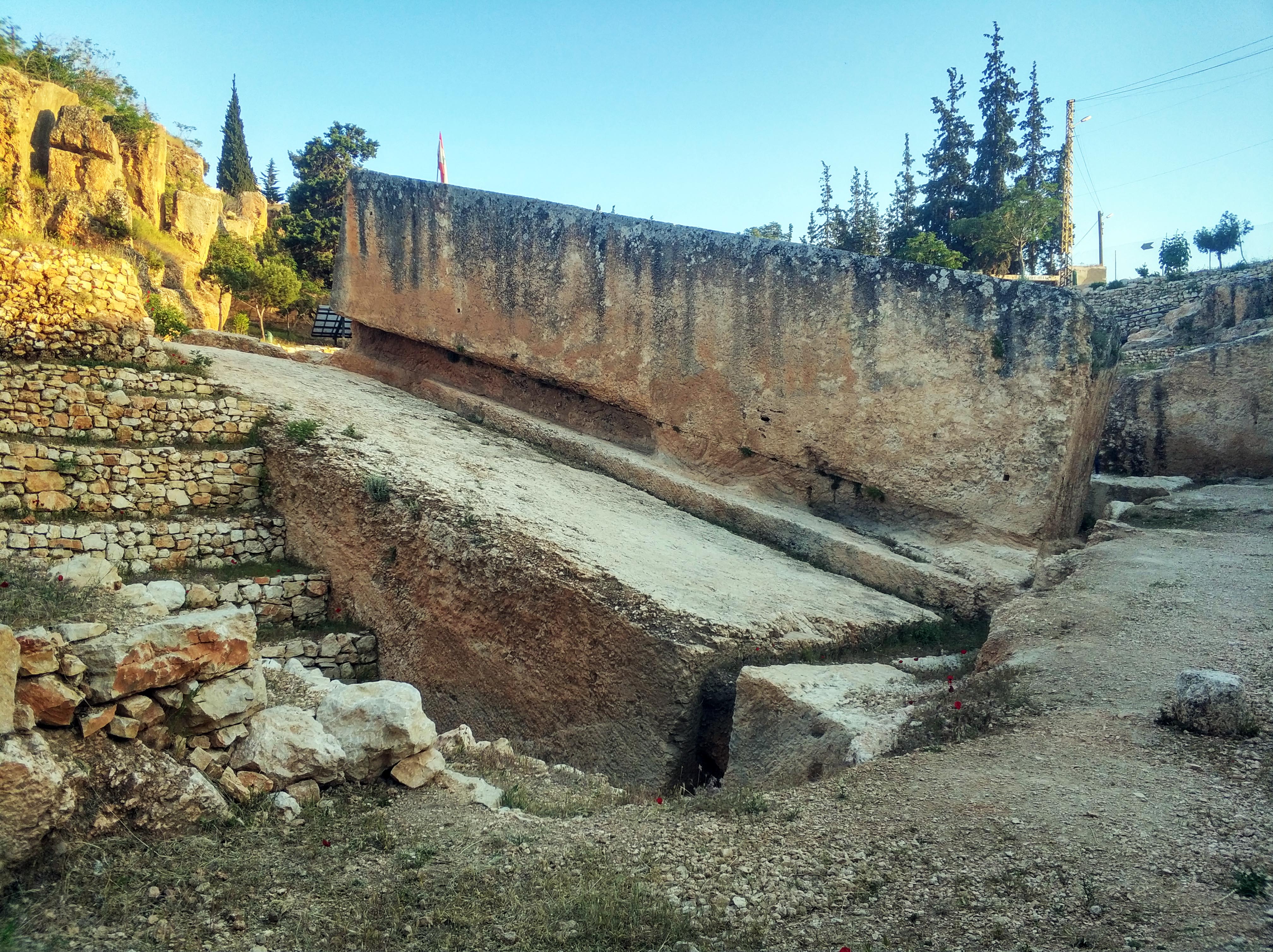
A megalith is a large Rock (geology), stone that has been used to construct a prehistoric structure or monument, either alone or together with other stones. More than 35,000 megalithic structures have been identified across Europe, ranging geographically from Sweden in the north to the Mediterranean Sea in the south. The word was first used in 1849 by the British antiquarian Algernon Herbert in reference to Stonehenge and derives from the Ancient Greek words "wikt:μέγας, mega" for great and "wikt:λίθος, lithos" for stone. Most extant megaliths were erected between the Neolithic period (although earlier Mesolithic examples are known) through the Chalcolithic, Chalcolithic period and into the Bronze Age. Types and definitions While "megalith" is often used to describe a single piece of stone, it also can be used to denote one or more rocks hewn in definite shapes for special purposes. It has been used to describe structures built by people from many parts of the wo ... [...More Info...] [...Related Items...] OR: [Wikipedia] [Google] [Baidu] |
River Thurso
The River Thurso () has Loch Rumsdale in Caithness as its source, about south and west of the burgh of Thurso, Caithness, and about south of the railway line linking the burghs of Thurso and Wick with Inverness. At its source and until it reaches Loch More the river is known also as Strathmore Water. Caithness is in the Highland area of Scotland. From Loch Rumsdale the river flows generally east/southeast across about until it is joined by Glutt Water, and then generally northeast across about 7 kilometres until it enters the southern end of Loch More. On the loch's eastern side, towards its northern end, the river flows almost immediately into the western end of Loch Beg. Then from Loch Beg's eastern end the river flows east/northeast across about until it is joined by Little River. From Little River the River Thurso flows generally northward across about until it reaches its mouth in Thurso Bay and the Atlantic Ocean The Atlantic Ocean is the second larg ... [...More Info...] [...Related Items...] OR: [Wikipedia] [Google] [Baidu] |
Caithness
Caithness (; ; ) is a Shires of Scotland, historic county, registration county and Lieutenancy areas of Scotland, lieutenancy area of Scotland. There are two towns, being Wick, Caithness, Wick, which was the county town, and Thurso. The county includes the northernmost point of mainland Britain at Dunnet Head, and also the most north-easterly point at Duncansby Head near John o' Groats. The Flow Country is the largest blanket bog in Europe, and covers a large inland area in the west of the county. Caithness has a land boundary with the historic county of Sutherland to the west and is otherwise bounded by sea. The land boundary follows a drainage divide, watershed and is crossed by two roads (the A9 road (Great Britain), A9 and the A836 road, A836) and by one railway (the Far North Line). Across the Pentland Firth, ferries link Caithness with Orkney, and Caithness also has an airport at Wick, Highland, Wick. The Pentland Firth island of Stroma, Scotland, Stroma is within Caithne ... [...More Info...] [...Related Items...] OR: [Wikipedia] [Google] [Baidu] |
Scotland
Scotland is a Countries of the United Kingdom, country that is part of the United Kingdom. It contains nearly one-third of the United Kingdom's land area, consisting of the northern part of the island of Great Britain and more than 790 adjacent Islands of Scotland, islands, principally in the archipelagos of the Hebrides and the Northern Isles. To the south-east, Scotland has its Anglo-Scottish border, only land border, which is long and shared with England; the country is surrounded by the Atlantic Ocean to the north and west, the North Sea to the north-east and east, and the Irish Sea to the south. The population in 2022 was 5,439,842. Edinburgh is the capital and Glasgow is the most populous of the cities of Scotland. The Kingdom of Scotland emerged as an independent sovereign state in the 9th century. In 1603, James VI succeeded to the thrones of Kingdom of England, England and Kingdom of Ireland, Ireland, forming a personal union of the Union of the Crowns, three kingdo ... [...More Info...] [...Related Items...] OR: [Wikipedia] [Google] [Baidu] |
Westerdale
Westerdale is a village, civil parish and valley in North Yorkshire, England. The Esk Valley Walk runs through part of the village. The village is at the confluence of three streams (Esklets) which combine as the head of the River Esk. From 1974 to 2023 it was part of the Borough of Scarborough, it is now administered by the unitary North Yorkshire Council. According to the 2011 UK census, Westerdale parish had a population of 149, a decrease on the 2001 UK census figure of 175. Geography The village Westerdale village is a single street of around 25 houses, to the north east of a small stream which joins the Esk near Hunters Sty bridge. There is a church – Christ Church, and a small, disused Methodist chapel. Close to the church can be found the Village Hall (formerly a small schoolhouse), a postbox and a telephone box. Ironstone was formerly mined in the village and the church sits on a plateau where the ironstone is just over thick. The village is south of Guisboro ... [...More Info...] [...Related Items...] OR: [Wikipedia] [Google] [Baidu] |
Stone Row
A stone row or stone alignment is a linear arrangement of megalithic standing stones set at intervals along a common axis or series of axes, usually dating from the later Neolithic or Bronze Age.Power (1997), p.23 Rows may be individual or grouped, and three or more aligned stones can constitute a row. Description The term alignment is sometimes taken to imply that the rows were placed purposely in relation to other factors such as other monuments or topographical or astronomical features. Archaeologists treat stone rows as discrete features however and alignment refers to the stones being lined up with one another rather than anything else. Their purpose is thought to be religious or ceremonial perhaps marking a processional route. Another theory is that each generation would erect a new stone to contribute to a sequence that demonstrated a people's continual presence. Stone rows can be few metres or several kilometres in length and made from stones that can be as tall as 2m, ... [...More Info...] [...Related Items...] OR: [Wikipedia] [Google] [Baidu] |
Broch
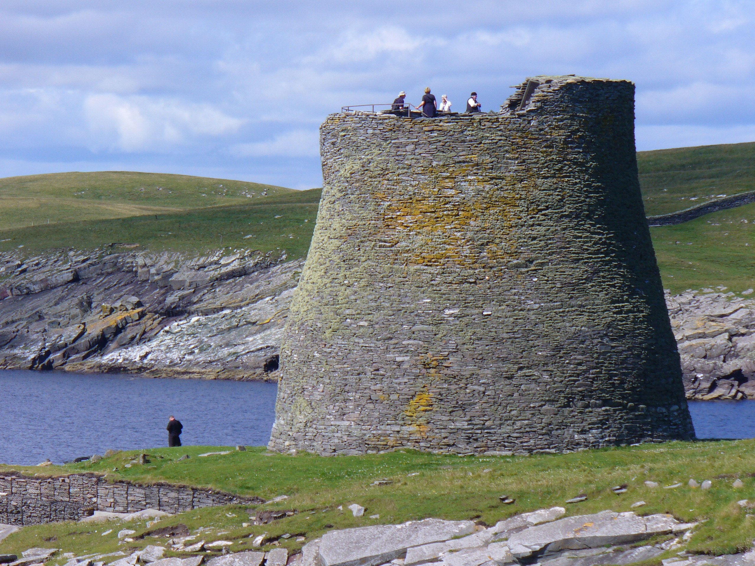
In archaeology, a broch is an British Iron Age, Iron Age drystone hollow-walled structure found in Scotland. Brochs belong to the classification "complex Atlantic roundhouse" devised by Scottish archaeologists in the 1980s. Brochs are roundhouse buildings found throughout Atlantic Scotland. The word broch is derived from the Scots language, Lowland Scots 'brough', meaning fort. In the mid-19th century, Scottish antiquaries called brochs 'burgs', after Old Norse borg, with the same meaning. Brochs are often referred to as Dun (fortification), dùns in the west, and they are the most spectacular of a complex class of buildings found in northern Scotland. There are approximately 571 candidate broch sites throughout the country, according to the Royal Commission on the Ancient and Historical Monuments of Scotland. The origin of brochs is still subject to ongoing research. While most archaeologists believed 80 years ago that brochs were built by immigrants, there is now little do ... [...More Info...] [...Related Items...] OR: [Wikipedia] [Google] [Baidu] |
Tulach Beag
Tullos is an area of Aberdeen, Scotland. The area takes its name from the Vale of Tullos, which lies between Tullos Hill and Torry Hill. Tullos derived its name from a corruption of the Gaelic ‘Tulach’ meaning a hill. In this extract from the "Book of St. Fittick", published in 1902, Dr. Thomas White Ogilvie describes what the scene looked like in his day. "It is full of quiet charm, this little glen, with its Kirk on the height and its Kirk in the hollow, extending from the great gap in the cliff, which forms the Bay, up to the river, where, with majestic bend, it sweeps glittering and gurgling by Allenvale and Duthie Park, sweetest of resting places for the quick and the dead." The scene is very different today. In 1850 the Caledonian, Great North of Scotland and North British Railways began to provide rail links to Aberdeen. The main line cut through the Vale of Tullos. The area south of the railway line is full of car showrooms, oil yards and waste recycling plan ... [...More Info...] [...Related Items...] OR: [Wikipedia] [Google] [Baidu] |
Archaeological Sites In Caithness
Archaeology or archeology is the study of human activity through the recovery and analysis of material culture. The archaeological record consists of artifacts, architecture, biofacts or ecofacts, sites, and cultural landscapes. Archaeology can be considered both a social science and a branch of the humanities. It is usually considered an independent academic discipline, but may also be classified as part of anthropology (in North America – the four-field approach), history or geography. The discipline involves surveying, excavation, and eventually analysis of data collected, to learn more about the past. In broad scope, archaeology relies on cross-disciplinary research. Archaeologists study human prehistory and history, from the development of the first stone tools at Lomekwi in East Africa 3.3 million years ago up until recent decades. Archaeology is distinct from palaeontology, which is the study of fossil remains. Archaeology is particularly important for learnin ... [...More Info...] [...Related Items...] OR: [Wikipedia] [Google] [Baidu] |


