|
Tongariro Domain
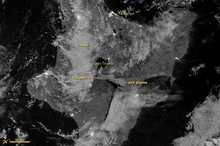
Mount Tongariro (; ) is a compound volcano in the Taupō Volcanic Zone of the North Island of New Zealand. It is located to the southwest of Lake Taupō, and is the northernmost of the three active volcanoes that dominate the landscape of the central North Island. Geology Mount Tongariro is part of the Tongariro volcanic centre, which consists of four massifs made of andesite: Tongariro, Kakaramea-Tihia Massif, Pihanga, and Ruapehu at the southern end of the North Island Volcanic Plateau. The andesitic eruptions formed Tongariro, a steep stratovolcano, reaching a height of . Tongariro is composed of layers of both lava and tephra and the eruptions that built the current stratovolcano commenced about 275,000 years ago. Tongariro consists of at least 12 cones. Ngauruhoe, while often regarded as a separate mountain, is geologically a cone of Tongariro. It is also the most active vent, having erupted more than 70 times since 1839, the last episode in 1973 to 1975. Activity has ... [...More Info...] [...Related Items...] OR: [Wikipedia] [Google] [Baidu] |
Complex Volcano
A complex volcano, also called a compound volcano or a volcanic complex, is a mixed landform consisting of related volcanic centers and their associated lava flows and pyroclastic rock. They may form due to changes in eruptive habit or in the location of the principal vent area on a particular volcano. Stratovolcanoes can also form a large caldera that gets filled in by a lava dome, or else multiple small cinder cones, lava domes and craters may develop on the caldera's rim. Although a comparatively unusual type of volcano, they are widespread in the world and in geologic history. Metamorphosed ash flow tuffs are widespread in the Precambrian rocks of northern New Mexico, which indicates that caldera complexes have been important for much of Earth's history. Yellowstone National Park is on three partly covered caldera complexes. The Long Valley Caldera in eastern California is also a complex volcano; the San Juan Mountains in southwestern Colorado are formed on a group ... [...More Info...] [...Related Items...] OR: [Wikipedia] [Google] [Baidu] |
Lake Taupō
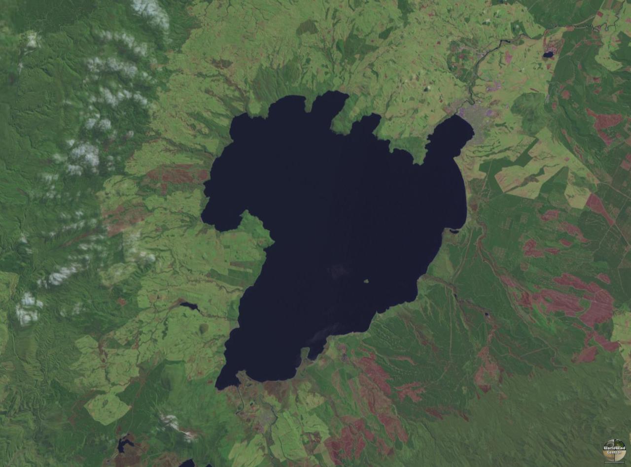
Lake Taupō (also spelled Taupo; or ) is a large crater lake in New Zealand's North Island, located in the caldera of Taupō Volcano. The lake is the namesake of the town of Taupō, which sits on a bay in the lake's northeastern shore. With a surface area of , it is the largest lake by surface area in New Zealand, and the second largest freshwater lake by surface area in geopolitical Oceania after Lake Murray in Papua New Guinea. Motutaiko Island lies in the southeastern area of the lake. Geography Lake Taupō has a perimeter of approximately and a maximum depth of . It is drained by the Waikato River (New Zealand's longest river), and its main tributaries are the Waitahanui River, the Tongariro River, and the Tauranga Taupō River. It is a noted trout fishery with stocks of introduced brown and rainbow trout. The level of the lake is controlled by Mercury Energy, the owner of the eight hydroelectric dams on the Waikato River downstream of Lake Taupō, using gates b ... [...More Info...] [...Related Items...] OR: [Wikipedia] [Google] [Baidu] |
Last Glacial Maximum
The Last Glacial Maximum (LGM), also referred to as the Last Glacial Coldest Period, was the most recent time during the Last Glacial Period where ice sheets were at their greatest extent between 26,000 and 20,000 years ago. Ice sheets covered much of Northern North America, Northern Europe, and Asia and profoundly affected Earth's climate by causing a major expansion of deserts, along with a large drop in sea levels. Based on changes in position of ice sheet margins dated via cosmogenic nuclide, terrestrial cosmogenic nuclides and radiocarbon dating, growth of ice sheets in the southern hemisphere commenced 33,000 years ago and maximum coverage has been estimated to have occurred sometime between 26,500 years ago and 20,000 years ago. After this, deglaciation caused an abrupt rise in sea level. Decline of the West Antarctica ice sheet occurred between 14,000 and 15,000 years ago, consistent with evidence for another abrupt rise in the sea level about 14,500 years ago. Glacier fl ... [...More Info...] [...Related Items...] OR: [Wikipedia] [Google] [Baidu] |
Moraines
A moraine is any accumulation of unconsolidated debris ( regolith and rock), sometimes referred to as glacial till, that occurs in both currently and formerly glaciated regions, and that has been previously carried along by a glacier or ice sheet. It may consist of partly rounded particles ranging in size from boulders (in which case it is often referred to as boulder clay) down to gravel and sand, in a groundmass of finely-divided clayey material sometimes called glacial flour. Lateral moraines are those formed at the side of the ice flow, and terminal moraines are those formed at the foot, marking the maximum advance of the glacier. Other types of moraine include ground moraines (till-covered areas forming sheets on flat or irregular topography) and medial moraines (moraines formed where two glaciers meet). Etymology The word ''moraine'' is borrowed from French , which in turn is derived from the Savoyard Italian ('mound of earth'). in this case was derived from Proven ... [...More Info...] [...Related Items...] OR: [Wikipedia] [Google] [Baidu] |
Glaze Ice
Glaze or glaze ice, also called glazed frost or verglas, is a smooth, transparent and homogeneous ice coating occurring when freezing rain or drizzle hits a surface. It is similar in appearance to clear ice, which forms from supercooled water droplets. It is a relatively common occurrence in temperate climates in the winter when precipitation forms in warm air aloft and falls into below-freezing temperature at the surface. Effects When the freezing rain or drizzle is light and not prolonged, the ice formed is thin. It usually causes only minor damage, relieving trees of their dead branches, etc. When large quantities accumulate, however, it is one of the most dangerous types of winter hazard. When the ice layer exceeds , tree limbs with branches heavily coated in ice can break off under the enormous weight and fall onto power lines. Windy conditions, when present, will exacerbate the damage. Power lines coated with ice become extremely heavy, causing support poles, insulators ... [...More Info...] [...Related Items...] OR: [Wikipedia] [Google] [Baidu] |
Emerald Lakes, New Zealand
Mount Tongariro (; ) is a compound volcano in the Taupō Volcanic Zone of the North Island of New Zealand. It is located to the southwest of Lake Taupō, and is the northernmost of the three active volcanoes that dominate the landscape of the central North Island. Geology Mount Tongariro is part of the Tongariro volcanic centre, which consists of four massifs made of andesite: Tongariro, Kakaramea-Tihia Massif, Pihanga, and Ruapehu at the southern end of the North Island Volcanic Plateau. The andesitic eruptions formed Tongariro, a steep stratovolcano, reaching a height of . Tongariro is composed of layers of both lava and tephra and the eruptions that built the current stratovolcano commenced about 275,000 years ago. Tongariro consists of at least 12 cones. Ngauruhoe, while often regarded as a separate mountain, is geologically a cone of Tongariro. It is also the most active vent, having erupted more than 70 times since 1839, the last episode in 1973 to 1975. Activity has ... [...More Info...] [...Related Items...] OR: [Wikipedia] [Google] [Baidu] |
Fumarole
A fumarole (or fumerole) is a vent in the surface of the Earth or another rocky planet from which hot volcanic gases and vapors are emitted, without any accompanying liquids or solids. Fumaroles are characteristic of the late stages of volcanic activity, but fumarole activity can also precede a volcanic eruption and has been used for eruption prediction. Most fumaroles die down within a few days or weeks of the end of an eruption, but a few are persistent, lasting for decades or longer. An area containing fumaroles is known as a fumarole field. The predominant vapor emitted by fumaroles is steam, formed by the circulation of groundwater through heated rock. This is typically accompanied by volcanic gases given off by magma cooling deep below the surface. These volcanic gases include sulfur compounds, such as various sulfur oxides and hydrogen sulfide, and sometimes hydrogen chloride, hydrogen fluoride, and other gases. A fumarole that emits significant sulfur compounds is some ... [...More Info...] [...Related Items...] OR: [Wikipedia] [Google] [Baidu] |
Volcanic Ash
Volcanic ash consists of fragments of rock, mineral crystals, and volcanic glass, produced during volcanic eruptions and measuring less than 2 mm (0.079 inches) in diameter. The term volcanic ash is also often loosely used to refer to all explosive eruption products (correctly referred to as '' tephra''), including particles larger than 2 mm. Volcanic ash is formed during explosive volcanic eruptions when dissolved gases in magma expand and escape violently into the atmosphere. The force of the gases shatters the magma and propels it into the atmosphere where it solidifies into fragments of volcanic rock and glass. Ash is also produced when magma comes into contact with water during phreatomagmatic eruptions, causing the water to explosively flash to steam leading to shattering of magma. Once in the air, ash is transported by wind up to thousands of kilometres away. Due to its wide dispersal, ash can have a number of impacts on society, including animal a ... [...More Info...] [...Related Items...] OR: [Wikipedia] [Google] [Baidu] |
Emerald Lakes From The Summit Of Red Crater
Emerald is a gemstone and a variety of the mineral beryl (Be3Al2(SiO3)6) colored green by trace amounts of chromium or sometimes vanadium.Hurlbut, Cornelius S. Jr., and Kammerling, Robert C. (1991). ''Gemology'', John Wiley & Sons, New York, p. 203, . Beryl has a hardness of 7.5–8 on the Mohs scale. Most emeralds have many inclusions, so their toughness (resistance to breakage) is classified as generally poor. Emerald is a cyclosilicate. Etymology The word "emerald" is derived (via and ), from Vulgar Latin: ''esmaralda/esmaraldus'', a variant of Latin ''smaragdus'', which was via (smáragdos; "green gem"). The Greek word may have a Semitic, Sanskrit or Persian origin. According to ''Webster's Dictionary'' the term emerald was first used in the 14th century. Properties determining value Emeralds, like all colored gemstones, are graded using four basic parameters known as "the four ''C''s": ''color'', ''clarity,'' ''cut'' and ''carat weight''. Normally, in grading c ... [...More Info...] [...Related Items...] OR: [Wikipedia] [Google] [Baidu] |
Mount Ngauruhoe
Mount Ngauruhoe () is a volcanic cone in New Zealand. It is the youngest vent in the Mount Tongariro, Tongariro stratovolcano complex on the Central Plateau, New Zealand, Central Plateau of the North Island and first erupted about 2,500 years ago. Although often regarded as a separate mountain, geologically, it is a secondary cone of Mount Tongariro. The volcano lies between the active volcanoes of Mount Tongariro to the north and Mount Ruapehu to the south, to the west of the Rangipo Desert and to the south of the southern shore of Lake Taupō. Etymology Before the initial mapping of the area introduced labelling confusion, the local Māori name for the cone was Tongariro, and its summit crater was known as Ngāuruhoe. The local Māori traditions state that the volcano was named by Ngātoro-i-rangi, an ancestor of the local Māori iwi, Ngāti Tūwharetoa. Ngātoro-i-rangi called volcanic fire from his homeland Hawaiki, which eventually emerged at Ngauruhoe. The name ... [...More Info...] [...Related Items...] OR: [Wikipedia] [Google] [Baidu] |
Tephra
Tephra is fragmental material produced by a Volcano, volcanic eruption regardless of composition, fragment size, or emplacement mechanism. Volcanologists also refer to airborne fragments as pyroclasts. Once clasts have fallen to the ground, they remain as tephra unless hot enough to fuse into pyroclastic rock or tuff. When a volcano explodes, it releases a variety of tephra including ash, cinders, and blocks. These layers settle on the land and, over time, sedimentation occurs incorporating these tephra layers into the geologic record. Tephrochronology is a geochronological technique that uses discrete layers of tephra—volcanic ash from a single eruption—to create a chronological framework in which Paleoecology, paleoenvironmental or Archaeology, archaeological records can be placed. Often, when a volcano explodes, biological organisms are killed and their remains are buried within the tephra layer. These fossils are later dated by scientists to determine the age of the ... [...More Info...] [...Related Items...] OR: [Wikipedia] [Google] [Baidu] |


