|
Tomales, CA
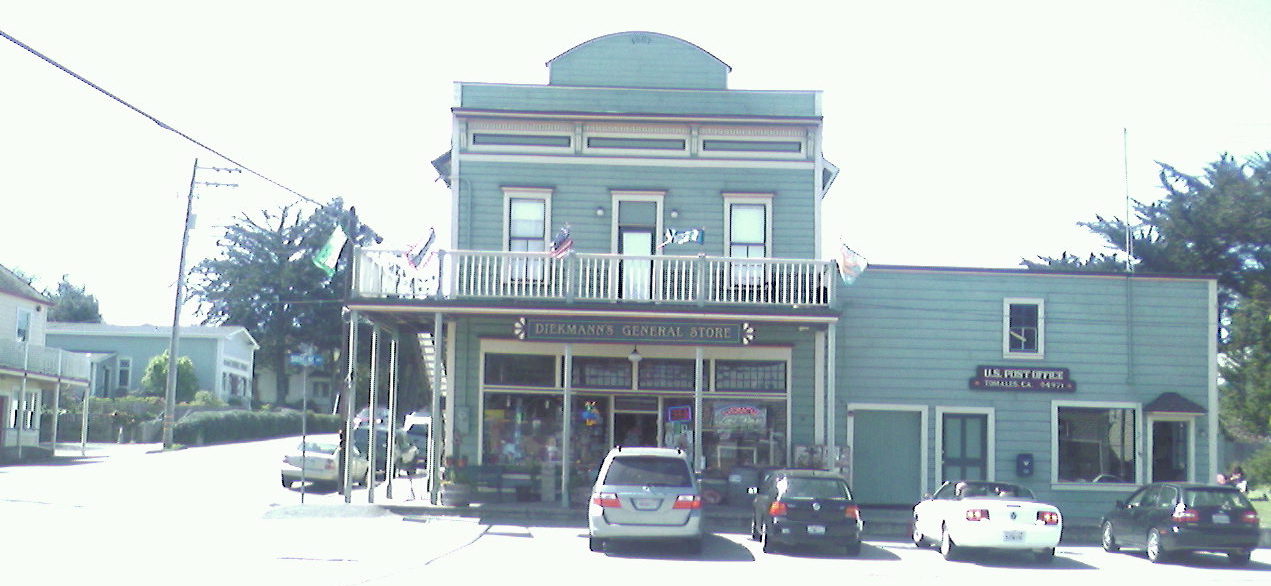
Tomales is a census-designated place (CDP) on State Route 1 in Marin County, California, United States. The population was 187 at the 2020 census. Geography Tomales is located above Keys Creek, about northeast of Tomales Bay. The nearest city is Petaluma, to the east by road, and the nearest large city is San Francisco, about 75 minutes () to the south. The CDP has a total area of , all of it land. History When Europeans first reached Tomales Bay, it was home to Coast Miwok people. Numerous authenticated Miwok villages are known from this area, including one (named ''Utumia'') sited near the present-day town of Tomales. The "Tomalles" post office opened in 1854, and changed its spelling to "Tomales" before 1879. Starting in the 1870s, Tomales was a stop on the North Pacific Coast Railroad connecting Cazadero to the Sausalito ferry. Built near the San Andreas Fault, Tomales was affected by the 1906 San Francisco earthquake. One of the town's two cemeteries predates the eart ... [...More Info...] [...Related Items...] OR: [Wikipedia] [Google] [Baidu] |
Unincorporated Community
An unincorporated area is a parcel of land that is not governed by a local general-purpose municipal corporation. (At p. 178.) They may be governed or serviced by an encompassing unit (such as a county) or another branch of the state (such as the military). There are many unincorporated communities and areas in the United States and Canada, but many countries do not use the concept of an unincorporated area. By country Argentina In Argentina, the provinces of Chubut Province, Chubut, Córdoba Province (Argentina), Córdoba, Entre Ríos Province, Entre Ríos, Formosa Province, Formosa, Neuquén Province, Neuquén, Río Negro Province, Río Negro, San Luis Province, San Luis, Santa Cruz Province, Argentina, Santa Cruz, Santiago del Estero Province, Santiago del Estero, Tierra del Fuego Province, Argentina, Tierra del Fuego, and Tucumán Province, Tucumán have areas that are outside any municipality or commune. Australia Unlike many other countries, Australia has only local go ... [...More Info...] [...Related Items...] OR: [Wikipedia] [Google] [Baidu] |
Census-designated Place
A census-designated place (CDP) is a Place (United States Census Bureau), concentration of population defined by the United States Census Bureau for statistical purposes only. CDPs have been used in each decennial census since 1980 as the counterparts of incorporated places, such as self-governing city (United States), cities, town (United States), towns, and village (United States), villages, for the purposes of gathering and correlating statistical data. CDPs are populated areas that generally include one officially designated but currently unincorporated area, unincorporated community, for which the CDP is named, plus surrounding inhabited countryside of varying dimensions and, occasionally, other, smaller unincorporated communities as well. CDPs include small rural communities, Edge city, edge cities, colonia (United States), colonias located along the Mexico–United States border, and unincorporated resort and retirement community, retirement communities and their environs. ... [...More Info...] [...Related Items...] OR: [Wikipedia] [Google] [Baidu] |
Census Designated Place
A census-designated place (CDP) is a Place (United States Census Bureau), concentration of population defined by the United States Census Bureau for statistical purposes only. CDPs have been used in each decennial census since 1980 as the counterparts of incorporated places, such as self-governing city (United States), cities, town (United States), towns, and village (United States), villages, for the purposes of gathering and correlating statistical data. CDPs are populated areas that generally include one officially designated but currently unincorporated area, unincorporated community, for which the CDP is named, plus surrounding inhabited countryside of varying dimensions and, occasionally, other, smaller unincorporated communities as well. CDPs include small rural communities, Edge city, edge cities, colonia (United States), colonias located along the Mexico–United States border, and unincorporated resort and retirement community, retirement communities and their environs. ... [...More Info...] [...Related Items...] OR: [Wikipedia] [Google] [Baidu] |
United States Census Bureau
The United States Census Bureau, officially the Bureau of the Census, is a principal agency of the Federal statistical system, U.S. federal statistical system, responsible for producing data about the American people and American economy, economy. The U.S. Census Bureau is part of the United States Department of Commerce, U.S. Department of Commerce and its Director of the United States Census Bureau, director is appointed by the president of the United States. Currently, Ron S. Jarmin is the acting director of the U.S. Census Bureau. The Census Bureau's primary mission is conducting the United States census, U.S. census every ten years, which allocates the seats of the United States House of Representatives, U.S. House of Representatives to the U.S. state, states based on their population. The bureau's various censuses and surveys help allocate over $675 billion in federal funds every year and it assists states, local communities, and businesses in making informed decisions. T ... [...More Info...] [...Related Items...] OR: [Wikipedia] [Google] [Baidu] |
1906 San Francisco Earthquake
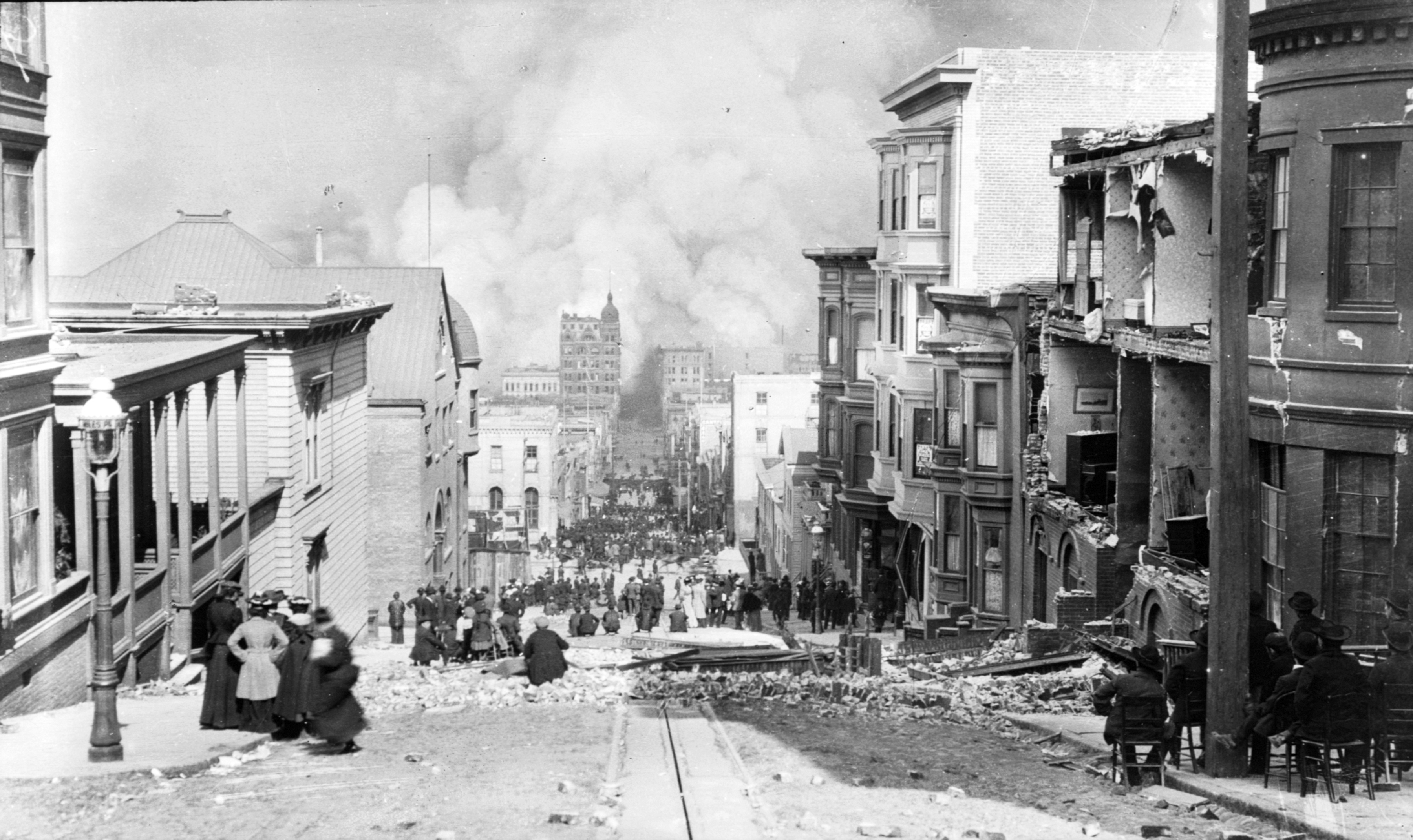
At 05:12 AM Pacific Time Zone, Pacific Standard Time on Wednesday, April 18, 1906, the coast of Northern California was struck by a major earthquake with an estimated Moment magnitude scale, moment magnitude of 7.9 and a maximum Mercalli intensity scale, Mercalli intensity of XI (''Extreme''). High-intensity shaking was felt from Eureka, California, Eureka on the North Coast (California), North Coast to the Salinas Valley, an agricultural region to the south of the San Francisco Bay Area. Devastating fires soon broke out in San Francisco and lasted for several days. More than 3,000 people died and over 80% of the city was destroyed. The event is remembered as the List of disasters in the United States by death toll, deadliest earthquake in the history of the United States. The death toll remains the greatest loss of life from a natural disaster in California's history and high on the list of worst American disasters. Tectonic setting The San Andreas Fault is a continental tran ... [...More Info...] [...Related Items...] OR: [Wikipedia] [Google] [Baidu] |
San Andreas Fault
The San Andreas Fault is a continental Fault (geology)#Strike-slip faults, right-lateral strike-slip transform fault that extends roughly through the U.S. state of California. It forms part of the tectonics, tectonic boundary between the Pacific plate and the North American plate. Traditionally, for scientific purposes, the fault has been classified into three main segments (northern, central, and southern), each with different characteristics and a different degree of earthquake risk. The average slip rate along the entire fault ranges from per year. In the north, the fault terminates offshore near Eureka, California, at the Mendocino triple junction, where three tectonic plates meet. The Cascadia subduction zone intersects the San Andreas fault at the Mendocino triple junction. It has been hypothesized that a major earthquake along the Cascadia subduction zone could trigger a rupture along the San Andreas Fault. In the south, the fault terminates near Bombay Beach, Califor ... [...More Info...] [...Related Items...] OR: [Wikipedia] [Google] [Baidu] |
Sausalito, California
Sausalito ( Spanish for "small willow grove") is a city in Marin County, California, United States, located southeast of Marin City, south-southeast of San Rafael, and about north of San Francisco from the Golden Gate Bridge. Sausalito's population was 7,269 as of the 2020 census. The community is situated near the northern end of the Golden Gate Bridge, and prior to the building of that bridge served as a terminus for rail, car, and ferry traffic. Sausalito developed rapidly as a shipbuilding center in World War II, with its industrial character giving way in postwar years to a reputation as a wealthy and artistic enclave, a picturesque residential community (incorporating large numbers of houseboats), and a tourist destination. The city is adjacent to, and largely bounded by, the protected spaces of the Golden Gate National Recreation Area as well as the San Francisco Bay. Etymology The name of Sausalito comes from the Spanish ''sauzalito'', meaning "small willow gr ... [...More Info...] [...Related Items...] OR: [Wikipedia] [Google] [Baidu] |
Cazadero, California
Cazadero (Spanish for "hunting ground") is an unincorporated community and census-designated place (CDP) in western Sonoma County, California, United States with a population of 298 in 2020. The downtown of Cazadero consists of two churches, a general store, a post office, a hardware store, an auto repair garage, private office space, and the Cazadero Volunteer Fire Department. Cazadero is the general area from the confluence of Austin Creek and the Russian River at the intersection of California State Route 116 and Cazadero Highway running north to the small town of the same name. The town is approximately from Route 116. Cazadero Highway parallels Austin Creek, which is a principal tributary of the lower Russian River. Located in the Sonoma Coast AVA, Cazadero can also be considered part of Wine Country. History Cazadero was the northern terminus of the North Pacific Coast Railroad, originally laid as narrow-gauge track in the 1870s. This railhead was fed by sev ... [...More Info...] [...Related Items...] OR: [Wikipedia] [Google] [Baidu] |
North Pacific Coast Railroad
The North Pacific Coast Railroad (NPC) was a common carrier narrow-gauge steam railroad begun in 1874 and sold in 1902 to new owners who renamed it the North Shore Railroad (California) (NSR) and rebuilt the southern section into a standard-gauge electric railway. The NPC operated in the northern California counties of Marin and Sonoma that carried redwood lumber, local dairy and agricultural products, express and passengers. The NPC operated almost of track that extended from a pier at Sausalito (which connected the line via ferry to San Francisco) and operated northwest to Duncans Mills and Cazadero (also known as Ingrams). The NPC became the North Shore Railroad (California) (NSR) on March 7, 1902. In 1907 the North Shore Railroad became part of the Northwestern Pacific Railroad (NWP). Southern portions of the line were standard gauged and electrified by the North Shore for suburban passenger service, though tracks north of Point Reyes Station remained narrow gaug ... [...More Info...] [...Related Items...] OR: [Wikipedia] [Google] [Baidu] |
Coast Miwok
The Coast Miwok are an Indigenous people of California that were the second-largest tribe of the Miwok people. Coast Miwok inhabited the general area of present-day Marin County and southern Sonoma County in Northern California, from the Golden Gate north to Duncans Point and eastward to Sonoma Creek. Coast Miwok included the Bodega Bay Miwok, or Olamentko (Olamentke), from authenticated Miwok villages around Bodega Bay, the Marin Miwok, or Hookooeko (Huukuiko), and Southern Sonoma Miwok, or Lekahtewutko (Lekatuit). While they did not have an overarching name for themselves, the Coast Miwok word for people, ''Micha-ko'', was suggested by A. L. Kroeber as a possible endonym, keeping with a common practice among tribal groups and the ethnographers studying them in the early 20th century and with the term ''Miwok'' itself, which is the Central Sierra Miwok word for 'people'. Culture The Coast Miwok spoke their own Coast Miwok language in the Utian linguistic group. They l ... [...More Info...] [...Related Items...] OR: [Wikipedia] [Google] [Baidu] |
San Francisco
San Francisco, officially the City and County of San Francisco, is a commercial, Financial District, San Francisco, financial, and Culture of San Francisco, cultural center of Northern California. With a population of 827,526 residents as of 2024, San Francisco is the List of California cities by population, fourth-most populous city in the U.S. state of California and the List of United States cities by population, 17th-most populous in the United States. San Francisco has a land area of at the upper end of the San Francisco Peninsula and is the County statistics of the United States, fifth-most densely populated U.S. county. Among U.S. cities proper with over 250,000 residents, San Francisco is ranked first by per capita income and sixth by aggregate income as of 2023. San Francisco anchors the Metropolitan statistical area#United States, 13th-most populous metropolitan statistical area in the U.S., with almost 4.6 million residents in 2023. The larger San Francisco Bay Area ... [...More Info...] [...Related Items...] OR: [Wikipedia] [Google] [Baidu] |


