|
Tofield
Tofield is a town in central Alberta, Canada. It is approximately east of Edmonton at the junction of Highway 14, Highway 834, and Highway 626. Beaverhill Lake is located immediately northeast of the community. History Before 1865, only Aboriginal people lived in this area, the home of the Cree. Beaverhill Lake (known then as Beaver or Beaver Hills Lake) was full of fish and wildfowl. A variety of wild fruits could be eaten fresh or added to pemmican. Big game animals, including herds of bison, were available for food and clothing. Tofield's Aboriginal legacy is evident in the names of local creeks: Maskawan, Amisk and Ketchamoot. The latter refers to Chief Ketchamoot who came from Ft. Pitt in 1860 to help the local Crees against their traditional Blackfoot enemies. Victorious, he remained in the area, and is buried on the bank of the Ketchamoot Creek. Tofield's first school was organized in 1890 and named McKenzie School in honor of the first postmaster in the area, at th ... [...More Info...] [...Related Items...] OR: [Wikipedia] [Google] [Baidu] |
Alberta Highway 14
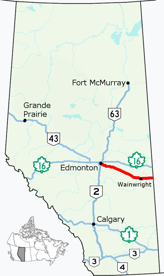
Alberta Provincial Highway No. 14, commonly referred to as Highway 14, is an east-west highway in central Alberta, Canada. It stretches from Edmonton through Wainwright to the Alberta–Saskatchewan border, running parallel to the more northern Highway 16. Highway 14 is about long. Along with Saskatchewan Highway 40 (with which it connects at the boundary), it forms part of the Poundmaker Trail, named after Chief Poundmaker of the Cree. Route description Highway 14 begins in south Edmonton as a freeway named Whitemud Drive at the Calgary Trail / Gateway Boulevard interchange, linking to Highway 2. It travels east for along Whitemud Drive through neighbourhoods of southeast Edmonton until reaching the Anthony Henday Drive ring road, with which it is concurrent for . Leaving the city, the highway veers east and intersects Highway 21 before the divided highway ends west of South Cooking Lake. It continues east toward Tofiel ... [...More Info...] [...Related Items...] OR: [Wikipedia] [Google] [Baidu] |
Alberta Highway 834
The Canadian province of Alberta has provincial highway network of nearly as of 2009, of which were paved. All of Alberta's provincial highways are maintained by Alberta Transportation (AT), a department of the Government of Alberta. The network includes two distinct series of numbered highways: * The 1–216 series (formerly known as primary highways), making up Alberta's core highway network—typically paved and with the highest traffic volume * The 500–986 series, providing more local access, with a higher proportion of gravel surfaces History In 1926, Alberta discontinued its system of marking highways with different colours in favour of a numbering system. By 1928, the year a gravel road stretched from Edmonton to the United States border, Alberta's provincial highway network comprised . Prior to 1973, the expanding highway system comprised one-digit and two-digit highways, with some numbers having letter suffixes (e.g., Highway 1X, Highway 26A). In 19 ... [...More Info...] [...Related Items...] OR: [Wikipedia] [Google] [Baidu] |
Beaver County, Alberta Beaver County is a municipal district in central-east Alberta, Canada. It is centred on Holden in the western part of Census Division No. 10. Its municipal office is located in Ryley. Beaver County was incorporated as a municipal district on July 31, 1999, and the name was changed from "County of Beaver No. 9" to "Beaver County". - Alberta Municipal Affairs Geography Communities and localities |
Central Alberta
Central Alberta is a region located in the Canadian province of Alberta. Central Alberta is the most densely populated rural area in the province. Agriculture and energy are important to the area's economy. Geography Central Alberta is bordered by the Canadian Rockies in the west, Southern Alberta and the Calgary Region to the south, Saskatchewan to the east and Northern Alberta to the north. It completely surrounds the Edmonton Capital Region and contains the central part of the heavily populated Calgary-Edmonton Corridor. The North Saskatchewan River crosses the region from west to east. Other rivers traversing the area are Red Deer River, Battle River, Athabasca River, Pembina River, Brazeau River, Beaver River. Tourist attractions in the region include: Alberta Prairie Railway Excursions, the Canadian Petroleum Discovery Centre in Leduc, Discovery Wildlife Park, Kerry Wood Nature Centre and Gaetz Lake Sanctuary in Red Deer, Nordegg Heritage Centre and Mine Sit ... [...More Info...] [...Related Items...] OR: [Wikipedia] [Google] [Baidu] |
List Of T Postal Codes Of Canada
__NOTOC__ This is a list of postal codes in Canada where the first letter is T. Postal codes beginning with T are located within the Canadian province of Alberta. Only the first three characters are listed, corresponding to the forward sortation area (FSA). Canada Post provides a free postal code look-up tool on its website, via its applications for smartphones, and sells hard-copy directories and CD-ROMs. Many vendors also sell validation tools, which allow customers to properly match addresses and postal codes. Hard-copy directories can also be consulted in all post offices, and some libraries. Alberta - 156 FSAs Urban Alberta Alberta ( ) is one of the thirteen provinces and territories of Canada. It is part of Western Canada and is one of the three prairie provinces. Alberta is bordered by British Columbia to the west, Saskatchewan to the east, the Northwest Ter ... - 157 FSAs Rural References External links *Canada PostAlberta postal code map {{Canadian po ... [...More Info...] [...Related Items...] OR: [Wikipedia] [Google] [Baidu] |
Beaverhill Lake, Alberta
Beaverhill Lake ( cr, script=Latn, amisk-wa-chi-sakhahigan) is a large lake in central Alberta, Canada. It is a site of regional importance in the Western Hemisphere Shorebird Reserve Network. It is managed by the Canadian Wildlife Service division of Environment Canada. It is located 70 km southeast of Edmonton, near the town of Tofield, and lies in the hydrographic basin of the North Saskatchewan River. As recently as 1990, the lake had a total area of and a maximum depth of only Like similar " prairie pothole" lakes, Beaverhill lake receded significantly after much of its headwaters were diverted, in recent years it has lost about one-quarter of its depth between 1999 and 2009. The lake is an important bird habitat and has been designated as a "National Nature Viewpoint" by Nature Canada (formerly known as the Canadian Nature Federation) in 1981. The Beaverhill Natural Area was established in 1987 to protect the lake and its surrounding area. Beaverhill Lake Heritage ... [...More Info...] [...Related Items...] OR: [Wikipedia] [Google] [Baidu] |
Beaverhill Lake
Beaverhill Lake ( cr, script=Latn, amisk-wa-chi-sakhahigan) is a large lake in central Alberta, Canada. It is a site of regional importance in the Western Hemisphere Shorebird Reserve Network. It is managed by the Canadian Wildlife Service division of Environment Canada. It is located 70 km southeast of Edmonton, near the town of Tofield, and lies in the hydrographic basin of the North Saskatchewan River. As recently as 1990, the lake had a total area of and a maximum depth of only Like similar "prairie pothole" lakes, Beaverhill lake receded significantly after much of its headwaters were diverted, in recent years it has lost about one-quarter of its depth between 1999 and 2009. The lake is an important bird habitat and has been designated as a "National Nature Viewpoint" by Nature Canada (formerly known as the Canadian Nature Federation) in 1981. The Beaverhill Natural Area was established in 1987 to protect the lake and its surrounding area. Beaverhill Lake Heritage R ... [...More Info...] [...Related Items...] OR: [Wikipedia] [Google] [Baidu] |
List Of Towns In Alberta
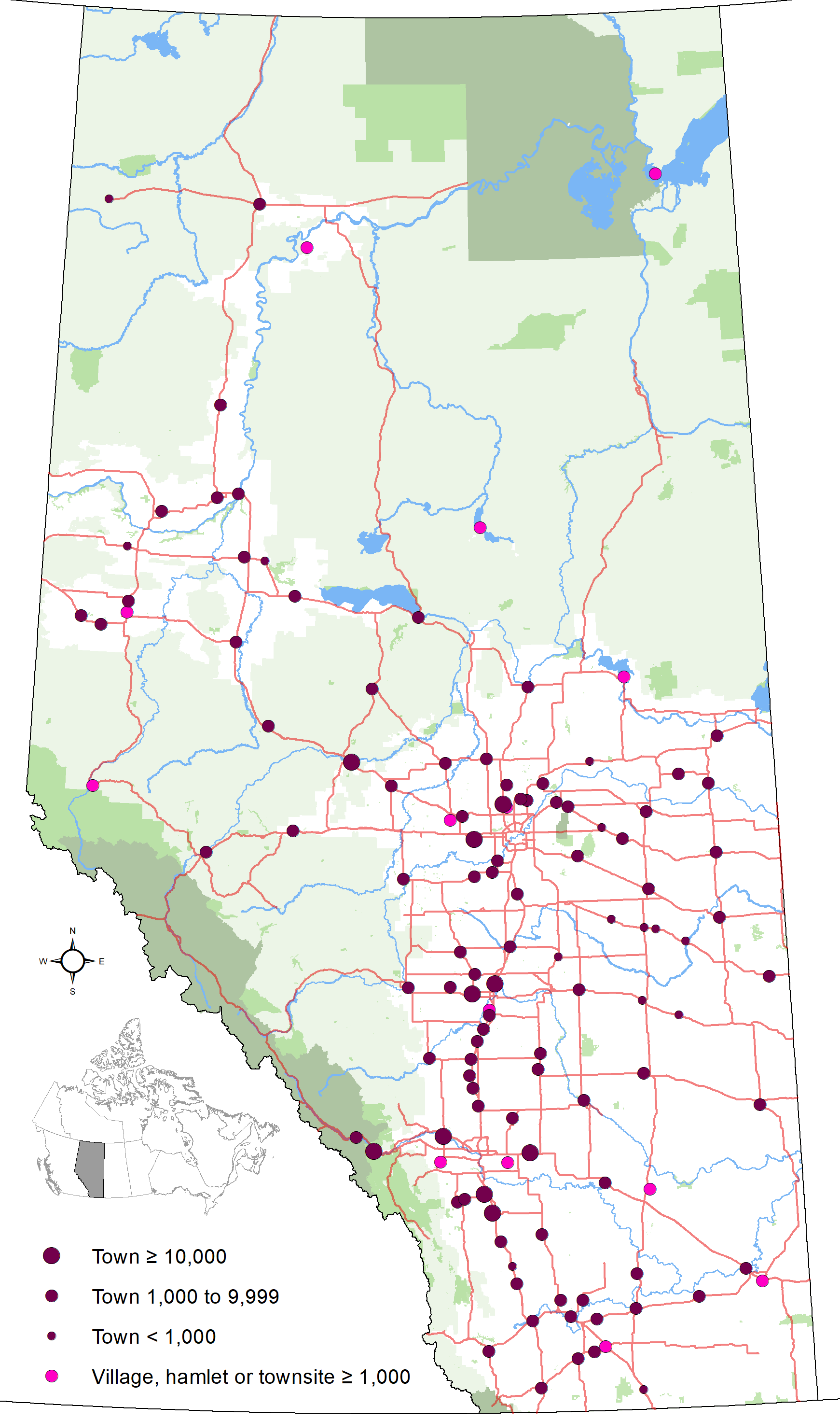
A town is an urban municipality status type used in the Canadian province of Alberta. Alberta towns are created when communities with populations of at least 1,000 people, where a majority of their buildings are on parcels of land smaller than 1,850 m2, apply to Alberta Municipal Affairs for town status under the authority of the ''Municipal Government Act''. Applications for town status are approved via orders in council made by the Lieutenant Governor in Council under recommendation from the Minister of Municipal Affairs. Alberta has 106 towns that had a cumulative population of 455,053 and an average population of 4,293 in the 2016 Canadian Census. The number of towns decreased from 107 to 106 on February 1, 2020, when Granum dissolved from town status to become a hamlet. Alberta's largest and smallest towns are Okotoks and Stavely with populations of 28,881 and 541 respectively. Nobleford is Alberta's newest town, incorporating from village status on February ... [...More Info...] [...Related Items...] OR: [Wikipedia] [Google] [Baidu] |
Edmonton
Edmonton ( ) is the capital city of the Canadian province of Alberta. Edmonton is situated on the North Saskatchewan River and is the centre of the Edmonton Metropolitan Region, which is surrounded by Alberta's central region. The city anchors the north end of what Statistics Canada defines as the " Calgary–Edmonton Corridor". As of 2021, Edmonton had a city population of 1,010,899 and a metropolitan population of 1,418,118, making it the fifth-largest city and sixth-largest metropolitan area (CMA) in Canada. Edmonton is North America's northernmost large city and metropolitan area comprising over one million people each. A resident of Edmonton is known as an ''Edmontonian''. Edmonton's historic growth has been facilitated through the absorption of five adjacent urban municipalities ( Strathcona, North Edmonton, West Edmonton, Beverly and Jasper Place) hus Edmonton is said to be a combination of two cities, two towns and two villages./ref> in addition to a seri ... [...More Info...] [...Related Items...] OR: [Wikipedia] [Google] [Baidu] |
Alberta
Alberta ( ) is one of the thirteen provinces and territories of Canada. It is part of Western Canada and is one of the three prairie provinces. Alberta is bordered by British Columbia to the west, Saskatchewan to the east, the Northwest Territories (NWT) to the north, and the U.S. state of Montana to the south. It is one of the only two landlocked provinces in Canada (Saskatchewan being the other). The eastern part of the province is occupied by the Great Plains, while the western part borders the Rocky Mountains. The province has a predominantly continental climate but experiences quick temperature changes due to air aridity. Seasonal temperature swings are less pronounced in western Alberta due to occasional Chinook winds. Alberta is the fourth largest province by area at , and the fourth most populous, being home to 4,262,635 people. Alberta's capital is Edmonton, while Calgary is its largest city. The two are Alberta's largest census metropolitan areas. More than ... [...More Info...] [...Related Items...] OR: [Wikipedia] [Google] [Baidu] |


