|
Tla-o-qui-aht
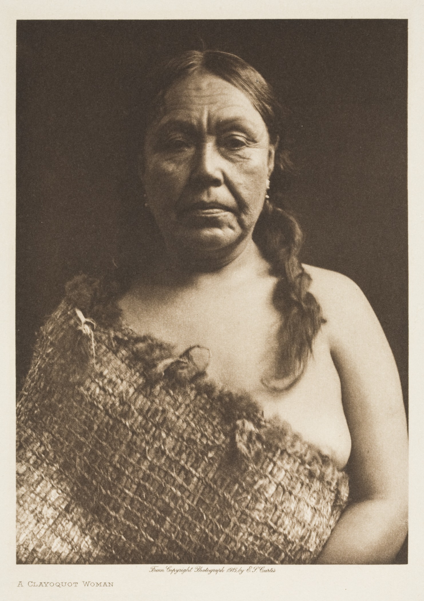
The Tla-o-qui-aht First Nations () are a Nuu-chah-nulth First Nation (band government) in Canada. They live on ten reserves along the Pacific Rim National Park Reserve on Vancouver Island, British Columbia. The band is part of the Nuu-chah-nulth Tribal Council. There were 618 people living in the Tla-o-qui-aht reserves in 1995. Their primary economic activities are fishing and tourism. Introduction Tla-o-qui-aht, whose ancestral border is determined by the height of land, the direction of the rivers flow and as far as the eye can see on the ocean, is a confederacy of aboriginal groups who historically were independent from one another. Tla-o-qui-aht First Nations is the Indian band mandated under the federal ''Indian Act'' to deliver civil and human services to Tla-o-qui-aht. The hereditary governance systems and structures of Tla-o-qui-aht that exist today, and that have existed since time immemorial have a dynamic relationship with the Indian band administration and w ... [...More Info...] [...Related Items...] OR: [Wikipedia] [Google] [Baidu] |
Clayoquot Sound
Clayoquot Sound is located on the west coast of Vancouver Island in the Provinces and territories of Canada, Canadian province of British Columbia. It is bordered by the Esowista Peninsula to the south, and the Hesquiaht Peninsula to the North. It is a body of water with many inlets and islands. Major inlets include Sydney Inlet, Shelter Inlet, Herbert Inlet, Bedwell Inlet, Lemmens Inlet, and Tofino Inlet. Major islands include Flores Island (British Columbia), Flores Island, Vargas Island, and Meares Island. The name is also used for the larger region of land around the waterbody (essentially its watershed). Origin of the name The name Clayoquot (other), Clayoquot is derived from the name of a subgroup of the Nuu-chah-nulth, who lived at Clayoqua 6, Clayoqua. In the late 20th century, this group merged into the multi-group band government known as the , meaning "different" or "changing" in their language. History First Nations have inhabited the area for thousands of ... [...More Info...] [...Related Items...] OR: [Wikipedia] [Google] [Baidu] |
Clayoquot Biosphere Trust
Clayoquot is an anglicization of the Nuu-chah-nulth language name "Tla-o-qui-aht", one of the indigenous tribes of the region so named. It may refer to: *Clayoquot, British Columbia, historically also known as Port Cox, a community on Stubbs Island, just northwest of Tofino, British Columbia *Clayoquot Sound and the associated region, including: **the Clayoquot River *** Clayoqua 6, an Indian Reserve at the mouth of that river ** Clayoquot Arm Provincial Park ** Clayoquot Plateau Provincial Park *the Tla-o-qui-aht First Nations, a band government of the Nuu-chah-nulth peoples, incorporating a number of historical tribes including: **the Tla-o-qui-aht The Tla-o-qui-aht First Nations () are a Nuu-chah-nulth First Nation (band government) in Canada. They live on ten reserves along the Pacific Rim National Park Reserve on Vancouver Island, British Columbia. The band is part of the Nuu-chah-n ... people (the two other groups comprising the Tla-o-qui-aht First Nations are the He ... [...More Info...] [...Related Items...] OR: [Wikipedia] [Google] [Baidu] |
Nuu-chah-nulth
The Nuu-chah-nulth ( ; ), also formerly referred to as the Nootka, Nutka, Aht, Nuuchahnulth or Tahkaht, are one of the Indigenous peoples of the Pacific Northwest Coast in Canada. The term Nuu-chah-nulth is used to describe fifteen related tribes whose traditional home is on the west coast of Vancouver Island. In precontact and early post-contact times, the number of tribes was much greater, but History of smallpox#Epidemics in the Americas, the smallpox epidemics and other consequences of contact with Europeans resulted in the disappearance of some groups and the absorption of others into neighbouring groups. The Nuu-chah-nulth are related to the Kwakwaka'wakw, the Haisla people, Haisla, and the Ditidaht First Nation. The Nuu-chah-nulth language belongs to the Wakashan languages, Wakashan family. The governing body is the Nuu-chah-nulth Tribal Council. History Contact with Europeans When James Cook first encountered the villagers at Yuquot, British Columbia, Yuquot in 1778 ... [...More Info...] [...Related Items...] OR: [Wikipedia] [Google] [Baidu] |
Pacific Rim National Park Reserve
Pacific Rim National Park Reserve is a national park located in British Columbia, Canada, which comprises three separate regions: Long Beach, the Broken Group Islands, and the West Coast Trail. It is located in the Pacific Coast Mountains, which are characterized by rugged coasts and temperate rainforests. Widespread vegetation found in the park includes western hemlock, Sitka spruce, western red-cedar, deer fern and sword fern. Animal species vary from marine and intertidal species, such as humpback whales and ochre sea star, to terrestrial mammals, such as Vancouver Coastal Sea wolves. For recreational purposes, Long Beach is used for surfing and windsurfing, the Broken Group for sea kayaking, and the West Coast Trail for hiking, as well as camping in all areas and scuba diving in the winter months in the Long Beach and Broken Group areas. The Wickaninnish Beach Provincial Park formed the nucleus upon which the national park was assembled. After years of negotiation be ... [...More Info...] [...Related Items...] OR: [Wikipedia] [Google] [Baidu] |
Meares Island
Meares Island is one of the many islands surrounding the Village of Tofino, British Columbia, Canada. Its name was given in 1862 by George Henry Richards, captain of , in honor of John Meares. The island is located in the Clayoquot Sound region and is the location of Opitsat, the main village of the Tla-o-qui-aht First Nations, and was the location of Fort Defiance, a short-lived American fur-trading post founded by Captain Robert Gray. Meares Island is reachable by boat or water taxi. Meares Island became historically significant shortly after 1984, when the Nuu-chah-nulth and environmentalist groups such as Greenpeace and Friends of Clayoquot Sound began protesting forestry giant MacMillan Bloedel's potential harvesting activities. The Nuu-chah-nulth, with significant cooperation from environmental groups, eventually erected a blockade, preventing MacMillan Bloedel MacMillan Bloedel Limited was a Canadian forestry company headquartered in Vancouver, British Columbia. ... [...More Info...] [...Related Items...] OR: [Wikipedia] [Google] [Baidu] |
Nuu-chah-nulth Tribal Council
The Nuu-chah-nulth Tribal Council is a First Nations Tribal Council in the Canadian province of British Columbia, located on the west coast of Vancouver Island. The organization is based in Port Alberni, British Columbia. History The different Nuu-chah-nulth tribes share many aspects of their language and cultural traditions. Nuu-chah-nulth peoples founded an organization called the West Coast Allied Tribes in 1958. In 1973, they incorporated a non-profit society called the West Coast District Society of Indian Chiefs, also known as the West Coast District Council. That organization changed its named to the Nuu-chah-nulth Tribal Council in 1979. Member First Nations Southern region *Ditidaht First Nation (Niitiinaʔatḥ) * Huu-ay-aht First Nation (Huuʕiiʔatḥ) * Hupacasath First Nation (Huupač̓asʔatḥ) * Tseshaht First Nation (C̓išaaʔatḥ) * Uchucklesaht First Nation (Ḥuučuqƛisʔatḥ) Central region *Ahousaht First Nation (ʕaaḥuusʔatḥ) * Hesquiaht ... [...More Info...] [...Related Items...] OR: [Wikipedia] [Google] [Baidu] |
First Nations In Canada
''First Nations'' () is a term used to identify Indigenous peoples in Canada who are neither Inuit nor Métis. Traditionally, First Nations in Canada were peoples who lived south of the tree line, and mainly south of the Arctic Circle. There are 634 recognized List of First Nations band governments, First Nations governments or bands across Canada. Roughly half are located in the provinces of Ontario and British Columbia. Under Canadian Charter of Rights and Freedoms, Charter jurisprudence, First Nations are a "designated group", along with women, Visible minority, visible minorities, and people with physical or mental disabilities. First Nations are not defined as a visible minority by the criteria of Statistics Canada. North American indigenous peoples have cultures spanning thousands of years. Many of their oral traditions accurately describe historical events, such as the 1700 Cascadia earthquake, Cascadia earthquake of 1700 and the 18th-century Tseax Cone eruption. Writ ... [...More Info...] [...Related Items...] OR: [Wikipedia] [Google] [Baidu] |
Kennedy Lake (Vancouver Island)
Kennedy Lake is the largest lake on Vancouver Island, British Columbia, Canada. Located north of Ucluelet on the island's central west coast, the lake is formed chiefly by the confluence of the Clayoquot and Kennedy Rivers. Outflow is via a short stretch of the Kennedy River into Tofino Inlet. The lake includes an extensive northern arm called Clayoquot Arm. The lake and surrounding region's natural beauty has led to portions of it being protected from the logging industry. Parks adjacent to the lake include Clayoquot Plateau Provincial Park, Pacific Rim National Park, Clayoquot Arm Provincial Park, Kennedy Lake Provincial Park, Kennedy River Bog Provincial Park and the Clayoquot Arm Beach recreation site. The lake is a popular recreation destination for camping, boating and fishing. It is an important spawning habitat for sockeye and various species of salmon and trout, and lies within the Coastal Western Hemlock Biogeoclimatic Zone. The lake is part of the ances ... [...More Info...] [...Related Items...] OR: [Wikipedia] [Google] [Baidu] |
Tofino
Tofino ( , Nuu-chah-nulth language, Nuu-chah-nulth: ''Načiks'') is a town of approximately 2,516 residents on the west coast of Vancouver Island in the Provinces and territories of Canada, Canadian province of British Columbia. The District of Tofino is located at the western terminus of British Columbia Highway 4, Highway 4 on the tip of the Esowista Peninsula at the southern edge of Clayoquot Sound. It is situated in the traditional territory of the Tla-o-qui-aht First Nations. A popular year-round tourism destination, Tofino's summer population swells to many times its winter size. It attracts Surfing, surfers, hikers, nature lovers, bird watchers, campers, whale watching, whale watchers and fishermen. Despite its small population, the town attracts a number of chefs and culinary professionals, which has resulted in a burgeoning choice of restaurants and specialty shops. In the winter, it is not as bustling, although many people visit Tofino and the West Coast to Storm cha ... [...More Info...] [...Related Items...] OR: [Wikipedia] [Google] [Baidu] |
Central Region Management Board
Central is an adjective usually referring to being in the center of some place or (mathematical) object. Central may also refer to: Directions and generalised locations * Central Africa, a region in the centre of Africa continent, also known as Middle Africa * Central America, a region in the centre of America continent * Central Asia, a region in the centre of Eurasian continent * Central Australia, a region of the Australian continent * Central Belt, an area in the centre of Scotland * Central Europe, a region of the European continent * Central London, the centre of London * Central Region (other) * Central United States, a region of the United States of America Specific locations Countries * Central African Republic, a country in Africa States and provinces * Blue Nile (state) or Central, a state in Sudan * Central Department, Paraguay * Central Province (Kenya) * Central Province (Papua New Guinea) * Central Province (Solomon Islands) * Central Province, Sri Lan ... [...More Info...] [...Related Items...] OR: [Wikipedia] [Google] [Baidu] |
Long Beach (British Columbia)
Long Beach is the largest and longest beach in the Pacific Rim National Park Reserve on the west coast of Vancouver Island, British Columbia, Canada. It is on Wickaninnish Bay between Tofino (NW) and Ucluelet (SE) and is adjoined by campgrounds and picnic areas. The Tofino-Ucluelet highway parallels the entirety of the beach. The beach's consistent surf, exposed to the open Pacific Ocean, established it as one of the earliest and most popular surfing locations in British Columbia. Long Beach features rocky 'islands' in the mid-tidal zone of the beach that are accessible only at low tide; when the tide is high, these islands are either surrounded by water or thrashed by ocean swells. In addition, dangerous rip current A rip current (or just rip) is a specific type of water current that can occur near beaches where waves break. A rip is a strong, localized, and narrow current of water that moves directly away from the shore by cutting through the lines of bre ...s exist aro ... [...More Info...] [...Related Items...] OR: [Wikipedia] [Google] [Baidu] |


