|
Timeline Of Ulster Defence Association Actions
This is a timeline of actions by the Ulster Defence Association (UDA), a Ulster loyalism, loyalist paramilitary group formed in 1971. Most of these actions took place during the conflict known as "the Troubles" in Northern Ireland. The UDA's declared goal was to defend Unionism in Ireland, Loyalist areas from attack and to combat Irish republicanism, Irish republican paramilitaries. However, most of its victims were Irish Catholics, Irish Catholic civilians, who were often chosen at random. It used the name Ulster Freedom Fighters (UFF) when it wished to claim responsibility for its attacks and avoid political embarrassment, as the UDA was a legal organisation for much of its history. The UFF usually claimed that those targeted were Provisional Irish Republican Army members or IRA sympathizers. Other times, attacks on Catholic civilians were claimed as "retaliation" for IRA actions, since the IRA drew most of its support from Catholics. Such retaliation was seen as both collective ... [...More Info...] [...Related Items...] OR: [Wikipedia] [Google] [Baidu] |
Ulster Defence Association
The Ulster Defence Association (UDA) is an Ulster loyalist paramilitary group in Northern Ireland. It was formed in September 1971 as an umbrella group for various loyalist groups and undertook an armed campaign of almost 24 years as one of the participants of the Troubles. Its declared goal was to defend Ulster Protestant loyalist areas and to combat Irish republicanism, particularly the Provisional Irish Republican Army (IRA). In the 1970s, uniformed UDA members openly patrolled these areas armed with batons and held large marches and rallies. Within the UDA was a group tasked with launching paramilitary attacks that used the cover name Ulster Freedom Fighters (UFF) so that the UDA would not be outlawed. The British government proscribed the UFF as a terrorist group in November 1973, but the UDA itself was not proscribed until August 1992. The UDA/UFF were responsible for more than 400 deaths. The vast majority of its victims were Irish Catholic civilians, – choose "o ... [...More Info...] [...Related Items...] OR: [Wikipedia] [Google] [Baidu] |
Knockagh Monument
The Knockagh Monument is a war memorial in County Antrim, Northern Ireland. It is located on top of Knockagh Hill, above the village of Greenisland with a panoramic view of the city of Belfast. Features The site is 390m (1230 feet) above sea level and is the largest war memorial in Northern Ireland. The monument is a -high basalt obelisk and is a replica of the Wellington Monument in Phoenix Park, Dublin, although is exactly half the height. The Monument's inscription was adapted from the hymn “O Valiant Hearts" by John S. Arkwright. It reads: History A committee was set up with Mr. Henry Barton, the High Sheriff of County Antrim, as secretary to raise £25,000 to erect an obelisk in local basalt, with bronze panels listing the names of all those from Co. Antrim who had died in the Great War. The foundation stone was laid on 7 October 1922, but financial difficulties delayed work for a decade. Following Mr Barton's death in 1935, Antrim Rural District Council were asked t ... [...More Info...] [...Related Items...] OR: [Wikipedia] [Google] [Baidu] |
County Armagh
County Armagh ( ) is one of the six counties of Northern Ireland and one of the traditional thirty-two counties of Ireland. It is located in the Provinces of Ireland, province of Ulster and adjoins the southern shore of Lough Neagh. It borders the Northern Irish counties of County Tyrone, Tyrone to the west and County Down, Down to the east. The county borders County Louth, Louth and County Monaghan, Monaghan to the south and southwest, which are in the Republic of Ireland. It is named after its county town, Armagh, which derives from the Irish language, Irish ''Ard Mhacha'', meaning "Macha's height". Macha was a sovereignty goddess in Irish mythology and is said to have been buried on a wooded hill around which the town of Armagh grew. County Armagh is colloquially known as the "Orchard County" because of its many apple orchards. The county covers an area of , making it the smallest of Northern Ireland's six counties by size and the List of Irish counties by area, sixth-smallest ... [...More Info...] [...Related Items...] OR: [Wikipedia] [Google] [Baidu] |
Portadown
Portadown ( ) is a town in County Armagh, Northern Ireland. The town is based on the River Bann in the north of the county, about southwest of Belfast. It is in the Armagh City, Banbridge and Craigavon Borough Council area and had a population of about 32,000 at the United Kingdom Census 2021, 2021 Census. For some purposes, Portadown is treated as part of the "Craigavon Urban Area", alongside Craigavon (planned town), Craigavon and Lurgan. Although Portadown was founded during the early 17th century English Plantation of Ulster, it was not until the Victorian era and the arrival of the railway that it developed as a major town. It earned the nickname "hub of the North" because it was a major railway junction; here the Great Northern Railway (Ireland), Great Northern Railway's line diverged for Belfast, Dublin, Armagh and Derry. In the 19th and 20th centuries, Portadown was also a major centre for the production of textiles (mainly Irish linen, linen). Portadown is the site of ... [...More Info...] [...Related Items...] OR: [Wikipedia] [Google] [Baidu] |
Lower Falls (District Electoral Area)
Lower Falls was one of the nine district electoral areas which existed in Belfast, Northern Ireland from 1985 to 2014. Located in the west of the city, the district elected five members to Belfast City Council and contained the wards of Beechmount; Clonard; Falls; Upper Springfield; and Whiterock. Lower Falls formed part of the Belfast West constituencies for the Northern Ireland Assembly and UK Parliament. The district, along with the neighbouring Upper Falls district took its name from the Falls Road, one of the main arterial routes in the west of the city. History Lower Falls was created for the 1985 local elections. The Falls and Clonard wards had previously been in Area F, with the remaining wards part of Area D. It was abolished for the 2014 local elections. The Falls and Clonard wards joined the Court District Electoral Area, while the remaining wards became part of a new Black Mountain District Electoral Area. Wards Councillors 2011 election 2005: 5 x Sinn F ... [...More Info...] [...Related Items...] OR: [Wikipedia] [Google] [Baidu] |
No-go Area
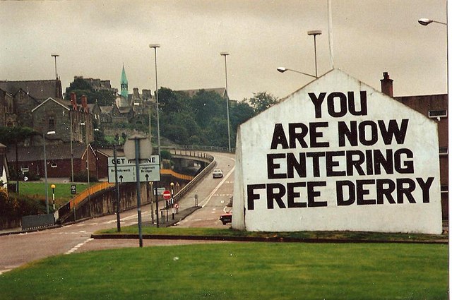
A "no-go area" or "no-go zone" is a neighborhood or other geographic area where some or all outsiders are either physically prevented from entering or can enter at risk. The term includes exclusion zones, which are areas that are officially kept off-limits by the government, such as border zones and military exclusion zones. It also includes areas held by violent non-state actors, such as guerillas/insurgents, organized crime and terrorist organizations. In some cases, these areas have been held by insurgent organizations attempting to topple the government, such as Free Derry, an area in Northern Ireland that was held by the Irish Republican Army from 1969 to 1972. In other cases, the areas simply coexist alongside the state; an example is Kowloon Walled City, an area in Hong Kong essentially ruled by triad organizations from the 1950s to the 1970s. In the 21st century, the term has most often been used to refer to areas that police or medical workers consider too dangerous t ... [...More Info...] [...Related Items...] OR: [Wikipedia] [Google] [Baidu] |
Shore Road, Belfast
The Shore Road is a major arterial route and area of housing and commerce that runs through north Belfast and Newtownabbey in Northern Ireland. It forms part of the A2 road (Northern Ireland), A2 road, a traffic route which links Belfast to the County Antrim coast. History The Shore Road is one of Belfast's oldest roads and is mentioned in the first census of the city – taken in 1757 – as being home to a colony of "Catholic Church, Papists". At the time the Shore Road name was applied to a larger area, including what is today known as York Street. The York Street-York Road and lower Shore Road experienced growth during the Industrial Revolution as a number of factories were located in the area. One of the main factories on York Street was Gallaher Group, Gallaher's Tobacco factory. It is no longer in operation and the building has been demolished. One of these few industrial buildings still standing is the Jennymount Mill, off the York Road. The building, renamed the Lanyo ... [...More Info...] [...Related Items...] OR: [Wikipedia] [Google] [Baidu] |
Battle Of Springmartin
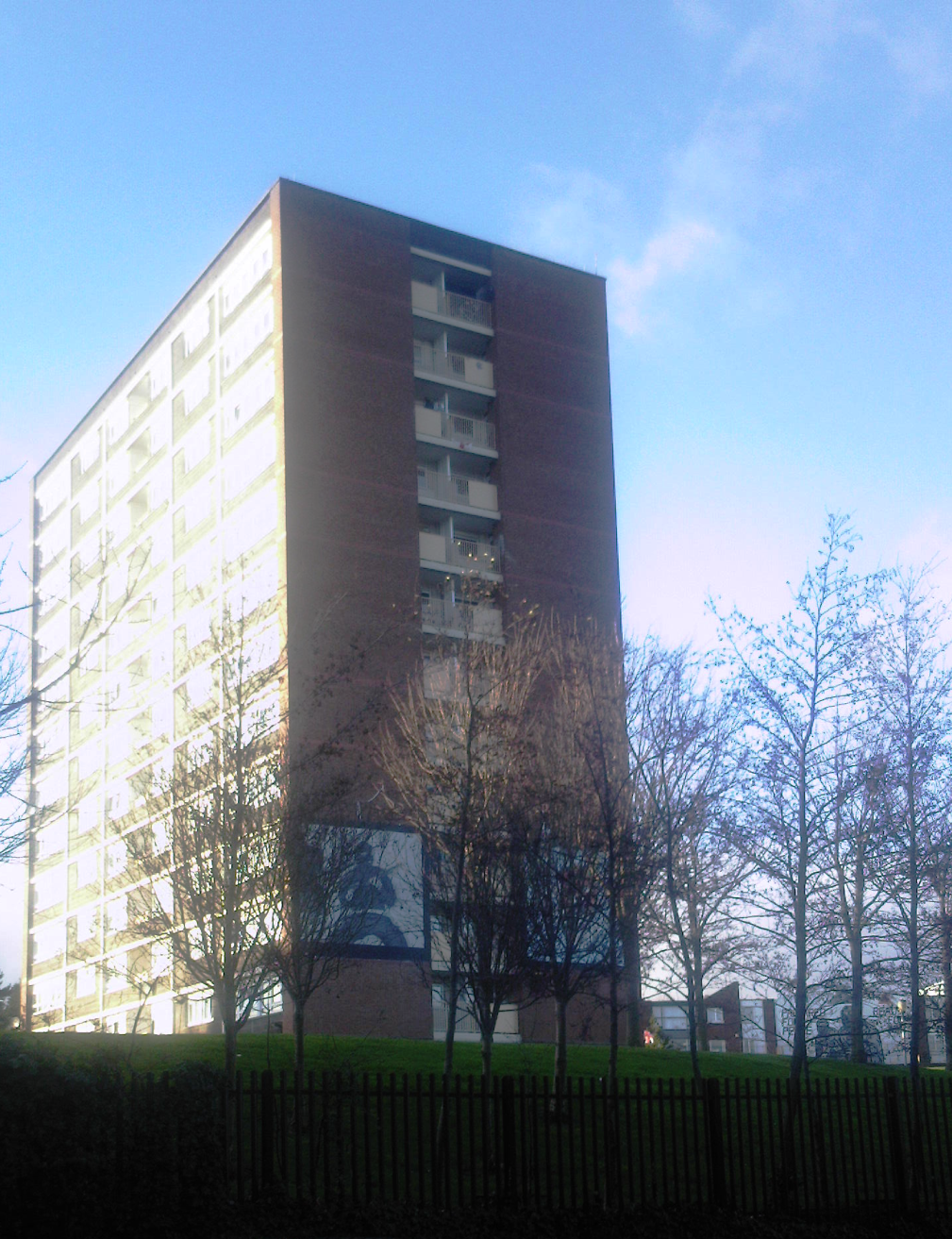
The Battle at Springmartin was a series of gun battles in Belfast, Northern Ireland on 13–14 May 1972, as part of The Troubles. It involved the British Army, the Provisional Irish Republican Army, the Official Irish Republican Army, and the Ulster Volunteer Force (UVF). The violence began when a car bomb, planted by Ulster loyalists, exploded outside a crowded pub in the mainly Irish nationalist and Catholic district of Ballymurphy. UVF snipers then opened fire on the survivors from an abandoned high-rise flat. This began the worst fighting in Northern Ireland since the suspension of the Parliament of Northern Ireland and the imposition of direct rule from London. For the rest of the night and throughout the next day, local IRA units fought gun battles with both the UVF and British Army. Most of the fighting took place along the interface between the Catholic Ballymurphy and Ulster Protestant Springmartin housing estates, and the British Army base that sat between them. ... [...More Info...] [...Related Items...] OR: [Wikipedia] [Google] [Baidu] |
Shaw's Bridge
Shaw's Bridge is the name given to two adjacent bridges across the River Lagan in Belfast, Northern Ireland. The older of the bridges is a historic stone arched bridge, which is open to cyclists and pedestrians. The new bridge is a concrete bridge which carries the A55 road (Northern Ireland), A55 road. Old bridge The crossing is located at a shallow section of the Lagan, which had historically been used as a crossing point. The bridge is named after Captain John Shaw of Oliver Cromwell's army, who built an oak bridge here in 1655, possibly replacing one from 1617. A stone bridge was built in 1691 by Thomas Burgh (1670–1730), Thomas Burgh, although this was destroyed by floods, leading to its replacement with the current bridge in 1709. The bridge is composed of five stone arches: four across the river and one across the adjacent footpath. Its deck is only wide enough for one lane of traffic. Despite this, it was an important connection for many years, carrying the main ro ... [...More Info...] [...Related Items...] OR: [Wikipedia] [Google] [Baidu] |
Oldpark (District Electoral Area)
Oldpark is one of the ten district electoral areas (DEA) in Belfast, Northern Ireland. Located in the north of the city, the district elects six members to Belfast City Council and contains the wards of Ardoyne; Ballysillan; Cliftonville; Legoniel; New Lodge, Belfast, New Lodge and Water Works. Oldpark forms part of the Belfast North constituency for the Belfast North (Assembly constituency), Northern Ireland Assembly and Belfast North (UK Parliament constituency), UK Parliament. History The DEA was created for the 1985 local elections. Legoniel, Ballysillan and Ardoyne wards had previously been part of Belfast Area E, Area E, New Lodge and the southern half of the Waterworks ward had been in Belfast Area G, Area G, while Cliftonville and the northern half of Waterworks ward had been in Belfast Area H, Area H. Wards Councillors 2023 Election 2019: 3 x Sinn Féin, 1 x SDLP, 1 x DUP, 1 x People Before Profit 2023: 4 x Sinn Féin, 1 x DUP, 1 x Independent 2019–2023 Chang ... [...More Info...] [...Related Items...] OR: [Wikipedia] [Google] [Baidu] |
Thompson Submachine Gun
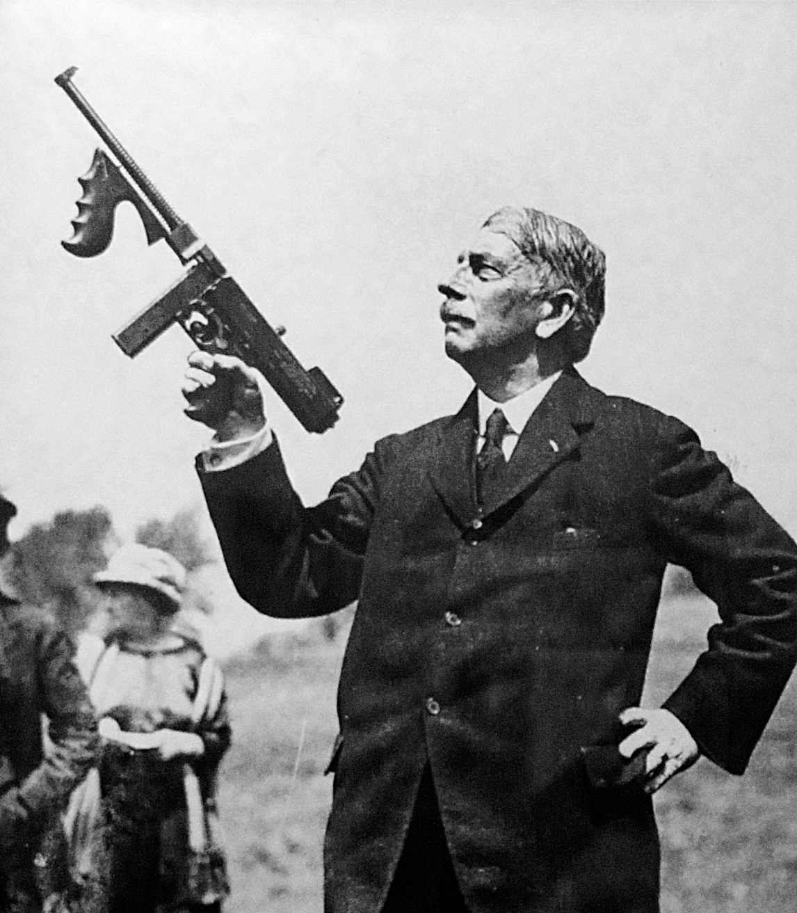
The Thompson submachine gun (also known as the "Tommy gun", "Chicago typewriter", or "trench broom") is a blowback-operated, selective-fire submachine gun, invented and developed by Brigadier General John T. Thompson, a United States Army officer, in 1918. It was designed to break the stalemate of trench warfare of World War I, although early models did not arrive in time for actual combat. The Thompson saw early use by the United States Marine Corps during the Banana Wars, the United States Postal Inspection Service, the Irish Republican Army, the Republic of China, and the FBI following the Kansas City Massacre. The weapon was also sold to the general public. Because it was so widely used by criminals, the Thompson became notorious during the Prohibition era as the signature weapon of various organized crime syndicates in the United States in the 1920s. It was a common sight in the media at the time, and was used by both law enforcement officers and criminals. The T ... [...More Info...] [...Related Items...] OR: [Wikipedia] [Google] [Baidu] |
British Army
The British Army is the principal Army, land warfare force of the United Kingdom. the British Army comprises 73,847 regular full-time personnel, 4,127 Brigade of Gurkhas, Gurkhas, 25,742 Army Reserve (United Kingdom), volunteer reserve personnel and 4,697 "other personnel", for a total of 108,413. The British Army traces back to 1707 and the Acts of Union 1707, formation of the united Kingdom of Great Britain which joined the Kingdoms of Kingdom of England, England and Kingdom of Scotland, Scotland into a Political union, single state and, with that, united the English Army and the Scots Army as the British Army. The Parliament of England, English Bill of Rights 1689 and Convention of the Estates, Scottish Claim of Right Act 1689 require parliamentary consent for the Crown to maintain a peacetime standing army. Members of the British Army swear allegiance to the Charles III, monarch as their commander-in-chief. The army is administered by the Ministry of Defence (United Kingd ... [...More Info...] [...Related Items...] OR: [Wikipedia] [Google] [Baidu] |


