|
Tilshead
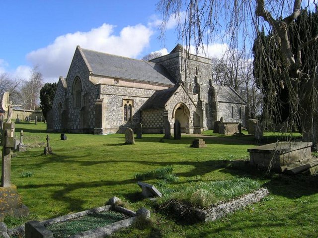
Tilshead () is a village and civil parish in the county of Wiltshire in Southern England, about northwest of the town of Amesbury. It is close to the geographical centre of Salisbury Plain, on the A360 road approximately midway between the villages of Shrewton and Market Lavington, and is near the source of the River Till. Its population in 2011 was 358, down from a peak of 989 inhabitants in 1951. History Salisbury Plain has much evidence of prehistoric activity. One kilometre south of Tilshead village, under the ridge of Copehill Down, is the White Barrow, a large Neolithic long barrow. To the southwest and southeast are ancient boundary ditches, partly followed by the parish boundary; the ditch in the southeast has a long barrow next to it. The name of the settlement derives from "Theodwulf's hide". In 1086, ''Tydolveshyde'' or ''Tidolthide'' was a borough and large royal estate, with a relatively large population of 164 households and nine mills. The tithing of South Til ... [...More Info...] [...Related Items...] OR: [Wikipedia] [Google] [Baidu] |
Tilshead Lodge
Tilshead Lodge (now demolished) was a large 18th-century country house, southwest of Tilshead in Wiltshire, England, and about northwest of Salisbury. History Tilshead Lodge was built in the early 18th century, probably as a sporting lodge. By 1760 there were formal gardens to the south of the house, which was rebuilt around 1800. For most of its life the estate was a training establishment which, until the 19th century, was known as Tilshead Buildings. It is said by local tradition that Charles II of England, Charles II stabled his horses there. The Andrews and Dury maps of Wiltshire in 1773 and 1810 show a racing circuit called "Tylshead Race" a mile south of the house, although this was probably built as a training circuit rather than for use in competitive races. The estate was bought by the War Office in two lots, in 1911 and 1933, in order to extend the Salisbury Plain Training Area. During World War II the house and grounds were used as an army base. An Ordnance Survey ... [...More Info...] [...Related Items...] OR: [Wikipedia] [Google] [Baidu] |
River Till (Wiltshire)
The River Till rises near Tilshead on Salisbury Plain in the English county of Wiltshire. It flows for about south and south-east, through Orcheston, Maddington, Shrewton, Winterbourne Stoke, Berwick St James and Stapleford, to join the River Wylye. The upper part of the river is a winterbourne, flowing only in winter and early spring. The whole length of the Till has been designated as a Site of Special Scientific Interest, as its vegetation includes water crowfoot which provides habitat for fish and snails. Although Tilshead village appears to be named from the river, the opposite applies. The village name was first used in the 16th century, and comes from older names based on "Theodwulf's hide" (recorded in Domesday Book as ''Tidolthide''). The river was called the Winterbourne until around the start of the 20th century, when the name River Till began to be used on Ordnance Survey maps. Water quality The Environment Agency measures the water quality of the river syst ... [...More Info...] [...Related Items...] OR: [Wikipedia] [Google] [Baidu] |
Whorwellsdown (hundred)
Whorwellsdown was a hundred of the English county of Wiltshire, lying in the west of the county to the south of the towns of Bradford on Avon and Melksham and to the north and east of Westbury. An arm of the hundred reached several miles southwards into Salisbury Plain, with a detached portion, a tithing of Tilshead, lying high on the Plain about five miles east of the southern arm of the rest of the hundred. At its western end, it reached as far as the Somerset county boundary. Extent At the time of the Domesday Book (1086), the hundred contained Romsey Abbey's manors of Steeple Ashton and Edington, together with other estates at Edington, Coulston, Keevil, and Tilshead. Steeple Ashton then included West Ashton, North Bradley and Southwick.'The Hundred of Whorwellsdown', in ''A History of the County of Wiltshire: Volume 8: Warminster, Westbury and Whorwellsdown Hundreds'' (1965)pp. 193–197online at british-history.ac.uk In 1831, the hundred included Steeple Ashton (with We ... [...More Info...] [...Related Items...] OR: [Wikipedia] [Google] [Baidu] |
A360 Road
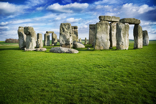
The A360 is an A road in Wiltshire, England, running from Devizes to Salisbury, through the villages of Potterne, West Lavington, Tilshead, and Shrewton, and passing near the Stonehenge ancient monument. Route The road is long and starts at the junction of the A342 and A361 roads in the town of Devizes. It continues southwards towards Salisbury Plain, passing West Lavington via Potterne, then south-east to Shrewton via Tilshead. It turns right at Airman's Corner (a junction with an entrance to Stonehenge and the B3086), crosses the A303 and continues southwards into Salisbury, joining the A36 near the centre of the city. History Original route The A360 originally ran south from Shrewton, following the River Till via Winterbourne Stoke to join the A36 beyond Stapleford. This section was re-routed sometime before 1958, at first eastward for about along the A344 Amesbury road, then turning south near Stonehenge onto the former Devizes-Salisbury road; a straighter route ... [...More Info...] [...Related Items...] OR: [Wikipedia] [Google] [Baidu] |
Shrewton
Shrewton is a village and civil parish on Salisbury Plain in Wiltshire, England, around west of Amesbury and north of Salisbury. It lies on the A360 road between Stonehenge and Tilshead. It is close to the source of the River Till, which flows south to Stapleford. History The Domesday Book of 1086 recorded three estates held by Edward of Salisbury at ''Wintreburne'', in all with 43 households. The name Shrewton came into use from 1236 and is derived from the Old English ''scīr-rēfa tūn'', meaning 'sheriff's farm or settlement'. Addeston was a village of medieval origin, which now forms an integral part of the modern village of Shrewton. The place name survives in Addestone Farm () and Addestone Manor (). A village or hamlet called Netton lay in the east of the parish, but dwindled away by the 19th century; the name survives in Nett Road and Net Down. In 1934 the civil parish of Shrewton was enlarged by the addition of the parishes of Maddington (to the south an ... [...More Info...] [...Related Items...] OR: [Wikipedia] [Google] [Baidu] |
Amesbury
Amesbury () is a town and civil parish in Wiltshire, England. It is known for the prehistoric monument of Stonehenge which is within the parish. The town is claimed to be the oldest occupied settlement in Great Britain, having been first settled around 8820 BC. The parish includes the hamlets of Ratfyn and West Amesbury, and part of Boscombe Down military airfield. Etymology The derivation of the name of the town is uncertain. It may derive from an Anglo-Saxon named ''Ambre'', or from the Old English ''amore-burh'' meaning 'fortification frequented by buntings or/and Yellowhammers'. It has also been suggested that the name is derived from Ambrosius Aurelianus, leader of Romano-British resistance to Saxon invasions in the 5th century. Geography Amesbury is located in southern Wiltshire, north-northeast of Salisbury on the A345. It sits in the River Avon valley on the southern fringes of Salisbury Plain and has historically been considered an important river crossing ... [...More Info...] [...Related Items...] OR: [Wikipedia] [Google] [Baidu] |
Salisbury Plain
Salisbury Plain is a chalk plateau in the south western part of central southern England covering . It is part of a system of chalk downlands throughout eastern and southern England formed by the rocks of the Chalk Group and largely lies within the county of Wiltshire, but stretches into Hampshire. The plain is famous for its rich archaeology, including Stonehenge, one of England's best known landmarks. Large areas are given over to military training and thus the sparsely populated plain is the biggest remaining area of calcareous grassland in northwest Europe. Additionally the plain has arable land, and a few small areas of beech trees and coniferous woodland. Its highest point is Easton Hill. Physical geography The boundaries of Salisbury Plain have never been truly defined, and there is some difference of opinion as to its exact area. The river valleys surrounding it, and other downs and plains beyond them loosely define its boundaries. To the north the scarp of the ... [...More Info...] [...Related Items...] OR: [Wikipedia] [Google] [Baidu] |
White Barrow
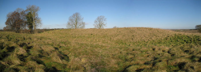
White Barrow is a large Neolithic long barrow just below the crest of Copehill Down on Salisbury Plain, just south of the village of Tilshead in Wiltshire, England. It is a scheduled monument, and is owned by the National Trust. It was the first ancient monument to be purchased by the National Trust. History White Barrow is 77.5 m long and approximately 47 m wide (including the surrounding ditch). It has never been fully excavated, but dating of materials found in and around it suggests that it dates from 3500 to 4000 BC, making it contemporary with other long barrows on Salisbury Plain, as well as the nearby causewayed enclosure called Robin Hood's Ball. The antiquarian Colt Hoare opened the mound in the 1806, and found areas of black earth that he believed to be the remains of a wooden-structured burial chamber. A geophysical survey by English Heritage in 1997 found evidence of a possible burial chamber or mortuary cairn inside the barrow, and an arc of post pits at its e ... [...More Info...] [...Related Items...] OR: [Wikipedia] [Google] [Baidu] |
Public House
A pub (short for public house) is a kind of drinking establishment which is licensed to serve alcoholic drinks for consumption on the premises. The term ''public house'' first appeared in the United Kingdom in late 17th century, and was used to differentiate private houses from those which were, quite literally, open to the public as "alehouses", " taverns" and " inns". By Georgian times, the term had become common parlance, although taverns, as a distinct establishment, had largely ceased to exist by the beginning of the 19th century. Today, there is no strict definition, but CAMRA states a pub has four characteristics:GLA Economics, Closing time: London's public houses, 2017 # is open to the public without membership or residency # serves draught beer or cider without requiring food be consumed # has at least one indoor area not laid out for meals # allows drinks to be bought at a bar (i.e., not only table service) The history of pubs can be traced to Roman taverns ... [...More Info...] [...Related Items...] OR: [Wikipedia] [Google] [Baidu] |
Unitary Authorities Of England
The unitary authorities of England are those local authorities which are responsible for the provision of all local government services within a district. They are constituted under the Local Government Act 1992, which amended the Local Government Act 1972 to allow the existence of counties that do not have multiple districts. They typically allow large towns to have separate local authorities from the less urbanised parts of their counties and originally provided a single authority for small counties where division into districts would be impractical. However, the UK government has more recently proposed the formation of much larger unitary authorities, including a single authority for North Yorkshire, the largest non-metropolitan county in England, at present divided into seven districts. Unitary authorities do not cover all of England. Most were established during the 1990s, though further tranches were created in 2009 and 2019–21. Unitary authorities have the powers an ... [...More Info...] [...Related Items...] OR: [Wikipedia] [Google] [Baidu] |
War Office
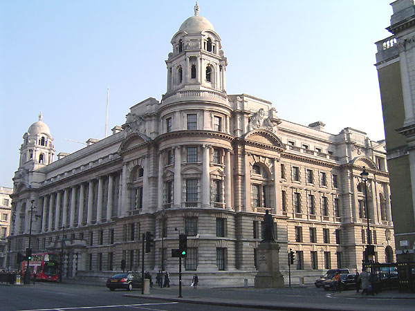
The War Office was a department of the British Government responsible for the administration of the British Army between 1857 and 1964, when its functions were transferred to the new Ministry of Defence (United Kingdom), Ministry of Defence (MoD). This article contains text from this source, which is available under th Open Government Licence v3.0 © Crown copyright It was equivalent to the Admiralty (United Kingdom), Admiralty, responsible for the Royal Navy (RN), and (much later) the Air Ministry, which oversaw the Royal Air Force (RAF). The name 'War Office' is also given to the former home of the department, located at the junction of Horse Guards Avenue and Whitehall in central London. The landmark building was sold on 1 March 2016 by HM Government for more than British pound, £350 million, on a 250 year lease for conversion into a luxury hotel and residential apartments. Prior to 1855, 'War Office' signified the office of the Secretary at War. In the 17th an ... [...More Info...] [...Related Items...] OR: [Wikipedia] [Google] [Baidu] |
Parish Councils In England
Parish councils are civil local authorities found in England which are the lowest tier of local government. They are elected corporate bodies, with variable tax raising powers, and they carry out beneficial public activities in geographical areas known as civil parishes. There are about 9,000 parish and town councils in England, and over 16 million people live in communities served by them. Parish councils may be known by different styles, they may resolve to call themselves a town council, village council, community council, neighbourhood council, or if the parish has city status, it may call itself a city council. However their powers and duties are the same whatever name they carry.Local Government and Public Involvement in Health Act 2007 Parish councils receive the majority of their funding by levying a precept upon the council tax paid by the residents of the parish (or parishes) covered by the council. In 2021-22 the amount raised by precept was £616 million. Other f ... [...More Info...] [...Related Items...] OR: [Wikipedia] [Google] [Baidu] |


