|
Thurgoland
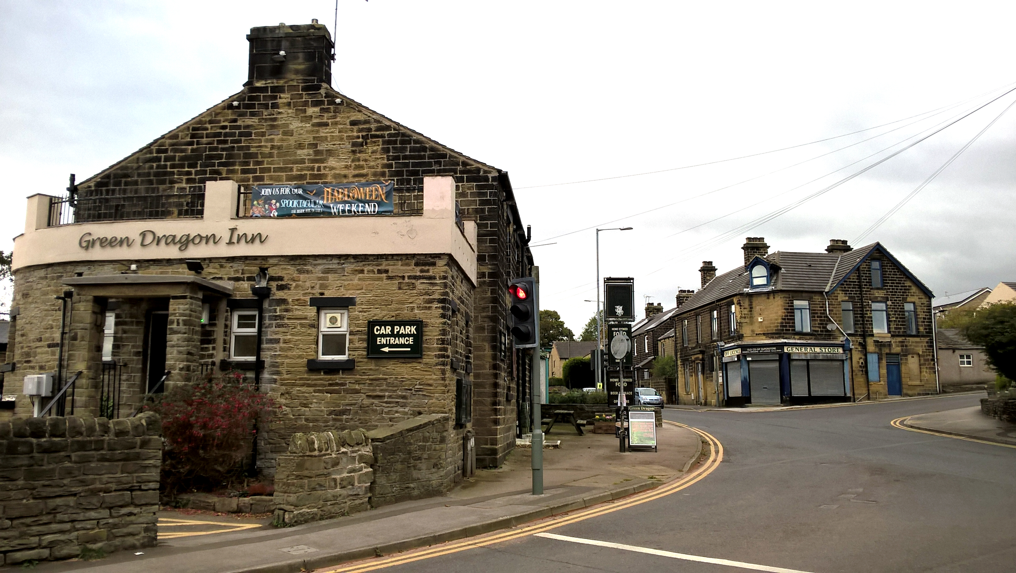
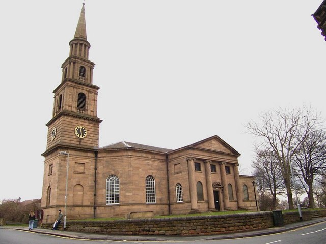
Thurgoland (, ) is a village and civil parish in the Metropolitan Borough of Barnsley in South Yorkshire, England, on the A629 road. According to the 2001 census the parish had a population of 1,801, increasing to 1,969 at the 2011 Census. Buildings The village has one primary school, and Holy Trinity Church, Thurgoland (Church of England), built in 1870. There are three public houses: The Horse & Jockey, The Green Dragon and The Bridge Inn. There are several listed buildings on Huthwaite Lane, including Huthwaite Hall (1748) designed by John Carr (architect), John Carr. There is a recreational ground at the centre of the village, by the village hall and the youth centre. Thurgoland Junior School is ranked second in the local league table. History The earliest known written record of Thurgoland is in the Domesday Book of 1086, in which it is referred to as ''Turgesland''. The name is of Old Norse origin and may mean 'Cultivated land of a man called Thorgeirr'. Other source ... [...More Info...] [...Related Items...] OR: [Wikipedia] [Google] [Baidu] |
Thurgoland Railway Station
Thurgoland railway station was a small railway station built by the Sheffield, Ashton-Under-Lyne and Manchester Railway to serve the village of Thurgoland, South Yorkshire, England England is a Countries of the United Kingdom, country that is part of the United Kingdom. It is located on the island of Great Britain, of which it covers about 62%, and List of islands of England, more than 100 smaller adjacent islands. It ... and opened on 5 December 1845. Due to cost-cutting measures involving staff and infrastructure the station was closed, along with Dukinfield Dog Lane, Hazelhead and Oxspring on 1 November 1847, making this one of the shortest-lived stations anywhere, with a life span of just one year and 11 months. References * Dow, George. "Great Central Volume 1" (The Progenitors, 1813 - 1865), Locomotive Publishing Co., London, 1959. * "A Railway Chronology of the Sheffield Area" Edited by Richard V. Proctor. Sheffield City Libraries, 1975. Disused rai ... [...More Info...] [...Related Items...] OR: [Wikipedia] [Google] [Baidu] |
Sheffield, Ashton-under-Lyne And Manchester Railway
The Sheffield, Ashton-under-Lyne and Manchester Railway was an early British railway company which opened in stages between 1841 and 1845 between Sheffield and Manchester via Ashton-under-Lyne. The Peak District formed a formidable barrier, and the line's engineer constructed Woodhead Tunnel, over long. The company amalgamated with the Sheffield and Lincolnshire Junction Railway and Great Grimsby and Sheffield Junction Railway companies, together forming the Manchester, Sheffield and Lincolnshire Railway in 1847.George Dow, ''Great Central: volume I: The Progenitors, 1813–1863'', Locomotive Publishing Co Ltd, London, 1959, , page 84 In the twentieth century the line carried an exceptionally heavy freight traffic, and it was electrified in 1954; at that time a new Woodhead Tunnel was driven. In 1974 the major part of the route was closed to passenger trains, leaving passenger operation continuing only on the Manchester–Hadfield, Derbyshire, Hadfield section, and in 1981 the l ... [...More Info...] [...Related Items...] OR: [Wikipedia] [Google] [Baidu] |
River Don, South Yorkshire
The River Don (also called River Dun in some stretches) is a river in South Yorkshire and the East Riding of Yorkshire, England. It rises in the Pennines, west of Dunford Bridge, and flows for eastwards, through the Don Valley, via Penistone, Sheffield, Rotherham, Mexborough, Conisbrough, Doncaster and Stainforth. It originally joined the Trent, but was re-engineered by Cornelius Vermuyden as the ''Dutch River'' in the 1620s, and now joins the River Ouse at Goole. Don Valley is a UK parliamentary constituency near the Doncaster stretch of the river. Etymology The probable origin of the name was Brittonic ''Dānā'', from a root ''dān-'', meaning "water" or "river". The name Dôn (or Danu), a Celtic mother goddess, has the same origin. The river gave its name to the Don River, one of the principal rivers of Toronto, Ontario, Canada. Geography The Don can be divided into sections by the different types of structures built to restrict its passage. The upper re ... [...More Info...] [...Related Items...] OR: [Wikipedia] [Google] [Baidu] |
Penistone And Stocksbridge (UK Parliament Constituency)
Penistone and Stocksbridge is a constituency in South Yorkshire represented in the House of Commons of the UK Parliament since 2024 by Marie Tidball, a Labour MP. As with all Westminster constituencies, adults qualifying to vote in the seat elect one Member of Parliament (MP) by the first past the post system at least every five years. Boundaries 2010–present: The Metropolitan Borough of Barnsley wards of Dodworth, Penistone East, and Penistone West, and the City of Sheffield wards of Stocksbridge and Upper Don, East Ecclesfield and West Ecclesfield. The 2023 Periodic Review of Westminster constituencies left the boundaries unchanged. History The seat largely resembles the old Penistone constituency, which, following the election of a Conservative in the Conservative landslide in 1931, returned MPs representing the Labour Party through to its abolition in 1983. In 1983, two new constituencies were formed, Sheffield Hillsborough and Barnsley West and Penisto ... [...More Info...] [...Related Items...] OR: [Wikipedia] [Google] [Baidu] |
Metropolitan Borough Of Barnsley
The Metropolitan Borough of Barnsley is a metropolitan borough in South Yorkshire, England; the main settlement is Barnsley and other notable towns include Wombwell, Worsbrough, Penistone and Hoyland. The borough is bisected by the M1 motorway; it is rural to the west, and largely urban/industrial to the east. It is estimated that around 16% of the borough is classed as urban overall, with this area being home to the vast majority of its residents. Additionally, 68% of Barnsley's 32,863 hectares is green belt and 9% is national park land, the majority of which is west of the M1. In 2007, it was estimated that Barnsley had 224,600 residents, measured at the 2011 census as 231,221. The neighbouring districts are Doncaster, Rotherham, Sheffield, High Peak, Kirklees and Wakefield. History The borough was created on 1 April 1974 under the Local Government Act 1972. It covered the whole area of 12 former districts and parts of another two, which were all abolished at the ... [...More Info...] [...Related Items...] OR: [Wikipedia] [Google] [Baidu] |
Penistone East Ward
Penistone ( ) is a market town and civil parish in the Metropolitan Borough of Barnsley, South Yorkshire, England, which had a population of 13,270 at the 2021 census. Historically in the West Riding of Yorkshire, it is west of Barnsley, north-east of Glossop, north-west of Sheffield, south-west of Leeds and east of Manchester in the foothills of the Pennines. The town is frequently noted on lists of unusual place names. The highest point, Hartcliffe Tower, is above sea level and has views over the Woodhead bypass and the Dark Peak. The surrounding countryside is predominantly rural with farming on rich well-watered soil on mainly gentle slopes rising to the bleak moorland to the west of the town. Dry stone walls, small hamlets and farms surrounded by fields and livestock are synonymous with the area. The area is known for its rugged breed of sheep, the Whitefaced Woodland. The market town itself stands at its highest point around St Johns Church at around above se ... [...More Info...] [...Related Items...] OR: [Wikipedia] [Google] [Baidu] |
John Carr (architect)
John Carr (1723 – 22 February 1807) was an English architect. He is best known for Buxton Crescent in Derbyshire and Harewood House in West Yorkshire. Much of his work was in the Palladian style. In his day he was considered to be the leading architect in the north of England. Life He was born in 1723 in Horbury near Wakefield, West Riding of Yorkshire, the eldest of nine children and the son of a master stonemason, mason, under whom he trained. He started an independent career in 1748 and continued until shortly before his death. John Carr was Lord Mayor of York in 1770 and again in 1785. Towards the end of his life Carr purchased an estate at Askham Richard, near York, to which he retired. On 22 February 1807 he died at Askham Hall. He was buried in St Peter and St Leonard's Church, Horbury, which he had designed and paid for. Career Carr decided to remain in Yorkshire rather than move to London because he calculated that there was ample patronage and the wealth to sustain ... [...More Info...] [...Related Items...] OR: [Wikipedia] [Google] [Baidu] |
United Kingdom Census 2001
A nationwide census, known as Census 2001, was conducted in the United Kingdom on Sunday, 29 April 2001. This was the 20th Census in the United Kingdom, UK census and recorded a resident population of 58,789,194. The 2001 UK census was organised by the Office for National Statistics (ONS) in England and Wales, the General Register Office for Scotland (GROS) and the Northern Ireland Statistics and Research Agency (NISRA). Detailed results by region, council area, ward and ONS coding system, output area are available from their respective websites. Organisation Similar to previous UK censuses, the 2001 census was organised by the three statistical agencies, ONS, GROS, and NISRA, and coordinated at the national level by the Office for National Statistics. The Order in Council#Orders in Council as Statutory Instruments, Orders in Council to conduct the census, specifying the people and information to be included in the census, were made under the authority of the Census Act 1920 in ... [...More Info...] [...Related Items...] OR: [Wikipedia] [Google] [Baidu] |
Mean Sea Level
A mean is a quantity representing the "center" of a collection of numbers and is intermediate to the extreme values of the set of numbers. There are several kinds of means (or "measures of central tendency") in mathematics, especially in statistics. Each attempts to summarize or typify a given group of data, illustrating the magnitude and sign of the data set. Which of these measures is most illuminating depends on what is being measured, and on context and purpose. The ''arithmetic mean'', also known as "arithmetic average", is the sum of the values divided by the number of values. The arithmetic mean of a set of numbers ''x''1, ''x''2, ..., x''n'' is typically denoted using an overhead bar, \bar. If the numbers are from observing a sample of a larger group, the arithmetic mean is termed the '' sample mean'' (\bar) to distinguish it from the group mean (or expected value) of the underlying distribution, denoted \mu or \mu_x. Outside probability and statistics, a wide rang ... [...More Info...] [...Related Items...] OR: [Wikipedia] [Google] [Baidu] |
Ordnance Survey
The Ordnance Survey (OS) is the national mapping agency for Great Britain. The agency's name indicates its original military purpose (see Artillery, ordnance and surveying), which was to map Scotland in the wake of the Jacobite rising of 1745. There was also a more general and nationwide need in light of the potential threat of invasion during the Napoleonic Wars. Since 1 April 2015, the Ordnance Survey has operated as Ordnance Survey Ltd, a state-owned enterprise, government-owned company, 100% in public ownership. The Ordnance Survey Board remains accountable to the Secretary of State for Science, Innovation and Technology. It was also a member of the Public Data Group. Paper maps represent only 5% of the company's annual revenue. It produces digital map data, online route planning and sharing services and mobile apps, plus many other location-based products for business, government and consumers. Ordnance Survey mapping is usually classified as either "Scale (map), lar ... [...More Info...] [...Related Items...] OR: [Wikipedia] [Google] [Baidu] |
Irish Migration To Great Britain
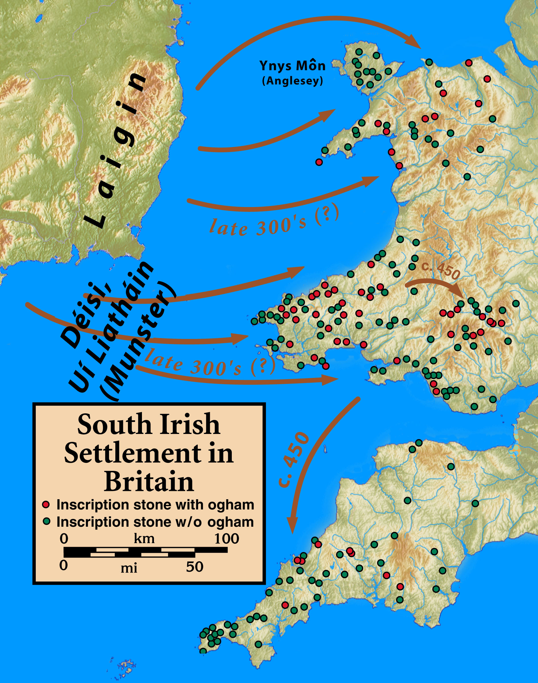
Irish people in Great Britain or British Irish are immigrants from the island of Ireland living in Great Britain as well as their British-born descendants. Irish migration to Great Britain has occurred from the earliest recorded history to the present. There has been a continuous movement of people between the islands of Ireland and Great Britain due to their proximity. This tide has ebbed and flowed in response to politics, economics and social conditions of both places. Today, millions of residents of Great Britain are either from Ireland or are entitled to an Irish passport due to having a parent or grandparent who was born in Ireland. It is estimated that as many as six million people living in the UK have at least one Irish grandparent (around 10% of the UK population). The Irish diaspora () refers to Irish people and their descendants who live outside Ireland. This article refers to those who reside in Great Britain, the largest island and principal territory of the U ... [...More Info...] [...Related Items...] OR: [Wikipedia] [Google] [Baidu] |


