|
Thornaby-on-Tees
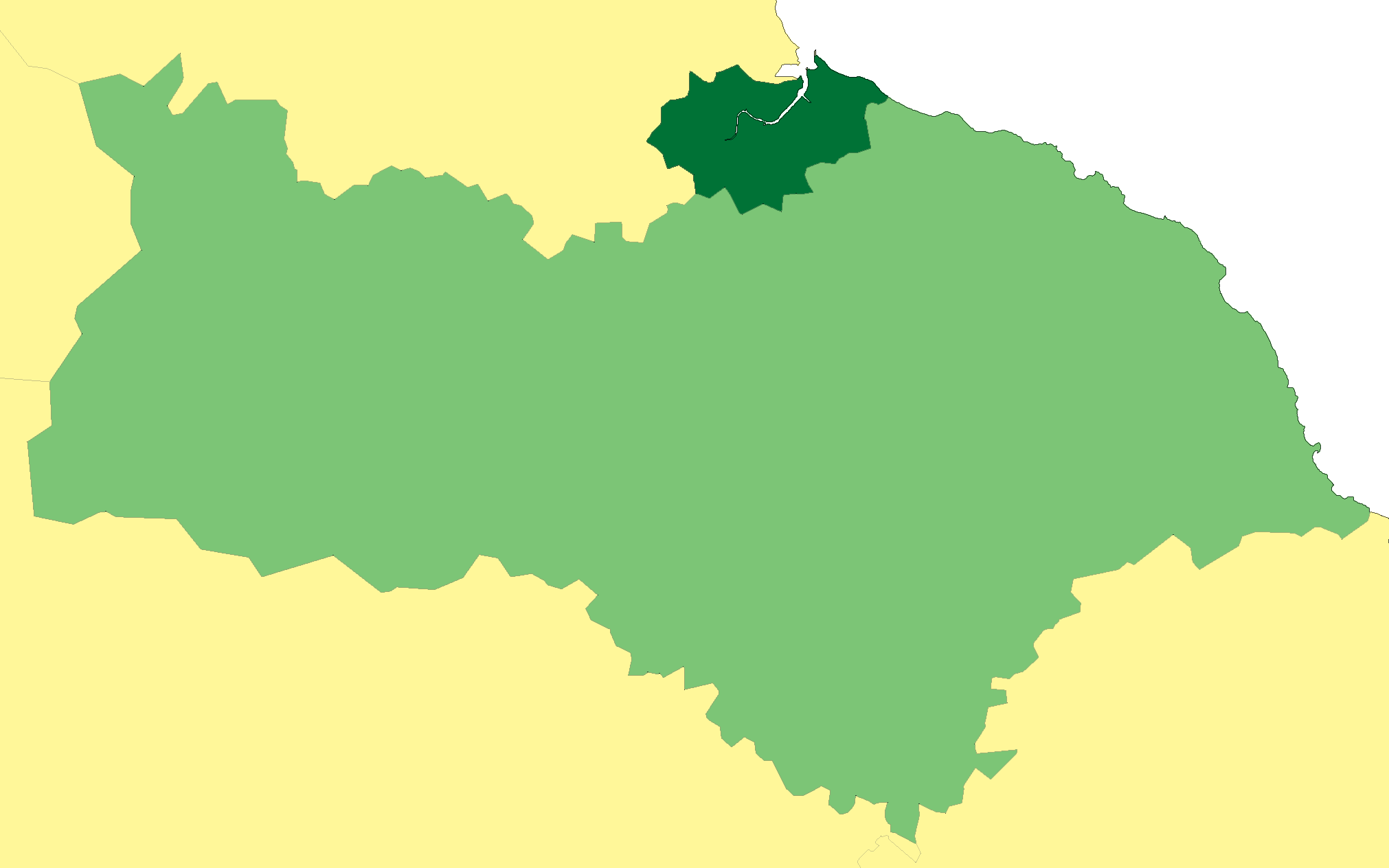
Thornaby-on-Tees, commonly referred to as Thornaby, is a town and Civil parishes in England, civil parish in North Yorkshire, England, north of York and south-east of Middlesbrough. On the south bank of the River Tees, Thornaby falls within the Borough of Stockton-on-Tees and the Tees Valley area. The parish had a population of 24,741 at the United Kingdom Census 2011, 2011 census. The town was incorporated as a municipal borough in 1892, during the Victorian era. The borough was abolished in 1968 on the creation of the County Borough of Teesside. A civil parish called Thornaby was re-created in 1996. The modern centre was built on the north eastern part of RAF Thornaby, Thornaby airfield and lies south-east of Stockton-on-Tees and south-west of Middlesbrough. History Prehistoric There are other signs of Thornaby being a much older settlement. Traces of prehistoric man have been found, the earliest being a stone axe, 8 inches long, dating back to the Mesolithic Per ... [...More Info...] [...Related Items...] OR: [Wikipedia] [Google] [Baidu] |
Thornaby Town Hall
Thornaby Town Hall is a municipal building in the Mandale Road in Thornaby-on-Tees, North Yorkshire, England. The building, which is owned by Thornaby Town Council, is a Grade II listed building. History In anticipation of the proposed merger of Thornaby and South Stockton into the municipal borough of Thornaby-on-Tees municipal borough in 1892, civic leaders decided to commission a dedicated town hall. The site they selected was a developing area occupied by some clay pits in what had previously been close to the Mandale Marshes just south of South Stockton railway station. The foundation stone for the new building was laid by the chairman of the South Stockton local board of health, John Steel, on 25 October 1890. It was designed by James Garry of West Hartlepool in the Renaissance style, built by W. C. Atkinson and was officially opened as Thornaby Town Hall in 1892. The design involved a chamfered main frontage at the junction of Mandale Road and Railway Terrace; the corn ... [...More Info...] [...Related Items...] OR: [Wikipedia] [Google] [Baidu] |
RAF Thornaby
Royal Air Force Thornaby, or more simply RAF Thornaby, is a former Royal Air Force Station located in the town and borough of Thornaby-on-Tees, in the North Riding of Yorkshire, England. Fighter Command, Bomber Command and Coastal Command all operated from the base over its history, but its stint under Coastal Command is what the base was notable for, particularly in the air-sea rescue environment and the development of the ''Thornaby Bag''. This was an emergency bag dropped to downed aircrew at sea and contained food, cigarettes and drink. History The aerodrome was officially opened on 29 September 1929, although flying in Thornaby dates back to 1912 when Gustav Hamel used the Vale Farm for a flying display. Subsequently, the Royal Flying Corps used the same fields as a staging post between Catterick and Marske Aerodrome between 1914 and 1918.608 squadron and RAF Thornaby, E. W. Sockett In 1920, the government purchased of farm land from Thornaby Hall and develope ... [...More Info...] [...Related Items...] OR: [Wikipedia] [Google] [Baidu] |
County Borough Of Teesside
The County Borough of Teesside was a county borough in the north-east of England, which existed for just six years. It was created in 1968 to cover the Teesside conurbation which had grown up around the various port and industrial towns near the mouth of the River Tees. The council was based in Middlesbrough, the area's largest town. The county borough was abolished in 1974 on the creation of the new county of Cleveland, which covered a larger area, with the county borough's territory being split between three of the four districts created in the new county. Prior to 1968 the area was governed by the six separate authorities of Billingham, Eston, Middlesbrough, Redcar, Stockton-on-Tees and Thornaby-on-Tees. Middlesbrough was a county borough, providing all local government services in its area; the others were all district-level authorities, with strategic functions provided by their respective county councils. The River Tees formed the boundary between County Durham and North ... [...More Info...] [...Related Items...] OR: [Wikipedia] [Google] [Baidu] |
Borough Of Stockton-on-Tees
The Borough of Stockton-on-Tees is a unitary authority area in England with borough status in County Durham and North Yorkshire. In 2021, it had a population of 196,600. Its main settlement and namesake of the borough is Stockton-on-Tees, which lies on the north bank of the River Tees, along with the towns of Billingham and Norton-on-Tees, in County Durham. It also includes the towns of Ingleby Barwick, Thornaby-on-Tees and Yarm, all south of the Tees, in North Yorkshire. The borough locally governed by Stockton-on-Tees Borough Council. The borough forms part of the Tees Valley together with four other nearby boroughs (Darlington, Middlesbrough, Redcar and Cleveland, and Hartlepool). All bridges spanning the River Tees are partially within the borough, including the Yarm Viaduct and the Tees Transporter Bridge, with the Middlesbrough to the south downstream on the other side to the east of the borough. Teesside International Airport is shared between the borough and the Darl ... [...More Info...] [...Related Items...] OR: [Wikipedia] [Google] [Baidu] |
Stockton South (UK Parliament Constituency)
Stockton South was a constituency represented in the House of Commons of the UK Parliament from 2019 until its abolition for the 2024 general election by Matt Vickers of the Conservative Party. Under the 2023 periodic review of Westminster constituencies, the seat was abolished; subject to moderate boundary changes, it was reformed as Stockton West. Boundaries 1983–1997: The Borough of Stockton-on-Tees wards of Bishopsgarth, Egglescliffe, Fairfield, Grangefield, Hartburn, Ingleby Barwick, Mandale, Parkfield, Preston, Stainsby, Victoria, Village, and Yarm, and the Borough of Middlesbrough wards of Ayresome, Brookfield, and Kader. 1997–2010: The Borough of Stockton-on-Tees wards of Bishopsgarth, Egglescliffe, Elm Tree, Fairfield, Grangefield, Hartburn, Ingleby Barwick, Mandale, Parkfield, Preston, Stainsby, Victoria, Village, and Yarm. ''The three Middlesbrough wards were transferred to the redrawn Middlesbrough constituency.'' 2010–2024: The Borough of Stockton-on-Te ... [...More Info...] [...Related Items...] OR: [Wikipedia] [Google] [Baidu] |
Middlesbrough And Thornaby East (UK Parliament Constituency)
Middlesbrough and Thornaby East is a constituency of the House of Commons in the UK Parliament. Further to the completion of the 2023 Periodic Review of Westminster constituencies, it was first contested in the 2024 general election and is currently held by Andy McDonald of the Labour Party, who previously held the abolished constituency of Middlesbrough from 2012 to 2024. Boundaries The composition of the constituency is as follows (as they existed on 1 December 2020): * The Borough of Middlesbrough wards of: Acklam; Ayresome; Berwick Hills & Pallister; Brambles & Thorntree; Central; Kader; Linthorpe; Longlands & Beechwood; Newport; North Ormesby; Park; Trimdon. * The Borough of Stockton-on-Tees wards of: Mandale and Victoria; Stainsby Hill. The seat is the successor to the Middlesbrough constituency, subject to alignment of the boundaries to take account of a revised local authority ward structure. In order for the electorate to be within the permitted range, the two Stockton- ... [...More Info...] [...Related Items...] OR: [Wikipedia] [Google] [Baidu] |
North Yorkshire
North Yorkshire is a Ceremonial counties of England, ceremonial county in Northern England.The Unitary authorities of England, unitary authority areas of City of York, York and North Yorkshire (district), North Yorkshire are in Yorkshire and the Humber, and Borough of Middlesbrough, Middlesbrough, Redcar and Cleveland, and Stockton-on-Tees Borough Council, Stockton-on-Tees are in North East England. It borders County Durham to the north, the North Sea to the east, the East Riding of Yorkshire to the south-east, South Yorkshire to the south, West Yorkshire to the south-west, and Cumbria and Lancashire to the west. The county is the largest in England by land area, at , and had a population of 1,158,816 in 2021. The largest settlements are Middlesbrough (148,215) in the north-east and the city of York (141,685) in the south. Middlesbrough is part of the Teesside built-up area, which extends into County Durham and had a total population of 376,663 in 2011. The remainder of the cou ... [...More Info...] [...Related Items...] OR: [Wikipedia] [Google] [Baidu] |
Tees Valley
Tees Valley is a combined authority area in North East England, around the lower River Tees. The area is not a geographical valley. The combined authority covers five council areas: Darlington, Hartlepool, Middlesbrough, Redcar and Cleveland and Stockton-on-Tees: this includes areas in both County Durham and North Yorkshire counties. The town of Middlesbrough is the largest population centre in the area. The borough of Middlesbrough is the smallest of the five, at only and a population of : the Stockton-on-Tees borough (including multiple towns) is the largest with an area of and a population of , as of . From 1968 until 1974, parts of the area were included in the County Borough of Teesside council area. This was replaced by Cleveland county; it had four borough councils which became unitary authorities after the county was abolished in 1996. Darlington became a unitary authority in 1997; the five authorities formed a Local Enterprise Partnership in 2011, further collabo ... [...More Info...] [...Related Items...] OR: [Wikipedia] [Google] [Baidu] |
River Tees
The River Tees (), in England, rises on the eastern slope of Cross Fell in the North Pennines and flows eastwards for to reach the North Sea in the North East of England. The modern-day history of the river has been tied with the industries on Teesside in its lower reaches, where it has provided the means of import and export of goods to and from the North East England. The need for water further downstream also meant that reservoirs were built in the extreme upper reaches, such as Cow Green. Etymology The name ''Tees'' is possibly of Brittonic origin. The element ''*tēs'', meaning "warmth" with connotations of "boiling, excitement" ( Welsh ''tes''), may underlie the name. ''*Teihx-s'', a root possibly derived from Brittonic ''*ti'' (Welsh ''tail'', "dung, manure"), has also been used to explain the name ''Tees'' (compare River Tyne). Geography The river drains and has a number of tributaries including the River Greta, River Lune, River Balder, River Leven and ... [...More Info...] [...Related Items...] OR: [Wikipedia] [Google] [Baidu] |
Infinity Bridge
The Infinity Bridge is a public pedestrian and cycle footbridge across the River Tees in the borough of Stockton-on-Tees in northern England. The bridge is situated one kilometre downriver of Stockton town centre, between the Princess of Wales Bridge and the Tees Barrage. It connects the Teesdale Business Park and the University of Durham's Queen's Campus, Durham University, Queen's Campus in Thornaby-on-Tees on the south bank of the Tees with the Tees Valley Regeneration's £320 million North Shore development on the north bank. Built at a cost of £15 million with funding from Stockton Borough Council, English Partnerships and its successor body the Homes and Communities Agency, One NorthEast, and the European Regional Development Fund the bridge is a major part of the North Shore Redevelopment Project undertaken by Tees Valley Regeneration. The bridge had the project title ''North Shore Footbridge'' before being given its official name ''Infinity Bridge'', chosen by ... [...More Info...] [...Related Items...] OR: [Wikipedia] [Google] [Baidu] |


