|
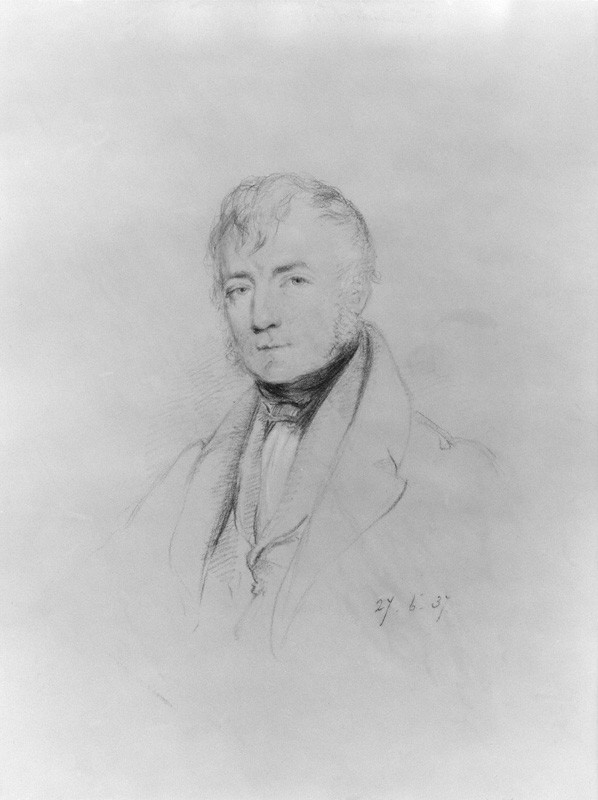
Thomas Frederick Colby
Thomas Frederick Colby FRS FRSE FGS FRGS (1 September 17849 October 1852), was a British major-general and director of the Ordnance Survey (OS). A Fellow of the Royal Astronomical Society and Royal Society, Colby was one of the leading geographers of his time. An officer in the Royal Engineers, Colby overcame the loss of one hand in a shooting accident to begin in 1802 a lifelong connection with the Ordnance Survey. His most important work was the Survey of Ireland. He began planning this enormous enterprise in 1824 and directed it until 1846, in which year the final maps made by the survey were almost ready for issue. He was the inventor of the "Colby Bar" (a compensation bar), an apparatus used in base-measurements. Early life He was the eldest child of Major Thomas Colby, Royal Marines (died 1813) and his wife, Cornelia Hadden, sister of James Murray Hadden. He was born at St. Margaret's-next- Rochester on 1 September 1784. Colby was brought up by his father's sisters at R ... [...More Info...] [...Related Items...] OR: [Wikipedia] [Google] [Baidu] |
Royal Society Of London
The Royal Society, formally The Royal Society of London for Improving Natural Knowledge, is a learned society and the United Kingdom's national academy of sciences. The society fulfils a number of roles: promoting science and its benefits, recognising excellence in science, supporting outstanding science, providing scientific advice for policy, education and public engagement and fostering international and global co-operation. Founded on 28 November 1660, it was granted a royal charter by King Charles II and is the oldest continuously existing scientific academy in the world. The society is governed by its Council, which is chaired by the society's president, according to a set of statutes and standing orders. The members of Council and the president are elected from and by its Fellows, the basic members of the society, who are themselves elected by existing Fellows. , there are about 1,700 fellows, allowed to use the postnominal title FRS (Fellow of the Royal Society) ... [...More Info...] [...Related Items...] OR: [Wikipedia] [Google] [Baidu] |
Royal Military Academy, Woolwich
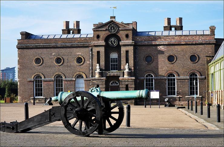
The Royal Military Academy (RMA) at Woolwich, in south-east London, was a British Army military academy for the training of Officer (armed forces), commissioned officers of the Royal Artillery and Royal Engineers. It later also trained officers of the Royal Corps of Signals and other technical corps. RMA Woolwich was commonly known as "The Shop" because its first building was a converted workshop of the Royal Arsenal, Woolwich Arsenal. History Origins in the Royal Arsenal An attempt had been made by the Board of Ordnance in 1720 to set up an academy within its Arsenal (then known as the Warren) to provide training and education for prospective officers of its new Royal Regiment of Artillery, Regiment of Artillery and Corps of Royal Engineers, Corps of Engineers (both of which had been established there in 1716). A new building was being constructed in readiness for the Academy and funds had been secured, seemingly, through investment in the South Sea Company; but the latter's col ... [...More Info...] [...Related Items...] OR: [Wikipedia] [Google] [Baidu] |
River Tees
The River Tees (), in England, rises on the eastern slope of Cross Fell in the North Pennines and flows eastwards for to reach the North Sea in the North East of England. The modern-day history of the river has been tied with the industries on Teesside in its lower reaches, where it has provided the means of import and export of goods to and from the North East England. The need for water further downstream also meant that reservoirs were built in the extreme upper reaches, such as Cow Green. Etymology The name ''Tees'' is possibly of Brittonic origin. The element ''*tēs'', meaning "warmth" with connotations of "boiling, excitement" ( Welsh ''tes''), may underlie the name. ''*Teihx-s'', a root possibly derived from Brittonic ''*ti'' (Welsh ''tail'', "dung, manure"), has also been used to explain the name ''Tees'' (compare River Tyne). Geography The river drains and has a number of tributaries including the River Greta, River Lune, River Balder, River Leven and ... [...More Info...] [...Related Items...] OR: [Wikipedia] [Google] [Baidu] |
Meridional Line
In geodesy and navigation, a meridian arc is the curve between two points near the Earth's surface having the same longitude. The term may refer either to a segment of the meridian, or to its length. Both the practical determination of meridian arcs (employing measuring instruments in field campaigns) as well as its theoretical calculation (based on geometry and abstract mathematics) have been pursued for many years. Measurement The purpose of measuring meridian arcs is to determine a figure of the Earth. One or more measurements of meridian arcs can be used to infer the shape of the reference ellipsoid that best approximates the geoid in the region of the measurements. Measurements of meridian arcs at several latitudes along many meridians around the world can be combined in order to approximate a ''geocentric ellipsoid'' intended to fit the entire world. The earliest determinations of the size of a spherical Earth required a single arc. Accurate survey work beginning in the ... [...More Info...] [...Related Items...] OR: [Wikipedia] [Google] [Baidu] |
Napoleonic Wars
{{Infobox military conflict , conflict = Napoleonic Wars , partof = the French Revolutionary and Napoleonic Wars , image = Napoleonic Wars (revision).jpg , caption = Left to right, top to bottom:Battles of Battle of Austerlitz, Austerlitz, Fall of Berlin (1806), Berlin, Battle of Friedland, Friedland, Battle of Aspern-Essling, Aspern-Essling, French occupation of Moscow, Moscow, Battle of Leipzig, Leipzig and Battle of Paris (1814), Paris , date = {{start and end dates, 1803, 5, 18, 1815, 11, 20, df=yes({{Age in years, months, weeks and days, month1=05, day1=18, year1=1803, month2=11, day2=20, year2=1815) , place = Atlantic Ocean, Caucasus, Europe, French Guiana, Mediterranean Sea, North Sea, West Indies, Ottoman Egypt, Egypt, East Indies. , result = Coalition victory , combatant1 = Coalition forces of the Napoleonic Wars, Coalition forces:{{flagcountry, United Kingdom of Great Britain and ... [...More Info...] [...Related Items...] OR: [Wikipedia] [Google] [Baidu] |
Triangulation Station
A triangulation station, also known as a trigonometrical point, and sometimes informally as a trig, is a fixed surveying station, used in geodetic surveying and other surveying projects in its vicinity. The station is usually set up by a mapping organisation with known coordinates and elevation published. Numerous stations are installed on summits for purposes of visibility and prominence. A graven metal plate on the top of a pillar may provide a mounting point for a theodolite or reflector, often using some form of kinematic coupling to ensure reproducible positioning. Use Trigonometrical stations form networks of triangulation. Positions of land boundaries, roads, railways, bridges and other infrastructure can be accurately located by the network, a task essential to the construction of modern infrastructure. Apart from the known stations set up by government, some temporary trigonometrical stations are set up near construction sites for monitoring the precision and progres ... [...More Info...] [...Related Items...] OR: [Wikipedia] [Google] [Baidu] |
Yorkshire Moors
The North York Moors is an upland area in north-eastern Yorkshire, England. It contains one of the largest expanses of heather moorland in the United Kingdom. The area was designated as a National Park in 1952, through the National Parks and Access to the Countryside Act 1949. Covering an area of , the National Park has a population of 23,380. It is administered by the North York Moors National Park Authority, which is based in Helmsley. Location and transport To the east, the area is clearly defined by the impressive cliffs of the North Sea coast. The northern and western boundaries are defined by the steep scarp slopes of the Cleveland Hills edging the Tees lowlands and the Hambleton Hills above the Vale of Mowbray. To the south lies the broken line of the Tabular Hills and the Vale of Pickering. Four roads cross the North York Moors from north to south. In the east, the A171 joins Whitby and Scarborough. Further inland, the A169 runs between Pickering and Whitby. M ... [...More Info...] [...Related Items...] OR: [Wikipedia] [Google] [Baidu] |
Delamere Forest
Delamere Forest is a large Woodland, wood in the village of Delamere, Cheshire, Delamere in Cheshire, England. The woodland, which is managed by Forestry England, covers an area of making it the largest area of woodland in the county. It contains a mixture of deciduous and evergreen trees.Forestry Commission: Delamere Forest Park: Information (accessed 4 May 2010) Delamere, which means "forest of the lakes", is all that remains of the great Forests of Mara and Mondrem which covered over of this part of Cheshire. Established in the late 11th century, they were the Royal forest, hunting forests of the Normans, Norman Earl of Chester, Earls of Chester. Order was maintained under Royal forest#Forest law, forest law. However this governance limited the a ... [...More Info...] [...Related Items...] OR: [Wikipedia] [Google] [Baidu] |
Rhuddlan Marsh
Rhuddlan () is a town, community, and electoral ward in Denbighshire, Wales. Its associated urban zone is mainly on the right bank of the Clwyd; it is directly south of seafront town Rhyl. It gave its name to the Welsh district of Rhuddlan from 1974 to 1996. As of the 2001 census, the population was 4,296 decreasing to 3,709 in the 2011 census. It was historically in Flintshire. Etymology The name of the town is a combination of the Welsh words ' "red" + ' "riverbank". History In AD 921, the Anglo-Saxon king, Edward the Elder, founded a burh named (mouth of the Clwydd) at Rhuddlan. In the following century, before the Norman Conquest and subsequent Norman occupation of lower Gwynedd, the Perfeddwlad, Rhuddlan was the site of a Welsh cantref and served as the seat of government and capital of Gwynedd for the Welsh king Gruffydd ap Llywelyn (ruled 1055–1063). Following the Conquest, in 1086, Rhuddlan was recorded in the Domesday Book as a small settlement within the h ... [...More Info...] [...Related Items...] OR: [Wikipedia] [Google] [Baidu] |
Beaumaris
Beaumaris (; ) is a town and community (Wales), community on the Anglesey, Isle of Anglesey in Wales, of which it is the former county town. It is located at the eastern entrance to the Menai Strait, the tidal waterway separating Anglesey from the coast of North Wales. At the 2021 census, its population was 1,121. The community includes Llanfaes. History Beaumaris was originally a Vikings, Viking settlement known as ("Port of the Vikings"), but the town itself began its development in 1295 when Edward I of England, having conquered Wales, commissioned the building of Beaumaris Castle as part of a chain of fortifications around the North Wales coast (others include Conwy Castle, Conwy, Caernarfon Castle, Caernarfon and Harlech Castle, Harlech). The castle was built on a marsh and that is where it found its name; the Norman-French builders called it , which translates as "fair marsh". The ancient village of Llanfaes, a mile to the north of Beaumaris, had been occupied by A ... [...More Info...] [...Related Items...] OR: [Wikipedia] [Google] [Baidu] |
Azimuth
An azimuth (; from ) is the horizontal angle from a cardinal direction, most commonly north, in a local or observer-centric spherical coordinate system. Mathematically, the relative position vector from an observer ( origin) to a point of interest is projected perpendicularly onto a reference plane (the horizontal plane); the angle between the projected vector and a reference vector on the reference plane is called the azimuth. When used as a celestial coordinate, the azimuth is the horizontal direction of a star or other astronomical object in the sky. The star is the point of interest, the reference plane is the local area (e.g. a circular area with a 5 km radius at sea level) around an observer on Earth's surface, and the reference vector points to true north. The azimuth is the angle between the north vector and the star's vector on the horizontal plane. Azimuth is usually measured in degrees (°), in the positive range 0° to 360° or in the signed ... [...More Info...] [...Related Items...] OR: [Wikipedia] [Google] [Baidu] |
Pole Star
A pole star is a visible star that is approximately aligned with the axis of rotation of an astronomical body; that is, a star whose apparent position is close to one of the celestial poles. On Earth, a pole star would lie directly overhead when viewed from the North or the South Pole. Currently, Earth's pole stars are Polaris (Alpha Ursae Minoris), a bright magnitude 2 star aligned approximately with its northern axis that serves as a pre-eminent star in celestial navigation, and a much dimmer magnitude 5.5 star on its southern axis, Polaris Australis (Sigma Octantis). From around 1700 BC until just after 300 AD, Kochab (Beta Ursae Minoris) and Pherkad (Gamma Ursae Minoris) were twin northern pole stars, though neither was as close to the pole as Polaris is now. History In classical antiquity, Beta Ursae Minoris (Kochab) was closer to the celestial north pole than Alpha Ursae Minoris. While there was no naked-eye star close to the pole, the midpoint between ... [...More Info...] [...Related Items...] OR: [Wikipedia] [Google] [Baidu] |


