|
Texas State Highway 9 (1917–1971)
Interstate 37 (I-37) is a Interstate Highway located within the southern portion of the US state of Texas. The highway was first designated in 1959 as a route between Corpus Christi and San Antonio. Construction in the urban areas of Corpus Christi and San Antonio began in the 1960s, and the segments of the Interstate Highway in rural areas were completed by the 1980s. Prior to I-37, the route between Corpus Christi and San Antonio was served by a combination of State Highway 9 (SH 9) from Corpus Christi to Three Rivers and US Highway 281 (US 281) from Three Rivers to San Antonio. As a result of the construction of I-37, SH 9 was removed from the State Highway System (the designation would be reinstated to another highway in 2014). The highway begins in Corpus Christi at US 181 and SH 35 and heads north to San Antonio, where it ends at I-35. Beyond I-35, the freeway continues as US 281 to northern San Antonio as a major fre ... [...More Info...] [...Related Items...] OR: [Wikipedia] [Google] [Baidu] |
Federal Highway Administration
The Federal Highway Administration (FHWA) is a division of the United States Department of Transportation that specializes in highway transportation. The agency's major activities are grouped into two programs, the Federal-aid Highway Program and the Federal Lands Highway Program. Its role had previously been performed by the Office of Road Inquiry, Office of Public Roads and the Bureau of Public Roads. History Background With the coming of the bicycle in the 1890s, interest grew regarding the improvement of streets and roads in America. The traditional method of putting the burden on maintaining roads on local landowners was increasingly inadequate. In 1893, the federal Office of Road Inquiry (ORI) was founded; in 1905, it was renamed the Office of Public Roads (OPR) and made a division of the United States Department of Agriculture. Demands grew for local and state government to take charge. With the coming of the automobile, urgent efforts were made to upgrade and moderniz ... [...More Info...] [...Related Items...] OR: [Wikipedia] [Google] [Baidu] |
Texas State Highway 35
State Highway 35 (SH 35) is a state highway near the southeastern edge of Texas, United States, that is maintained by the Texas Department of Transportation (TxDOT). It runs primarily south–north, paralleling the Gulf of Mexico for much of its length, from a junction with Interstate 37 in Corpus Christi to Interstate 45 in southeastern Houston. Route description The southern terminus of SH 35 is at an interchange with Interstate 37 (I-37) near downtown Corpus Christi, concurrent with U.S. Route 181 (US 181). The two highways run as a freeway near Corpus Christi Bay before crossing Nueces Bay on the Corpus Christi Harbor Bridge and entering Portland. In Gregory, the two routes separate, with US 181 traveling towards Sinton, and the freeway segment of SH 35 ends shortly thereafter. After crossing FM 136, SH 35 runs eastward to Aransas Pass before turning towards the northeast. In Rockport, SH 35 runs as a divided expressway. A ... [...More Info...] [...Related Items...] OR: [Wikipedia] [Google] [Baidu] |
Limited-access Road
A limited-access road, known by various terms worldwide, including limited-access highway, partial controlled-access highway, and expressway, is a highway or arterial road for high-speed traffic which has many or most characteristics of a controlled-access highway (also known as a ''freeway'' or ''motorway''), including limited or no access to adjacent property; some degree of separation of opposing traffic flow (often being dual carriageways); use of grade separated Interchange (road), interchanges to some extent; prohibition of slow modes of transport, such as bicycles, horse-drawn vehicles or ridden horses, or self-propelled agricultural machines; and very few or no intersection (road), intersecting cross-streets or level crossings. The degree of isolation from local traffic allowed varies between countries and regions. The precise definition of these terms varies by jurisdiction.''Manual on Uniform Traffic Control Devices''Section 1A.13 Definitions of Words and Phrases in This ... [...More Info...] [...Related Items...] OR: [Wikipedia] [Google] [Baidu] |
Texas Gulf Coast
Texas Gulf Coast is an intertidal zone which borders the Coast, coastal region of South Texas, Southeast Texas, and the Texas Coastal Bend. The Texas coastal geography boundaries the Gulf of Mexico encompassing a geographical distance relative bearing at of coastline according to Congressional Research Service, CRS and of shoreline according to National Oceanic and Atmospheric Administration, NOAA. Administrative divisions of Texas Gulf Coast There are 14 List of counties in Texas, Texas counties encompassing the Gulf of Mexico coastal boundary; Topography of Texas Gulf Coast The Texas coastal bend sustains the Texas–Gulf water resource region as a Water cycle, hydrological cycle unifying a drainage basin of river deltas at the littoral zone of the Texas Gulf Coast. Texas coastal management and impact resiliency In accordance with the Coastal Zone Management Act and Coastal Barrier Resources Act, the Texas Gulf shores maintain a coastal management program striving to prohi ... [...More Info...] [...Related Items...] OR: [Wikipedia] [Google] [Baidu] |
San Antonio International Airport
San Antonio International Airport is an international airport in San Antonio, Texas, United States. It is in Uptown Central San Antonio, about north of Downtown. It has three runways and covers . Its elevation is above sea level. SAT averages 260 daily departures and arrivals at its 27 gates, which serve 14 airlines flying non-stop to 45 destinations in the US and Mexico. The airport is the 44th busiest airport in the United States by passenger traffic. History Beginnings San Antonio International Airport was founded in 1941 when the City of San Antonio purchased of undeveloped land that was then north of the city limits (now part of the city's Uptown District) for a project to be called "San Antonio Municipal Airport." World War II wartime needs meant the airport was not fully finished till after the war. A large portion of the northeast section of the airport was pressed into federal government service. This area was known as Alamo Field and was used by the United Sta ... [...More Info...] [...Related Items...] OR: [Wikipedia] [Google] [Baidu] |
Alamo Mission
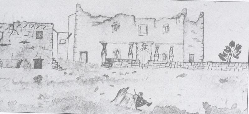
The Alamo is a historic Spanish mission and fortress compound founded in the 18th century by Catholic missionaries in what is now San Antonio, Texas, United States. It was the site of the Battle of the Alamo in 1836, a pivotal event of the Texas Revolution in which American folk heroes James Bowie and Davy Crockett were killed. Today it is a museum in the Alamo Plaza Historic District and a part of the San Antonio Missions World Heritage Site. Originally named the Misión San Antonio de Valero, it was one of the early Spanish missions in Texas, built to convert American tribes to Christianity. The mission was secularized in 1793 and then abandoned. Ten years later, it became a fortress housing the Second Flying Company of San Carlos de Parras military unit, who likely gave the mission the name Alamo ("cottonwood trees"). During the Texas Revolution, Mexican General Martín Perfecto de Cos surrendered the fort to the Texian Army in December 1835, following the Siege of Bé ... [...More Info...] [...Related Items...] OR: [Wikipedia] [Google] [Baidu] |
San Antonio River Walk
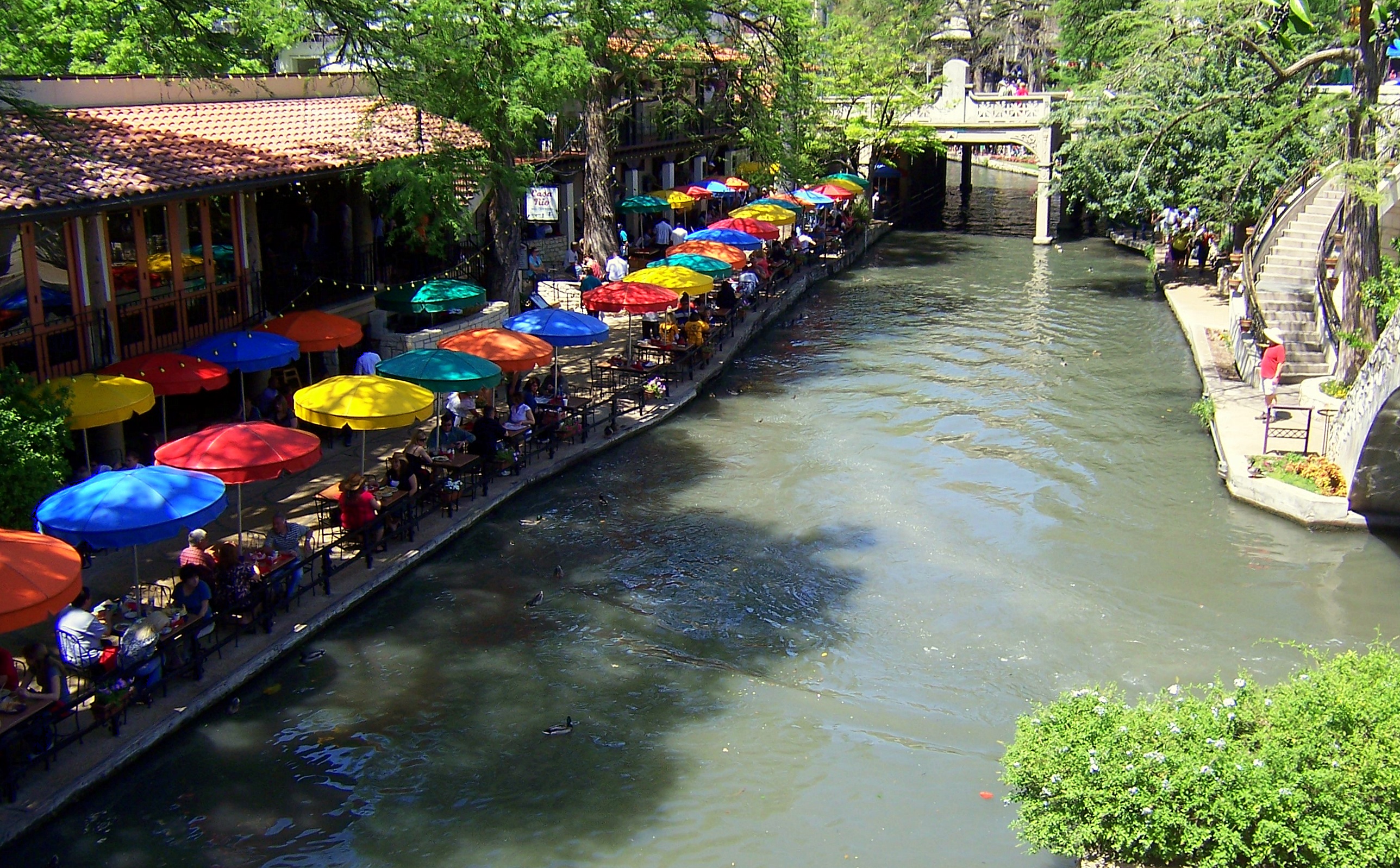
The San Antonio River Walk is a city park and special-case pedestrian street in San Antonio, Texas, one level down from the automobile street. The River Walk winds and loops under bridges as two parallel sidewalks lined with restaurants and shops, connecting the major tourist draws such as the Shops at Rivercenter, the Arneson River Theatre, Marriage Island, La Villita, HemisFair Park, Petty House, the Tower Life Building, the San Antonio Museum of Art, the Pearl, and the city's five Spanish colonial missions, which have been named a World Heritage Site, which includes the Alamo. During the annual springtime Fiesta San Antonio, the River Parade features flowery floats that float down the river. The area within the circumference of the River Walk is the heart of the original 1700s Villa de Bejar outpost, which would eventually become the City of San Antonio. History In September 1921, a disastrous flood along the San Antonio River took 51 lives, with an additional ... [...More Info...] [...Related Items...] OR: [Wikipedia] [Google] [Baidu] |
Tower Of The Americas
The Tower of the Americas is a observation tower-restaurant located in the Hemisfair district in the southeastern portion of Downtown San Antonio, Texas, United States. The tower was designed by San Antonio architect O'Neil Ford and was built as the theme structure of the 1968 World's Fair, HemisFair '68. Originally known as 'HemisFair Tower', it was ultimately named 'the Tower of the Americas' as a result of a name-the-tower contest created by the executive committee. Sixty-eight people submitted the name by which the tower is now known. It was the tallest observation tower in the United States from 1968 until 1996, when the Stratosphere Tower in Las Vegas was completed. The tower is the tallest occupiable structure in San Antonio, and it is the 30th-tallest occupiable structure in Texas. The tower is located in the middle of the former HemisFair '68 site and has an observation deck, accessible by elevator for a fee. There is also a lounge and revolving restaurant a ... [...More Info...] [...Related Items...] OR: [Wikipedia] [Google] [Baidu] |
Alamodome
The Alamodome is a 64,000-seat domed indoor multi-purpose stadium in San Antonio, Texas. It is located on the southeastern fringe of downtown San Antonio. The facility opened on May 15, 1993, having been constructed at a cost of $186 million. The multi-purpose facility was intended to increase the city's convention traffic and attract a professional football franchise. It also placated the San Antonio Spurs' demands for a larger arena. The Spurs played in the Alamodome for a decade, then became disenchanted with the facility and convinced Bexar County, Texas, Bexar County to construct a new arena for them, now called the Frost Bank Center. The Alamodome's regular tenants are currently the San Antonio Brahmas of the United Football League (2024), United Football League and the UTSA Roadrunners football, UTSA Roadrunners. Recent tenants include the San Antonio Commanders of the Alliance of American Football and the San Antonio Talons of the Arena Football League. Features ... [...More Info...] [...Related Items...] OR: [Wikipedia] [Google] [Baidu] |
Brooks City-Base
Brooks is a mixed-use development that was founded on the former Brooks Air Force Base when the United States Air Force The United States Air Force (USAF) is the Air force, air service branch of the United States Department of Defense. It is one of the six United States Armed Forces and one of the eight uniformed services of the United States. Tracing its ori ... closed the facility in 2002. Following the 1995 BRAC, when Brooks AFB was removed from the Base Realignment and Closure list, city, state, military, and community planners began several years of hard work to develop a plan to privatize approved the gradual transition in ownership of Brooks AFB from the Air Force to the Brooks Development Authority. This transition came into full effect on Jul. 22, 2002, when the Brooks Development Authority assumed control of the newly named Brooks City-Base. In 2005, Brooks City-Base was once again placed on the BRAC list. Air Force operations ceased on Sep. 15, 2011. In 2017, ... [...More Info...] [...Related Items...] OR: [Wikipedia] [Google] [Baidu] |
Downtown San Antonio
Downtown San Antonio is the central business district of San Antonio, Texas, and the urban core of Greater San Antonio, a metropolitan area with nearly 2.5 million people. Downtown San Antonio is encircled by Texas State Highway Loop 1604, 1604 and Interstate 410, I-410 loops and three interstate freeways: Interstate 35 in Texas, I-35, Interstate 37 (Texas), I-37, and Interstate 10 in Texas, I-10. Together, the three highways create a rectangular route around the city's urban core: I-35 to the north and west, I-37 to the east, and I-10 to the south. The rectangular loop has a nine-mile circumference and is known as the "Downtown Loop" or "Central Loop", which encompasses both it and Neighborhoods and districts of San Antonio, Southtown. Districts Downtown is home to many districts including the Alamo District, Alamodome District, Arsenal, Central Business District, Convention Center District, Historic Civic District, Houston Street District, Lavaca District, La Villita Distric ... [...More Info...] [...Related Items...] OR: [Wikipedia] [Google] [Baidu] |
Corpus Christi International Airport
Corpus Christi International Airport is west of Corpus Christi, in Nueces County, Texas. It opened in 1960, replacing Cliff Maus airport at , where the Lozano Golf Center is now located. The airport's six-gate Hayden Wilson Head Terminal, designed by Gensler, opened on November 3, 2002, with a theme of "When the Sun Meets the Sea." The Corpus Christi International Airport has tried to attract airline service from Mexico. In 1974, Texas International Airlines was flying Douglas DC-9-10s between Corpus Christi and Mexico City via McAllen, TX, and DC-9s twice a week to Tampico and Veracruz via McAllen in 1975. In 1967, Mexicana de Aviacion Douglas DC-6s flew direct to Mexico City via Monterrey three days a week. With the arrival of the Chautauqua Airlines operating United Express flights with Canadair CRJ200 regional jets via a code sharing agreement with United Airlines (with Chautauqua operating a number of United Express flights into the airport at the time), the airl ... [...More Info...] [...Related Items...] OR: [Wikipedia] [Google] [Baidu] |


