|
Tennessee State Route 52
State Route 52 (SR 52) is an east–west state highway that crosses nine counties in northern and northeastern Tennessee. The route originates in Orlinda, Tennessee, Orlinda along Tennessee State Route 49, SR 49 and ends in Elgin, Tennessee, Elgin along U.S. Route 27 in Tennessee, U.S. Route 27 (US 27). SR 52 is mostly a primary route, but becomes secondary west of I-65. Between Celina and Livingston it is part of Corridor J of the Appalachian Development Highway System. Route description In the border counties SR 52 begins as a secondary state route in Orlinda, Tennessee, Orlinda at Tennessee State Route 49, SR 49 in Robertson County, Tennessee, Robertson County. It begins an eastward trek and junctions with Interstate 65 in Tennessee, I-65 (Exit 117) west of Portland, Tennessee, Portland. A short distance later, it junctions with U.S. Route 31W, US 31W (Tennessee State Route 41, SR 41) and enters Sumner County, Tennessee, Sumner County. Once it does so, it becomes a prima ... [...More Info...] [...Related Items...] OR: [Wikipedia] [Google] [Baidu] |
TDOT
The Tennessee Department of Transportation (TDOT) is the department of transportation for the State of Tennessee, with multimodal responsibilities in roadways, aviation, public transit, waterways, and railroads. It was established in 1915 as the Tennessee Department of Highways and Public Works, and renamed the Tennessee Department of Transportation in 1972. The core agency mission of TDOT is to provide a safe and reliable transportation system for people, goods, and services that supports economic prosperity in Tennessee. Since 1998, TDOT has been ranked amongst the top five in the nation for quality highway infrastructure. It is primarily headquartered in downtown Nashville and operates four regional offices in Chattanooga, Jackson, Knoxville, and Nashville. Major responsibilities The major duties and responsibilities of TDOT are to: * plan, build, and maintain the state-owned highway and Interstate system of over ; * administer funding and provide technical assistance in th ... [...More Info...] [...Related Items...] OR: [Wikipedia] [Google] [Baidu] |
Fentress County, Tennessee
Fentress County is a county located in the U.S. state of Tennessee. As of the 2020 census, the population was 18,489. Its county seat is Jamestown. History Fentress County was formed on November 28, 1823, from portions of Morgan, Overton and White counties. The resulting county was named for James Fentress (1763–1843), who served as speaker of the state house, chairman of Montgomery County Court, and commissioner to select seats for Haywood, Carroll, Gibson and Weakley counties in West Tennessee. Fentress County was the site of several saltpeter mines. Saltpeter is the main ingredient of gunpowder and was obtained by leaching the earth from local caves. The largest mine was in York Cave, near the Wolf River Post Office. At one time, twenty-five large leaching vats were in operation in this cave. According to Barr (1961) this cave was mined during the Civil War. Buffalo Cave near Jamestown was also a major mine with twelve leaching vats. Manson Saltpeter Cave in Bi ... [...More Info...] [...Related Items...] OR: [Wikipedia] [Google] [Baidu] |
Tennessee State Route 6
State Route 6 (SR 6) is a State highway (US), state highway that is unsigned highway, unsigned. It travels through the Central Tennessee, central part of the U.S. state of Tennessee from Lawrence County, Tennessee, Lawrence County to Sumner County, Tennessee, Sumner County. The highway is related to the following U.S. Highways: *U.S. Route 43 in Tennessee, U.S. Route 43 (US 43) from the Alabama state line to Columbia, Tennessee, Columbia *U.S. Route 31 in Tennessee, US 31 from Columbia to Nashville, Tennessee, Nashville *U.S. Route 31E in Tennessee, US 31E from Nashville to the Kentucky state line TDOT designations Most of State Route 6 is a primary highway; however, between SR 397 in Franklin and SR 254 right past the Davidson County line to SR 155 are all the areas where State Route 6 is secondary. There is ambiguity between the two Davidson County Functional Classification Maps19b19a and thTDOT Traffic Mapinformation is not consistent designat ... [...More Info...] [...Related Items...] OR: [Wikipedia] [Google] [Baidu] |
Tennessee State Route 109
State Route 109 (SR 109) is a primary state highway in Middle Tennessee. It runs from the intersection of Tennessee State Route 265, SR 265 and Interstate 840 (Tennessee), Interstate 840 (I-840, exit 72) near Lebanon, Tennessee, Lebanon, north through Gallatin, Tennessee, Gallatin to the Kentucky state line and Interstate 65 in Tennessee, I-65 (exit 121). SR 109 is mentioned in several country music songs including "Church on the Cumberland Road" by Shenandoah (band), Shenandoah and "Goodbye Earl" by the Dixie Chicks. The first Cracker Barrel Restaurant was opened by Dan Evins at the corner of Interstate 40 (Tennessee), I-40 and SR 109 in Lebanon, Tennessee, in 1969. History SR 109 originally ended at its interchange with U.S. Route 70 in Tennessee, U.S. Route 70 (US 70), but was extended southward to connect with I-40 in 1968 and in the early 2000s to connect with SR 265 and I-840. The highway is a four-lane divided highway from I-840/SR 265 to I-40 where it becomes a four-l ... [...More Info...] [...Related Items...] OR: [Wikipedia] [Google] [Baidu] |
Tennessee State Route 41
Tennessee (, ), officially the State of Tennessee, is a landlocked U.S. state, state in the Southeastern United States, Southeastern region of the United States. It borders Kentucky to the north, Virginia to the northeast, North Carolina to the east, Georgia (U.S. state), Georgia, Alabama, and Mississippi to the south, Arkansas to the southwest, and Missouri to the northwest. Tennessee is the List of U.S. states and territories by area, 36th-largest by area and the List of U.S. states and territories by population, 15th-most populous of the 50 states. According to the United States Census Bureau, the state's estimated population as of 2024 is 7.22 million. Tennessee is geographically, culturally, and legally divided into three Grand Divisions of Tennessee, Grand Divisions of East Tennessee, East, Middle Tennessee, Middle, and West Tennessee. Nashville, Tennessee, Nashville is the state's capital and largest city, and anchors its largest metropolitan area. Tennessee has dive ... [...More Info...] [...Related Items...] OR: [Wikipedia] [Google] [Baidu] |
Interstate 65 In Tennessee
Interstate 65 (I-65) is part of the Interstate Highway System that runs north–south from Mobile, Alabama, to Gary, Indiana. In Tennessee, I-65 traverses the Middle Tennessee, middle portion of the state, running from Ardmore, Tennessee, Ardmore at the Alabama border to the Kentucky border near Portland, Tennessee, Portland. The route serves the state capital and largest city of Nashville, Tennessee, Nashville, along with many of its suburbs. Outside of urban areas, the Interstate bypasses most cities and towns that it serves, instead providing access via List of state routes in Tennessee, state and List of U.S. Highways in Tennessee, U.S. Highways. The Interstate passes through the Highland Rim and Nashville Basin physiographic regions of Tennessee, and is often used as the dividing line between the eastern and western portions of the former. Of the four states which I-65 runs through, the segment in Tennessee is the shortest, at long. I-65 parallels the older U.S. Ro ... [...More Info...] [...Related Items...] OR: [Wikipedia] [Google] [Baidu] |
Appalachian Development Highway System
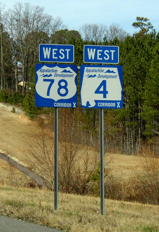
The Appalachian Development Highway System (ADHS) is a series of highway corridors in the Appalachia region of the eastern United States. The routes are designed as local and regional routes for improving economic development in the historically isolated region. It was established as part of the Appalachian Regional Development Act of 1965, and has been repeatedly supplemented by various federal and state legislative and regulatory actions. The system consists of a mixture of state, U.S., and Interstate routes. The routes are formally designated as "corridors" and assigned a letter. Signage of these corridors varies from place to place, but where signed are often done so with a distinctive blue-colored sign. The Appalachian Regional Commission (ARC) forecast benefits of ADHS' completion by FY 2045 as the creation of 47,000 new jobs and $4.2 billion in gross regional product (GRP). History In 1964, the President's Appalachian Regional Commission (PARC) reported to Con ... [...More Info...] [...Related Items...] OR: [Wikipedia] [Google] [Baidu] |
Tennessee State Route 49
State Route 49 (SR 49) is a state highway in Tennessee. The route forms a broad southern arc that passes through the rural Middle Tennessee towns of Dover, Erin, Charlotte, Ashland City, Pleasant View, and Springfield. Route description SR 49 begins in Stewart County in downtown Dover at a junction with US 79/ SR 76 as a primary highway. It goes east, paralleling the Cumberland River before turning south and having an intersection with SR 233. It then goes through some farmland and hills before crossing into Houston County. SR 49 then immediately enters Tennessee Ridge and comes to an intersection with SR 147, where SR 49 turns east again towards Erin. SR 49 then enters Erin shortly afterwards, going straight through downtown before having an intersection with SR 149. It then intersects with SR 13 not even a half a mile later. It then goes through some more hills and farmland, having an intersection and concurrency with SR 46 before crossing into Dickson County. S ... [...More Info...] [...Related Items...] OR: [Wikipedia] [Google] [Baidu] |
Tennessee
Tennessee (, ), officially the State of Tennessee, is a landlocked U.S. state, state in the Southeastern United States, Southeastern region of the United States. It borders Kentucky to the north, Virginia to the northeast, North Carolina to the east, Georgia (U.S. state), Georgia, Alabama, and Mississippi to the south, Arkansas to the southwest, and Missouri to the northwest. Tennessee is the List of U.S. states and territories by area, 36th-largest by area and the List of U.S. states and territories by population, 15th-most populous of the 50 states. According to the United States Census Bureau, the state's estimated population as of 2024 is 7.22 million. Tennessee is geographically, culturally, and legally divided into three Grand Divisions of Tennessee, Grand Divisions of East Tennessee, East, Middle Tennessee, Middle, and West Tennessee. Nashville, Tennessee, Nashville is the state's capital and largest city, and anchors its largest metropolitan area. Tennessee has dive ... [...More Info...] [...Related Items...] OR: [Wikipedia] [Google] [Baidu] |


