|
Tennessee State Route 293
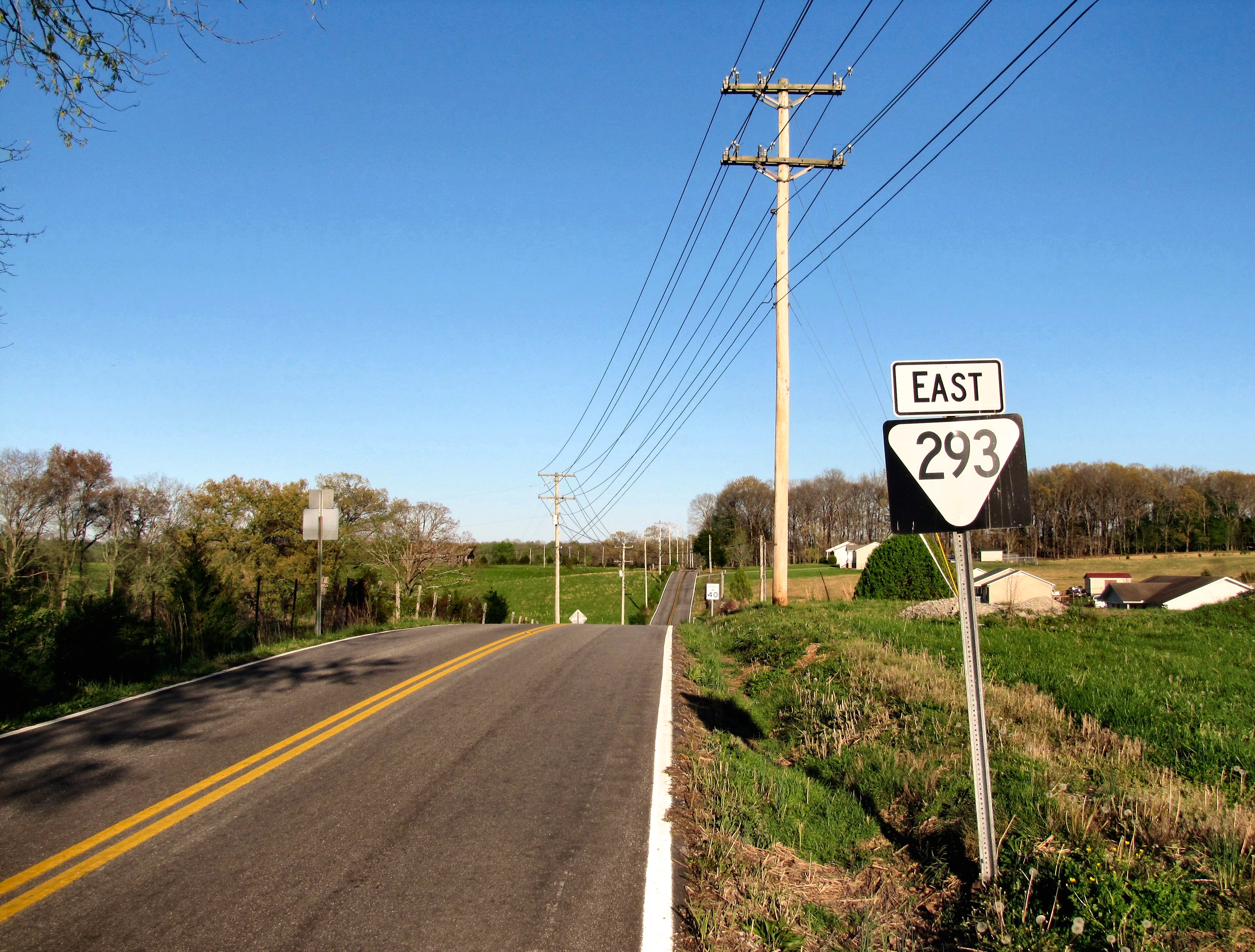
State Route 293 (SR 293) is a east-west state highway that, excluding its western terminus, is located entirely in Overton County, Tennessee. Route description SR 293 begins on the Overton- Putnam county line at an intersection with SR 136 north of Bangham. It heads east, in Overton County, along Tommy Dodson Highway (as it is signed in the field) though rural farmland for several miles to enter Rickman and come to an intersection with SR 111. SR 293 turns south along a short concurrency with SR 111 before turning southeast along Rickman Monterey Highway to pass through downtown, where it has an intersection with former SR 42. The highway then leaves Rickman and winds its way through farmland and rural areas for the next several miles before coming to an end at an intersection with SR 84. The entire route of SR 293 is a rural two-lane highway. Major intersections References {{reflist 293 __NOTOC__ Year 293 ( CCXCIII) was a common year starting on ... [...More Info...] [...Related Items...] OR: [Wikipedia] [Google] [Baidu] |
Bangham, Tennessee
Bangham is an unincorporated community in northern Putnam County, Tennessee, United States. It is concentrated around the intersection of Hilham Road (Tennessee State Route 136) and Paran Road, north of Cookeville. The Bangham Community Center, located along Hilham Road, was originally a school built by the Works Progress Administration The Works Progress Administration (WPA; renamed in 1939 as the Work Projects Administration) was an American New Deal agency that employed millions of jobseekers (mostly men who were not formally educated) to carry out public works projects, in ... in 1936. The center is now home to the Hollis Moore Loftis Library, named for a popular teacher who once taught at the school.Buddy Pearson,New Bangham Community Library Opening On Saturday" ''Cookeville Herald-Citizen'', 14 March 2015. References Unincorporated communities in Putnam County, Tennessee Unincorporated communities in Tennessee {{PutnamCountyTN-geo-stub ... [...More Info...] [...Related Items...] OR: [Wikipedia] [Google] [Baidu] |
Rickman, Tennessee
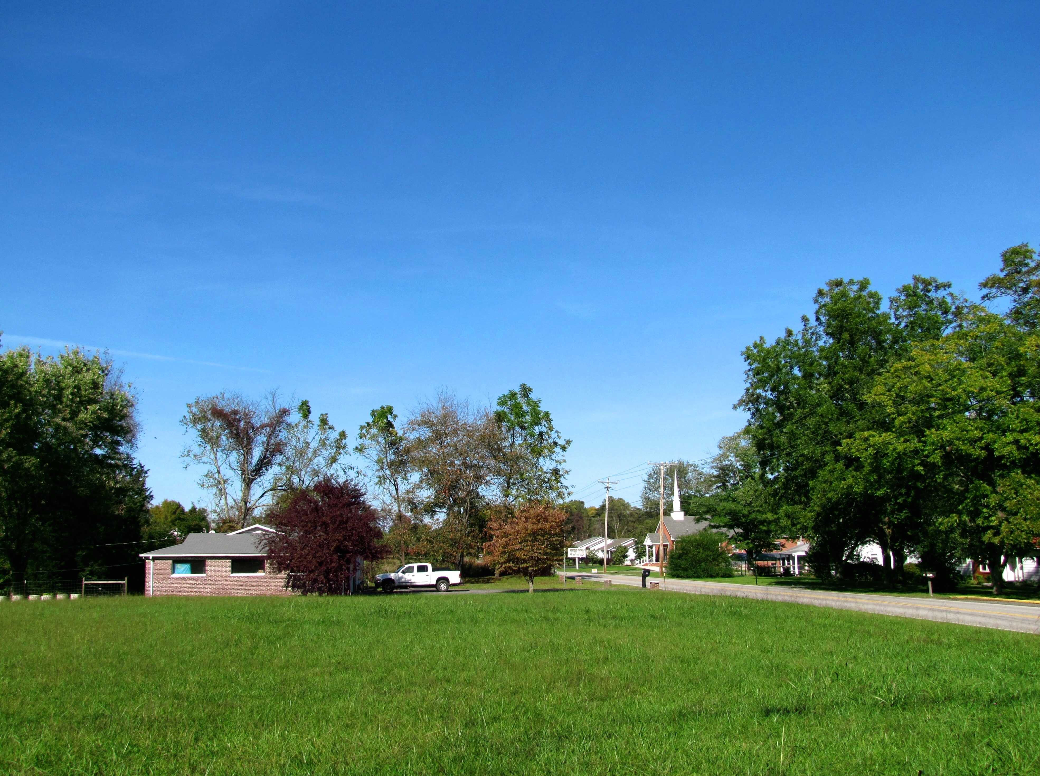
Rickman is an unincorporated community in Overton County, Tennessee, United States. Its ZIP code is 38580. The community is concentrated around the intersection of Rickman Monterey Highway ( State Route 293) and Rickman Road (former State Route 42), northeast of Algood and southwest of Livingston Livingston may refer to: Businesses * Livingston Energy Flight, an Italian airline (2003–2010) * Livingston Compagnia Aerea, an Italian airline (2011–2014), also known as Livingston Airline * Livingston International, a North American custom ..., and is home to a post office, an elementary school, and several churches and small businesses. State Route 111 does pass through the community along the west side. History Originally known as Bilbrey's Crossing, Rickman was later renamed for Carney H. Rickman, who operated a large lumber yard nearby along the railroad. Education Rickman is home to one primary school, which is Rickman Elementary School. In 2011, RES had 765 students ... [...More Info...] [...Related Items...] OR: [Wikipedia] [Google] [Baidu] |
Livingston, Tennessee
Livingston is a town in Overton County, Tennessee, United States, and serves as the county seat. The population was 3,905 at the 2020 census and 4,058 at the 2010 census. The current mayor, Curtis Hayes, began serving his mayoral position in September 2006. Livingston is part of the Cookeville, Tennessee Micropolitan Statistical Area. History Livingston was named after Edward Livingston (1764–1836), who served as Secretary of State under President Andrew Jackson. In 1833, in a close and controversial election, the residents of Overton County voted to move the county seat from the town of Monroe to Livingston.The Federal Writers' Project, ''The WPA Guide to Tennessee'' (Knoxville, Tenn.: University of Tennessee Press, 1986), 508. Geography Livingston is located at (36.386942, -85.325568), approximately 15 miles north by northeast of Cookeville. According to the United States Census Bureau, the town has a total area of , of which is land and (0.77%) is water. Elevation ... [...More Info...] [...Related Items...] OR: [Wikipedia] [Google] [Baidu] |
Putnam County, Tennessee
Putnam County is a county located in the U.S. state of Tennessee. As of the 2020 census, the population was 79,854. Its county seat is Cookeville. Putnam County is part of the Cookeville, TN Micropolitan Statistical Area. History Putnam County is named in honor of Israel Putnam, who was a hero in the French and Indian War and a general in the American Revolutionary War. The county was initially established on February 2, 1842, when the Twenty-fourth Tennessee General Assembly enacted a measure creating the county from portions of Jackson, Overton, Fentress, and White counties. After the survey was completed by Mounce Gore, the Assembly instructed the commissioners to locate the county seat, to be called "Monticello," near the center of the county. Contending, however, that the formation of Putnam was illegal because it reduced their areas below constitutional limits, Overton and Jackson counties secured an injunction against its continued operation. Putnam officials fa ... [...More Info...] [...Related Items...] OR: [Wikipedia] [Google] [Baidu] |
Overton County, Tennessee
Overton County is a county located in the U.S. state of Tennessee. As of the 2020 census, the population was 22,511. Its county seat is Livingston. Overton County is part of the Cookeville, TN Micropolitan Statistical Area. History On May 10, 1933, a half-mile wide F4 tornado struck the small community of Beatty Swamps (also referred to as Bethsadia). The tornado destroyed every structure in the town and either killed or injured nearly every inhabitant, with 33 of the 35 deaths occurring in the area. Much of the area was swept clean of debris, a reaper-binder was thrown , and cars were moved hundreds of feet. Archived June 6, 2011.Grazulis, ''Significant'', pp. 850-851 < ... [...More Info...] [...Related Items...] OR: [Wikipedia] [Google] [Baidu] |
Tennessee State Route 136
State Route 136 (SR 136) is a state highway in the central portion of the U.S. state of Tennessee. It connects US 70S near Rock Island in Warren County with SR 52 in northern Overton County, traversing much of the northeastern Highland Rim. Route description SR 136 begins in Warren County at an intersection with US 70S just south of Rock Island. The route proceeds north to Rock Island and junctions with SR 287, which connects it to Rock Island State Park to the west. SR 136 then bridges the Caney Fork River and enters White County before turning northeast through the community of Walling. It then turns northward again and continues through mostly rural terrain. After several miles it junctions with US 70 west of Sparta, and SR 135 at Bakers Crossroads, near the Putnam County line. It turns eastward briefly after passing the Upper Cumberland Regional Airport before it has an interchange with SR 111 at Hampto ... [...More Info...] [...Related Items...] OR: [Wikipedia] [Google] [Baidu] |
Tennessee State Route 111
State Route 111 (SR 111) is a north–south highway in Middle and East Tennessee. The road begins in Soddy-Daisy and ends north of Byrdstown in the community of Static, at the Tennessee/Kentucky state line. The length is . Route description The highway begins at an interchange with U.S. Route 27/ SR 29 (US 27/SR 29) in Soddy-Daisy. SR 111 travels generally northwest as a controlled access highway before it crosses into Sequatchie County. The controlled-access sections of SR 111 are unusual, as they contain 70 mph speed limits, which are generally reserved for Interstate highways. It then proceeds over Walden Ridge and into the Sequatchie Valley, where it comes to an interchange with US 127 and starts a concurrency with SR 8 in Dunlap, where the freeway ends. The concurrency goes up the Cumberland Plateau, continuing as a 4-lane road, albeit without a dividing median or wide shoulders, and into the northern part of the county where ... [...More Info...] [...Related Items...] OR: [Wikipedia] [Google] [Baidu] |
Tennessee State Route 42
State Route 111 (SR 111) is a north–south highway in Middle and East Tennessee. The road begins in Soddy-Daisy and ends north of Byrdstown in the community of Static, at the Tennessee/Kentucky state line. The length is . Route description The highway begins at an interchange with U.S. Route 27/ SR 29 (US 27/SR 29) in Soddy-Daisy. SR 111 travels generally northwest as a controlled access highway before it crosses into Sequatchie County. The controlled-access sections of SR 111 are unusual, as they contain 70 mph speed limits, which are generally reserved for Interstate highways. It then proceeds over Walden Ridge and into the Sequatchie Valley, where it comes to an interchange with US 127 and starts a concurrency with SR 8 in Dunlap, where the freeway ends. The concurrency goes up the Cumberland Plateau, continuing as a 4-lane road, albeit without a dividing median or wide shoulders, and into the northern part of the county where it na ... [...More Info...] [...Related Items...] OR: [Wikipedia] [Google] [Baidu] |
Tennessee State Route 84
State Route 84 (SR 84) is a north–south state highway in eastern Middle Tennessee. It originates at Sparta on U.S. Route 70 (US 70), goes through the town of Monterey, and ends on the west side of Livingston along SR 85. Route description White County SR 84 begins as a secondary highway in downtown Sparta, in White County, at a junction with US 70/ SR 1. It then follows a northeasterly path to through some rural farmland before entering some mountains and crossing into Putnam County. Putnam County SR 84 then becomes very curvy before it intersects and becomes concurrent with US 70N/ SR 24, where it becomes a primary highway, and enters Monterey. US 70N/SR 84/SR 24 then intersect I-40 (Exit 300) before entering downtown Monterey. In downtown, US 70N/SR 24 split off and turn south, while SR 84 continues to an intersection with SR 62, where it makes a sharp left turn and goes northeast, leaving Monterey. Overton County SR 84 then becomes curvy as it ... [...More Info...] [...Related Items...] OR: [Wikipedia] [Google] [Baidu] |
Tennessee Department Of Transportation
The Tennessee Department of Transportation (TDOT) is a multimodal agency with statewide responsibilities in roadways, aviation, public transit, waterways, and railroads. The mission of TDOT is to provide a safe and reliable transportation system for people, goods, and services that supports economic prosperity in Tennessee. Since 1998, TDOT has been ranked amongst the top five in the nation for quality highway infrastructure. It is primarily headquartered in downtown Nashville and operates four regional offices in Chattanooga, Jackson, Knoxville, and Nashville. Major responsibilities The major duties and responsibilities of TDOT are to: * plan, build, and maintain the state-owned highway and Interstate system of over ; * administer funding and provide technical assistance in the planning and construction of state and federal aid road programs for cities and counties; * provide incident management on Tennessee's Interstate system through TDOT SmartWay, an intelligent transporta ... [...More Info...] [...Related Items...] OR: [Wikipedia] [Google] [Baidu] |
Algood, Tennessee
Algood is a city in Putnam County, Tennessee, United States. The population was 3,963 at the 2020 census. It is part of the Cookeville Micropolitan Statistical Area. History While Algood was not established until the late 19th century, in the early 19th century a small community developed just south of modern Algood at White Plains, an antebellum plantation and important stopover along the Walton Road (which connected Nashville and Knoxville). In the 1880s, the Nashville & Knoxville Railroad erected a depot at what is now Algood. The land on which the depot was built was purchased from a circuit rider and early settler named Joel Algood, and thus the train stop was named after him. For a period of time the area would be called Algood's Old Fields. In 1899, the Algood Methodist Church (now Algood United Methodist Church) was built on land donated by the children of this early settler. Algood was initially incorporated in 1901, but repealed its own charter two years later. ... [...More Info...] [...Related Items...] OR: [Wikipedia] [Google] [Baidu] |


